- Pleak, Texas
Infobox Settlement
official_name = Pleak, Texas
settlement_type = Village
nickname =
motto =
imagesize =
image_caption =
image_
mapsize = 250px
map_caption = Location of Pleak, Texas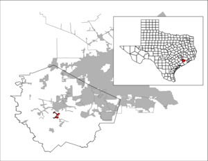
mapsize1 = 250px
map_caption1 =subdivision_type = Country
subdivision_name =United States
subdivision_type1 = State
subdivision_name1 =Texas
subdivision_type2 = County
subdivision_name2 = Fort Bendgovernment_footnotes =
government_type =
leader_title =
leader_name =
leader_title1 =
leader_name1 =
established_title =
established_date =unit_pref = Imperial
area_footnotes =area_magnitude =
area_total_km2 = 5.2
area_land_km2 = 5.2
area_water_km2 = 0.0
area_total_sq_mi = 2.0
area_land_sq_mi = 2.0
area_water_sq_mi = 0.0population_as_of = 2000
population_footnotes =
population_total = 947
population_density_km2 = 182.9
population_density_sq_mi = 473.8timezone = Central (CST)
utc_offset = -6
timezone_DST = CDT
utc_offset_DST = -5
elevation_footnotes =
elevation_m = 26
elevation_ft = 85
latd = 29 |latm = 29 |lats = 3 |latNS = N
longd = 95 |longm = 48 |longs = 36 |longEW = Wpostal_code_type =
ZIP code
postal_code = 77469
area_code = 281
blank_name = FIPS code
blank_info = 48-58088GR|2
blank1_name = GNIS feature ID
blank1_info = 1378879GR|3
website =
footnotes =Pleak is a village in Fort Bend County,
Texas ,United States and a part of theHouston Metropolitan Area . The population was 947 at the 2000 census.Geography
Pleak is located at 29°29'3" North, 95°48'36" West (29.484144, -95.810087)GR|1.
According to the
United States Census Bureau , the village has a total area of 2.0square mile s (5.2km² ), all of it land.Demographics
As of the
census GR|2 of 2000, there were 947 people, 318 households, and 269 families residing in the village. Thepopulation density was 473.8 people per square mile (182.8/km²). There were 325 housing units at an average density of 162.6/sq mi (62.7/km²). The racial makeup of the village was 80.04% White, 4.33% African American, 0.32% Native American, 0.32% Asian, 0.00% Pacific Islander, 13.94% from other races, and 1.06% from two or more races. 29.25% of the population were Hispanic or Latino of any race.There were 318 households out of which 38.4% had children under the age of 18 living with them, 71.1% were married couples living together, 8.5% had a female householder with no husband present, and 15.1% were non-families. 12.6% of all households were made up of individuals and 4.1% had someone living alone who was 65 years of age or older. The average household size was 2.98 and the average family size was 3.22.
In the village the population was spread out with 27.1% under the age of 18, 8.3% from 18 to 24, 27.9% from 25 to 44, 28.2% from 45 to 64, and 8.4% who were 65 years of age or older. The median age was 38 years. For every 100 females there were 98.1 males. For every 100 females age 18 and over, there were 100.0 males.
The median income for a household in the village was $52,188, and the median income for a family was $56,364. Males had a median income of $35,313 versus $25,625 for females. The
per capita income for the village was $20,773. 4.5% of the population and 3.4% of families were below thepoverty line . 6.0% of those under the age of 18 and 0.0% of those 65 and older were living below the poverty line.Education
Pleak is a part of the
Lamar Consolidated Independent School District .It is zoned to Meyer Elementary, Navarro Middle School, George Junior High, and
B.F. Terry High School .References
External links

Wikimedia Foundation. 2010.