- Cypress, Texas
-
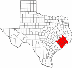
Cypress — Unincorporated area — Location within the state of Texas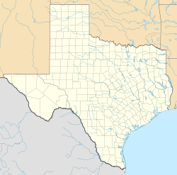
 Cypress
Coordinates: 29°59′41″N 95°40′3″W / 29.99472°N 95.6675°WCoordinates: 29°59′41″N 95°40′3″W / 29.99472°N 95.6675°W Country United States State Texas County Harris Population (2000) - Total 46,025 Time zone Central (CST) (UTC-6) - Summer (DST) CDT (UTC-5) ZIP codes 77429, 77433 FIPS code GNIS feature ID Cypress (sometimes combined as Cy-Fair for Cypress-Fairbanks, the latter now incorporated as a neighborhood of Houston) is an unincorporated area of Harris County, Texas, United States located completely inside the extraterritorial jurisdiction of the City of Houston. The Cypress area is located along U.S. Highway 290 (Northwest Freeway) approximately twenty-five miles (40 km) northwest of Downtown Houston. The Cypress urban cluster ranks 50th in the top 100 highest-income urban areas in the United States.
Large scale residential and commercial development beginning in the 1980s transformed the once rural area into one of the Houston area's largest suburban communities.
Contents
History
The area around which Cypress sits now was populated by Atakapan Indian tribes, but they soon disappeared after the appearance of German settlers in the 1840s; the German heritage is most notably reflected in the names of some of the major thoroughfares of the area, such as Huffmeister and Telge Roads.[1] General Sam Houston and his Texas Army camped in the area on March 22, 1836 on the way to Harrisburg, which is now in East Houston, just days before the Battle of San Jacinto.[2] The area was mostly rural until the 1980s when developers began construction of several master-planned communities. The area is often referred to as Cy-Fair or Cypress-Fairbanks, which comes from when the Cypress and Fairbanks volunteer fire departments joined together to form the Cypress-Fairbanks Volunteer Fire Department (now known simply as Cy-Fair VFD). In March 2008, the Cypress Historical Society (CHS) was formed as a non-profit corporation with its primary mission being "...to discover, educate, promote, collect, preserve and make available to the public, historical documents and artifacts of the Cypress area." [3] The CHS organization holds regular events aimed at exposing Cypress' residents to the historical and cultural foundation upon which the area was built.
Geography
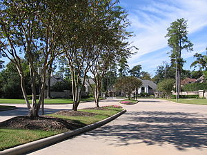 Longwood is a heavily wooded golf course community located in North Cypress
Cypress is located at 29°59′40″N 95°40′3″W / 29.99444°N 95.6675°W, near the intersection of US Highway 290 and Spring-Cypress Road. Cypress is located within the Cypress Creek and Little Cypress Creek watershed.
Cypress has two distinct geographic profiles separated by Highway 290. The area north of US 290 is forested and thickly wooded, while the area south of 290 is predominately ranchland and grassy prairie dotted with scrub brush, Live Oaks and Post Oaks.
Cypress falls under the jurisdiction of Harris County Precincts 3 and 4 (separated by Cypress Creek).
Major arteries include Highway 290 to the South and State Highway 249 to the East.
 Coles Crossing is a 2700 home Subdivision encompassed by Spring Cypress, Jarvis, Barker-Cypress and Huffmeister Roads.
Demographics
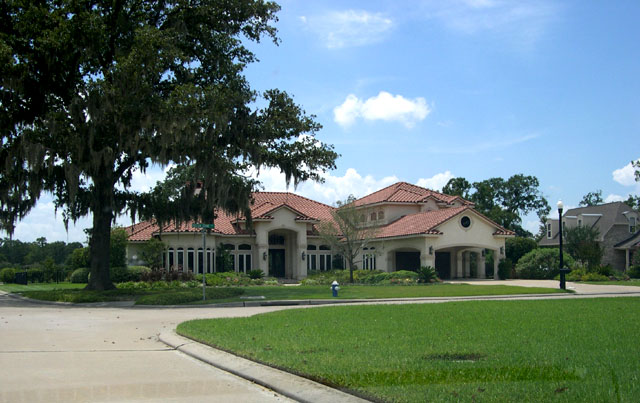
 Blackhorse Ranch is a golf course community in Cypress
As of the 2000 US Census, there were approximately 46,025 people, 15,207 households, and 12,914 families living in the zip codes labeled as Cypress. There were 15,207 housing units at an average density of 494.6 per square mile (190.9/km²).[4][5]
The 77429 Zip Code is one of the most affluent zip codes in Harris County; nearly 77% of the population has an income over US $50,000 and 42.65% earning over $100,000.[6] The Cypress urban cluster ranks 50th in the top 100 highest-income urban areas in the United States.
Healthcare
There are two major hospitals in the Cypress area, North Cypress Medical Center and Cypress Fairbanks Medical Center Hospital.
Government and infrastructure
The area of Cypress is served by two volunteer fire departments, Cy-Fair Volunteer Fire Department and Cypress Creek VFD. The Cy-Fair VFD is the largest volunteer fire department in the United States with 12 stations.[7]
The United States Postal Service operates the Cypress Post Office at 16635 Spring Cypress Road.[8]
Economy
In 2010 Sysco announced that it purchased the former Hewlett Packard call center along U.S. Highway 290 in Cypress and that it will establish a shared services facility for its distribution centers in North America.[9]
Attractions
- Cypress is home to Tin Hall, one of the oldest continually operating Dance Halls in Texas, in operation since 1889.
- Cypress is home to The Berry Center, an $80 million multi-use complex owned by Cy-Fair ISD. The Berry Center features a football stadium, basketball arena, conference center, auditorium, multimedia production, and catering facility.
- Cypress is home to Northwest Forest Conference Center, an 80-acre (320,000 m2) resort and conference center with a life-size replica of the Alamo.
- Cypress is home to the trailhead of the planned Cypress Creek Greenway Project, a major parks project which will link major anchor parks along the entirety of Cypress Creek via a Greenbelt complete with Hike & Bike Trails, Horseback Riding, Canoeing and other attractions for outdoors/nature enthusiasts. It will link up with the planned Spring Creek Greenway northeast of Interstate 45.
- Cypress has numerous Golf Courses, including:
- Longwood Golf Club-Cypress, TX
- Blackhorse-Cypress, TX
- Houston National
- Cypress Lakes-Cypress, TX
- Cypress Golf Club-Cypress, TX
- Hearthstone Country Club - in Houston, TX is located a few miles south east of Cypress.
- Cypress Top Historic Park, located at 26026 Old Hempstead Highway in Cypress, TX 77429, is run by Harris County Precinct 3, Commissioner Steve Radack.[10] The park grounds are open daily, and building tours are given on Tuesdays by Harris County historians and volunteers from the Cypress Historical Society.
Education
Primary and secondary schools
Public schools
Cypress is served by Cypress-Fairbanks Independent School District, the third largest school district in the State of Texas and one of the fastest growing in the United States. CFISD serves nearly 107,000 students as of 2010[11].
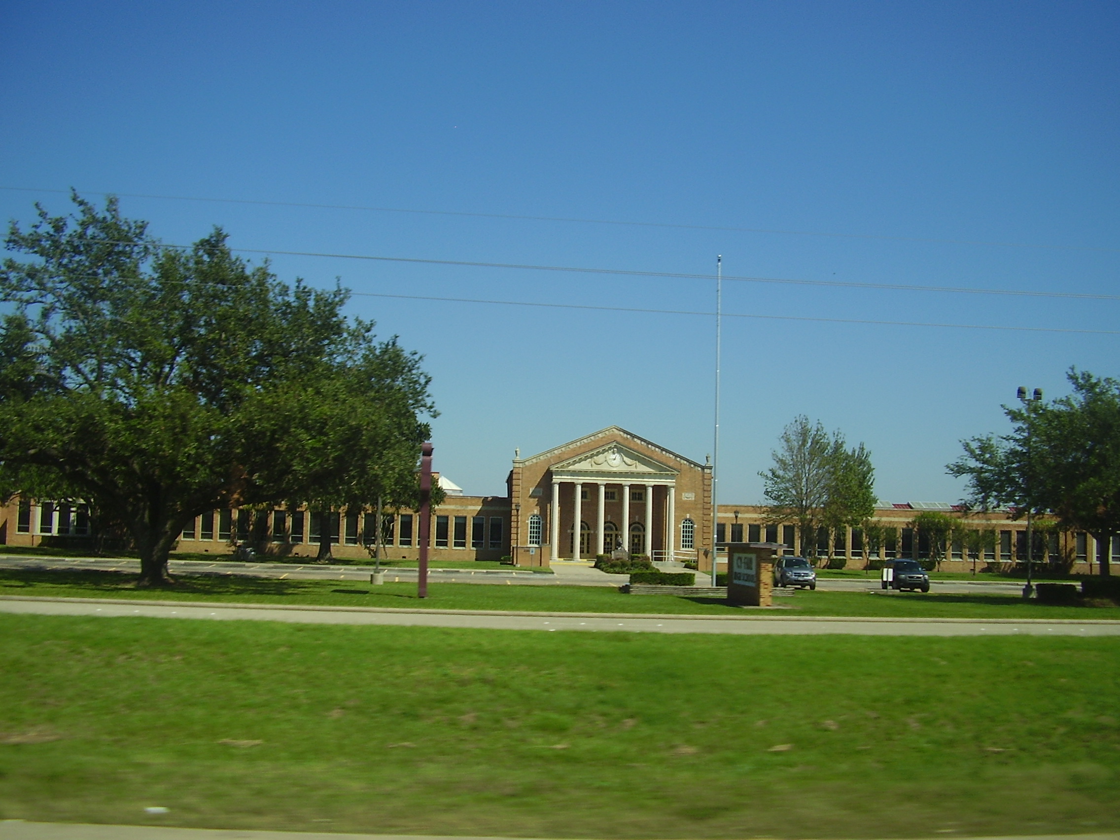
Cypress-Fairbanks ISD high school students attend Cy-Fair High School, Cypress Lakes High School, Jersey Village High School, Cypress Creek High School, Cypress Falls High School, Cypress Woods High School, Cypress Springs High School, Langham Creek High School, Cypress Ridge High School, and Cypress Ranch High School.
Windfern High School offers an alternative path toward graduation for accepted students from the above high school attendance zones.
Private schools
St. Elizabeth Ann Seton School, a K-8 Roman Catholic school operated by the Roman Catholic Archdiocese of Galveston-Houston, is in close proximity to Cypress.
Cypress Christian School, a K–12 private school, is located in the area.[12]
Covenant Academy, a K-8 private Christian classical school, is located near the Cy-Fair High School complex.
Colleges and universities
Lone Star College (originally the North Harris Montgomery Community College District) serves the community. The territory in Cypress-Fairbanks ISD joined the community college district in 2000.[13] Cypress is home of the Lone Star College–CyFair campus.
Public libraries
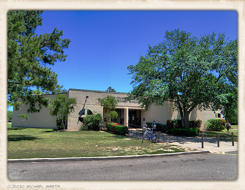
Harris County Public Library (HCPL) operates public libraries in the Cypress area. LSC-Cyfair Library, a partner effort between HCPL and Lone Star College System, is located at 9191 Barker-Cypress Road on the Lone Star College–CyFair campus.[14] The Northwest Branch Library is located at 11355 Regency Green Drive.[15]
 Northwest Branch Library
References
- ^ http://www.tshaonline.org/handbook/online/articles/CC/hlc66.html. Handbook of Texas Online, Entry for Cypress. Last accessed November 18, 2006.
- ^ http://atlas.thc.state.tx.us/viewform.asp?atlas_num=5201010623&site_name=Burnett%2C%20Matthew&class=5000. Texas Historical Site Atlas. Last accessed November 18, 2006.
- ^ http://www.cypresshistoricalsociety.com
- ^ http://factfinder.census.gov/servlet/QTTable?_bm=y&-geo_id=86000US77429&-qr_name=DEC_2000_SF1_U_DP1&-ds_name=DEC_2000_SF1_U&-_lang=en&-_sse=on. US Census Fact Sheet for Zip Code 77429. Last accessed November 18, 2006.
- ^ http://factfinder.census.gov/servlet/QTTable?_bm=y&-geo_id=86000US77433&-qr_name=DEC_2000_SF1_U_DP1&-ds_name=DEC_2000_SF1_U&-_lang=en&-redoLog=false&-_sse=on. US Census Fact Sheet for Zip Code 77433. Last accessed November 18, 2006.
- ^ http://webadv.chron.com/house/house_z/zipcode/harris01p4.html. Listing of Harris County zipcodes. Last accessed November 19, 2006.
- ^ http://www.hcnonline.com/articles/2008/07/17/copperfield_sun/news/072308_new_station.txt |title=Cy-Fair VFD to Celebrate 12th Station Opening |work=hcnonline.com |publisher=Copperfield Sun |accessdate=2008-10-04
- ^ "Post Office Location - CYPRESS." United States Postal Service. Retrieved on December 4, 2008.
- ^ Stauffer, Kimberly. "Sysco Corporation plans to open new facility in Cypress." Community Impact Newspaper (JG Media, Inc.) Friday March 5, 2010. Retrieved on April 23, 2010. "Sysco Corporation has purchased the former Hewlett-Packard call center at 24500 Hwy. 290 in Cypress to create a shared services facility for its North American distribution centers."
- ^ http://www.pct3.hctx.net/parks/cypresstophistoric.aspx
- ^ [1]. Cypress-Fairbanks Independent School District. Last accessed November 16, 2011.
- ^ "School Profile." Cypress Christian School. Retrieved on November 6, 2010.
- ^ "History." North Harris Montgomery Community College District. December 22, 2002. Retrieved on April 5, 2010.
- ^ "LSC-Cy-Fair Library." Harris County Public Library. Retrieved on February 15, 2009.
- ^ "Northwest Branch Library." Harris County Public Library. Retrieved on February 15, 2009.
External links
 Houston–Sugar Land–Baytown
Counties Austin • Brazoria • Chambers • Fort Bend • Galveston • Harris • Liberty • Montgomery • San Jacinto • Waller
"Principal" cities Other cities Alvin • Angleton • Bellaire • Clute • Deer Park • Dickinson • Freeport • Friendswood • Galena Park • Humble • Jacinto City • Katy • Lake Jackson • La Marque • La Porte • League City • Missouri City • Pasadena • Pearland • Richmond • Rosenberg • South Houston • Stafford • Texas City • West University Place
- For a complete listing, see list of cities and towns in Houston–Sugar Land–Baytown MSA
Unincorporated
areasAtascocita • Channelview • Cloverleaf • Crosby • Cypress • Fresno • Hockley • Klein • Port Bolivar • Spring • The WoodlandsBodies of water Buffalo Bayou • Galveston Bay • Gulf Intracoastal Waterway • Houston Ship Channel • San Jacinto River • Trinity River • Lake Houston • Lake Conroe State of Texas
Topics Architecture · Climate · Geography · Government · History · Languages · Literature · Sports · Texans · Transportation · Symbols · Visitor Attractions
Society Regions Ark‑La‑Tex · Big Bend · Blackland Prairies · Brazos Valley · Central Texas · Coastal Bend · Cross Timbers · Deep East Texas · East Texas · Edwards Plateau · Golden Triangle · Hill Country · Llano Estacado · Northeast Texas · North Texas · Osage Plains · Panhandle · Permian Basin · Piney Woods · Rio Grande Valley · Southeast Texas · South Plains · South Texas · Trans-Pecos · West Texas
Metropolitan
areasAbilene · Amarillo · Austin–Round Rock–San Marcos · Beaumont–Port Arthur · Brownsville–Harlingen · College Station–Bryan · Corpus Christi · Dallas–Fort Worth–Arlington · El Paso · Houston–Sugar Land–Baytown · Killeen–Temple–Fort Hood · Laredo · Longview · Lubbock · McAllen–Edinburg–Mission · Midland · Odessa · San Angelo · San Antonio–New Braunfels · Sherman–Denison · Texarkana · Tyler · Victoria · Waco · Wichita Falls
Counties See: Table of Texas counties or List
Categories:- Unincorporated communities in Texas
- Populated places in Harris County, Texas


Wikimedia Foundation. 2010.