- Mount Hope, Kansas
-
Mount Hope, Kansas — City — Location of Mount Hope, Kansas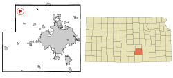 Detailed map of Mount Hope, Kansas
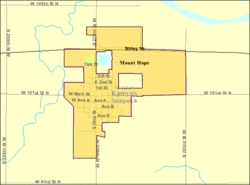
Coordinates: 37°52′9″N 97°39′53″W / 37.86917°N 97.66472°WCoordinates: 37°52′9″N 97°39′53″W / 37.86917°N 97.66472°W Country United States State Kansas County Sedgwick Government – Mayor Terry Somers Area – Total 1.0 sq mi (2.7 km2) – Land 1.0 sq mi (2.7 km2) – Water 0.0 sq mi (0.0 km2) Elevation 1,440 ft (439 m) Population (2010)[1] – Total 813 – Density 813/sq mi (313.9/km2) Time zone Central (CST) (UTC-6) – Summer (DST) CDT (UTC-5) ZIP code 67108 Area code(s) 316 FIPS code 20-48900[2] GNIS feature ID 0473810[3] Website MountHopeCity.com Mount Hope is a city in Sedgwick County, Kansas, United States. As of the 2010 census, the city population was 813.[1]
Contents
Geography
Mount Hope is located at 37°52′9″N 97°39′53″W / 37.86917°N 97.66472°W (37.869198, -97.664663)[4]. According to the United States Census Bureau, the city has a total area of 1.0 square mile (2.6 km2), of which, 1.0 square mile (2.6 km2) of it is land and 0.97% is water.
Demographics
Historical populations Census Pop. %± 1990 805 — 2000 830 3.1% 2010 813 −2.0% U.S. Decennial Census As of the census[2] of 2000, there were 830 people, 301 households, and 217 families residing in the city. The population density was 810.9 people per square mile (314.2/km²). There were 319 housing units at an average density of 311.7 per square mile (120.8/km²). The racial makeup of the city was 96.27% White, 0.36% African American, 0.48% Native American, 1.08% from other races, and 1.81% from two or more races. Hispanic or Latino of any race were 3.01% of the population.
There were 301 households out of which 37.5% had children under the age of 18 living with them, 61.8% were married couples living together, 7.0% had a female householder with no husband present, and 27.6% were non-families. 26.6% of all households were made up of individuals and 18.3% had someone living alone who was 65 years of age or older. The average household size was 2.60 and the average family size was 3.14.
In the city the population was spread out with 29.0% under the age of 18, 5.3% from 18 to 24, 27.0% from 25 to 44, 20.4% from 45 to 64, and 18.3% who were 65 years of age or older. The median age was 37 years. For every 100 females there were 82.0 males. For every 100 females age 18 and over, there were 81.8 males.
The median income for a household in the city was $38,512, and the median income for a family was $45,625. Males had a median income of $36,484 versus $29,375 for females. The per capita income for the city was $19,103. About 5.5% of families and 3.7% of the population were below the poverty line, including 1.7% of those under age 18 and 5.9% of those age 65 or over.
References
- ^ a b "2010 City Population and Housing Occupancy Status". U.S. Census Bureau. http://factfinder2.census.gov/faces/tableservices/jsf/pages/productview.xhtml?pid=DEC_10_PL_GCTPL2.ST13&prodType=table. Retrieved March 6, 2011.
- ^ a b "American FactFinder". United States Census Bureau. http://factfinder.census.gov. Retrieved 2008-01-31.
- ^ "US Board on Geographic Names". United States Geological Survey. 2007-10-25. http://geonames.usgs.gov. Retrieved 2008-01-31.
- ^ "US Gazetteer files: 2010, 2000, and 1990". United States Census Bureau. 2011-02-12. http://www.census.gov/geo/www/gazetteer/gazette.html. Retrieved 2011-04-23.
External links
- City
- Schools
- USD 312, local school district
- Maps
- Mount Hope City Map, KDOT
- Sumner County Map, KDOT
Municipalities and communities of Sedgwick County, Kansas Cities Andale | Andover‡ | Bel Aire | Bentley | Cheney | Clearwater | Colwich | Derby | Eastborough | Garden Plain | Goddard | Haysville | Kechi | Maize | Mount Hope | Mulvane‡ | Park City | Sedgwick‡ | Valley Center | Viola | Wichita

CDP Unincorporated
communitiesTownships Footnotes ‡This populated place also has portions in an adjacent county or counties
Categories:- Cities in Kansas
- Populated places in Sedgwick County, Kansas
- Wichita metropolitan area


Wikimedia Foundation. 2010.