- Haysville, Kansas
Infobox Settlement
official_name = Haysville, Kansas
settlement_type =City
nickname =
motto =
imagesize =
image_caption =
image_
imagesize =
image_caption =
image_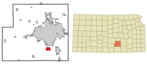
mapsize = 250px
map_caption = Location of Haysville, Kansas
mapsize1 =
map_caption1 =subdivision_type = Country
subdivision_name =United States
subdivision_type1 = State
subdivision_name1 =Kansas
subdivision_type2 = County
subdivision_name2 = Sedgwick
government_footnotes =
government_type =
leader_title =Mayor
leader_name =Bruce Armstrong
leader_title1 =
leader_name1 =
established_title =
established_date =unit_pref = Imperial
area_footnotes =area_magnitude =
area_total_km2 = 9.1
area_land_km2 = 9.1
area_water_km2 = 0.0
area_total_sq_mi = 3.5
area_land_sq_mi = 3.5
area_water_sq_mi = 0.0population_as_of = 2000
population_footnotes =
population_total = 8502
population_density_km2 = 935.4
population_density_sq_mi = 2422.8timezone = Central (CST)
utc_offset = -6
timezone_DST = CDT
utc_offset_DST = -5
elevation_footnotes =
elevation_m = 384
elevation_ft = 1260
latd = 37 |latm = 33 |lats = 50 |latNS = N
longd = 97 |longm = 21 |longs = 11 |longEW = Wpostal_code_type =
ZIP code
postal_code = 67060
area_code = 316
blank_name = FIPS code
blank_info = 20-31125GR|2
blank1_name = GNIS feature ID
blank1_info = 0481653GR|3
website =
footnotes =Haysville is a city in Sedgwick County,
Kansas ,United States . It is a suburb ofWichita . The population was 8,502 at the 2000 census.Geography
Haysville is located at coor dms|37|33|50|N|97|21|11|W|city (37.563787, -97.353044)GR|1.
According to the
United States Census Bureau , the city has a total area of 3.5square mile s (9.1km² ), of which, 3.5 square miles (9.1 km²) of it is land and 0.28% is water.Demographics
As of the
census GR|2 of 2000, there were 8,502 people, 3,021 households, and 2,350 families residing in the city. Thepopulation density was 2,422.8 people per square mile (935.2/km²). There were 3,167 housing units at an average density of 902.5/sq mi (348.4/km²). The racial makeup of the city was 93.86% White, 0.53% African American, 1.14% Native American, 0.53% Asian, 0.01% Pacific Islander, 1.41% from other races, and 2.52% from two or more races. Hispanic or Latino of any race were 3.20% of the population.There were 3,021 households out of which 42.4% had children under the age of 18 living with them, 62.0% were married couples living together, 11.1% had a female householder with no husband present, and 22.2% were non-families. 19.1% of all households were made up of individuals and 8.6% had someone living alone who was 65 years of age or older. The average household size was 2.78 and the average family size was 3.18.
In the city the population was spread out with 30.8% under the age of 18, 8.5% from 18 to 24, 28.8% from 25 to 44, 20.5% from 45 to 64, and 11.4% who were 65 years of age or older. The median age was 34 years. For every 100 females there were 98.3 males. For every 100 females age 18 and over, there were 94.0 males.
The median income for a household in the city was $46,667, and the median income for a family was $50,118. Males had a median income of $37,626 versus $23,681 for females. The
per capita income for the city was $18,484. About 2.9% of families and 4.4% of the population were below thepoverty line , including 4.8% of those under age 18 and 7.5% of those age 65 or over.Education
The city of Haysville is served by
Haysville Public School (USD 261)school district.High SchoolHaysville Campus High School, located in Wichita, but serves as the High School of
Haysville, Kansas USD 261 .Middle School:
Haysville Middle School
Haysville West Middle SchoolElementary Schools:
Freeman Elementary
Nelson Elementary
Oatville Elementary
Prairie Elementary
Rex Elementary
Ruth Clark ElementaryFall festival
The annual Haysville Fall Festival is the largest community event of the year for the city of Haysville. The three day event takes place in and around Riggs Park, the city's largest
public park . The "Fall Festival Committee" is responsible for thefestival each year; but other civic, religious, and community organizations also come together to volunteer their help during the Fall Festival. The Fall Festival celebrated its 20th year in 2004, and the most recent festival was held October 20-22 in 2007.References
External links
* [http://haysvilleonline.com Community website]
* [http://haysville-ks.com City website]
* [http://usd261.com School district website]
* [http://www.haysvillecommunitylibrary.org/index.html Library website]
Wikimedia Foundation. 2010.