- Dexter, Kansas
-
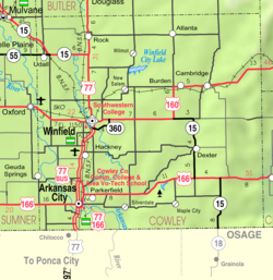
Dexter, Kansas — City — Location of Dexter, Kansas
Coordinates: 37°10′46″N 96°42′58″W / 37.17944°N 96.71611°WCoordinates: 37°10′46″N 96°42′58″W / 37.17944°N 96.71611°W Country United States State Kansas County Cowley Area – Total 0.3 sq mi (0.7 km2) – Land 0.3 sq mi (0.7 km2) – Water 0.0 sq mi (0.0 km2) Elevation 1,211 ft (369 m) Population (2010)[1] – Total 278 – Density 926.7/sq mi (357.8/km2) Time zone Central (CST) (UTC-6) – Summer (DST) CDT (UTC-5) ZIP code 67038 Area code(s) 620 FIPS code 20-17925[2] GNIS feature ID 0469581[3] Website City website Dexter is a city in Cowley County, Kansas, United States. As of the 2010 census, the city population was 278.[1]
Contents
History
Early in the 20th century Dexter became the focus of research that would confirm the existence of an abundance of naturally occurring and readily available helium. In May 1903, a newly drilled natural gas well was found to contain a nonflammable gas. Researchers at the University of Kansas found the “Dexter gas” contained only 15 percent methane and 72 percent nitrogen, causing the gas to be nonflammable. In addition they discovered helium within an “inert residue” in the gas and, after expanding their research to other wells throughout Kansas, Missouri, and Oklahoma, published a paper in 1907 saying that helium could be extracted from natural gas. Helium did not have any practical applications at the time, but by 1917 the federal government was sponsoring extensive research into the possibility of using helium in airships.
Geography
Dexter is located at 37°10′46″N 96°42′58″W / 37.179373°N 96.715987°W (37.179373, -96.715987).[4] According to the United States Census Bureau, the city has a total area of 0.3 square miles (0.78 km2), all of it land.
Area events
- Blackdog Festival, celebrates the historic Black Dog Trail, also known as the Great Osage Trail, created by Osage Indian natives.[5]
Area attractions
- The "Oh Henry!" Candy Bar was invented by a man named Tom Henry of Arkansas City, whose family now runs a candy factory on route K-15 in Dexter, Kansas called "Henry's Candies". The factory sells "Momma Henry" bars, which are near identical to the original "Oh Henry!" candy bar.
- Cowley Lake Waterfall
Demographics
Historical populations Census Pop. %± 1990 320 — 2000 364 13.8% 2010 278 −23.6% U.S. Decennial Census According to the census[2] of 2000, there were 364 people, 119 households, and 81 families residing in the city. The population density was 1,309.4 people per square mile (501.9/km2). There were 133 housing units at an average density of 478.4 per square mile (183.4/km2). The racial makeup of the city was 92.03% White, 0.27% African American, 5.22% Native American, 0.82% from other races, and 1.65% from two or more races. Hispanic or Latino of any race were 1.10% of the population.
There were 119 households out of which 38.7% had children under the age of 18 living with them, 59.7% were married couples living together, 5.9% had a female householder with no husband present, and 31.1% were non-families. 25.2% of all households were made up of individuals and 10.1% had someone living alone who was 65 years of age or older. The average household size was 2.73 and the average family size was 3.43.
In the city the population was spread out with 28.0% under the age of 18, 6.3% from 18 to 24, 26.6% from 25 to 44, 20.6% from 45 to 64, and 18.4% who were 65 years of age or older. The median age was 38 years. For every 100 females there were 87.6 males. For every 100 females age 18 and over, there were 83.2 males.
The median income for a household in the city was $32,656, and the median income for a family was $39,286. Males had a median income of $25,536 versus $18,125 for females. The per capita income for the city was $12,615. About 14.1% of families and 16.4% of the population were below the poverty line, including 23.4% of those under age 18 and 6.9% of those age 65 or over.
References
- ^ a b "2010 City Population and Housing Occupancy Status". U.S. Census Bureau. http://factfinder2.census.gov/faces/tableservices/jsf/pages/productview.xhtml?pid=DEC_10_PL_GCTPL2.ST13&prodType=table. Retrieved March 6, 2011.
- ^ a b "American FactFinder". United States Census Bureau. http://factfinder.census.gov. Retrieved 2008-01-31.
- ^ "US Board on Geographic Names". United States Geological Survey. 2007-10-25. http://geonames.usgs.gov. Retrieved 2008-01-31.
- ^ "US Gazetteer files: 2010, 2000, and 1990". United States Census Bureau. 2011-02-12. http://www.census.gov/geo/www/gazetteer/gazette.html. Retrieved 2011-04-23.
- ^ Black Dog Trail - History
- McCool, John H. This Week in KU History: December 7, 1905 “High On Helium”. Detailing the discovery of helium by KU's chemistry professors.
External links
- City
- Schools
- USD 471, local school district
- Maps
- Cowley County Map, KDOT
Municipalities and communities of Cowley County, Kansas Cities Arkansas City | Atlanta | Burden | Cambridge | Dexter | Geuda Springs‡ | Parkerfield | Udall | Winfield

Townships Beaver | Bolton | Cedar | Creswell | Dexter | Fairview | Grant | Harvey | Liberty | Maple | Ninnescah | Omnia | Otter | Pleasant Valley | Richland | Rock Creek | Salem | Sheridan | Silver Creek | Silverdale | Spring Creek | Tisdale | Vernon | Walnut | Windsor
Unincorporated
communitiesAkron | Hackney | Maple City | Rock | Silverdale | Tisdale
Footnotes ‡This populated place also has portions in an adjacent county or counties
Categories:- Cities in Kansas
- Populated places in Cowley County, Kansas


Wikimedia Foundation. 2010.