- Maple Township, Cowley County, Kansas
-
Maple Township — Township — Location in Cowley County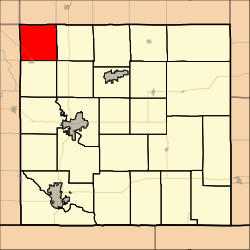
Coordinates: 37°26′12″N 097°05′38″W / 37.43667°N 97.09389°WCoordinates: 37°26′12″N 097°05′38″W / 37.43667°N 97.09389°W Country United States State Kansas County Cowley Area – Total 35.11 sq mi (90.94 km2) – Land 35.11 sq mi (90.93 km2) – Water 0 sq mi (0 km2) 0% Elevation 1,237 ft (377 m) Population (2000) – Total 702 – Density 20/sq mi (7.7/km2) GNIS feature ID 0470215 Maple Township is a township in Cowley County, Kansas, USA. As of the 2000 census, its population was 702.
Geography
Maple Township covers an area of 35.11 square miles (90.9 km2) and contains no incorporated settlements. According to the USGS, it contains two cemeteries: Red Bud and Star Valley.
The stream of Coon Creek runs through this township.
References
External links
Municipalities and communities of Cowley County, Kansas Cities Arkansas City | Atlanta | Burden | Cambridge | Dexter | Geuda Springs‡ | Parkerfield | Udall | Winfield

Townships Beaver | Bolton | Cedar | Creswell | Dexter | Fairview | Grant | Harvey | Liberty | Maple | Ninnescah | Omnia | Otter | Pleasant Valley | Richland | Rock Creek | Salem | Sheridan | Silver Creek | Silverdale | Spring Creek | Tisdale | Vernon | Walnut | Windsor
Unincorporated
communitiesAkron | Hackney | Maple City | Rock | Silverdale | Tisdale
Footnotes ‡This populated place also has portions in an adjacent county or counties
Categories:- Townships in Cowley County, Kansas
- Kansas geography stubs

Wikimedia Foundation. 2010.