- Creswell Township, Cowley County, Kansas
-
Creswell Township — Township — Location in Cowley County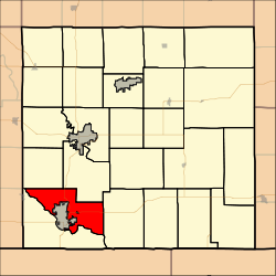
Coordinates: 37°06′05″N 097°03′52″W / 37.10139°N 97.06444°WCoordinates: 37°06′05″N 097°03′52″W / 37.10139°N 97.06444°W Country United States State Kansas County Cowley Area - Total 38.3 sq mi (99.19 km2) - Land 37.51 sq mi (97.14 km2) - Water 0.79 sq mi (2.05 km2) 2.07% Elevation 1,165 ft (355 m) Population (2000) - Total 2,098 - Density 55.9/sq mi (21.6/km2) GNIS feature ID 0470065 Creswell Township is a township in Cowley County, Kansas, USA. As of the 2000 census, its population was 2,098.
Contents
Geography
Creswell Township covers an area of 38.3 square miles (99 km2) and contains two incorporated settlements, Arkansas City and Parkerfield. According to the USGS, it contains one cemetery, Parker.
The streams of Spring Creek and Walnut River run through this township.
Transportation
Creswell Township contains two airports or landing strips: Charden Farms Airport and Marrs Field.
References
External links
Municipalities and communities of Cowley County, Kansas County seat: Winfield Cities Arkansas City | Atlanta | Burden | Cambridge | Dexter | Geuda Springs‡ | Parkerfield | Udall | Winfield

Townships Beaver | Bolton | Cedar | Creswell | Dexter | Fairview | Grant | Harvey | Liberty | Maple | Ninnescah | Omnia | Otter | Pleasant Valley | Richland | Rock Creek | Salem | Sheridan | Silver Creek | Silverdale | Spring Creek | Tisdale | Vernon | Walnut | Windsor
Unincorporated
communitiesAkron | Hackney | Maple City | Rock | Silverdale | Tisdale
Footnotes ‡This populated place also has portions in an adjacent county or counties
Categories:- Townships in Cowley County, Kansas
- Kansas geography stubs

Wikimedia Foundation. 2010.