- Yinchuan
-
Yinchuan
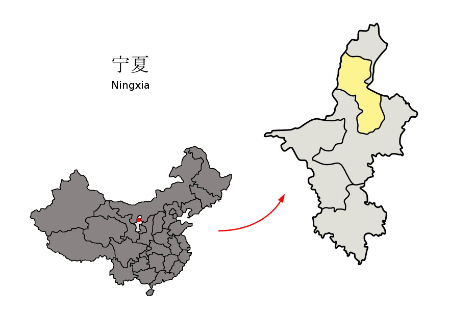
银川— Prefecture-level city — 银川市  The territory of Yinchuan prefecture-level city (yellow) within Ningxia
 Satellite image of Yinchuan
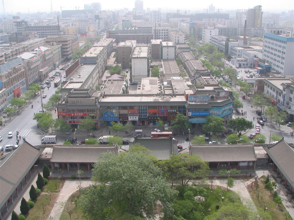
 Location within China
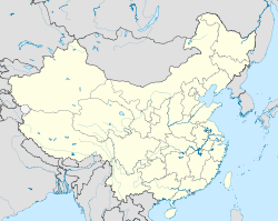
 Yinchuan
Coordinates: 38°28′N 106°16′E / 38.467°N 106.267°ECoordinates: 38°28′N 106°16′E / 38.467°N 106.267°E Country People's Republic of China Region Ningxia County-level divisions Township divisions Government – CPC Yinchuan – Mayor Wang Rugui[1] Area – Prefecture-level city 4,467 km2 (1,724.7 sq mi) – Urban 2,045 km2 (789.6 sq mi) – Metro 2,045 km2 (789.6 sq mi) Elevation 1,100 m (3,608 ft) Population (2010 census)[2] – Prefecture-level city 1,993,088 – Urban 1,290,170 – Urban density 630.9/km2 (1,634/sq mi) – Metro 1,290,170 – Metro density 630.9/km2 (1,634/sq mi) Time zone China Standard Time (UTC+8) Postal code 750000 Area code(s) 951 License plate prefixes 宁A Website www.yinchuan.gov.cn (Chinese) Yinchuan Simplified Chinese 银川 Traditional Chinese 銀川 Hanyu Pinyin Yínchuān Literal meaning silver river Transcriptions Mandarin - Hanyu Pinyin Yínchuān Min - Hokkien POJ Gîn-chhoan Wu - Romanization nyin平tshoe平 Cantonese (Yue) - Jyutping ngan4cyun1 Yinchuan (simplified Chinese: 银川; traditional Chinese: 銀川; pinyin: Yínchuān; Wade–Giles: Yin-ch'uan) is the capital of the Ningxia Hui Autonomous Region, People's Republic of China, and former capital of the Western Xia Empire of the Tanguts. It has an area of 4,467 km² and a total population of 1.99 million. Its built up area is home to 1,290,170 inhabitants spread on 3 urban districts. The name of the city literally means "silver river"; the character for "river" (川) is the same as that in Sichuan, but not as those in, for example, the Yellow River (黄河) or Yangtze River (长江).
Contents
History
Yinchuan originally was a xian (county) under the name of Fuping in the 1st century BC; its name was changed to Huaiyuan in the 6th century AD. After the fall of the Tang dynasty in 907, it was occupied by the Tangut Xi-Xia dynasty, of which it was the capital. After the destruction of the Xi-Xia dynasty by the Mongols in 1227, it came under the rule of the Mongol Yuan Dynasty. Under the Ming (1368–1644) and Qing (1644–1911) dynasties, it was a prefecture of Ningxia. In 1928, when the province of Ningxia was formed from parts of Gansu and Inner Mongolia, it became the capital city. In 1954, when Ningxia province was abolished, the city was put in Gansu province; but, with the establishment of the Ningxia Hui autonomous region in 1958, Yinchuan once again became the capital.
Traditionally, Yinchuan was an administrative and commercial center. In the 1950s it had many commercial enterprises, and there were some handicrafts but no modern industry. The city has since grown considerably. Extensive coal deposits discovered on the eastern bank of the Yellow River, near Shizuishan, 100 km to the north, have made Shizuishan a coal-mining center.
Yinchuan, however, remains largely nonindustrial. The immediate plains area, intensively irrigated by a system developed as long ago as the Han (206 BC–AD 220) and Tang (618–907) dynasties, is extremely productive. Yinchuan is the chief agricultural market and distribution center for this area and also deals in animal products from the herds tended by nomads in the surrounding grasslands. It is a market for grain and has flour mills, as well as rice-hulling and oil-extraction plants. The wool produced in the surrounding plains supplies a woolen-textile mill. Yinchuan is a center for the Muslim (Hui) minority peoples, who constitute a third of the population. Yinchuan currently serves as a major trade route between Western cities such as Urumqi and the East.
On July 23, 1993 an airliner that was attempting its second takeoff veered off the runway, crashed into a lake, and broke apart; at least 59 of the 113 persons aboard the craft were killed.[3]
Geography
Yinchuan lies in the middle of the Yinchuan or Ningxia Plain. It is sheltered from the deserts of Mongolia by the high ranges of the Helan Mountain to its west. The Yellow River runs through Yinchuan from southwest to northeast. The average elevation of Yinchuan is 1,100 meters (about 3,608 feet). The urban center of Yinchuan lies about halfway between the Yellow River and the edge of Helan Mountain.
Climate
Yinchuan has a desert climate (Köppen BWk) with cold and windy (but dry) winters, dust-laden springs, hot and somewhat humid summers, and rather short autumns. Monthly means range from −7.9 °C (17.8 °F) in January to 23.5 °C (74.3 °F) in July, with the mean for year at 9.0 °C (48.2 °F). Rainfall, is not heavy during any season, not even summer. Diurnal temperature differences tend to be large due to the aridity, which also partly contributes to the high annual sunshine hour total of just over 2,900 hours. There are 158 frost-free days.
Climate data for Yinchuan (1971-2000) Month Jan Feb Mar Apr May Jun Jul Aug Sep Oct Nov Dec Year Average high °C (°F) −0.8
(30.6)3.5
(38.3)10.4
(50.7)18.9
(66.0)24.2
(75.6)27.8
(82.0)29.5
(85.1)27.6
(81.7)23.2
(73.8)16.7
(62.1)7.7
(45.9)0.8
(33.4)15.8 Average low °C (°F) −13.7
(7.3)−9.8
(14.4)−2.8
(27.0)3.9
(39.0)10.1
(50.2)15.1
(59.2)17.6
(63.7)16.2
(61.2)10.4
(50.7)3.1
(37.6)−3.2
(26.2)−10.3
(13.5)3.1 Precipitation mm (inches) 1.2
(0.047)2.3
(0.091)6.3
(0.248)8.3
(0.327)18.7
(0.736)17.4
(0.685)42.8
(1.685)51.5
(2.028)22.5
(0.886)11.5
(0.453)2.9
(0.114)0.9
(0.035)186.3
(7.335)% humidity 55 50 49 42 46 56 64 69 67 62 64 62 57.2 Avg. precipitation days 1.2 1.4 2.3 2.6 4.1 5.6 7.9 8.7 5.7 3.4 1.4 0.8 45.1 Sunshine hours 205.7 201.1 232.6 255.5 287.1 285.3 281.8 267.2 240.2 231.9 214.3 203.1 2,905.8 Source: China Meteorological Administration Administrative divisions
Map # Name Hanzi Hanyu Pinyin Xiao'erjing Population
(2010)Area (km²) Density (/km²) 
City proper 1 Xingqing District 兴庆区 Xīngqìng Qū دٍ ﻓْﻊ ﺛُﻮ 678,306 768 883 2 Jinfeng District 金凤区 Jīnfèng Qū دٍ ﻓْﻊ ﺛُﻮ 282,554 290 974 3 Xixia District 西夏区 Xīxià Qū ثِ ﺷﯿَا ﺛُﻮ 329,310 987 334 Satellite cities 4 Lingwu City 灵武市 Língwǔ Shì لٍ ءُ شِ 261,677 4,639 56 Rural 5 Yongning County 永宁县 Yǒngníng Xiàn ﻳْﻮ نٍ ﺷِﯿًﺎ 218,260 1,295 169 6 Helan County 贺兰县 Hèlán Xiàn حْ لً ﺷِﯿًﺎ 222,981 1,600 139 Economy
The city's gross domestic product per capita was ¥31,436 (US$4,526) in 2008, ranking 197th of 659 Chinese cities. Its main industries are the production of Chinese wolfberry, wheat, apple, and rice.[citation needed]
Transportation
- Yinchuan is located near the western bank of the upper course of the Yellow River, near the western end of the Great Wall of China in the south-central section of the Helan Shan and Ordos Desert.
- It is served by Yinchuan Hedong Airport.
- It is served by a river port at Hengcheng, about 15 km to the east. Until the 1950s the river, which is navigable downstream as far as Baotou in the Inner Mongolian autonomous region and upstream to Zhongwei and Zhongning, was the chief communication link.
- Highways also link the city to Baotou along the river, to Lanzhou in Gansu province to the southwest, to Wuwei in Gansu to the west, and to Xi'an in Shaanxi province to the southeast.
- Since 1958 the city has been on the railway from Lanzhou to Baotou and is thus linked to other parts of China by rail.
- China National Highway 211
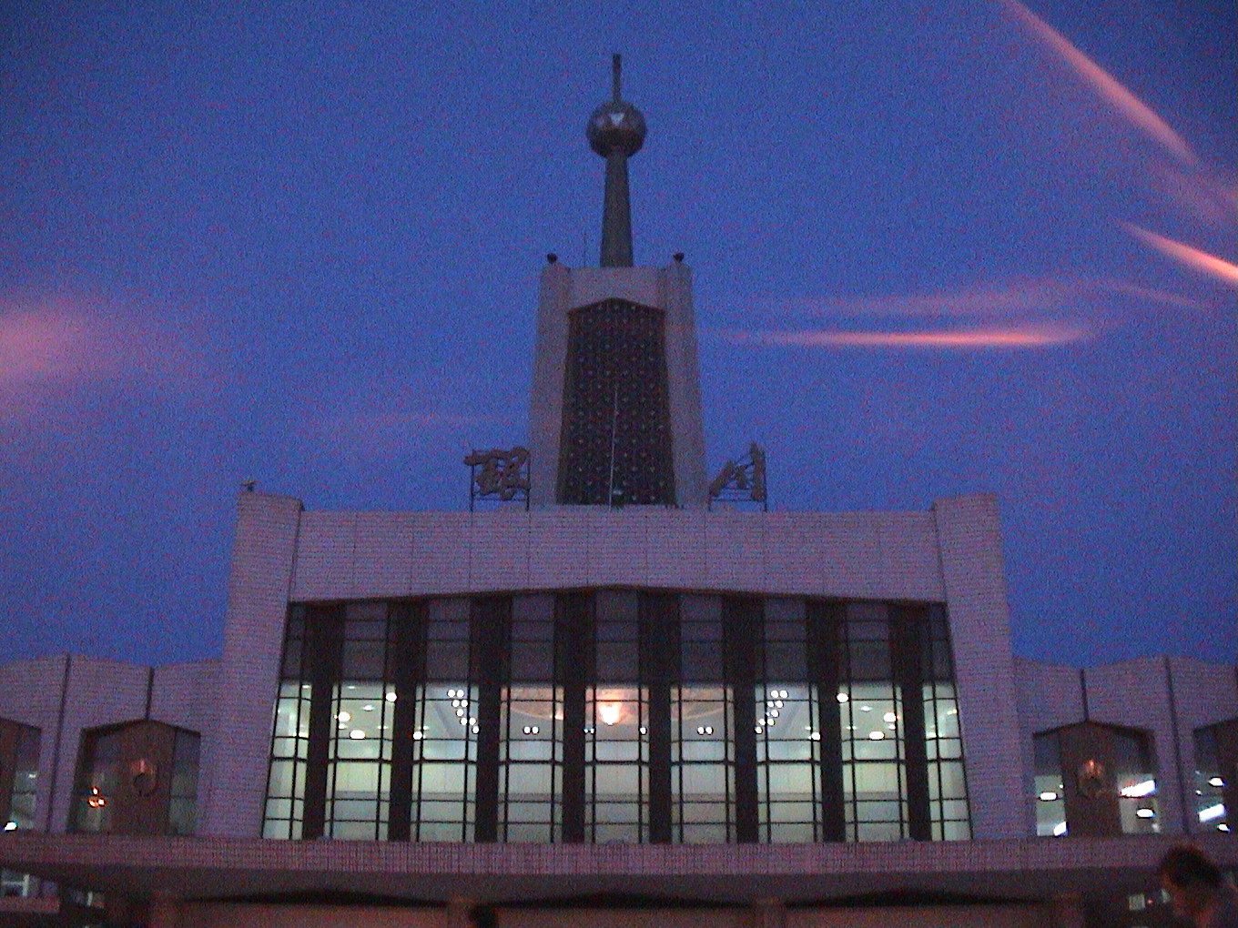
 Yinchun Railroad station
Tourism
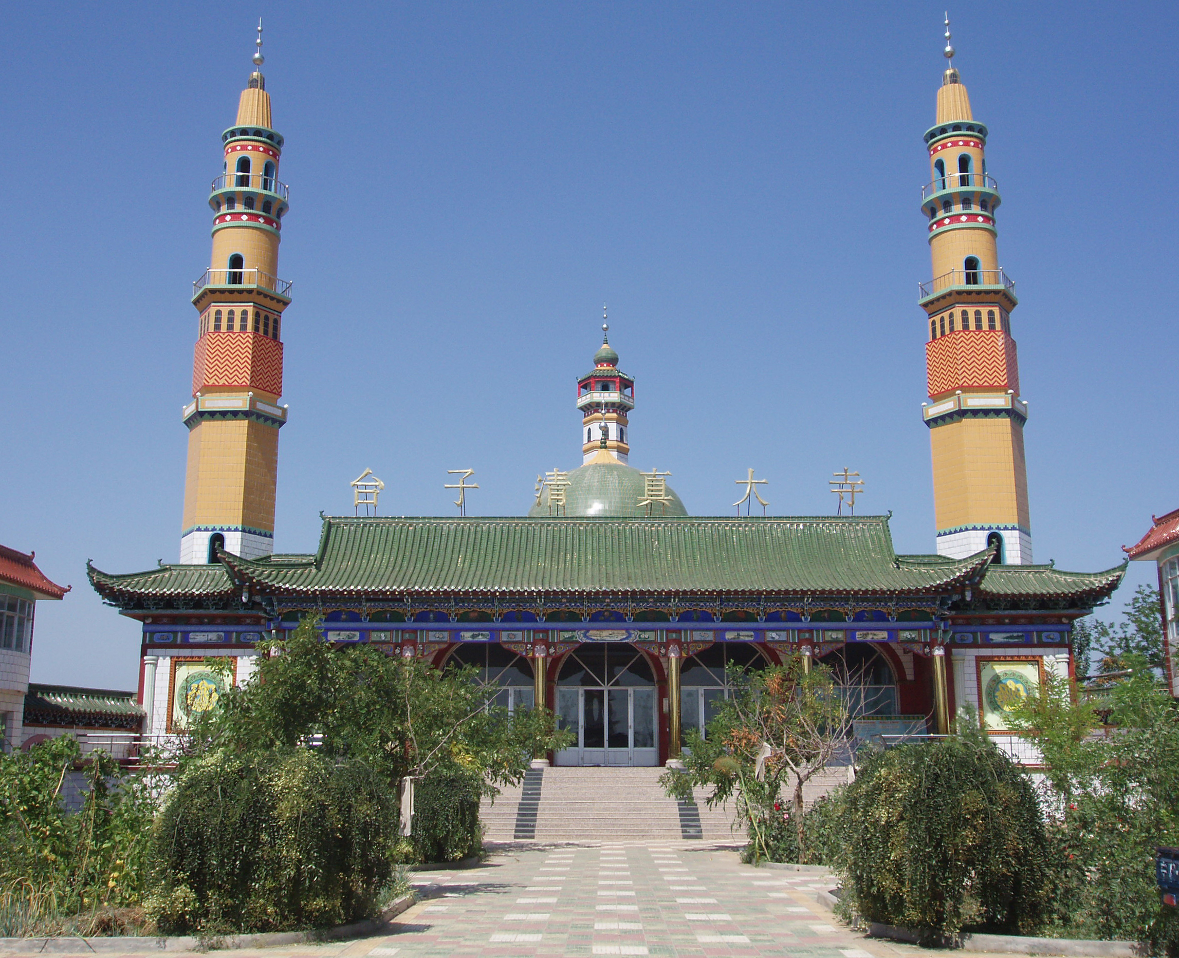
 A mosque in Yinchuan, China.
The city's attractions include the Sand-lake and the Western Xia tombs. Sand Lake is 35 miles north of Yinchuan. Being a world of desert and lake, it is an ideal place for bird watching, sand slide and cableway slide. Appreciating reeds, lotus and fish are also popular. The Western Xia Imperial Tombs are 15.5 miles west of Yinchuan on east side of Mt. Helan. Since June 1972, nine imperial tombs and 253 lesser tombs have been unearthed, which are as grand as Ming Tombs in Beijing. With a total area of more than 19.3 square miles, it is unique among royal burials.
There are two pagodas in Yinchuan that are part of the 'Eight Famous Scenery of Ningxia': one is the Haibao Pagoda in the northern suburb and the other is the Chengtiansi Pagoda in the west.
Since 2000, Yinchuan has hosted the annual Yinchuan International Car and Motorcycle Tourism Festival, which usually occurs in August. It is the largest event of its kind in China; approximately 3000 motorcycles attend annually.
It is also possible to see parts of the Great Wall which are located near the city.
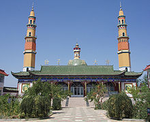 A mosque in Yinchuan
Colleges and universities
- Ningxia Polytechnical University
- Ningxia University
- Second Northwest Nationalities University
- Ningxia Medical Institute
 The West Movie Studio in suburb of Yinchuan
2006 Internet phenomenon
Yinchuan was subject to an Internet phenomenon after a user of Google Earth posted images of a People's Liberation Army military facility.[4] The facility, estimated at around 630,000 m² in size, is 35 km from Yinchuan and in the town of Huangyangtan. The purpose of the facility was speculated on the Internet following the original posting, although no official explanation for the site has been given. A subsequent posting of a photograph on the Chinese wforum.com claimed that it constituted a terrain model of the disputed Aksai Chin region of China;[5][6][7] the image includes a watermark of Xinhua News Agency, the official press agency of the government of the People's Republic of China.
Authorities in the Ningxia Hui Autonomous Region have been quoted as saying that the site is used as a tank training facility.[8]
References
- ^ "Large Bearing Project of Schaeffler Group Started Construction in Yinchuan ETDZ" (Press release). Foreign Investment Administration, MOFCOM. 2008-04-18. http://www.fdi.gov.cn/pub/FDI_EN/StateDevelopmentZone/NewsUpdate/NewsUpdateContent/t20080418_91755.htm. Retrieved 2008-07-17. "Wang Rugui, Mayor of Yinchuan on behalf of the CPC Committee of Yinchuan and the municipal government expressed the warm congratulation to [sic] the start of the project."
- ^ According to 2010 China National Census
- ^ July 23 Events in History
- ^ Google Earth Community (2006). China - Huangyangtan - Scale model of landscape?. Retrieved August 14, 2006.
- ^ Hutcheon, Stephen (14 August 2006). "The riddle of China's Area 51". The Age. http://www.theage.com.au/articles/2006/08/14/1155407679963.html.
- ^ Aroor, Shiv (5 August 2006). "From sky, see how China builds model of Indian border 2400 km away". Indian Express. http://www.indianexpress.com/story/9972.html.
- ^ Haines, Lester (19 July 2006). "Chinese black helicopters circle Google Earth". The Register. http://www.theregister.co.uk/2006/07/19/huangyangtan_mystery/.
- ^ Hutcheon, Stephen (23 July 2006). "Chinese X-file not so mysterious after all". The Age. http://www.theage.com.au/news/web/chinese-xfile-not-so-mysterious-after-all/2006/07/23/1153593217781.html.
External links
- Yinchuan Government website
- Weather forecast for Yinchuan in Ningxia (China), 1117 m
- The Yinchuan World Rock Art Museum
Ningxia topics Yinchuan (capital)General Geography Education Cuisine Visitor attractions Xixia TombsNingxia Hui Autonomous Region county-level divisions Yinchuan (capital)Yinchuan: Xingqing District · Jinfeng District · Xixia District · Lingwu City · Yongning County · Helan County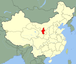 Ningxia in China
Shizuishan: Dawukou District · Huinong District · Pingluo County
Wuzhong: Litong District · Qingtongxia City · Yanchi County · Tongxin County
Guyuan: Yuanzhou District · Xiji County · Longde County · Jingyuan County · Pengyang County
Zhongwei: Shapotou District · Zhongning County · Haiyuan CountyMetropolitan cities of the People's Republic of China Municipalities and National central cities Regional central cities Special administrative regions Sub-provincial cities (not included above) Separate state-planning cities (not included above) Provincial capitals (not included above) Autonomous regional capitals Comparatively large cities (not included above) Special economic zone cities (not included above) Coastal development cities (not included above) XPCC / Bingtuan cities State-level new areas Pudong New Area (Shanghai) · Binhai New Area (Tianjin) · Liangjiang New Area (Chongqing) · Zhoushan Archipelago New Area (Zhoushan)Provincial capitals of the People's Republic of China Changchun, Jilin · Changsha, Hunan · Chengdu, Sichuan · Fuzhou, Fujian · Guangzhou, Guangdong · Guiyang, Guizhou · Haikou, Hainan · Hangzhou, Zhejiang · Harbin, Heilongjiang · Hefei, Anhui · Hohhot, Inner Mongolia · Jinan, Shandong · Kunming, Yunnan · Lanzhou, Gansu · Lhasa, Tibet · Nanchang, Jiangxi · Nanjing, Jiangsu · Nanning, Guangxi · Shenyang, Liaoning · Shijiazhuang, Hebei · Taiyuan, Shanxi · Ürümqi, Xinjiang · Wuhan, Hubei · Xi'an, Shaanxi · Xining, Qinghai · Yinchuan, Ningxia · Zhengzhou, Henan
Dongcheng District (Beijing) · Yuzhong District (Chongqing) · Huangpu District (Shanghai) · Heping District (Tianjin)

Major cities along the Yellow River Provinces and Autonomous regions Cities(from upper reaches to lower reaches)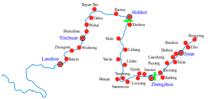
Gansu Ningxia Inner Mongolia Shanxi Shaanxi Henan Shandong Baotou–Lanzhou Railway (← Beijing–Baotou Railway) · Baotou East · Baotou · Baotou West · Haye Hutong · Baiyanhua · Gongmiaozi · Malashan · Urat Front Banner · Xixiaozhao · Wuyuan · Sifentan · Linhe District · Toudaoqiao · Bayan Gol · Hanggin Banner · Jiangui · Wuhai North · Wuhai · Wuhai West · Huinong District · Nuanquan · Yinchuan · Huangyangtan · Daba · Qingtongxia · Zhongning County · Huangyangwan · Zhongwei · Shapotou District · Gantang · Yingpanshui · Great Wall · Jingtai County · Xingquanbao · Hongxiantai · Hongshaxian · Bayin West · Zhujiayao · Fengshuicun · Gaolan County · Shaojiatang · Shuiyuan · Lanzhou East · Lanzhou · (Lanzhou–Xinjiang Railway →) Connecting Railways: Baotou–Shenmu Railway · Baotou–Bayan Obo Railway · Baotou Ring Railway · Pingru Railway · Baotou–Zhongwei Railway · Gantang–Wuwei Railway · Honghui Railway · Longhai RailwayCategories:
- Cities in Ningxia
- Internet memes
- Provincial capitals in China


Wikimedia Foundation. 2010.