- Yellow River
-
Yellow River (Huang He) 
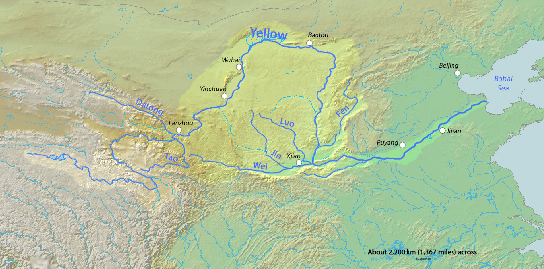
Current Course of the Yellow River with major citiesOrigin Bayan Har Mountains, Qinghai Province Mouth Bohai Sea Basin countries People's Republic of China Length 5,464 km (3,395 mi) Source elevation 4,500 m (14,800 ft) Avg. discharge 2,571 m3/s (90,800 cu ft/s) Basin area 752,000 km2 (290,000 sq mi) Yellow River 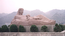
The "Mother River" monument in Lanzhou Chinese name Traditional Chinese 黃河 Simplified Chinese 黄河 Transcriptions Mandarin - Hanyu Pinyin Huáng Hé - Postal Map Hwang Ho Mongolian name Mongolian Хатан гол
Ȟatan Gol
Шар мөрөн
Šar MörönTibetan name Tibetan རྨ་ཆུ། Transcriptions - Wylie r Ma chu - THDL ma chu The Yellow River or Huang He, formerly known as the Hwang Ho, is the second-longest river in China (after the Yangtze) and the sixth-longest in the world at the estimated length of 5,464 kilometers (3,395 mi).[1] Originating in the Bayan Har Mountains in Qinghai Province in western China, it flows through nine provinces of China and empties into the Bohai Sea. The Yellow River basin has an east-west extent of 1900 km (1,180 mi) and a north-south extent of 1100 km (684 mi). Its total basin area is 742,443 km² (290,520 mi²).
The Yellow River is called "the cradle of Chinese civilization" as its basin – specifically, the Wei valley that cuts across the long Ordos loop – was the birthplace of ancient Chinese civilizations and the most prosperous region in early Chinese history. However, frequent devastating floods and course changes produced by the continual elevation of the river bed, sometimes above the level of its surrounding fields has also earned it the unenviable names "China's Sorrow" and "Scourge of the Sons of Han."[2]
Contents
Name
Early Chinese literature refers to the Yellow River simply as 河 (Old Chinese: *C.gˤaj[3]), a character that has come to simply mean "river" in modern usage. The first appearance of the name 黃河 (Old Chinese: *N-kʷˤaŋ C.gˤaj; Middle Chinese: Hwang Ha[3]) is in the Book of Han written during the Western Han dynasty (206 BC – AD 9). The epithet "yellow" describes the perennial color of the muddy water in the lower course of the river, arising from loess being carried downstream.
One of its older Mongolian names was the "Black River",[4] as it runs clear prior to its entry onto the Loess Plateau, but the current name of the river among Inner Mongolians is Ȟatan Gol (Хатан гол, "Queen River").[5] In Mongolia itself, it is simply called the Šar Mörön (Шар мөрөн, "Yellow River").
In Qinghai, the river's Tibetan name is "River of the Peacock" (Tibetan: རྨ་ཆུ།, Ma Chu; Chinese: s 玛曲, t 瑪曲, p Mǎ Qū).
History
Prior to the advent of modern dams in China, the Yellow River was extremely prone to flooding. In the 2,540 years prior to AD 1946, the Yellow River has been reckoned to have flooded 1,593 times, shifting its course 26 times noticeably[6] and nine times severely.[7] These floods include some of the deadliest natural disasters ever recorded. Before modern disaster management, when floods occurred, some of the population might initially die from drowning but then many more would suffer from the ensuing famine and spread of diseases.[8]
The cause of the floods is the large amount of fine-grained loess carried by the river from the Loess Plateau, which is continuously deposited along the bottom of its channel. The sedimentation causes natural dams to slowly accrue. These subaqueous dams were unpredictable and generally undetectable. Eventually, the enormous amount of water has to find a new way to the sea and bursts out across the flat North China Plain, sometimes finding a new course. The traditional Chinese response of building higher and higher levees along the banks sometimes also contributed to the severity of the floods: When flood water did break through the levees, it could no longer drain back into the river bed as it would after a normal flood as the river bed was sometimes now higher than the surrounding countryside.
Another historical source of devastating floods is the collapse of upstream ice dams in Inner Mongolia with an accompanying sudden release of vast quantities of impounded water. There have been 11 such major floods in the past century, each causing tremendous loss of life and property. Nowadays, explosives dropped from aircraft are used to break the ice dams before they become dangerous.[citation needed]
Ancient times
Historical maps from the Spring and Autumn period[9] and Qin Dynasty[10] indicate that the Yellow River at that time flowed considerably north of its present course. These maps show that after the river passed Luoyang, it flowed along the border between Shanxi and Henan Provinces, then continued along the border between Hebei and Shandong before emptying into Bohai Bay near present-day Tianjin. Another outlet followed essentially the present course.[7]
The river left these paths in 602 BC[9] and shifted completely south of the Shandong peninsula.[7] Sabotage of dikes, canals, and reservoirs and deliberate flooding of rival states became a standard military tactic during the Warring States period.[11] Major flooding in AD 11 is credited with the downfall of the short-lived Xin dynasty, and another flood in AD 70 returned the river north of Shandong on essentially its present course.[7]
Medieval times
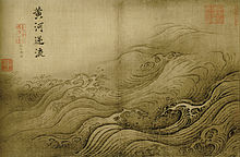
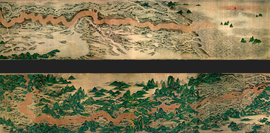
 The Yellow River as depicted in Qing Dynasty Chinese landscape painting
In 923, a desperate Liang general Tuan Ning again broke the dikes, flooding 1,000 square miles (2,600 km2) in an failed attempt to protect the Liang capital from the Later Tang. A similar proposal from the Song engineer Li Chun concerning flooding the lower reaches of the river to protect the central plains from the Khitai was overruled in 1020: the Treaty of Shanyuan between the two states had expressly forbid the Song from establishing new moats or changing river courses.[12]
Breaches occurred regardless: one at Henglong in 1034 divided the course in three and repeatedly flooded the northern regions of Dezhou and Bozhou.[12] The Song worked for five years futilely attempting to restore the previous course – using over 35,000 employees, 100,000 conscripts, and 220,000 tons of wood and bamboo in a single year[12] – before abandoning the project in 1041. The more sluggish river then occasioned a breach at Shanghu that sent the main outlet north towards Tianjin in 1048[7] and by 1194 blocked the mouth of the Huai River.[13] The build up of silt deposits was such that even after the Yellow River later shifted its course, the Huai was no longer able to flow along its historic one. Instead, its water pools into Hongze Lake and then runs southward toward the Yangtze River.[citation needed]
A flood in 1324[7] or 1344[citation needed] returned the Yellow River south of Shandong.
The 1642 flood was man-made, caused by the attempt of the Ming governor of Kaifeng to use the river to destroy the peasant rebels under Li Zicheng who had been besieging the city for the past six months.[14] He directed his men to break the dikes in an attempt to flood the rebels, but destroyed his own city instead: the flood and the ensuing famine and plague are estimated to have killed 300,000 of the city's previous population of 378,000.[15] The once-prosperous city was nearly abandoned until its rebuilding under the Qing emperor Kangxi.
Recent times
 A map of China depicting the Yellow River's path in the early 19th century.
In 1851,[7] 1853,[13] or 1855,[citation needed] it returned to the north amid the floods that provoked the Nien Rebellion.
The 1887 flood has been estimated to have killed between 900,000 and 2,000,000 people.[16]
The Yellow River adopted essentially its present course during the 1897 flood.[13][17]
The 1931 flood killed an estimated 1,000,000 to 4,000,000.[16]
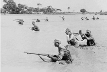 Soldiers during the 1938 Yellow River flood
On 9 June 1938, during the Second Sino-Japanese War, Nationalist troops under Chiang Kai-Shek broke the levees holding back the river near the village of Huayuankou in Henan, causing what has been called a "war-induced natural disaster".[by whom?] The goal of the operation was to stop the advancing Japanese troops by following a strategy of "using water as a substitute for soldiers" (yishui daibing). The 1938 flood of an area covering 54,000 km² took some 500,000 to 900,000 Chinese lives, along with an unknown number of Japanese soldiers. The flood prevented the Japanese army from taking the city of Zhengzhou, but did not stop them from reaching their goal of capturing Wuhan, the temporary capital of China at the time.[18]
Characteristics
The Yellow River is notable for the large amount of silt it carries—1.6 billion tons annually at the point where it descends from the Loess Plateau. If it is running to the sea with sufficient volume, 1.4 billion tons are carried to the sea annually.[citation needed] One estimate gives 34 kilograms of silt per cubic meter as opposed to 10 for the Colorado and 1 for the Nile.[19]
Its average discharge is said to be 2,110 cubic meters per second (32,000 for the Yangtze), with a maximum of 25,000 and minimum of 245. However, since 1972, it often runs dry before it reaches the sea. The low volume is due to increased agricultural irrigation, increased by a factor of five since 1950. Water diverted from the river as of 1999 served 140 million people and irrigated 74,000 km² (48,572 mi²) of land.[20] The Yellow River delta totals 8,000 square kilometers (3,090 mi²). However, with the decrease in silt reaching the sea, it has been reported to be shrinking slightly each year since 1996 through erosion.[21]
The highest volume occurs during the rainy season from July to October, when 60% of the annual volume of the river flows. Maximum demand for irrigation is needed between March and June. In order to capture excess water for use when needed and for flood control and electricity generation, several dams have been built, but their expected life is limited due to the high silt load. A proposed South-North Water Transfer Project involves several schemes to divert water from the Yangtze River: one in the western headwaters of the rivers where they are closest to one another, another from the upper reaches of the Han River, and a third using the route of the old Grand Canal.[citation needed]
Due to its heavy load of silt the Yellow River is a depositing stream – that is, it deposits part of its carried burden of soil in its bed in stretches where it is flowing slowly. These deposits elevate the riverbed which flows between natural levees in its lower reaches. Should a flood occur, the river may break out of the levees into the surrounding lower flood plain and adopt a new course. Historically this has occurred about once every hundred years. In modern times, considerable effort has been made to strengthen levees and control floods.[citation needed]
Geography
According to the China Exploration and Research Society, the source of the Yellow River is at 34° 29' 31.1" N, 96° 20' 24.6" E in the Bayan Har Mountains near the eastern edge of Yushu Tibetan Autonomous Prefecture. The source tribituaries drain into Gyaring Lake and Ngoring Lake on the western edge of Golog Prefecture high in the Bayan Har Mountains in Qinghai Province in the far west of China. In the Zoige Basin along the boundary with Gansu Province, the Yellow River loops northwest and then northeast before turning south, creating the "Ordos Loop", and then flows generally eastward across northern China to the Gulf of Bohai, draining a basin of 752,443 square kilometres (290,520 sq mi) which nourishes 140 million people with drinking water and irrigation.[20]
The Yellow River passes through seven present-day provinces and two autonomous regions, namely (from west to east) Qinghai, Gansu, Ningxia, Inner Mongolia, Shaanxi, Shanxi, Henan, and Shandong. Major cities along the present course of the Yellow River include (from west to east) Lanzhou, Yinchuan, Wuhai, Baotou, Luoyang, Zhengzhou, Kaifeng, and Jinan. The current mouth of the Yellow River is located at Dongying, Shandong.
The river is commonly divided into three stages. These are roughly the northeast of the Tibetan Plateau, the Ordos Loop and the North China Plain. However, different scholars have different opinions on how the three stages are divided.[citation needed] This article adopts the division used by the Yellow River Conservancy Commission.[22]
Upper reaches
The upper reaches of the Yellow River constitute a segment starting from its source in the Bayan Har Mountains and ending at Hekou Town (Togtoh County) of Inner Mongolia just before it turns sharply to the south. This segment has a total length of 3,472 kilometres (2,157 mi) and total basin area of 386,000 square kilometres (149,000 sq mi), 51.4% of the total basin area. Along this length, the elevation of the Yellow River drops 3496 metres, with an average grade of 0.10%.
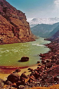
The source section flows mainly through pastures, swamps, and knolls between the Bayan Har Mountains (巴顏喀啦山脈), and the Anemaqen (Amne Machin) Mountains. The river water is clear and flows steadily. Crystal clear lakes are characteristic of this section. The two main lakes along this section are Lake Zhaling (扎陵湖) and Lake Eling (鄂陵湖), with capacities of 4.7 billion and 10.8 billion m³ (166 and 381 billion ft3), respectively. At elevations over 4,290 metres (14,070 ft)) above sea level they are the largest two plateau freshwater lakes in China. A significant amount of land in the Yellow River's source area has been designated as the Sanjiangyuan ("'Three Rivers' Sources") National Nature Reserve, to protect the source region of the Yellow River, the Yangtze, and the Mekong.
The valley section stretches from Longyang Gorge in Qinghai to Qingtong Gorge in Gansu. Steep cliffs line both sides of the river. The water bed is narrow and the average drop is large, so the flow in this section is extremely turbulent and fast. There are 20 gorges in this section, the most famous of these being the Longyang, Jishi, Liujia, Bapan, and Qingtong gorges. The flow conditions in this section makes it the best location for hydroelectric plants.
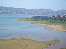
After emerging from the Qingtong Gorge, the river comes into a section of vast alluvial plains, the Yinchuan Plain and Hetao Plain. In this section, the regions along the river are mostly deserts and grasslands, with very few tributaries. The flow is slow. The Hetao Plain has a length of 900 km (560 mi) and width of 30 to 50 km (20–30 mi). It is historically the most important irrigation plain along the Yellow River.
Middle reaches

The part of the Yellow River (see Ordos Loop) between Hekou Town (Togtoh County), in Inner Mongolia and Zhengzhou in Henan constitutes the middle reaches of the river. The middle reaches are 1,206 km (749 mi) long, with a basin area of 344,000 square kilometres (133,000 sq mi), 45.7% of the total, with a total elevation drop of 890 metres (2,920 ft), an average drop of 0.074%. There are 30 large tributaries along the middle reaches, and the water flow is increased by 43.5% on this stage. The middle reaches contribute 92% of the river's silts.
The middle stream of the Yellow River passes through the Loess Plateau, where substantial erosion takes place. The large amount of mud and sand discharged into the river makes the Yellow River the most sediment-laden river in the world. The highest recorded annual level of silts discharged into the Yellow River is 3.91 billion tons in 1933. The highest silt concentration level was recorded in 1977 at 920 kg/m³ (57.4 lb/ft3). These sediments later deposit in the slower lower reaches of the river, elevating the river bed and creating the famous "river above ground".
From Hekou County to Yumenkou, the river passes through the longest series of continuous valleys on its main course, collectively called the Jinshan Valley. The abundant hydrodynamic resources stored in this section make it the second most suitable area to build hydroelectric power plants. The famous Hukou Waterfall is in the lower part of this valley.
Lower reaches
In the lower reaches, from Zhengzhou to the sea, a distance of 786 kilometres (488 mi), the river is confined to a levee-lined course as it flows to the northeast across the North China Plain before emptying into the Bohai Sea. The basin area in this stage is only 23,000 square kilometres (8,900 sq mi), a mere 3% of the total, because few tributaries add to the flow in this stage; nearly all rivers to the south drain into the Huai River, whereas those to the north drain into the Hai River. The total drop in elevation of the lower reaches is 93.6 metres (307 ft), with an average grade of 0.012%.
The silts received from the middle reaches form sediments here, elevating the river bed. During 2,000 years of levee construction, excessive sediment deposits have raised the riverbed several meters above the surrounding ground.
In Kaifeng, the Yellow River is 10 metres (33 ft) above the ground level.[23]
Tributaries
Tributaries of the Yellow River include (upstream to downstream (?)
- White River (白河)
- Black River[disambiguation needed
 ] (黑河)
 - Star River (湟水)
- Daxia River (大夏河)
- Tao River (洮河)
- Zuli River (祖厉河/祖厲河)
- Qingshui River (清水河)
- Dahei River (大黑河)
- Kuye River (窟野河)
- Wuding River (无定河/無定河)
- Fen River (汾河)
- Wei River (渭河)
- Luo River (洛河)
- Qin River (沁河)
- Dawen River (大汶河)
- Kuo River ()
The Wei River is the largest of these tributaries.
Hydroelectric power dams
Below is the list of hydroelectric power stations built on the Yellow River, arranged according to the year to start operation (in brackets):
- Sanmenxia Dam hydroelectric power station (1960)
- Sanshenggong hydroelectric power station (1966)
- Qingtong Gorge hydroelectric power station (1968) (Qingtongxia City, Ningxia)
- Liujiaxia Dam (Liujia Gorge)(1974) (Yongjing County, Gansu)
- Lijiaxia Dam (1997) (Jainca County, Qinghai)
- Yanguoxia Dam (Yanguo Gorge) hydroelectric power station (1975) (Yongjing County, Gansu)
- Tianqiao hydroelectric power station (1977)
- Bapanxia Dam (Bapan Gorge) (1980) (Xigu District, Gansu)
- Longyangxia Dam (1992) (Gonghe County, Qinghai)
- Da Gorge hydroelectric power station (1998)
- Li Gorge hydroelectric power station (1999)
- Wanjiazhai Dam (1999)
- Xiaolangdi Dam (2001) (Jiyuan, Henan)
- Laxiwa Dam (2010) (Guide County, Qinghai)
As reported in 2000, the 7 largest hydro power plants (Longyangxia, Lijiaxia, Liujiaxia, Yanguoxia, Bapanxia, Daxia and Qinglongxia) had the total installed capacity of 5,618 MW.[24]
Crossings
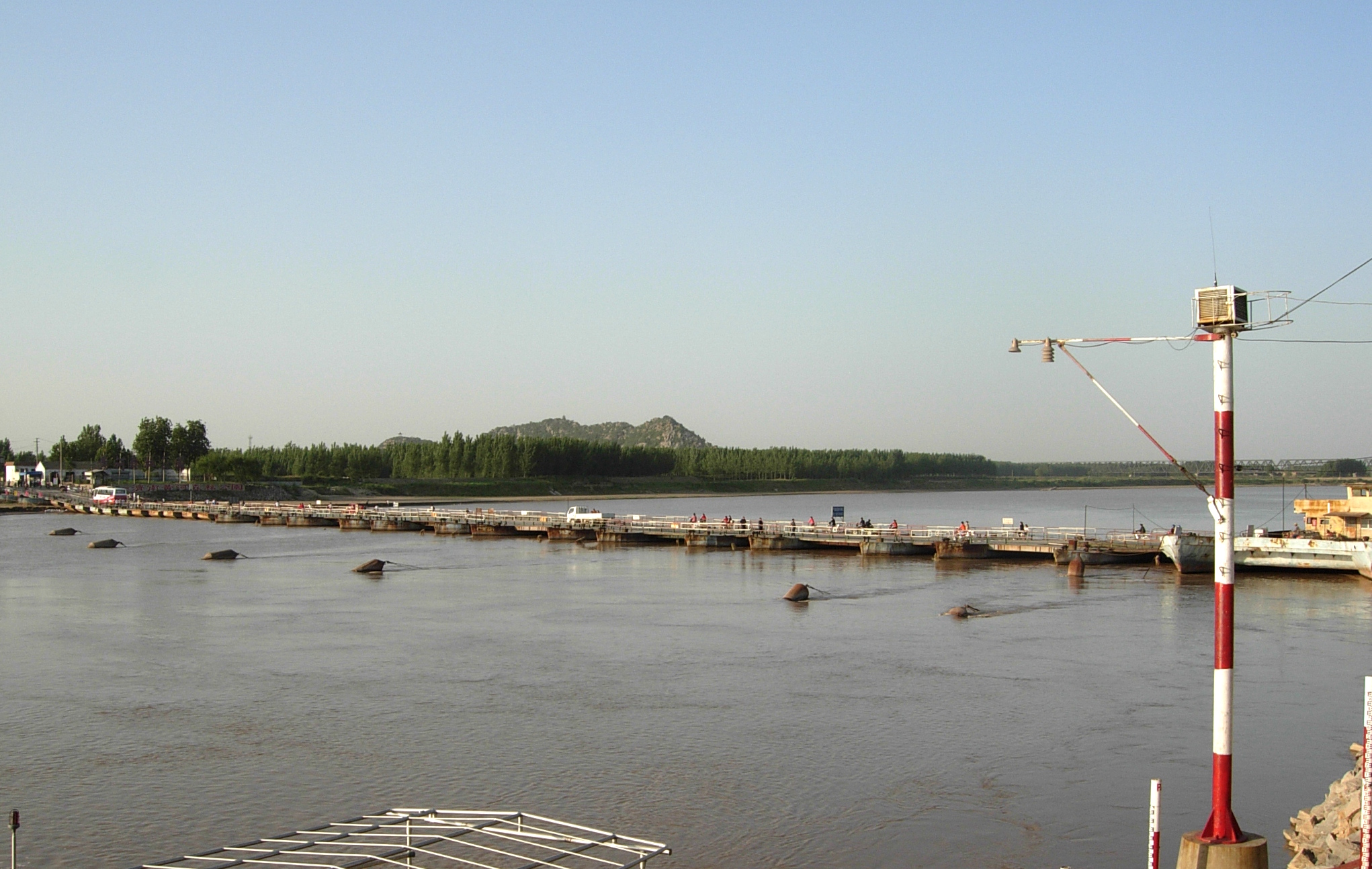
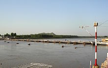 Pontoon bridge (Luokou pontoon bridge simplified Chinese: 洛口浮桥; traditional Chinese: 洛口浮橋; pinyin: Luòkŏu Fúqiáo) over the Yellow River in Jinan
The main bridges and ferries by the province names in the order of downstream to upstream are:[25][26][27]
- Shengli Yellow River Bridge
- Binzhou Yellow River Highway Bridge
- Sunkou Yellow River Highway Bridge
- Zhongshan Bridge
- Jinan Yellow River Bridge (simplified Chinese: 济南黄河大桥; traditional Chinese: 濟南黃河大橋; pinyin: Jǐnán Huánghé Dà Qiáo, 36°45′23.49″N 117°1′54.54″E / 36.756525°N 117.0318167°E)
- Sanmen Yellow River Bridge (Sanmenxia)
- Hancheng Yumenkou Yellow River Bridge
- Yinchuan Yellow River Bridge (Yinchuan)
- Baotou Yellow River Bridge (Baotou)
- Lanzhou Yellow River Bridge (Lanzhou)
- Lanzhou Zhongshan Bridge (Lanzhou)
- Dari Yellow River Bridge (Dari)
- Zalinghu crossing
Pollution
On 25 November 2008, Tania Branigan of The Guardian filed a report "China's Mother River: the Yellow River", claiming that severe pollution has made one-third of China's Yellow River unusable even for agricultural or industrial use, due to factory discharges and sewage from fast-expanding cities.[28] The Yellow River Conservancy Commission had surveyed more than 8,384 miles (13,493 km) of the river in 2007 and said 33.8% of the river system registered worse than "level five" according the criteria used by the UN Environmental Program. Level five is unfit for drinking, aquaculture, industrial use, or even agriculture. The report said waste and sewage discharged into the system last year totaled 4.29b tons. Industry and manufacturing made up 70% of the discharge into the river with households accounting for 23% and just over 6% coming from other sources.[which?]
Yellow River in culture
The provinces of Hebei and Henan derive their names from the Yellow River. Their names mean, respectively, "North of the River" and "South of the River".
- Mother river, China's Sorrow.
Traditionally, it is believed that the Chinese civilization originated in the Yellow River basin. The Chinese refer to the river as "the Mother River" and "the cradle of the Chinese civilization". During the long history of China, the Yellow River has been considered a blessing as well as a curse and has been nicknamed both "China's Pride" (simplified Chinese: 中国的骄傲; traditional Chinese: 中國的驕傲; pinyin: Zhōngguóde Jiāo'ào) and "China's Sorrow"[29] (simplified Chinese: 中国的痛; traditional Chinese: 中國的痛; pinyin: Zhōngguóde Tòng).
- When the Yellow River flows clear.
Sometimes the Yellow River is poetically called the "Muddy Flow" (simplified Chinese: 浊流; traditional Chinese: 濁流; pinyin: Zhuó Liú). The Chinese idiom "when the Yellow River flows clear" is used to refer to an event that will never happen and is similar to the English expression "when pigs fly".
"The Yellow River running clear" was reported as a good omen during the reign of the Yongle Emperor, along with the appearance of such auspicious legendary beasts as qilin (an African giraffe brought to China by a Bengal embassy aboard Zheng He's ships in 1414) and zouyu (not positively identified) and other strange natural phenomena.[30]
See also
- 1938 Yellow River flood
- Central Plain (China)
- Geography of China
- Grand Canal of China
- List of rivers in China
- North China Plain
- North China University of Water Conservancy and Electric Power
- Water resources of China
- Yellow River Cantata
- Yellow River Piano Concerto
- Yellow Sea
- Red sea
References
- ^ Yellow River (Huang He) Delta, China, Asia
- ^ New York Times "A Troubled River Mirrors China's Path to Modernity". 19 November 2006 p. 4.
- ^ a b Baxter, Wm. H. & Sagart, Laurent. Baxter–Sagart Old Chinese ReconstructionPDF (1.93 MB), p. 41. 2011. Accessed 11 October 2011.
- ^ Parker, Edward H. China: Her History, Diplomacy, and Commerce, from the Earliest Times to the Present Day, p. 11. Dutton (New York), 1917.
- ^ Geonames.de. "geonames.de: Huang He".
- ^ Boyang.
- ^ a b c d e f g Tregear, T.R. A Geography of China, p. 218. 1965.
- ^ "Flooding and communicable diseases fact sheet". World Health Organization. p. 2. http://www.who.int/hac/techguidance/ems/flood_cds/en/index.html. Retrieved 27 July 2011.
- ^ a b Gernet, Jacques. Le monde chinois, p. 59. Map "4. Major states of the Chunqiu period (Spring and Autumn)". (French)
English version: Gernet, Jacques (1996), A History of Chinese Civilization (Second edition ed.), Cambridge, England: Cambridge University Press, ISBN 0521497817, http://books.google.com/books?id=jqb7L-pKCV8C - ^ "Qin Dynasty Map".
- ^ Allaby, Michael & Garrat, Richard. Facts on File Dangerous Weather Series: Floods, p. 142. Infobase Pub., 2003. ISBN 0816052824. Accessed 15 October 2011.
- ^ a b c Elvin, Mark & Liu Cuirong (eds.) Studies in Environment and History: Sediments of Time: Environment and Society in Chinese History, pp. 554 ff. Cambridge Uni. Press, 1998. ISBN 052156381X. Accessed 15 Oct. 2011.
- ^ a b c Grousset, Rene. The Rise and Splendour of the Chinese Empire, p. 303. University of California Press, 1959.
- ^ Lorge, Peter Allan. War, Politics and Society in Early Modern China, 900–1795, p. 147. Routledge, 2005. ISBN 978-0-415-31691-0.
- ^ Xu Xin. The Jews of Kaifeng, China: History, Culture, and Religion, p. 47. Ktav Publishing Inc, 2003. ISBN 978-0-88125-791-5.
- ^ a b International Rivers Report. "Before the Deluge". 2007.
- ^ Needham, Joseph. Science and Civilization in China. Vol. 1. Introductory Orientations, p. 68. Caves Books Ltd. (Taipei), 1986.
- ^ Lary, Diana. "The Waters Covered the Earth: China's War-Induced Natural Disaster". Op. cit. in Selden, Mark & So, Alvin Y., eds. War and State Terrorism: The United States, Japan, and the Asia-Pacific in the Long Twentieth Century, pp. 143–170. Rowman & Littlefield, 2004.
- ^ Tregear, T.R. A Geography of China, p. 219. 1965
- ^ a b New York Times http://video.nytimes.com/video/2006/11/17/world/1194817103057/china-s-yellow-river-part-1.html
- ^ "Yellow River Delta Shrinking 7.6 Square Kilometers Annually", China Daily February 1, 2005, retrieved 14 September 2006 from http://china.org.cn/english/2005/Feb/119497.htm
- ^ Yellow River Conservancy Commission
- ^ Yellow River: Geographic and Historical Settings
- ^ Yellow River Upstream Important to West-East Power Transmission People's Daily, December 14, 2000
- ^ Yellow River Bridges (Baidu Encyclopedia) (in Chinese)
- ^ Yellow River Bridge Photos (Baidu) (in Chinese
- ^ Yellow River Highway Bridge Photos (Baidu) (in Chinese)
- ^ Tania Branigan (25 November 2008). "One-third of China's Yellow River 'unfit for drinking or agriculture' Factory waste and sewage from growing cities has severely polluted major waterway, according to Chinese research". guardian.co.uk. http://www.guardian.co.uk/environment/2008/nov/25/water-china. Retrieved 2009-03-14.
- ^ Berkshire encyclopedia of China, page 1125 ISBN 978-0-9770159-4-8
- ^ Duyvendak, J.J.L. (1939), "The True Dates of the Chinese Maritime Expeditions in the Early Fifteenth Century The True Dates of the Chinese Maritime Expeditions in the Early Fifteenth Century", T'oung Pao, Second Series 34 (5): 401–403, http://www.jstor.org/stable/4527170
External links
- Yellow River Conservancy Commission:Yellow River
- Yellow River at University of Massachusetts Dartmouth
- Listen to the Yellow River Ballade from the Yellow River Cantata
- First raft descent of the Yellow River from its source in Qinghai to its mouth (1987)
- Yellow River at risk - Greenpeace China
- video.nytimes.com
The Seven Great Rivers of China Amur River (Heilong Jiang) · Hai He · Huai He · Liao He · Pearl River (Zhu Jiang) · Yangtze River (Chang Jiang) · Yellow River (Huang He) Major cities along the Yellow River Provinces and Autonomous regions Cities(from upper reaches to lower reaches)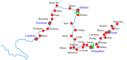
Gansu Ningxia Inner Mongolia Shanxi Shaanxi Henan Shandong Coordinates: 34°55′19″N 97°30′43″E / 34.92194°N 97.51194°E
Categories:- Yellow River
- Rivers of Tibet
- Rivers of China
- Rivers of Qinghai
- Rivers of Gansu
- Rivers of Ningxia
- Rivers of Inner Mongolia
- Rivers of Shaanxi
- Rivers of Shanxi
- Rivers of Henan
- Rivers of Shandong
- Drainage basins of the Pacific Ocean


Wikimedia Foundation. 2010.