- Mount Airy (SEPTA station)
-
Mount Airy
SEPTA regional rail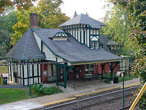
Station statistics Address 119 East Gowen Avenue between Devon and Sprague Streets,
Philadelphia, PA 19119Lines Platforms 2 side platforms Tracks 2 Other information Opened 1875 Accessible 
Owned by SEPTA Fare zone 2 Services Preceding station SEPTA Following station toward 30th Street StationChestnut Hill East Line toward Chestnut Hill EastMt. Airy Station

Location: East Gowen Avenue
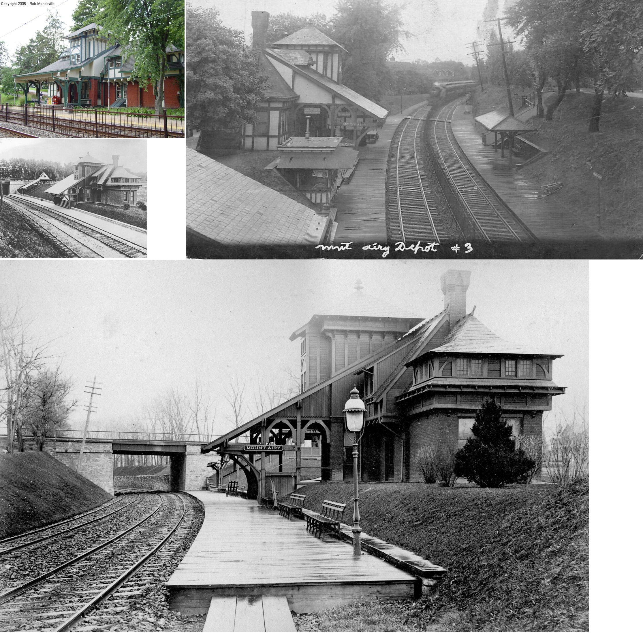
Philadelphia, PennsylvaniaCoordinates: 40°3′53.71″N 75°11′29.77″W / 40.0649194°N 75.1916028°WCoordinates: 40°3′53.71″N 75°11′29.77″W / 40.0649194°N 75.1916028°W Built: 1875 Architectural style: Stick/eastlake Governing body: Private NRHP Reference#: 77001186 Added to NRHP: September 22, 1977[1] Mount Airy Station is a SEPTA Regional Rail station at 119 East Gowen Avenue between Devon and Sprague Streets, Philadelphia, Pennsylvania. The station building is in the National Register of Historic Places and was built in 1875 with Frank Furness as the architect, according to the Philadelphia Architects and Buildings project.
The station is in zone 2 on the Chestnut Hill East Line, on former Reading Railroad tracks, and is 9.3 track miles from Suburban Station. In 2004, this station saw 231 boardings on an average weekday.
References
- ^ "National Register Information System". National Register of Historic Places. National Park Service. 2007-01-23. http://nrhp.focus.nps.gov/natreg/docs/All_Data.html.
External links
- SEPTA – Mt. Airy Station
- Older and 2005 Mount Airy RDG Station images
- Gowen Avenue entrance from Google Maps Street View
- Station House from Google Maps Street View
SEPTA City Transit Division Market–Frankford Line • Broad Street Line • Subway–Surface Trolley Lines (Routes 10, 11, 13, 34, and 36) • Route 15 • Trackless trolleys • City surface routesSuburban Division Regional Rail Main Line • Airport Line • Chestnut Hill East Line • Chestnut Hill West Line • Cynwyd Line • Fox Chase Line • Lansdale/Doylestown Line • Manayunk/Norristown Line • Media/Elwyn Line • Paoli/Thorndale Line • Trenton Line • Warminster Line • West Trenton Line • Wilmington/Newark LineMajor stations Frankford Transportation Center • Fern Rock Transportation Center • Market East Station • Norristown Transportation Center • Olney Transportation Center • Suburban Station • 30th Street Station • 69th Street Transportation CenterFormer services Route 23 trolley • Route 56 trolley • Route 60 trolley • Elwyn-West Chester service • Cynwyd-Ivy Ridge service • Fox Chase Rapid Transit LineCategories:- SEPTA Regional Rail stations
- Stations along Reading Company lines
- Railway stations on the National Register of Historic Places in Pennsylvania
- Frank Furness buildings
- Pennsylvania railway station stubs
- SEPTA stubs


Wikimedia Foundation. 2010.