- Manassa, Colorado
-
Town of Manassa, Colorado — Town — Location in Conejos County and the state of Colorado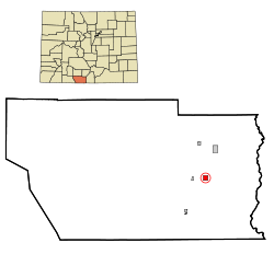
Coordinates: 37°10′29″N 105°56′11″W / 37.17472°N 105.93639°WCoordinates: 37°10′29″N 105°56′11″W / 37.17472°N 105.93639°W Country  United States
State  Colorado
County[1] Conejos Founded 1851 Incorporated (town) June 6, 1889[2] Government - Type Statutory Town[1] Area - Total 0.9 sq mi (2.4 km2) - Land 0.9 sq mi (2.4 km2) - Water 0 sq mi (0 km2) Elevation[3] 7,690 ft (2,344 m) Population (2000) - Total 1,042 - Density 1,157.8/sq mi (434.2/km2) Time zone Mountain (MST) (UTC-7) - Summer (DST) MDT (UTC-6) ZIP code[4] 81141 (PO Box) Area code(s) 719 FIPS code 08-48060 GNIS feature ID 0192989 The Town of Manassa is a Statutory Town that is the most populous town in Conejos County, Colorado, United States. With a population of 1,042 at the 2000 census, Manassa is the largest community in Conejos County.
This small town, surrounded by farms and ranches, is exactly one square mile in size, with a small amount of residential development on its outskirts. A mostly agricultural community, there are few business establishments in the town. A small-town feel abounds with no traffic control signals or stop lights.
The U.S. Post Office zip code for Manassa is 81141, and the area code is (719).
Contents
History
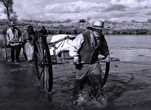
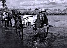 Early settlers, like these pioneers crossing the Platte River, founded Manassa in 1879.
Today, approximately half of Manassa's residents are of Spanish and Mexican heritage. Migration patterns reflect people from northern New Mexico settled this area in the mid 19th century. Many are the descendants of colonists from the Spanish colonial period beginning in 1598 with Juan de Oñate colonization of New Mexico. Most of the other citizens of Manassa are the descendants of the Mormon pioneers who founded Manassa in 1879, and named the town after a son of the Israelite, Joseph.
Manassa was located a short distance from two ranches purchased by the Mormons from Hispanos on the south side of the Conejos River, across from Los Cerritos.
The selection of the land for the colony was made on the assurance that the railroad would soon be built nearby. However, one year later the railroad bypassed the colony, and instead passed through Romeo, Colorado, just three miles (5 km) to the west.[5]
Geography
Just directly north of the New Mexico state border, Manassa is located in the San Luis Valley in just about the southernmost central part of the State of Colorado at 37°10′29″N 105°56′11″W / 37.17472°N 105.93639°W ( Latitude 37.174695 North, Longitude 105.936359 West)[6].
This legendary area is not far from the headwaters of the Rio Grande, a short distance from the Continental Divide and the Great Sand Dunes National Park and Preserve and is surrounded by the world famous Rocky Mountains.
Manassa's elevation is 7,683 feet (2,342 m) above sea level, however, the land within Manassa city limits is entirely flat, with rolling hills nearby. Foothills and mountains (taller than 14,000 feet) are farther in each direction, including the Sangre de Cristo mountain range to the east and the San Juan mountain range to the west.
According to the United States Census Bureau, the town has a total area of 0.9 square miles (2.3 km2), all of it land.
Manassa experiences a semi-arid climate (Köppen BSk) with cold, dry winters and warm, somewhat wetter summers.
Climate data for Manassa Month Jan Feb Mar Apr May Jun Jul Aug Sep Oct Nov Dec Year Record high °F (°C) 64
(18)69
(21)73
(23)82
(28)95
(35)93
(34)94
(34)94
(34)88
(31)82
(28)78
(26)65
(18)95
(35)Average high °F (°C) 35.2
(1.8)41.9
(5.5)51.1
(10.6)59.6
(15.3)68.1
(20.1)77.4
(25.2)80.5
(26.9)78.6
(25.9)73.3
(22.9)63.3
(17.4)47.5
(8.6)37.1
(2.8)59.47
(15.26)Daily mean °F (°C) 18.6
(−7.4)25.5
(−3.6)35.0
(1.7)42.2
(5.7)50.9
(10.5)59.5
(15.3)63.6
(17.6)62.0
(16.7)55.6
(13.1)45.1
(7.3)31.1
(−0.5)20.6
(−6.3)42.48
(5.82)Average low °F (°C) 2.0
(−16.7)9.1
(−12.7)18.8
(−7.3)24.8
(−4.0)33.7
(0.9)41.5
(5.3)46.7
(8.2)45.3
(7.4)37.8
(3.2)26.8
(−2.9)14.7
(−9.6)4.1
(−15.5)25.44
(−3.64)Record low °F (°C) −34
(−37)−29
(−34)−22
(−30)−2
(−19)9
(−13)21
(−6)30
(−1)29
(−2)15
(−9)−7
(−22)−26
(−32)−30
(−34)−34
(−37)Precipitation inches (mm) 0.26
(6.6)0.26
(6.6)0.44
(11.2)0.48
(12.2)0.79
(20.1)0.48
(12.2)1.15
(29.2)1.52
(38.6)1.03
(26.2)0.70
(17.8)0.56
(14.2)0.34
(8.6)8.01
(203.5)Source no. 1: NOAA (normals, 1971-2000) [7] Source no. 2: The Weather Channel (Records) [8] Demographics
As of the census[9] of 2000, there were 1,042 people, 362 households, and 280 families residing in the town. The population density was 1,110.9 people per square mile (428.0/km²). There were 398 housing units at an average density of 424.3 per square mile (163.5/km²). The racial makeup of the town was 81.00% White, 0.48% African American, 1.63% Native American, 0.10% Asian, 0.19% Pacific Islander, 13.24% from other races, and 3.36% from two or more races. Hispanic or Latino of any race were 48.75% of the population.
There were 362 households out of which 41.2% had children under the age of 18 living with them, 59.1% were married couples living together, 13.5% had a female householder with no husband present, and 22.4% were non-families. 20.7% of all households were made up of individuals and 9.1% had someone living alone who was 65 years of age or older. The average household size was 2.88 and the average family size was 3.33.
In the town the population was spread out with 33.7% under the age of 18, 9.4% from 18 to 24, 22.9% from 25 to 44, 20.3% from 45 to 64, and 13.6% who were 65 years of age or older. The median age was 31 years. For every 100 females there were 95.9 males. For every 100 females age 18 and over, there were 97.4 males.
The median income for a household in the town was $23,092, and the median income for a family was $26,827. Males had a median income of $23,295 versus $16,029 for females. The per capita income for the town was $12,576. About 23.2% of families and 28.6% of the population were below the poverty line, including 40.8% of those under age 18 and 19.4% of those age 65 or over.
Streets
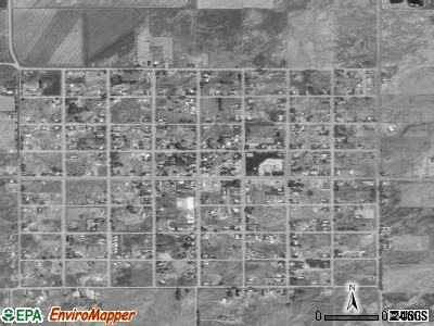
 Satellite photograph showing the layout of Manassa's streets. Farmland and ranches abound in all directions, giving way to foothills and high mountains.
Manassa's wide streets, such as those typically found elsewhere in towns started by Mormons, are fashioned in a grid system. The town fits perfectly in a township and comprises one square mile made up of eight blocks by eight blocks for a total of 64 city blocks. From east to west, the streets are numbered First through Ninth. From south to north, the streets are named South, Jack, Morgan, Smith, Main (aka State Highway 142), Berthelson, Peterson, Dotson, and North.
Manassa's mile-long Main Street is also known as State Highway 142, connecting Romeo (3 miles to the west) with the historic town of San Luis (Costilla County) to the east. The San Luis Hills are east of Manassa, on State Highway 142, between Manassa and the town of San Luis.
Transportation
Travel connections to major cities are generally made at Colorado Springs, Denver, or Albuquerque. With daily flights to Denver, the nearest commercial airport is in Alamosa 24 miles (39 km) to the north. Alamosa, with a population of about 8,500, is the home of Adams State College and is also the main trading center for the San Luis Valley.
Schools and churches
Manassa students attend public schools in the North Conejos RE-1J School District. There is an elementary school in Manassa, however, older students attend the district's middle school (Centauri Middle School) and high school (Centauri High School) about 10 miles (16 km) north and west of Manassa, just south of the town of La Jara. The high school mascot is "Falcons" and the school colors are "Red" and "White".
There are two churches in Manassa: St. Theresa of the Baby Jesus Roman Catholic Church and a meetinghouse for The Church of Jesus Christ of Latter-day Saints. The oldest church in Colorado is located in nearby Conejos, Colorado, about ten miles (16 km) southwest of Manassa and near the town of Antonito.
Pioneer Days
The community-at-large, and people from all over the San Luis Valley and beyond, still celebrates Manassa Pioneer Days with a remarkable parade on two days, horse races, rodeo, motorcross races, demolition derby, fireworks, entertainment, barbecues, 5K run and renewing of friendships while remembering the past.
A carnival at Pioneer Days brings the Tilt-a-Whirl, bumper cars, a merry-go-round and other midway rides. Bandstand entertainment and vendor booths line Manassa’s city park on Main Street.
One of the oldest festivals in the state, the 131st annual celebration was held in 2010 and is an annual event. The weekend-long affair is held on the weekend closest to July 24, in honor of the arrival of Brigham Young and fellow members of the Church of Jesus Christ of Latter-day Saints in Utah's Great Salt Lake Valley on July 24, 1847 [see Pioneer Day (Utah)].
The Mormon pioneers, as they were commonly known, left their settlement in Nauvoo, Illinois, and journeyed West seeking refuge from religious persecution.
Each year, attendance at Manassa's Pioneer Days is estimated at close to 10,000 per day, with people coming from many parts of the country to visit family and friends and to enjoy the festivities.
Notable people
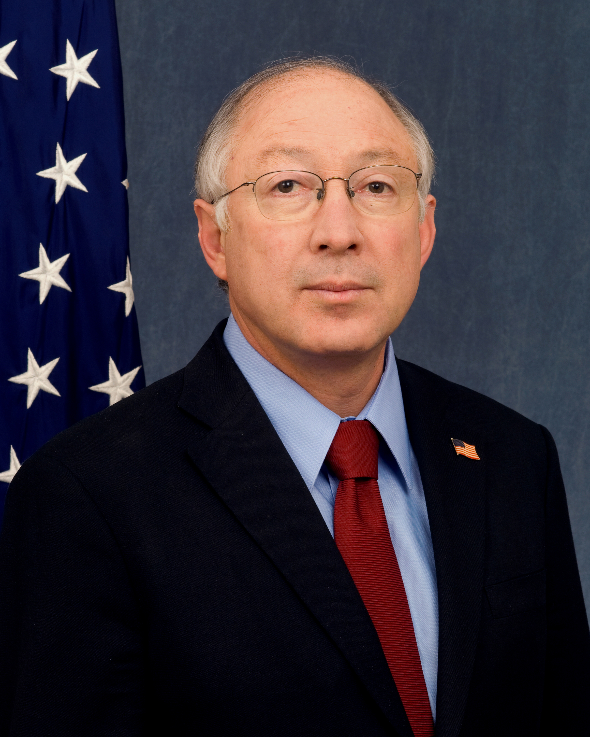
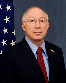 Secretary of the U. S. Department of the Interior and former U. S. Senator Kenneth L. Salazar, D-Colorado
- Heavyweight champion boxer Jack Dempsey. The Jack Dempsey Museum is located on the town's main street.[10]
- Ken Salazar Secretary of the Interior, Former U. S. Senator, Democrat, first elected 2004 for a six-year term. Former Attorney General for the State of Colorado.
- John Salazar Commissioner of the Colorado Department of Agriculture since 2011 and U.S. Congressman from Colorado's 3rd congressional district from 2005 to 2011
- Anthony "Tony" Dunn, former defensive end in the National Football League. Tony played college football for the University of Northern Colorado where he received honors as a Div. II All-American, 3-time All-Conference, UNC Male athlete of the year. In 2003 Tony signed a free-agent contract with the Tennessee Titans. Dunn also played for the Arena Football League's Colorado Crush. Notably, Tony is the only All-American produced by the stellar coaching of Larry Jo Hunt.[11]
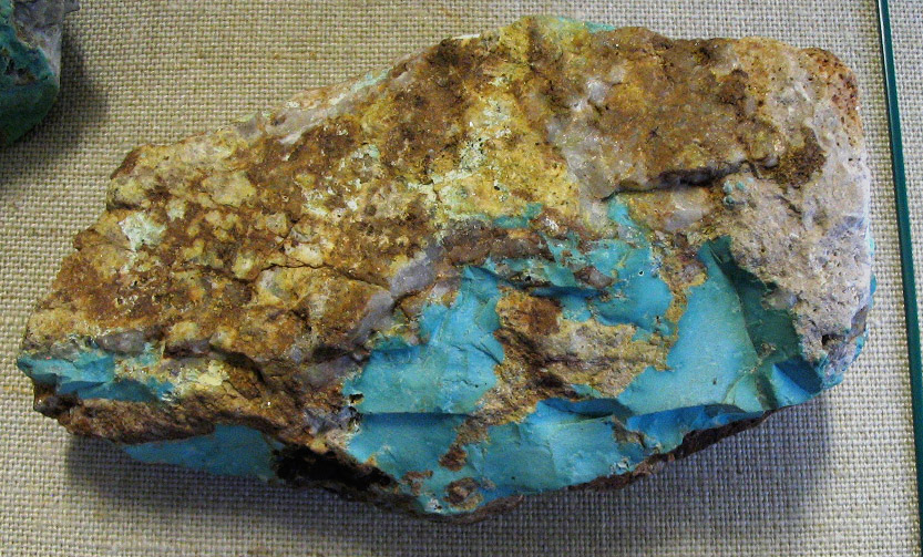
Turquoise mine
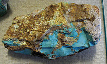 Massive turquoise in matrix with quartz from a mine in Mineral Park, Arizona.
Manassa turquoise is mined east of Manassa, in south central Colorado. It is known for its blue-green to green color with a golden or brown, non-webbed matrix. The Manassa mine is still in production, and owned by the King family, thus the alternate name sometimes used for this turquoise. This stone is a favorite of many; the beautiful green color is very striking, excellent when used in gold.
This site, originally mined by Ancestral Pueblo peoples, was rediscovered in 1890 by gold prospector I.P. King, and his descendants still work the claim. King’s Manassa turquoise is best known for its brilliant greens and golden matrices, but blue and blue-green turquoise was found amid these deposits as well.
Jewelry manufacturing
The Manassa area has long been known for its beautiful silver and turquoise jewelry and also for the production of fine pewter items.
While some turquoise has been mined in the low hills east of Manassa, most of the jewelry industry in Manassa, and nearby, has utilized and polished the raw turquoise found in the copper and silver mines of Arizona and Nevada. Additionally, coral from the seas and other semiprecious cabachons and cut stones have been added to silver and gold jewelry.
Media
The Valley Courier Newspaper in Alamosa, Colorado, and the SLV Dweller, "a website dedicated to all things San Luis Valley," are two media outlets covering events in and near Manassa.
Conejos County Official Website
Political representation
- Colorado State House District 32 (Ed Vigil, D-San Luis)
- Colorado State Senate District 5 (Gail Schwartz, D-Snowmass Village)
- U. S. Representative District 3 (John Salazar, D-Manassa)
- United States Senators: Mark Udall (D-Boulder), and Michael Bennet (D-Denver)
References
- ^ a b "Active Colorado Municipalities". State of Colorado, Department of Local Affairs. http://www.dola.state.co.us/dlg/local_governments/municipalities.html. Retrieved 2007-09-01.
- ^ "Colorado Municipal Incorporations". State of Colorado, Department of Personnel & Administration, Colorado State Archives. 2004-12-01. http://www.colorado.gov/dpa/doit/archives/muninc.html. Retrieved 2007-09-02.
- ^ "US Board on Geographic Names". United States Geological Survey. 2007-10-25. http://geonames.usgs.gov. Retrieved 2008-01-31.
- ^ "ZIP Code Lookup" (JavaScript/HTML). United States Postal Service. http://zip4.usps.com/zip4/citytown.jsp. Retrieved November 17, 2007.
- ^ Wayside Excursions:Manassa, America’s Byways, Rocky Mountain Public Broadcasting Network, Denver, Colorado
- ^ "US Gazetteer files: 2010, 2000, and 1990". United States Census Bureau. 2011-02-12. http://www.census.gov/geo/www/gazetteer/gazette.html. Retrieved 2011-04-23.
- ^ "Climatography of the United States NO.81". National Oceanic and Atmospheric Administration. http://cdo.ncdc.noaa.gov/climatenormals/clim81/COnorm.pdf. Retrieved January 15, 2011.
- ^ "Monthly Averages for Manassa, CO". The Weather Channel. http://www.weather.com/outlook/travel/businesstraveler/wxclimatology/monthly/USCO0251. Retrieved January 15, 2011.
- ^ "American FactFinder". United States Census Bureau. http://factfinder.census.gov. Retrieved 2008-01-31.
- ^ http://www.museumtrail.org/JackDempseyMuseum.asp
- ^ http://uncbears.com/genrel/050103aaa.html
External links
- Town of Manassa contacts
- The Manassa Project Information about the Manassa Pioneer Day Celebration
- SLV Dweller - Since 2002, SLV Dweller has served as an agglomeration of San Luis Valley news and information from varied sources.
- Comprehensive Collection of video and quite a few photographs of Manassa and the surrounding area, as well as a collection of stories and articles from the San Luis Valley Dweller.
- Various Pictures of Sites Around Manassa and other information such as climate, population, income, et cetera.
- Beautiful pictures of the San Luis Valley, including one of the San Luis hills east of Manassa
- Photographs These are photographs of sites, not in Manassa, but within Conejos County, such as the new courthouse in the town of Conejos and the oldest church in the State of Colorado, located in Guadalupe
Municipalities and communities of Conejos County, Colorado County seat: Conejos Towns 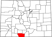
CDPs Categories:- Populated places in Conejos County, Colorado
- Towns in Colorado
- Populated places established in 1879


Wikimedia Foundation. 2010.