- Antonito, Colorado
Infobox Settlement
name = Town of Antonito, Colorado
other_name =
native_name =
nickname =
settlement_type =Town
motto =
imagesize = 370px
image_caption =
flag_size =
image_
seal_size =
image_shield =
shield_size =
image_blank_emblem =
blank_emblem_type =
blank_emblem_size =
imagesize = 370px
image_caption =
flag_size =
image_
seal_size =
image_shield =
shield_size =
image_blank_emblem =
blank_emblem_type =
blank_emblem_size =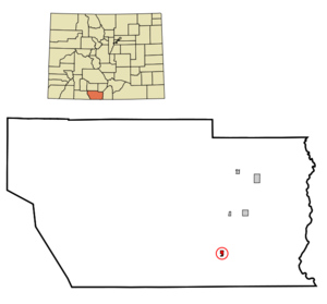
mapsize = 250px
map_caption = Location in Conejos County and theState of Colorado
mapsize1 =
map_caption1 =
image_dot_
dot_mapsize =
dot_map_caption =
dot_x =
dot_y =
pushpin_
pushpin_label_position =
pushpin_map_caption =
pushpin_mapsize =
subdivision_type = Country
subdivision_name = USA
subdivision_type1 = State
subdivision_name1 = flag|Colorado|name=State of Colorado
subdivision_type2 = Countycite web | url = http://www.dola.state.co.us/dlg/local_governments/municipalities.html | title = Active Colorado Municipalities | format =HTML | publisher = State of Colorado, Department of Local Affairs | accessdate = 2007-09-01]
subdivision_name2 = Conejos County
subdivision_type3 =
subdivision_name3 =
subdivision_type4 =
subdivision_name4 =
government_footnotes =
government_type = Statutory Town
leader_title =Mayor
leader_name = Mike Trujillo Jr.
leader_title1 =
leader_name1 =
leader_title2 =
leader_name2 =
leader_title3 =
leader_name3 =
leader_title4 =
leader_name4 =
established_title =
established_date =
established_title2 = Incorporated (town)
established_date2 =December 29 ,1889 cite web | url = http://www.colorado.gov/dpa/doit/archives/muninc.html | title = Colorado Municipal Incorporations | format =HTML | publisher = State of Colorado, Department of Personnel & Administration, Colorado State Archives | date =2004-12-01 | accessdate = 2007-08-18]
established_title3 =
established_date3 =
area_magnitude =
unit_pref = Imperial
area_footnotes =
area_total_km2 = 1
area_land_km2 = 1
area_water_km2 = 0
area_total_sq_mi = 0.4
area_land_sq_mi = 0.4
area_water_sq_mi = 0
area_water_percent =
area_urban_km2 =
area_urban_sq_mi =
area_metro_km2 =
area_metro_sq_mi =
area_blank1_title =
area_blank1_km2 =
area_blank1_sq_mi =
population_as_of = 2000
population_footnotes =
population_note =
population_total = 873
population_density_km2 = 873
population_density_sq_mi = 2182.5
population_metro =
population_density_metro_km2 =
population_density_metro_sq_mi =
population_urban =
population_density_urban_km2 =
population_density_urban_sq_mi =
population_blank1_title =
population_blank1 =
population_density_blank1_km2 =
population_density_blank1_sq_mi =
timezone = MST
utc_offset = -7
timezone_DST = MDT
utc_offset_DST = -6
latd = 37 |latm = 4 |lats = 39 |latNS = N
longd = 106 |longm = 0 |longs = 34 |longEW = W
elevation_footnotes = GR|3
elevation_m = 2405
elevation_ft = 7890
postal_code_type =ZIP code
postal_code = 81120cite web | date =August 18 2007 | url = http://zip4.usps.com/zip4/citytown.jsp | title = ZIP Code Lookup| format =JavaScript /HTML | publisher =United States Postal Service | accessdate = August 18 | accessyear = 2007]
area_code = 719
blank_name =Highway s
blank_info =
blank1_name = GNIS feature ID
blank1_info = [http://geonames.usgs.gov/pls/gnispublic/f?p=gnispq:3:::NO::P3_FID:0190909 0190909]
website =
footnotes =The Town of Antonito is a Statutory Town located in Conejos County,
Colorado ,United States . As of the 2000 census, the town population was 873.Geography
Antonito is located at coor dms|37|4|39|N|106|0|34|W|city (37.077490, -106.009489)GR|1, along U.S. Highway 285.
According to the
United States Census Bureau , the town has a total area of 0.4square mile s (1.0km² ), all of it land.Antonito is also the Eastern Terminus of the Cumbres & Toltec Scenic Railroad, and the southern terminal of the San Luis and Rio Grande Railroad.Demographics
As of the
census GR|2 of 2000, there were 873 people, 357 households, and 234 families residing in the town. Thepopulation density was 2,212.3 people per square mile (864.3/km²). There were 396 housing units at an average density of 1,003.5/sq mi (392.0/km²). The racial makeup of the town was 61.40% White, 0.11% African American, 3.55% Native American, 0.23% Asian, 31.96% from other races, and 2.75% from two or more races. Hispanic or Latino of any race were 90.26% of the population.There were 357 households out of which 33.9% had children under the age of 18 living with them, 37.8% were married couples living together, 20.4% had a female householder with no husband present, and 34.2% were non-families. 31.9% of all households were made up of individuals and 16.5% had someone living alone who was 65 years of age or older. The average household size was 2.45 and the average family size was 3.09.
In the town the population was spread out with 28.8% under the age of 18, 8.4% from 18 to 24, 23.1% from 25 to 44, 21.4% from 45 to 64, and 18.3% who were 65 years of age or older. The median age was 36 years. For every 100 females there were 98.9 males. For every 100 females age 18 and over, there were 91.4 males.
The median income for a household in the town was $19,205, and the median income for a family was $23,162. Males had a median income of $25,417 versus $17,500 for females. The
per capita income for the town was $10,047. About 26.4% of families and 29.6% of the population were below thepoverty line , including 36.3% of those under age 18 and 22.5% of those age 65 or over.Recent Years
Antonito was once known as the "perlite capital of the world" but with one perlite mill closed and many other businesses closing down the town is struggling to survive financially.
Town Hall opens an hour late and closes an hour early , facility management budget has been cut, and the town clerk comes in only as needed. The town eliminated health insurance for employees. But most worrisome to residents of this San Luis Valley community of about 800 people is that the town can not afford to support a police force.Fact|date=August 2007 In December of 2004 the police force was on a day to day operation, but as of January 2005 the police force was disbanded. [cite web
last =
first =
authorlink =
coauthors =
title = Colorado makes Antonito small loan
work =
publisher = The New Mexican
date= 2005-01-29
url = http://www.freenewmexican.com/news/9856.html
format =HTML
doi =
accessdate = 2007-08-14] In February 2005 the town marshal was let go leaving no one to patrol the streets. After that there were several meetings between agencies on the issue of who would patrol the town. Neither of the appropriate agencies wanted to handle this because the work would entail a lack of compensation. Since disbanding the police force the town has been plagued by numerous crimes both violent and nonviolent.Fact|date=August 2007Note-worthy Antonitoans
While many people view Antonito as a "financially-struggling" town with a monetarily poor school district, note-worthy people were born, raised and/or lived in the town.Fact|date=August 2007
José Inez Taylor, co-author of the book "Alex and the Hobo".
Ruben Archuleta, Pueblo Colorado's first Hispanic Chief of Police in 1995, and author of several books:" I Came From El Valle, Land of the Penitentes, Land of Tradition, Eppie Archuleta and the Tale of Juan de la Burra" and "Penitente Renaissance, Manifesting Hope".
Carlos Lucero, the first Hispanic president of the Colorado Bar Association, in 1995 became the first Hispanic judge to sit on the United States Court of Appeals for the Tenth Circuit.
Celedonio Mondragon, founder of the oldest Hispanic fraternal organization in the nation, La Sociedad Protection Mutua de Trabajadores Unidos.
Internationally recognized muralist, Fred "Lightning Heart" Haberlein, graduated from Antonito High School.
Outsider artist, Donald "Cano" Espinoza--builder of the world famous "Cano's Castle".
State Representative Rafael Gallegos, D-Antonito.
Chicano poet Aaron A. Abeyta, was born and raised in Antonito. Abeyta won the American Book Award in 2001 for his first collection of poems, "Colcha".
ee also
*
Conejos County, Colorado
*State of Colorado
**Colorado municipalities References
External links
* [http://www.dot.state.co.us/App_DTD_DataAccess/Downloads/CityMaps/Antonito.pdf CDOT map of the Town of Antonito]
* [http://www.slvdweller.com SLV Dweller] - San Luis Valley News, Culture, History and Events.
Wikimedia Foundation. 2010.