- Telchac Pueblo
-
Telchac Pueblo — Town — 
Coat of armsLocation of Telchac Pueblo within State of Yucatan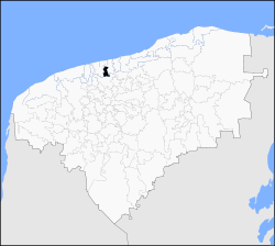 Location of Telchac Pueblo within Mexico
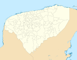
 Telchac Pueblo
Coordinates: 21°12′21″N 89°15′29″W / 21.20583°N 89.25806°WCoordinates: 21°12′21″N 89°15′29″W / 21.20583°N 89.25806°W Country  Mexico
State  Yucatán
Municipality Telchac Pueblo IDH  0.818[1] high
Government – Type Ayuntamiento – Body H. Ayuntamiento de Telchac Pueblo – Municipal president Heyder Alfredo Maldonado Lopez 
Area – Total 31.564 sq mi (81.8 km2) Elevation 32 ft (10 m) Population (2005) – Total 3,557 – Density 112.7/sq mi (43.5/km2) Demonym Telchaqueño(a) Time zone Central Standard Time – Summer (DST) Central Daylight Time (UTC) ZIP 97400 Calling Code 991 The Municipality of Telchac Pueblo is a small town of farmers and merchants, located to the north of the Yucatán Peninsula, is one of the 106 municipalities of the Mexican state of Yucatán.
Contents
Toponomy
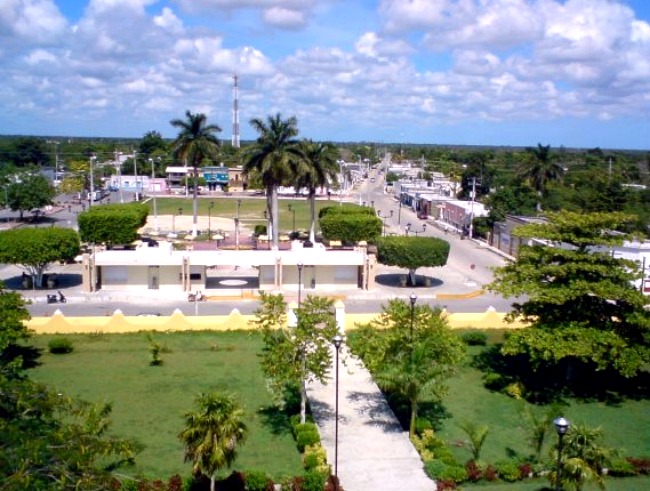
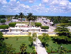 Downtown from top of Church
The name of municipality comes from the Maya language and officially translated into Spanish means "Rain or necessary water", as the result of the words Tel, contraction of teel, indispensable or necessary and chac, contraction of chaac, rain or water. Erroneously it is said that meaning is "Red Rooster" (Tel means rooster and Chac means red).
The denomination "Pueblo" (English: Town), is used to differentiate it from the nearby town called Telchac Puerto (English: Port of Telchac). Both were once a single municipality, but in 1932, for political problems, it split into two municipalities. When Telchac Puerto was part of Telchac Pueblo it name was Miramar, and even now there is an area that keeps that name in Telchac Puerto, Telchac Pueblo kept that area after the separation, but eventually, lost that part and the town lost all the territory bordering the sea.
Geography
Telchac Pueblo is located in the north-central state of Yucatán and has a land area of 81.75 square kilometers. Bordered on the north with the municipality of Telchac Puerto, on the east with the municipality Sinanché, on the south with the municipality of Motul and on the west with the municipality of Dzemul.
Orography and hydrography
As in most of the Yucatán Peninsula, the territory is quite flat, reaching a maximum altitude of 10 meters above sea level and has a gently sloping south-north direction, towards the Gulf of Mexico;[2] physiographically the whole territory belongs to the Yucatecan Carso.[3]
All over town there are no rivers due to high soil permeability,[4] thi is a characteristic of the Yucatan area, water seeps into the ground where it forms underground rivers that form cenotes, which are outcrops to the surface of these subterranean river, in Telchac Pueblo there are 11 cenotes, 10 of which are open and a 1 semi-open.[5] The entire town is part of the Yucatan Basin belonging to the Northern Yucatan hydrological region.[6]
Climate and Ecosystems
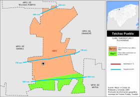
In Telchac Pueblo there are two kind of climate, in the extreme south the climate is classified as Warm humid with rains in summer, less humid, and the rest of the municipality is Semidry warm and very warm;[7] annual average temperature recorded is greater than 26°C;[8] Average annual precipitation increases from north to south, ergo, away from the coast in successive bands, the first from 500 to 600 mm, second from 600 to 700 mm, third from 700 to 800 mm and the last from 800 to 1,000 mm.[9]
Telchac Pueblo is covered by tropical rainforest, but significant parts have been converted to agricultural and urban areas.[10] Tree species include pochote (Ceiba pentandra), cedro (Cedrela odorata) and chacá (Bursera simaruba). Fauna includes rabbits, opossums, pocket gophers, eared dove, white-winged dove, and the endemic species of white owl and pájaro tho.
Geographic Maps of Telchac Pueblo 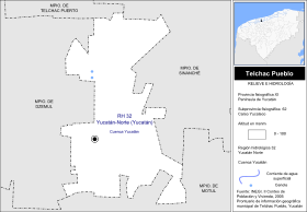
Topography and hydrology Climates Demography
According to the results of the 2005 Census realized by the Instituto Nacional de Estadística y Geografía, the total population was 3,404 inhabitants, which 1,730 are men and 1,674 are women;,[11] the annual population growth rate from 2000 to 2005 was 0.5%, 24.1% of the population is under 15 years of age, 62.9% from 15 to 64 years and 13% of over 64, 99.2% of inhabitants live in the county seat and 19.9% of the population over 5 years are speakers of an indigenous language, in this case, the Mayan language.[12]
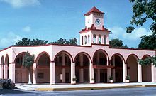
 Urban areas
Urban areas
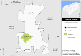
In Telchac Pueblo are a total of seven locations, the major and its total population in 2005 were:
Seat Population Total 3,404 Telchac Pueblo 3,377 San Roque 9 San Isidro 7 Infrastructure
 Infrastructure and communications
Communications
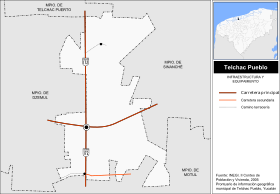
The municipality of Telchac Pueblo is connected to the rest of the state of Yucatan by land, there isn't in its territory ports, airports or airstrips.
The main road is the 172 state-owned, This road connects in north with Telchac Puerto, in south with the city of Motul where it connects with 176 federal highway; the second state-owned road connects in west with Dzemul and Baca, in east with Sinanché, Yobaín and Dzidzantún where it connects with 178 federal highway. There is also at the southern end of the municipality a secondary road from road 172 that communicates with the village of Uci, which belongs to the neighboring city of Motul.
Education
In education the town has two kindergartens, three elementary, one secondary and one high school. There is a library with free online computers and free wireless internet.
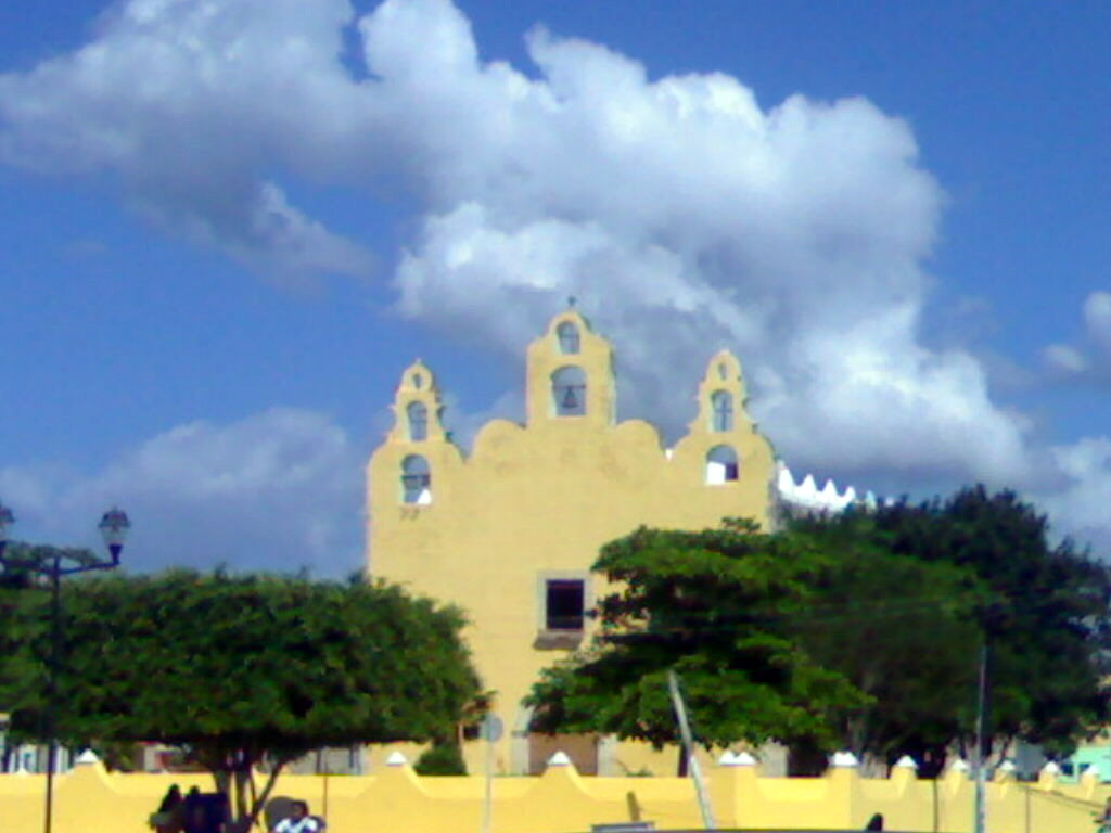
Churches
The Catholic Church of San Francisco de Asís (St. Francis of Assisi) was originally dedicated to St. Lawrence Martyr, it is now dedicated to St. Francis of Assisi, the patron saint of the village. It is located on the east side of the communities center. The exact timeframe of construction is not known, but the building dates from the end of the 17th century. Many theories suggest the year 1693, but is not official.
While the majority of the population is Catholic, other churches are present in the community, including Presbyterian and Evangelical churches, a Jehovah's Witnesses Kingdom Hall and most recently a meetinghouse for the The Church of Jesus Christ of Latter-day Saints, or Mormons.
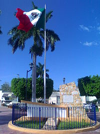
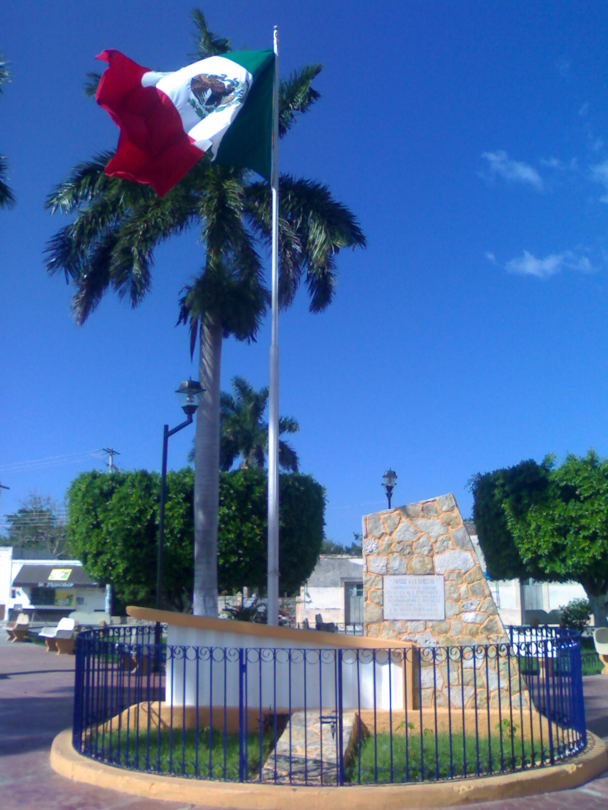
Park to the Flag
This park is a meeting point for people telchaqueña, there is no day or night that is not the inhabitants of this municipality "breathing fresh air" or just chatting, is a deeply rooted tradition among the residents, which in municipalities of the surrounding area is not seen as often. In addition, this park has 4 stores or posts; two of them lunch, where people tend to eat at night. The park has free wireless internet.
There are also another park called the "park to the mother", a gas station, a bank, three sports fields, two basketball courts and playground
Economy
Most of the town's population is engaged in primary sector of the economy, particularly to agriculture. Animal husbandry is also important, particularly livestock.
Trade and manufacturing activity are other important sectors of economic activity in the municipality.
The professionals who work in the city of Mérida, other municipalities, other states or countries, strengthen the local economy via remittances. Professionals who work in the state, usually still live in Telchac Pueblo and only move to work.
Politics
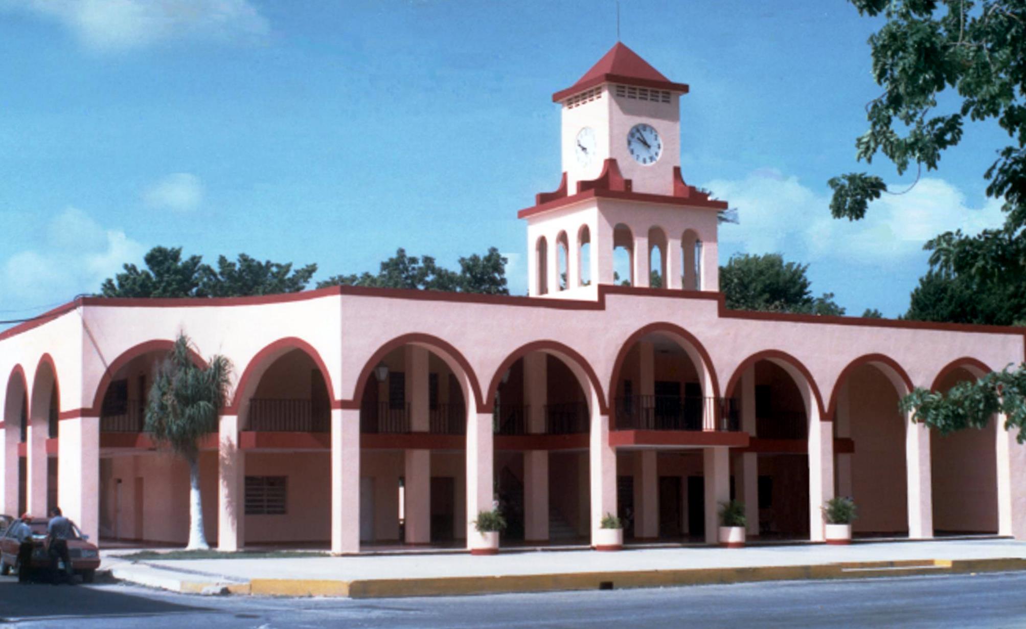
 City Council of Telchac Pueblo
The government of the municipality of Telchac Pueblo corresponds to the Ayuntamiento, composed of five council members, the first holds the post of Municipal President and the second the Syndic. Of the five council members, three are elected by relative majority and two by proportional representation;[13] all are elected by direct and secret vote for a period of three years without the possibility of immediate reelection and take office on July 1st of the year in which they were elected.[14]
Legislative representation
For purposes of the geographical division in state and federal electoral district for the election of deputies, the municipality of Telchac Pueblo is divided as follows:
State:
Federal:
Mayors
- 1995 - 1998: Carlos Raúl Jiménez Tamayo
- 1998 - 2001: Juan Tamayo Cab
- 2001 - 2004: José Enrique Ruiz Maldonado
- 2004 - 2007: Manuel Jesús Aguilar Pech
- 2007 - 2010: José Luis Aguilar Cervantes
- 2010 - 2012: Heyder Alfredo Maldonado López
Gallery
Telchac Pueblo 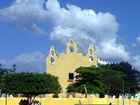
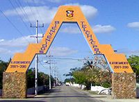
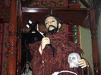
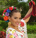
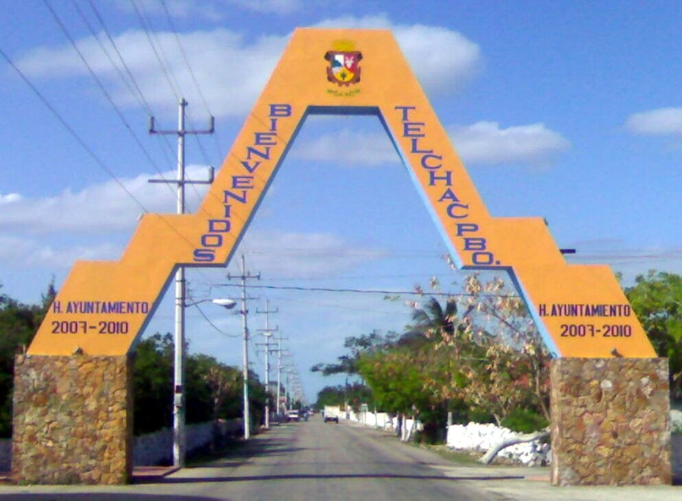
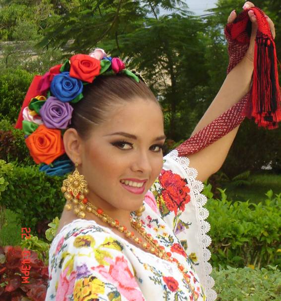
Church to St. Francis of Assisi The Mayan Arc Image of St. Francis of Assisi Lizzie Jimenez La flor mas bella of the state 2006 See also
References
- ^ "Indicadores de Desarrollo Humano y Género en México 2000-2005". http://www.undp.org.mx/IMG/pdf/Yucatan.pdf. Retrieved 16 de agosto de 2010.
- ^ Instituto Nacional de Estadística y Geografía. "Yucatán. Mapa de Elevaciones Principales". http://mapserver.inegi.gob.mx/geografia/espanol/estados/yuc/eleva.cfm. Retrieved 2010-05-22.
- ^ Instituto Nacional de Estadística y Geografía. "Yucatán. Mapa de Fisiografía". http://mapserver.inegi.org.mx/geografia/espanol/estados/yuc/fisio.cfm?c=444&e=09. Retrieved 2010-05-22.
- ^ Instituto Nacional de Estadística y Geografía. "Yucatán. Mapa con Principales ríos". http://mapserver.inegi.gob.mx/geografia/espanol/estados/yuc/sombreado_ri.cfm. Retrieved 2010-05-22.
- ^ Gobierno del Estado de Yucatán, Secretaría de Desarrollo Urbano y Medio Ambiente. "Censo de cenotes y grutas de Yucatán". http://www.seduma.yucatan.gob.mx/cenotes-grutas/censo-cenotes.php. Retrieved 2010-05-22.
- ^ Instituto Nacional de Estadística y Geografía. "Yucatán. Mapa de Regiones Hidrológicas". http://mapserver.inegi.gob.mx/geografia/espanol/estados/yuc/rh.cfm. Retrieved 2010-05-22.
- ^ Instituto Nacional de Estadística y Geografía. "Yucatán. Mapa de Climas". http://mapserver.inegi.gob.mx/geografia/espanol/estados/yuc/clim.cfm. Retrieved 2010-05-22.
- ^ Instituto Nacional de Estadística y Geografía. "Yucatán. Mapa de Temperatura Media Anual". http://mapserver.inegi.gob.mx/geografia/espanol/estados/yuc/temperat.cfm. Retrieved 2010-05-22.
- ^ Instituto Nacional de Estadística y Geografía. "Yucatán. Mapa de Precipitación Promedio Anual". http://mapserver.inegi.gob.mx/geografia/espanol/estados/yuc/precipit.cfm. Retrieved 2010-05-22.
- ^ Instituto Nacional de Estadística y Geografía. "Yucatán. Mapa de Agricultura y Vegetación". http://mapserver.inegi.gob.mx/geografia/espanol/estados/yuc/agri.cfm. Retrieved 2010-05-22.
- ^ Instituto Nacional de Estadística y Geografía. "Yucatán. Población total por municipio según grandes grupos de edad, 2005". http://www.inegi.org.mx/est/contenidos/espanol/soc/sis/sisept/default.aspx?t=mpob93&s=est&c=3839&e=31. Retrieved 2010-05-22.
- ^ Instituto Nacional de Estadística y Geografía. "Yucatán. Indicadores seleccionados de la población por municipio, 2005". http://www.inegi.org.mx/est/contenidos/espanol/soc/sis/sisept/default.aspx?t=mpob103&s=est&c=3850&e=31. Retrieved 2010-05-22.
- ^ H. Congreso del Estado de Yucatán. "Ley de Instituticiones y Procedimientos electoral del Estado de Yucatán, Artículo 7, Párrafo IV". http://www.congresoyucatan.gob.mx/pdf/leyes_2006/ley%20electoral.pdf. Retrieved 2010-05-21.
- ^ Instituto Nacional para el Federalismo y el Desarrollo Municipal. "Periodos de gobierno municipal". http://www.e-local.gob.mx/wb2/ELOCAL/ELOC_Periodos_de_gobierno_municipal. Retrieved 2010-05-21.
- ^ Instituto de Procedimientos Electorales y Participación Ciudadana de Yucatán. "Geografía electoral". http://www.ipepac.org.mx/?modulo=geografia-electoral&item=distritos-electorales&dto=XV. Retrieved 2010-05-21.
- ^ Instituto Federal Electoral. "Condensado de Yucatán". http://www.ife.org.mx/documentos/DISTRITOS/PDF_CES/PDF_CES_YUC.pdf. Retrieved 2010-05-21.
Sources
- Yucatán en el tiempo, enciclopedia alfabética, Mérida, Yucatán, 1998, ISBN 970 9071 00 9
- Instituto Nacional para el Federalismo y el Desarrollo Municipal, Secretaría de Gobernación (2005). "Enciclopedia de los Municipios de México". http://www.e-local.gob.mx/work/templates/enciclo/yucatan/municipios/31082a.htm. Retrieved 2010.
- Instituto Nacional de Estadística y Geografía (2010). "Prontuario de información geográfica municipal de los Estados Unidos Mexicanos: Telchac Pueblo, Yucatán". http://mapserver.inegi.gob.mx/webdocs/prontuario/31082.pdf. Retrieved 2010.
States of Mexico States Aguascalientes · Baja California · Baja California Sur · Campeche · Chiapas · Chihuahua · Coahuila · Colima · Durango · Guanajuato · Guerrero · Hidalgo · Jalisco · México · Michoacán · Morelos · Nayarit · Nuevo León · Oaxaca · Puebla · Querétaro · Quintana Roo · San Luis Potosí · Sinaloa · Sonora · Tabasco · Tamaulipas · Tlaxcala · Veracruz · Yucatán · Zacatecas

Federal District Topics 
Metros Larger cities Smaller cities Akil · Tzucacab · Tekit · Halachó · Tecoh · Dzidzantún · Seyé · Buctzotz · Caucel · Conkal · Cacalchén · Celestún · Temax · Temozón · Homún · Dzilam González · Kinchil · Teabo · Sotuta · Panabá · Cholul · Chichimilá · Itzincab · Hoctún · X-Can · Dzan · Pisté · Huhí · Cansahcab · Baca · Chocholá · Opichén · Hocabá · Maní · Chicxulub · Popolá · Komchén · Tetiz · Sucilá · Cuzamá · Timucuy · Ixil · Kimbilá · Kantunil · Sacalum · Tahmek · Telchac Pueblo · Tixpéhual · Santa Elena · Tahdziú · Popolnáh · Tixcacalcupul · Chablecal · Tekantó · Cenotillo · San José Tzal · Dzemul · Chelem
Municipalities Abalá · Acanceh · Akil · Baca · Bokobá · Buctzotz · Cacalchén · Calotmul · Cansahcab · Cantamayec · Celestún · Cenotillo · Chacsinkín · Chankom · Chapab · Chemax · Chicxulub Pueblo · Chichimilá · Chikindzonot · Chocholá · Chumayel · Conkal · Cuncunul · Cuzamá · Dzan · Dzemul · Dzidzantún · Dzilam de Bravo · Dzilam González · Dzitás · Dzoncauich · Espita · Halachó · Hocabá · Hoctún · Homún · Huhí · Hunucmá · Ixil · Izamal · Kanasín · Kantunil · Kaua · Kinchil · Kopomá · Mama · Maní · Maxcanú · Mayapán · Mérida · Mocochá · Motul · Muna · Muxupip · Opichén · Oxkutzcab · Panabá · Peto · Progreso · Quintana Roo · Río Lagartos · Sacalum · Samahil · Sanahcat · San Felipe · Santa Elena · Seyé · Sinanché · Sotuta · Sucilá · Sudzal · Suma · Tahdziú · Tahmek · Teabo · Tecoh · Tekal de Venegas · Tekantó · Tekax · Tekit · Tekom · Telchac Pueblo · Telchac Puerto · Temax · Temozón · Tepakán · Tetiz · Teya · Ticul · Timucuy · Tinúm · Tixcacalcupul · Tixkokob · Tixméhuac · Tixpéhual · Tizimín · Tunkás · Tzucacab · Uayma · Ucú · Umán · Valladolid · Xocchel · Yaxcabá · Yaxkukul · Yobaín
Categories:- Populated places in Yucatán
- Municipalities of Yucatán


Wikimedia Foundation. 2010.