- Maxcanú Municipality
-
Maxcanú — Municipality — Location of Maxcanú in Yucatán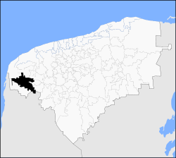 Location of Maxcanú in Yucatán
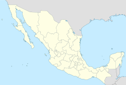
 Maxcanú
Coordinates: 20°36′N 89°54′W / 20.6°N 89.9°WCoordinates: 20°36′N 89°54′W / 20.6°N 89.9°W Country  Mexico
State  Yucatán
Government – Municipal President Fausto Jose Pereyra Carmona[1] Area – Total 1,320.82 km2 (510 sq mi) [1] Population (2005[2] [3]) – Total 20,830 Time zone Central Standard Time (UTC-6) – Summer (DST) Central Daylight Time (UTC-5) INEGI Code 048 Major Airport Merida (Manuel Crescencio Rejón) International Airport IATA Code MID ICAO Code MMMD Website Nuestros municipios - Maxcanú Maxcanú is a municipality (municipio) in the western/southwestern section of Mexican state of Yucatán. Its seat is the town of Maxcanú. The municipality covers an area of approximately 1,321 km² and has a total population of over 18,800 inhabitants.
The municipality shares borders with the following adjacent municipalities: Celestún, Samahíl, and Kinchil to the north, Chocholá, Kopomá, and Opichén to the east, and Halachó to the south. A small portion of its southern border is also shared with the State of Campeche.
Contents
Communities
Those considered the more important are, Chunchucmil, Kanach, Cochol, Paraiso, Santa Rosa and Santo Domingo. And the Haciendas of Simón, Xlam Riti, Crucero Copop, Ché, Canzote, Memu y Xamail. The minor towns in the municipality are: San Rafael, San Fernando, Granada, Chactún, Sombrilla, Chan Chocholá and Coahuilá.[1]
Landmarks
Archaeological
A temple dedicated to Our Lady of Mount Caramel that was built in the seventeenth century and two chapels, the first in honor of St. Michael the Archangel and the second at the Three Crosses; and three former haciendas Kochol called Santo Domingo, Grenada and Santa Rosa.[1]
Prehispanic
There is an archaeological site located near Chunchucmil, bearing the same name.[1]
See also
External links
- http://www.yucatan.gob.mx/estado/municipios/31048a.htm - Geographic, demographic, and historic information, in Spanish, about the Municipality of Maxcanú.
References
- ^ a b c d e "Nuestros municipios - Maxcanú" (HTML). http://www.yucatan.gob.mx/estado/municipios/31048a.htm#. Retrieved 2009-11-12.
- ^ "Encyclopedia of the Municipalities of Mexico: Yucatan" (HTML). http://www.e-local.gob.mx/wb2/ELOCAL/EMM_yucatan. Retrieved 2009-11-01.
- ^ Census Results by Locality, 2005 INEGI.
Topics 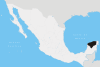
Metros Larger cities Smaller cities Akil · Tzucacab · Tekit · Halachó · Tecoh · Dzidzantún · Seyé · Buctzotz · Caucel · Conkal · Cacalchén · Celestún · Temax · Temozón · Homún · Dzilam González · Kinchil · Teabo · Sotuta · Panabá · Cholul · Chichimilá · Itzincab · Hoctún · X-Can · Dzan · Pisté · Huhí · Cansahcab · Baca · Chocholá · Opichén · Hocabá · Maní · Chicxulub · Popolá · Komchén · Tetiz · Sucilá · Cuzamá · Timucuy · Ixil · Kimbilá · Kantunil · Sacalum · Tahmek · Telchac Pueblo · Tixpéhual · Santa Elena · Tahdziú · Popolnáh · Tixcacalcupul · Chablecal · Tekantó · Cenotillo · San José Tzal · Dzemul · Chelem
Municipalities Abalá · Acanceh · Akil · Baca · Bokobá · Buctzotz · Cacalchén · Calotmul · Cansahcab · Cantamayec · Celestún · Cenotillo · Chacsinkín · Chankom · Chapab · Chemax · Chicxulub Pueblo · Chichimilá · Chikindzonot · Chocholá · Chumayel · Conkal · Cuncunul · Cuzamá · Dzan · Dzemul · Dzidzantún · Dzilam de Bravo · Dzilam González · Dzitás · Dzoncauich · Espita · Halachó · Hocabá · Hoctún · Homún · Huhí · Hunucmá · Ixil · Izamal · Kanasín · Kantunil · Kaua · Kinchil · Kopomá · Mama · Maní · Maxcanú · Mayapán · Mérida · Mocochá · Motul · Muna · Muxupip · Opichén · Oxkutzcab · Panabá · Peto · Progreso · Quintana Roo · Río Lagartos · Sacalum · Samahil · Sanahcat · San Felipe · Santa Elena · Seyé · Sinanché · Sotuta · Sucilá · Sudzal · Suma · Tahdziú · Tahmek · Teabo · Tecoh · Tekal de Venegas · Tekantó · Tekax · Tekit · Tekom · Telchac Pueblo · Telchac Puerto · Temax · Temozón · Tepakán · Tetiz · Teya · Ticul · Timucuy · Tinúm · Tixcacalcupul · Tixkokob · Tixméhuac · Tixpéhual · Tizimín · Tunkás · Tzucacab · Uayma · Ucú · Umán · Valladolid · Xocchel · Yaxcabá · Yaxkukul · Yobaín
Categories:- Municipalities of Yucatán
- Mexico geography stubs


Wikimedia Foundation. 2010.