- Peto Municipality
-
Peto — Municipality — 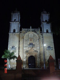 Location of Peto in Yucatán
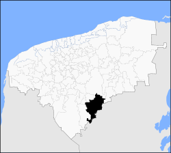 Location of Peto in Yucatán
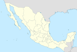
 Peto
PetoCoordinates: 20°07′N 89°55′W / 20.117°N 89.917°WCoordinates: 20°07′N 89°55′W / 20.117°N 89.917°W Country  Mexico
State  Yucatán
Government – Type PRI  2007-2010
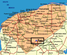
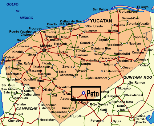
– Municipal President Jose Vicente Dominguez Canto[1] Area – Total 3,136 km2 (1,210.8 sq mi) [1] Elevation 35 m (115 ft) Population (2005 [2][3]) – Total 22,386 Time zone Central Standard Time (UTC-6) – Summer (DST) Central Daylight Time (UTC-5) INEGI Code 058 Major Airport Merida (Manuel Crescencio Rejón) International Airport IATA Code MID ICAO Code MMMD Website Official Website Peto is one of 106 municipalities in Yucatán state, Mexico. It has a municipal seat of the same name and is located in the centre-south portion of the Mexican state of Yucatán, 135 km to the south-east of state capital Mérida.
Communities
The municipality is made up of 74 communities, the most important include the following:
- Peto (Municipal Seat)
- Xoy
- Yaxcopil
- Tixhualatun
- Progresito
Additional Data
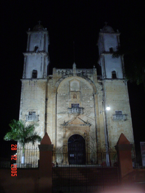
- City population (2005): 18,177
- City Founded: 1549
- Annual fairs: 29 April to 3 May; 26 December to 2 January
- Media: XEPET-AM, a government-run indigenous community radio station.
References
- ^ a b "Nuestros municipios - Peto". http://www.yucatan.gob.mx/estado/municipios/31058a.htm. Retrieved 2009-11-12.
- ^ "Encyclopedia of the Municipalities of Mexico: Yucatan". http://www.e-local.gob.mx/wb2/ELOCAL/EMM_yucatan. Retrieved 2009-11-01.
- ^ Census Results by Locality, 2005 INEGI.
 Location of Peto in Yucatán
Topics 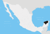
Metros Larger cities Smaller cities Akil · Tzucacab · Tekit · Halachó · Tecoh · Dzidzantún · Seyé · Buctzotz · Caucel · Conkal · Cacalchén · Celestún · Temax · Temozón · Homún · Dzilam González · Kinchil · Teabo · Sotuta · Panabá · Cholul · Chichimilá · Itzincab · Hoctún · X-Can · Dzan · Pisté · Huhí · Cansahcab · Baca · Chocholá · Opichén · Hocabá · Maní · Chicxulub · Popolá · Komchén · Tetiz · Sucilá · Cuzamá · Timucuy · Ixil · Kimbilá · Kantunil · Sacalum · Tahmek · Telchac Pueblo · Tixpéhual · Santa Elena · Tahdziú · Popolnáh · Tixcacalcupul · Chablecal · Tekantó · Cenotillo · San José Tzal · Dzemul · Chelem
Municipalities Abalá · Acanceh · Akil · Baca · Bokobá · Buctzotz · Cacalchén · Calotmul · Cansahcab · Cantamayec · Celestún · Cenotillo · Chacsinkín · Chankom · Chapab · Chemax · Chicxulub Pueblo · Chichimilá · Chikindzonot · Chocholá · Chumayel · Conkal · Cuncunul · Cuzamá · Dzan · Dzemul · Dzidzantún · Dzilam de Bravo · Dzilam González · Dzitás · Dzoncauich · Espita · Halachó · Hocabá · Hoctún · Homún · Huhí · Hunucmá · Ixil · Izamal · Kanasín · Kantunil · Kaua · Kinchil · Kopomá · Mama · Maní · Maxcanú · Mayapán · Mérida · Mocochá · Motul · Muna · Muxupip · Opichén · Oxkutzcab · Panabá · Peto · Progreso · Quintana Roo · Río Lagartos · Sacalum · Samahil · Sanahcat · San Felipe · Santa Elena · Seyé · Sinanché · Sotuta · Sucilá · Sudzal · Suma · Tahdziú · Tahmek · Teabo · Tecoh · Tekal de Venegas · Tekantó · Tekax · Tekit · Tekom · Telchac Pueblo · Telchac Puerto · Temax · Temozón · Tepakán · Tetiz · Teya · Ticul · Timucuy · Tinúm · Tixcacalcupul · Tixkokob · Tixméhuac · Tixpéhual · Tizimín · Tunkás · Tzucacab · Uayma · Ucú · Umán · Valladolid · Xocchel · Yaxcabá · Yaxkukul · Yobaín
Categories:- Populated places in Yucatán
- Municipalities of Yucatán


Wikimedia Foundation. 2010.