- Tecoh Municipality
-
Tecoh — Municipality — Location of Tecoh in Yucatán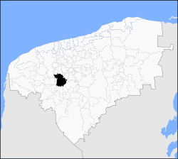 Location of Tecoh in Mexico
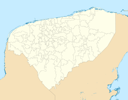
 Tecoh
TecohCoordinates: 20°44′N 89°28′W / 20.733°N 89.467°WCoordinates: 20°44′N 89°28′W / 20.733°N 89.467°W Country  Mexico
State  Yucatán
Government - Municipal President Victor Armando Pacheco May[1] Area - Total 452.2 km2 (174.6 sq mi) [1] Elevation 16 m (52 ft) Population (2005 [2] [3]) - Total 15,438 - Density 34.1/km2 (88.4/sq mi) Time zone Central Standard Time (UTC-6) - Summer (DST) Central Daylight Time (UTC-5) Postal Code 97820 Area code(s) 988 INEGI Code 076 Major Airport Merida (Manuel Crescencio Rejón) International Airport IATA Code MID ICAO Code MMMD Website Official Website Municipalities of Yucatan Tecoh is one of 106 municipalities in Yucatán state, Mexico., located 40 km south-east of Mérida, Yucatán. It has a municipla capital of the same name. As of 2003, the city Tecoh had a population of about 8,500 people. Most of the population is Maya. A number of buildings in the town were built atop older Pre-Columbian foundations. "Tecoh" means "Place of the Puma" in the Maya language, which is still widely spoken here.
Most of the farms in Tecoh are used to grow henequen, sugar, corn, and tropical fruit.
Contents
Communities
The municipality is made up of 20 communities, of which the most important are:[1]
- Tecoh (Municipal Seat)
- Xcanchakan
- Telchaquillo
- Lepan
- Pixya
Landmarks
Architectural
A church erected in honor of the Virgin de la Candelaria, a chapel in honor of the Santa Cruz and a church dedicated to the Virgin de la Asunción; all built since colonial times.[1]
Archaeological
The archaeological site of Mayapan.[1]
External links
References
- ^ a b c d e "Nuestros municipios - Tecoh" (HTML). http://www.yucatan.gob.mx/estado/municipios/31076a.htm. Retrieved 2009-11-12.
- ^ "Encyclopedia of the Municipalities of Mexico: Yucatan" (HTML). http://www.e-local.gob.mx/wb2/ELOCAL/EMM_yucatan. Retrieved 2009-11-01.
- ^ Census Results by Locality, 2005 INEGI.
Topics 
Metros Larger cities Smaller cities Akil · Tzucacab · Tekit · Halachó · Tecoh · Dzidzantún · Seyé · Buctzotz · Caucel · Conkal · Cacalchén · Celestún · Temax · Temozón · Homún · Dzilam González · Kinchil · Teabo · Sotuta · Panabá · Cholul · Chichimilá · Itzincab · Hoctún · X-Can · Dzan · Pisté · Huhí · Cansahcab · Baca · Chocholá · Opichén · Hocabá · Maní · Chicxulub · Popolá · Komchén · Tetiz · Sucilá · Cuzamá · Timucuy · Ixil · Kimbilá · Kantunil · Sacalum · Tahmek · Telchac Pueblo · Tixpéhual · Santa Elena · Tahdziú · Popolnáh · Tixcacalcupul · Chablecal · Tekantó · Cenotillo · San José Tzal · Dzemul · Chelem
Municipalities Abalá · Acanceh · Akil · Baca · Bokobá · Buctzotz · Cacalchén · Calotmul · Cansahcab · Cantamayec · Celestún · Cenotillo · Chacsinkín · Chankom · Chapab · Chemax · Chicxulub Pueblo · Chichimilá · Chikindzonot · Chocholá · Chumayel · Conkal · Cuncunul · Cuzamá · Dzan · Dzemul · Dzidzantún · Dzilam de Bravo · Dzilam González · Dzitás · Dzoncauich · Espita · Halachó · Hocabá · Hoctún · Homún · Huhí · Hunucmá · Ixil · Izamal · Kanasín · Kantunil · Kaua · Kinchil · Kopomá · Mama · Maní · Maxcanú · Mayapán · Mérida · Mocochá · Motul · Muna · Muxupip · Opichén · Oxkutzcab · Panabá · Peto · Progreso · Quintana Roo · Río Lagartos · Sacalum · Samahil · Sanahcat · San Felipe · Santa Elena · Seyé · Sinanché · Sotuta · Sucilá · Sudzal · Suma · Tahdziú · Tahmek · Teabo · Tecoh · Tekal de Venegas · Tekantó · Tekax · Tekit · Tekom · Telchac Pueblo · Telchac Puerto · Temax · Temozón · Tepakán · Tetiz · Teya · Ticul · Timucuy · Tinúm · Tixcacalcupul · Tixkokob · Tixméhuac · Tixpéhual · Tizimín · Tunkás · Tzucacab · Uayma · Ucú · Umán · Valladolid · Xocchel · Yaxcabá · Yaxkukul · Yobaín
Categories:- Populated places in Yucatán
- Municipalities of Yucatán
- Mexico geography stubs


Wikimedia Foundation. 2010.