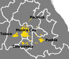
- Metropolitan areas of Mexico
-
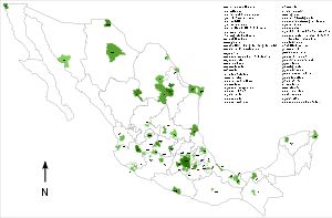 Map showing the location of the Metropolitan Areas in Mexico.
Metropolitan areas in Mexico have been traditionally defined as the group of municipalities that heavily interact with each other, usually around a core city.[1] In 2004, a joint effort between CONAPO, INEGI and the Ministry of Social Development (SEDESOL) agreed to define metropolitan areas as one of the following:[1]
- the group of two or more municipalities, in which a city with a population of at least 50,000 is located whose urban area extends over the limit of the municipality that originally contained the core city incorporating either physically or, under its area of direct influence, other adjacent predominantly urban municipalities, all of which either have a high degree of social and economic integration or are relevant for urban politics and administration; or
- a single municipality, in which a city of a population of at least one million is located and fully contained (that is, it does not transcend the limits of a single municipality); or
- a city with a population of at least 250,000 that forms a conurbation with other cities in the United States.
However, northwestern and southeastern states are divided into a small number of large municipalities whereas central states are divided into a large number of smaller municipalities. As such, metropolitan areas in the northwest usually do not extend over more than one municipality (and figures usually report population for the entire municipality) whereas metropolitan areas in the center extend over many municipalities.
A few metropolitan areas extend beyond the limits of one state: Greater Mexico City (Federal District, Mexico and Hidalgo), Puebla-Tlaxcala (Puebla and Tlaxcala, but excludes the city of Tlaxcala), Comarca Lagunera (Coahuila and Durango), and Tampico (Tamaulipas and Veracruz).
Contents
List of metropolitan areas in Mexico by population
 1 - Mexico City.
 2 - Guadalajara, Jalisco.
 3 - Monterrey, Nuevo Leon.
 4 - Puebla, Puebla.
 5 - Toluca, State of Mexico.
 6 - León, Guanajuato.
There is a total of fifty-six metropolitan areas of Mexico as defined by the following government bodies:- The National Institute of Statistics and Geography (INEGI).
- The Secretariat of Social Development (SEDESOL).
- The National Population Council (CONAPO).
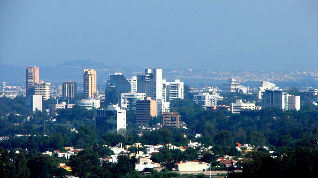
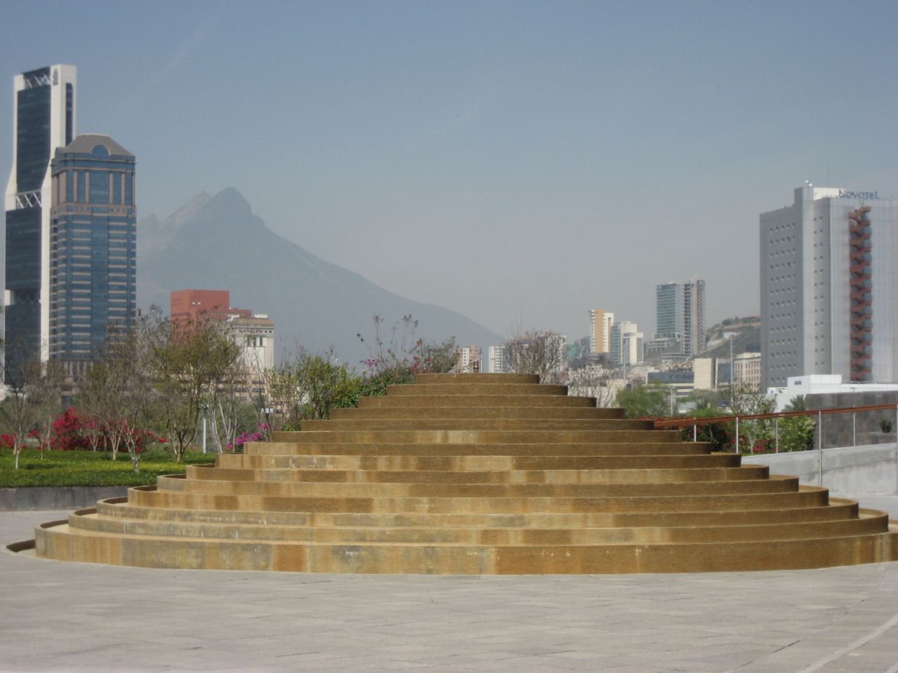
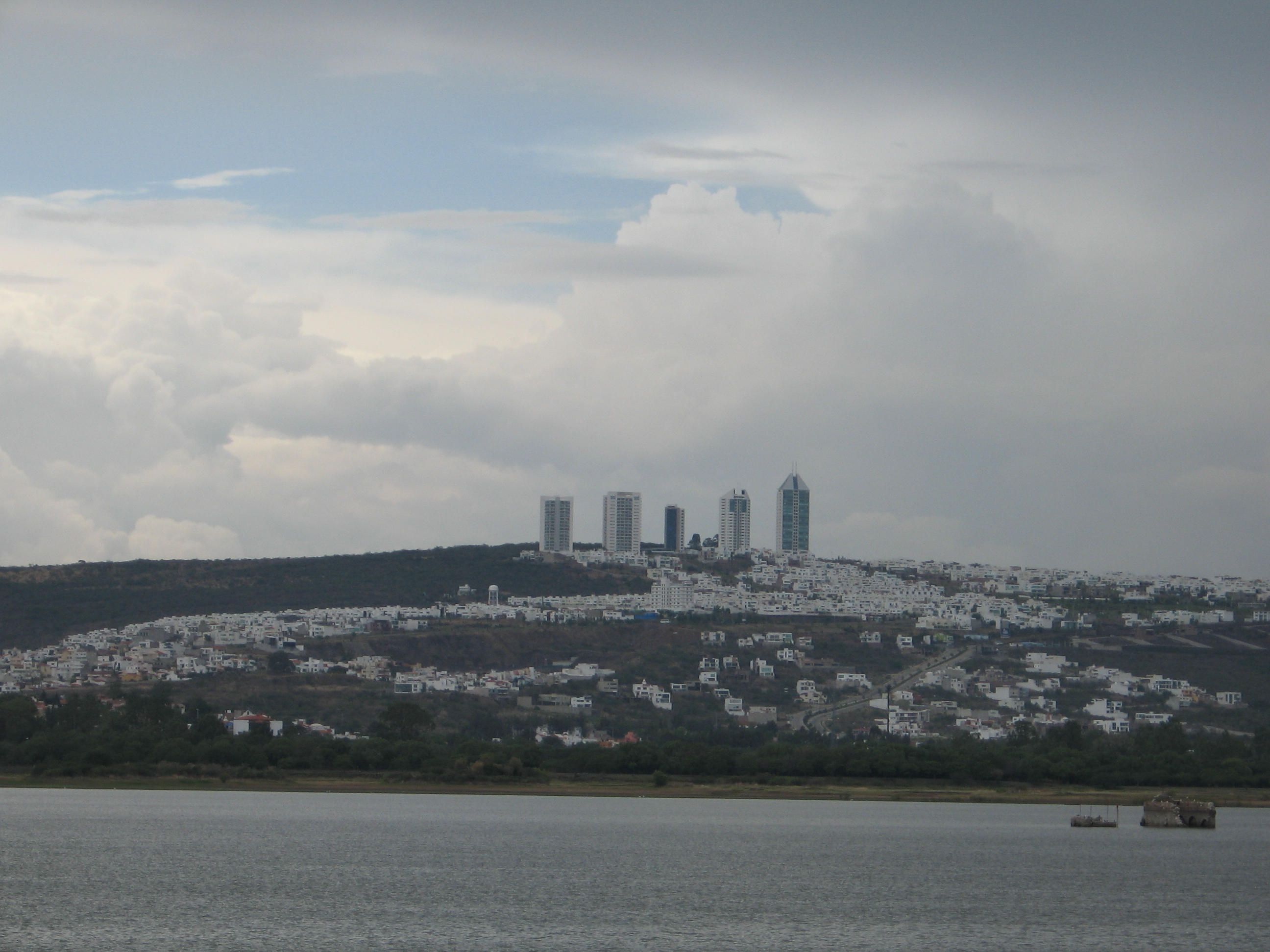
Rank Metropolitan Area Federative Entity 2010 Pop. 2000 Pop. Change 1 Mexico City DF, Mexico, Hidalgo 20,137,152 18,396,677 +9.46% 2 Guadalajara Jalisco 4,434,252 3,699,136 +19.87% 3 Monterrey Nuevo León 4,080,329 3,299,302 +23.67% 4 Puebla Puebla, Tlaxcala 3,124,347 1,885,321 +65.72% 5 Toluca Mexico 1,846,602 1,451,801 +27.19% 6 León Guanajuato 1,792,047 1,269,179 +41.20% 7 Tijuana Baja California 1,751,302 1,274,240 +37.44% 8 Juárez Chihuahua 1,328,017 1,218,817 +8.96% 9 Torreón Coahuila, Durango 1,215,993 1,007,291 +20.72% 10 Querétaro Querétaro 1,097,028 787,341 +39.33% 11 San Luis Potosí San Luis Potosí 1,040,822 850,828 +22.33% 12 Mérida Yucatán 1,035,238 803,920 +28.77% 13 Mexicali Baja California 936,145 764,602 +22.44% 14 Aguascalientes Aguascalientes 932,298 707,516 +31.77% 15 Cuernavaca Morelos 875,598 738,326 +18.59% 16 Acapulco Guerrero 863,438 791,558 +9.08% 17 Tampico Tamaulipas, Veracruz 858,620 746,417 +15.03% 18 Chihuahua Chihuahua 851,971 696,495 +22.32% 19 Saltillo Coahuila 823,098 637,273 +29.16% 20 Morelia Michoacán 806,822 659,940 +22.26% 21 Veracruz Veracruz 801,122 642,680 +24.65% 22 Villahermosa Tabasco 755,416 600,580 +25.78% 23 Reynosa–Río Bravo Tamaulipas 725,793 524,692 +38.33% 24 Cancún Quintana Roo 676,238 431,128 +56.85% 25 Xalapa Veracruz 666,268 510,410 +30.54% 26 Tuxtla Gutiérrez Chiapas 640,881 494,763 +29.53% 27 Oaxaca Oaxaca 593,522 460,350 +28.93% 28 Poza Rica Veracruz 513,308 443,419 +15.76% 29 Pachuca Hidalgo 512,180 375,022 +36.57% 30 Tlaxcala–Apizaco Tlaxcala 499,504 408,401 +22.31% 31 Matamoros Tamaulipas 493,308 418,141 +17.98% 32 Cuautla Morelos 434,153 358,405 +21.13% 33 Tepic Nayarit 429,161 342,840 +25.18% 34 Orizaba Veracruz 410,372 367,021 +11.81% 35 Nuevo Laredo Tamaulipas 384,018 310,915 +23.51% 36 Puerto Vallarta Jalisco, Nayarit 379,934 244,536 +55.37% 37 Minatitlán Veracruz 356,020 323,389 +10.09% 38 Coatzacoalcos Veracruz 347,223 307,724 +12.84% 39 Colima–Villa de Álvarez Colima 333,977 210,766 +58.46% 40 Monclova–Frontera Coahuila 317,314 282,853 +12.18% 41 Córdoba Veracruz 315,996 276,553 +14.26% 42 Zacatecas–Guadalupe Zacatecas 298,143 232,965 +27.98% 43 Tehuacán Puebla 296,894 240,507 +23.45% 44 La Piedad–Pénjamo Michoacán, Guanajuato 249,854 229,372 +8.93% 45 Zamora–Jacona Michoacán 249,805 216,048 +15.62% 46 Tulancingo Hidalgo 239,575 193,638 +23.72% 47 Tula Hidalgo 205,848 169,901 +21.16% 48 Guaymas Sonora 203,442 180,316 +12.83% 49 San Francisco del Rincón Guanajuato 182,330 145,017 +25.73% 50 Piedras Negras Coahuila 180,701 151,149 +19.55% 51 Tehuantepec Oaxaca 161,343 145,567 +10.84% 52 Tecomán Colima 141,465 127,863 +10.64% 53 Ocotlán Jalisco 141,365 125,027 +13.07% 54 Rioverde-Ciudad Fernández San Luis Potosí 135,423 128,935 +5.03% 55 Acayucan Veracruz 112,999 102,992 +9.72% 56 Moroleón–Uriangato Guanajuato 108,648 100,063 +8.58% Transnational conurbations
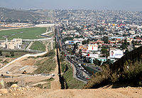 The Mexico–U.S. border separates densely populated Tijuana, Mexico (right), from San Diego, United States (left). The 2,000-mile border shared between Mexico and the U.S. is the most frequently crossed international border in the world, with 250 million legal crossings every year.[2][3]
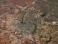 A 3D rendered image of the Nuevo Laredo - Laredo Metropolitan Area, a bi-national urban agglomeration divided by the Rio Grande.
The United States shares a 2,000-mile (3,000 km) border with Mexico. The 2,000 miles is the most frequently crossed international border in the world, with about 250 million legal crossing every year.[2] The distribution of population and urban population in Mexico has been changed significantly by the economic interaction between settlements in its north and the United States (U.S.). The increasing population concentration in the north of Mexico is strongly associated with the development of the maquila industries there and the eventual economic effects of North American Free Trade Agreement (NAFTA).[4] Metropolitan areas located at the border with the U.S. form transnational conurbations with deep economic and demographic interaction. For example, the San Diego – Tijuana metropolitan area consists of San Diego County in the U.S. and the municipalities of Tijuana, Playas de Rosarito, and Tecate in Mexico. The total population of the region has been estimated to be just over 5 million in 2009, making it by far the largest bi-national metropolitan area shared between the U.S. and Mexico.[5] The National Population Council (CONAPO) recognizes the existence of such metropolitan areas and defines them as the municipalities that contain a city of at least 200,000 inhabitants which share processes of conurbation with cities of the U.S.[1]
Rank Metropolitan Area Mexican State American State Population 1 Tijuana - San Diego Baja California California 5,009,170[5] 2 El Paso - Juarez Chihuahua Texas 2,461,538[5] 3 Reynosa - McAllen Tamaulipas Texas 1,700,000[5] 4 Matamoros - Brownsville Tamaulipas Texas 1,136,995[5] 5 Mexicali - Calexico Baja California California 956,223[5] 6 Nuevo Laredo - Laredo Tamaulipas Texas 747,494[5] 7 Nogales - Nogales Sonora Arizona 234,809[nb 1] 8 Piedras Negras - Eagle Pass Coahuila Texas 230,205[nb 2] 9 San Luis Río Colorado - San Luis Sonora Arizona 188,152[nb 3] 10 Ciudad Acuña - Del Río Coahuila Texas 183,750[nb 4] Megalopolis of central Mexico
 Central Mexico Megalopolis
A megalopolis is defined as a long chain of continuous metropolitan areas, or territories that are relatively integrated amongst each other, a clear example of which is the Northeast Megalopolis in the United States. In 1996, the Programa General de Desarollo Urbano del Distrito Federal first proposed this concept to refer to the megalopolis of central Mexico, which was later expanded by PROAIRE, a metropolitan commission on the environment.[6] A megalopolis, is known in Spanish as a corona regional de ciudades ("regional ring of cities"). The Megalopolis of central Mexico was defined to be integrated by the metropolitan areas of Mexico City, Puebla, Cuernavaca, Toluca and Pachuca, which may also conform complex subregional rings themselves (i.e. Greater Puebla conforming a regional ring with Atlixco, San Martín Texmelucan, Tlaxcala and Apizaco). The megalopolis of central Mexico is integrated by 173 municipalities (91 of the state of Mexico, 29 of the state of Puebla, 37 of the state of Tlaxcala, 16 of Morelos and 16 of Hidalgo) and the 16 boroughs of the Federal District,[6] with an approximate total population of almost 25 million people.
See also
- List of metropolitan areas by population
- List of metropolitan areas in the Americas by population
- List of urban agglomerations by population
- List of cities in Mexico
- Demographics of Mexico
Notes
- ^ Sum of legal residents of Nogales, Sonora (213,976) and Nogales, Arizona (20,833).
- ^ Sum of legal residents of Eagle Pass Metropolitan Area's population (48,401) and Piedras Negras, Coahuila (154,360).
- ^ Sum of legal residents of San Luis Río Colorado, Sonora (164,342) and San Luis, Arizona (23,810).
- ^ Sum of legal residents of Ciudad Acuña, Coahuila (135,605) and Del Rio, Texas (46,682).
References
- ^ a b c s/espanol/metodologias/otras/zonas_met.pdf CONAPO Áreas Metropolitanas
- ^ a b David M. Bridgeland, Ron Zahavi. Business Modeling: A Practical Guide to Realizing Business Value. Morgan Kaufmann, 2000. p. 134. ISBN 0123741513.
- ^ "Borders and Law Enforcement". U.S. Embassy Mexico. http://www.usembassy-mexico.gov/eng/eborder_mechs.html. Retrieved 8 December 2009.
- ^ Michael Pacione. Urban geography: a global perspective. Routledge, 2005. p. 105. ISBN 0415343054.
- ^ a b c d e f g "Metropolitan areas in the Americas". World Gazetteer. http://world-gazetteer.com/wg.php?x=&men=gcis&lng=en&dat=32&geo=-2&srt=pnan&col=aohdq&pt=a&va=x. Retrieved 8 December 2009.
- ^ a b Área metropolitana del Valle de México PROAIRE
External links
- National Population Council (CONAPO) — official website. (Spanish)
- National Institute of Statistics and Geography (INEGI) — official website. (Spanish)
Categories:- Metropolitan areas of Mexico
- Lists of metropolitan areas
- Mexico-related lists


Wikimedia Foundation. 2010.