- Nogales, Sonora
-
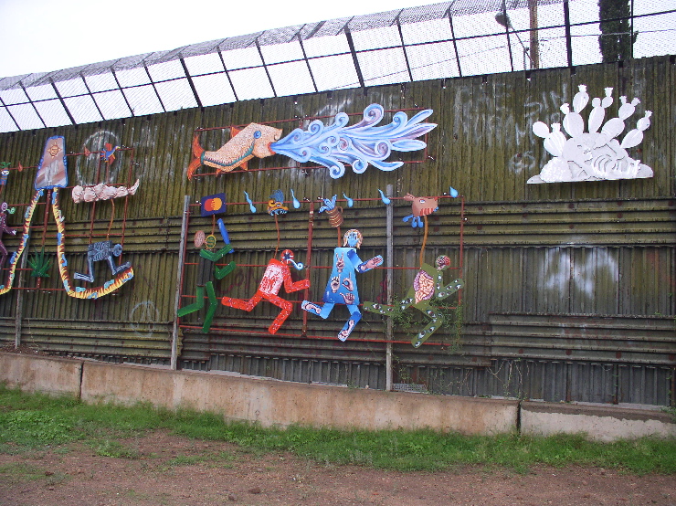
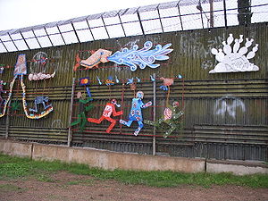 Mural on the Nogales, Sonora side of the US-Mexico border. It depicts the harsh realities of illegal immigrants travelling through the Sonoran desert. The wall itself, at this location, is constructed of Korean War-era perforated steel matting used as makeshift runways and landing strips.
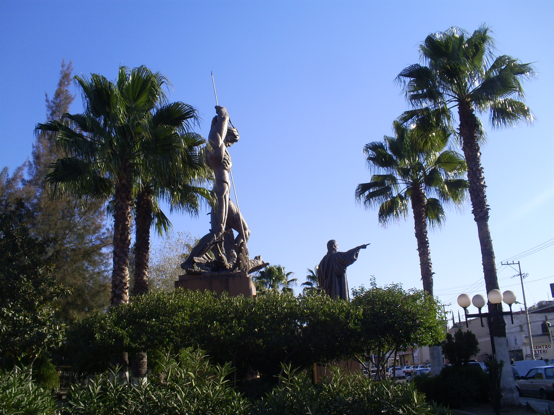
 Monument to president Benito Juarez.
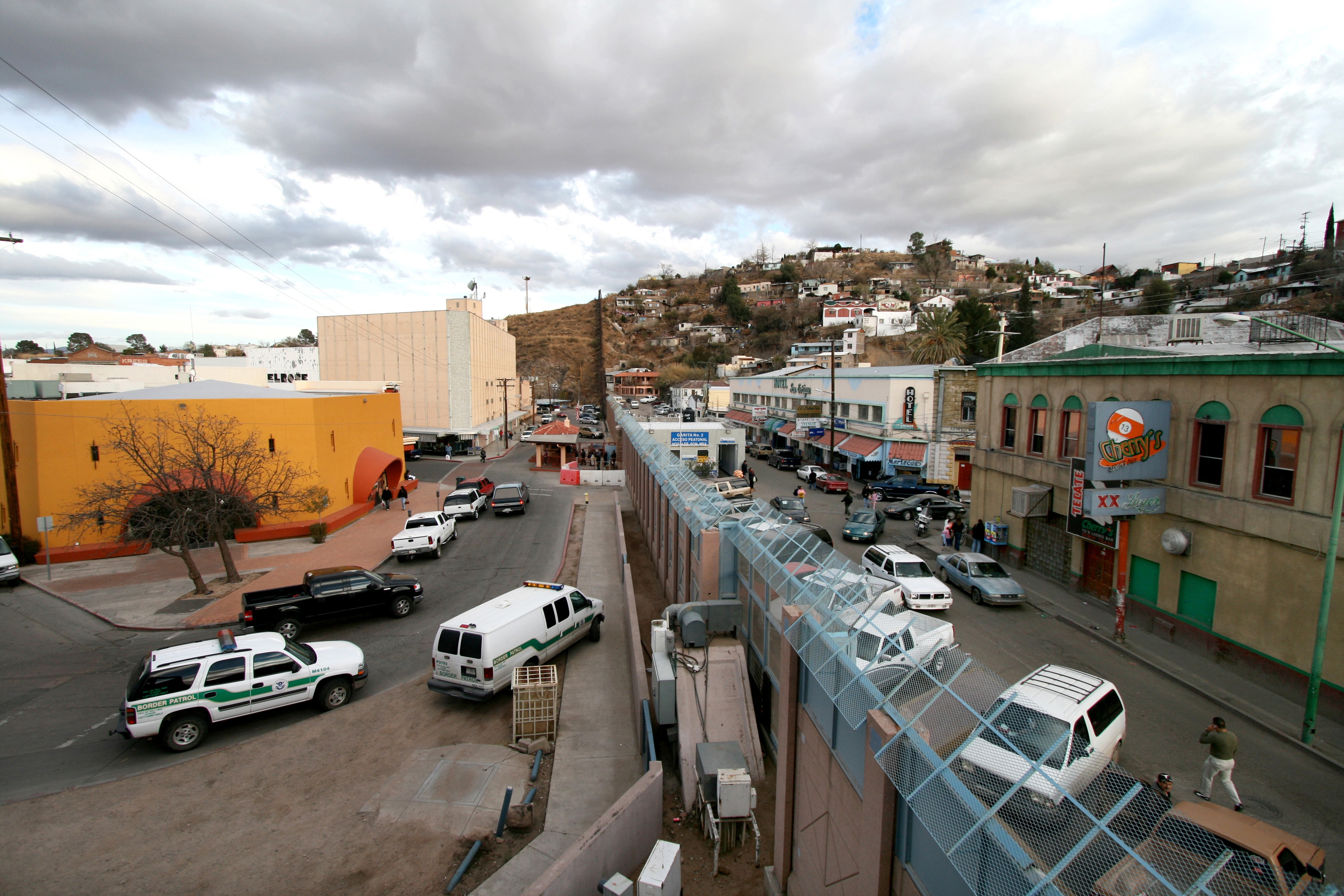
 Picture of the border between Arizona, on the left, and Sonora, on the right.
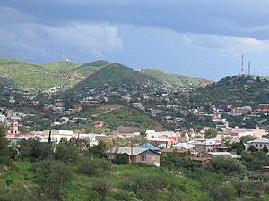 View of houses in Nogales, taken from the US side of the border. The border wall can be seen in the picture.
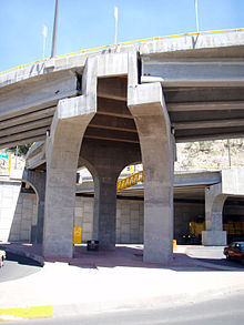 A train of the Mexican National Railway service travels below one of the bridges.
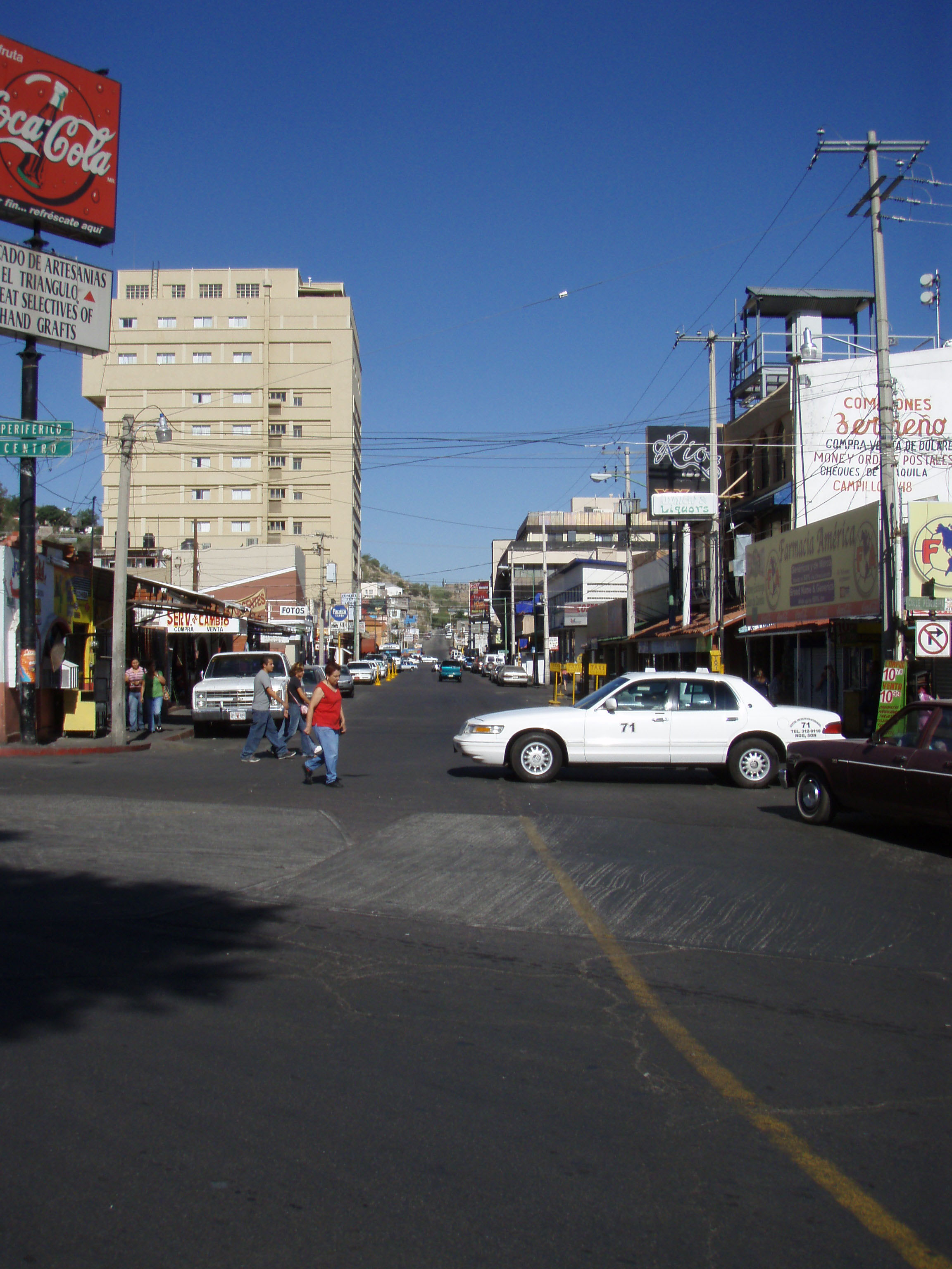
 View of the city upon entering from the US.
Heroica Nogales (Spanish pronunciation: [eˈɾoika noˈɣales]), more commonly known as Nogales, is a city and its surrounding municipality on the northern border of the Mexican State of Sonora. The municipality covers an area of 1,675 km², and borders to the north the city of Nogales, Arizona, United States, across the U.S.-Mexico border. As of 2000[update], the census reported that Nogales had a population of 159,103 people, representing approximately 50% growth from 1990. By the 2005 census the official population of the city was 189,759, and that of the municipality was 193,517. At the latest census in 2010, the official numbers were 212,533 for the city, and 220,292 for the municipality. The city and the municipality both rank third in the state in population, after Hermosillo and Ciudad Obregón. The municipality includes many outlying but small rural communities. The only other localities with over 1,000 inhabitants are La Mesa (2,996) 31°09′35″N 110°58′28″W / 31.15972°N 110.97444°W and Centro de Readaptación Social Nuevo (2,203) 31°11′04″N 110°58′04″W / 31.18444°N 110.96778°W. Nogales is served by Nogales International Airport.
The population growth is in part due to the influx of industry that has come since the opening of the maquiladora industry through the National Industrialization Program, decades before the North American Free Trade Agreement (NAFTA). Manufacturing now accounts for 55% of the city's gross domestic product, and services are growing as well, most of this caused by the growing jobs in the city.
Nogales officially became a municipality on July 11, 1884, date of the publication of Law No. 29, which had been signed the previous day by the then Governor of Sonora, Luis Emeterio Torres. Nogales was declared a city on January 1, 1920.
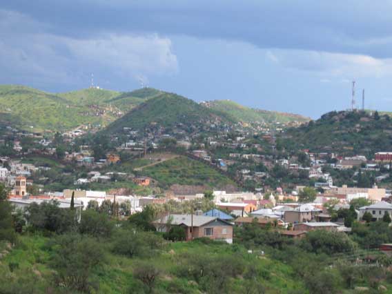
Nogales is known for its recent enormous population growth which covers the hills along the central narrow north-south valley. Dispersed among the houses, the visitor will find a mixture of factories, stores, etc. In 2006, the southern half of the city experienced a modern urbanization development including shopping malls, wide avenues, and modern housing conglomerations.
Contents
Economy
Tourism
Due to its location, Nogales is one of the most important ports of entry for U.S. tourists. The downtown area consists of bars, strip clubs, hotels, restaurants, and a large number of curio stores, which sell a large variety of artesanias (handicrafts, leather art, hand-made flowers, clothes) brought from the deeper central and southern states of Mexico. Local dishes commonly available in restaurants include many types of antojitos (Mexican food) such as enchiladas, tacos, burritos with carne machaca (dried meat), menudo and tamales.[1]
Medical and dental care for U.S. citizens
Because of its proximity to Tucson, Arizona, Nogales has become one of the largest providers of medical and dental care in Mexico for patients from the U.S., with care that is comparable in professionalism, equipment, and competency[citation needed] at prices that are 40% to 60% cheaper.
Manufacturing
Maquiladoras, or manufacturing plants, employ a large percentage of the population. Nogales' proximity to the U.S. and the abundance of inexpensive labor make it an efficient location for foreign companies to have manufacturing and assembly operations. Some of the companies that have established maquiladoras in Nogales include Otis Elevator, The Chamberlain Group, Walbro and Philips Avent.
Municipal government
Nogales was governed by the Institutional Revolutionary Party (PRI) for its entire history until the 2006 elections, when power shifted to the National Action Party (PAN). After more than ten decades of being in power, the PRI was ousted by PAN when long-time successful businessman and philanthropist Marco Antonio Martínez Dabdoub ran for the presidency of Nogales, winning by 30,000 votes over his PRI opponent.
Production and export
Approximately 92 establishments produce foreign exports. Sixty-five of these establishments are located in seven industrial parks, which employ approximately 25,400 workers, around 50 percent of the total employed population of the municipality.[1]
Other
The primary commercial artery is Mexico Federal Highway 15, which links the state with the U.S. as well as major cities in Mexico. Also important to the economy is livestock for both foreign export and cattle breeding.
Escobarista’s Rebellion
Early in March 1929, Escobarista’s Rebellion exploded in Nogales, sponsored by Obregonistas, supporters of Mexican president Alvaro Obregón, who was assassinated on July 17, 1928. General Manuel Aguirre, commanding the 64th regiment, took power without firing a shot, causing federales from Naco to send an aeroplane to attack the rebels, which dropped a few bombs over Nogales without doing any damage, while the rebels fought back with machine guns from the roofs without doing any damage to the airplanes. There was only one casualty, a man who was scared by a bomb explosion and had a heart attack. That same month, a hooded man appeared at night driving a tank on Morley Street on the U.S. side, then entering Mexico to help the federales in Naco. It seems that the tank was bought in 1927 for fighting the Yaquis, but U.S. officials prohibited it from leaving the U.S., and it was kept in a warehouse in Nogales Arizona.[2]
Notable residents
References
- ^ a b City of Nogales. "Municipio de Nogales Official Site". Archived from the original on 2007-05-04. http://web.archive.org/web/20070504191527/http://www.sonora.gob.mx/portal/Runscript.asp?p=ASP%5cpg212.asp. Retrieved 2007-10-19.
- ^ Municipio de Nogales. "La rebellion escobarista". Archived from the original on 2007-07-16. http://web.archive.org/web/20070716151408/http://www.municipiodenogales.org/escobarismo.htm. Retrieved 2007-10-19.
- ^ "MC Magic Music News & Info". billboard.com. http://www.billboard.com/artist/mc-magic/184919#/artist/mc-magic/184919. Retrieved 23 November 2010.
- ^ "Lucha Wiki". http://www.luchawiki.com/index.php?title=Mocho_Cota.
- Link to tables of population data from Census of 2005 INEGI: Instituto Nacional de Estadística, Geografía e Informática
External links
- Nogales, Ayuntamiento Digital (Official Website of Nogales, Sonora) (Spanish)
- Nogales Sonora Website
Coordinates: 31°19′07″N 110°56′45″W / 31.31861°N 110.94583°W
Alvarado (Veracruz) · Atlixco (Puebla) · Caborca (Sonora) · Cananea (Sonora) · Cárdenas (Tabasco) · Chiapa de Corzo (Chiapas) · Córdoba (Veracruz) · Cosoleacaque (Veracruz) · Cuautla (Morelos) · Ejutla de Crespo (Oaxaca) · Guaymas (Sonora) · Huajuapan de León (Oaxaca) · Huamantla (Tlaxcala) · Juchitán de Zaragoza (Oaxaca) · Matamoros (Tamaulipas) · Nogales (Sonora) · Puebla (Puebla) · Tenango del Valle (México) · Tlapacoyan (Veracruz) · Tlaxiaco (Oaxaca) · Valladolid (Yucatán) · Veracruz (Veracruz) · Ures (Sonora) · Zitácuaro (Michoacán)Categories:- Populated places in Sonora
- Twin cities
- Mexico–United States border crossings
- Municipalities of Sonora
- Nogales, Sonora
- Mexico–United States border towns

Wikimedia Foundation. 2010.