- Juchitán de Zaragoza
Infobox Settlement
official_name = Juchitán de Zaragoza
other_name =
native_name =
nickname =
settlement_type =
motto =
imagesize =
image_caption =
flag_size =
image_
seal_size =
image_shield =
shield_size =
city_logo =
citylogo_size =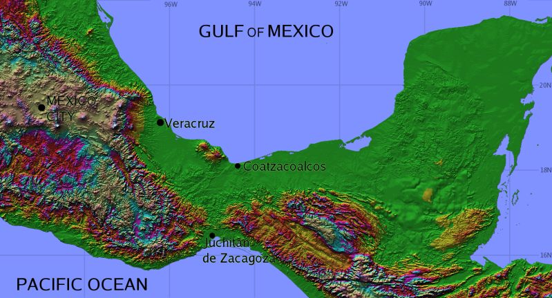
mapsize =
map_caption =
mapsize1 =
map_caption1 =
image_dot_
dot_mapsize =
dot_map_caption =
dot_x = |dot_y =
pushpin_
pushpin_label_position =
pushpin_map_caption =
pushpin_mapsize =
subdivision_type = Country
subdivision_name = MEX
subdivision_type1 = State
subdivision_name1 =Oaxaca
subdivision_type2 =Municipality
subdivision_name2 = Juchitán de Zaragoza
subdivision_type3 =
subdivision_name3 =
subdivision_type4 =
subdivision_name4 =
government_footnotes =
government_type =
leader_title =Mayor
leader_name =Alberto Reyna Figueroa
leader_title1 =
leader_name1 =
leader_title2 =
leader_name2 =
leader_title3 =
leader_name3 =
leader_title4 =
leader_name4 =
established_title = Founded
established_date = 1486Cosijopí (zapotec king)
established_title2 =
established_date2 =
established_title3 =
established_date3 =
area_magnitude =
unit_pref =
area_footnotes =
area_total_km2 =
area_land_km2 =
area_water_km2 =
area_total_sq_mi =
area_land_sq_mi =
area_water_sq_mi =
area_water_percent =
area_urban_km2 =
area_urban_sq_mi =
area_metro_km2 =
area_metro_sq_mi =
area_blank1_title =Municipality
area_blank1_km2 =
area_blank1_sq_mi =160.1
population_as_of =2005
population_footnotes =
population_note =
population_total =74174
population_density_km2 =
population_density_sq_mi =
population_metro =
population_density_metro_km2 =
population_density_metro_sq_mi =
population_urban =
population_density_urban_km2 =
population_density_urban_sq_mi =
population_blank1_title =Demonym
population_blank1 =Juchiteco(a)
population_density_blank1_km2 =
population_density_blank1_sq_mi =
timezone = CST
utc_offset = -6
timezone_DST =
utc_offset_DST =
latd=16 |latm=26 |lats= |latNS=N
longd=95 |longm=01 |longs= |longEW=W
elevation_footnotes =
elevation_m = 30
elevation_ft =
postal_code_type = Postal code
postal_code =70000
area_code =971
blank_name =
blank_info =
blank1_name =
blank1_info =
Website = haciendajuchitan.googlepages.com
footnotes = |Juchitán de Zaragoza (Spanish name;
Isthmus Zapotec : "Xabizende" IPA|/ʒàbìˈzěndè/) is an indigenous town in the southeast of the Mexican state ofOaxaca . With a 2005 census population of 70,714 inhabitants, it is the fourth-largest city in the state (just barely behindSalina Cruz ). The majority of the indigenous inhabitants areZapotec s andHuaves . The town also serves as the municipal seat for the surrounding municipality, with which it shares a name. The municipality has an area of 414.64 km² (160.1 sq mi) and a population of 85,869, the state's third-largest in population.It is located 26 km northeast of the city of
Tehuantepec . Its Palacio Municipal dates back to the middle of the 19th century and perhaps is the widest "palace" inMexico with 31 arches in it front portal. Its main church is the Parroquia de San Vicente Ferrer (Parish of San Vicente Ferrer) which dates from the 17th century. To the west of the Palacio is a large market where local products can be seen and a local variant of theZapotec language can be heard.cite journal |last= Quintanar Hinojosa |first=Beatriz |year=2007 |month= August |title=Istmus de Tehuantepec|journal=Guía México Desconocido: Oaxaca |volume= 137 |pages=92 |url= www.mexicodesconocido.com.mx ]Juchitán is famous for being the first Mexican town to elect a
left wing pro-socialist municipal government in the 20th century, whenLeopoldo de Gyves won the elections formayor in 1980 against thePartido Revolucionario Institucional (PRI).The people of Juchitán have led some local revolts over time: In 1834, "Che Gorio Melendre", a native of Juchitán, directed a revolt against the government of Oaxaca, demanding the control of
salt mine s on the coast located at the southwest of Juchitán and for local autonomy of thecounty . The revolt was interrupted by theMexican-American War in 1847. Irregular troops commanded by Melendre joined the resistance against the invasion. After the invasion by theUnited States , the governor ofOaxaca ,Benito Juárez responded to the local demands of Che Gorio Melendre onMay 19 1850 by sending troops to burn the city of Juchitán and to assassinate their leader Melendre.On
September 5 ,1866 , during the French invasion of Mexico, the indigenous people of Juchitán,Unión Hidalgo ,San Blas Atempa , andIxtaltepec defeated the RoyalFrench Army stationed inTehuantepec . Most of the army ofPorfirio Díaz , later thedictator of Mexico, were natives of Juchitán. José Fructuoso Gómez, nicknamedChe Gómez directed a 1910 revolt in support of theMexican Revolution , allied with Zapata and Villa. In the 1970s, a group of left wing students, workers and farmers organized with the intent of taking control of the local county throughelection s, instead of by force. In February 2001, Juchitán municipality received the caravan ofZapatista Army of National Liberation (EZLN).The violent history of Juchitán involves the strategic geopolitical location of the area, which is located on the
Isthmus of Tehuantepec , the thin part of Mexico between thePacific Ocean and theGulf of Mexico . The zone has been coveted by many countries since theMcLane-Ocampo Treaty , which was signed in December 1859. Under the treaty, PresidentBenito Juárez received a loan in exchange for the use of the isthmus of Tehuantepec by theUnited States . In 1970s an attempt to resurrect the treaty, called theAlfa-Omega project , was aborted. In 2000, the project was finally approved as thePlan Puebla Panama .Gamesa and Iberdrola are currently making important investments in Juchitán, to create a big wind power eolic park -called Proyecto La Venta II- able to produce at least 88 megawatts of energy. The project will make Juchitán the center of the alternative energies in Mexico becoming an example to the rest of Latin America as the eolic park would be the largest in all the region. This project has been criticized because of the lack of information given by Gamesa, Iberdrola and the Mexican Government about its possible ecological, political and cultural consequences on a region where its culture is based on the property of the land used by the Proyecto La Venta II.
Citizens of Juchitán have also made contributions in the arts, such as
paint ing,poetry ,music ,folk dance , andsculpture .On 2006, it was renamed as "Heroica Ciudad de Juchitán de Zaragoza" (Heroic City of Juchitán de Zaragoza), degree given by the State Congress in regard of its inhabitants' defense against the French Invasion.
In May, residents celebrate the Fiesta de las Velas (Festival of the Candles) in honor of its patron saint San Vicente Ferrer, with a large procession.
The municipality
As municipal seat, Juchitán has governing jurisdiction over the following communities:
15 de Agosto, 5 de Septiembre, Álvaro Obregón, Cerro Cristo, Charis, Chicapa de Castro, Colonia 19 de Marzo (Colonia San José), Colonia de la Amistad, Colonia Jesús González Cortaza, Colonia José Yola, Colonia Mariano Montero, Colonia San Vicente, Colonia Santa Rosita, Dos Arbolitos, Dos Hermanos, El Caballero Burro, El Chamizal (Toledo Cueto), El Chaparral, El Porvenir, El Tamarindo, Emiliano Zapata, Esquipulas 1, Esquipulas 2, Estero Guiee, Gaspar Torres Urbieta, Huanacastal, La Esperanza, La Estancia (Santa Cecilia), La Guadalupana, La Liebre (Paraje la Liebre), La Negrita, La Providencia, La Venta, La Ventosa 1, La Ventosa 2, Los Aguacates, Los Cocos Los Ordaz II, Los Vicentes Minerva, Onésimas (Argelino Solórzano), Parada San Vicente, Pepe y Lolita, Piedra Larga, Playa San Vicente, Primera Curva, Rancho Adelma, Rancho Babel López Sánchez, Rancho Chuvalessa, Rancho de los Vásquez (Colonia Palomar), Rancho Domitilo Marquez, Rancho Don Cutberto, Rancho el Ángel, Rancho Esquipulas, Rancho Francisco Rancho Guadalupe, Rancho Juanita, Rancho Lucita, Rancho Martín Vicente, Rancho Nemesio Valdivieso López, Rancho San Antonio, Rancho San Luis, Rancho Torres, Río Viejo (Mojonera), Salinas Santa Cruz, San Antonio, San Isidro, San José, Santa Clara, Santa Fe 1, Santa Fe 2, Santa Lucía, Santa María del Mar, and Santa Rita
References
* [http://www.inegi.gob.mx/est/contenidos/espanol/sistemas/conteo2005/localidad/iter/ Link to tables of population data from Census of 2005] INEGI: Instituto Nacional de Estadística, Geografía e Informática
* [http://www.e-local.gob.mx/wb2/ELOCAL/EMM_oaxaca Oaxaca] Enciclopedia de los Municipios de MéxicoExternal links
* [http://www.salinacruzenlinea.com.mx Historia de Tehuantepec, Historia de Salina Cruz, Noticias del Istmo]
* [http://www.e-local.gob.mx/work/templates/enciclo/oaxaca/municipios/20043a.htm Juchitán de Zaragoza municipal site]
* [http://www.margen.org/marcha/26-02-02a.htm EZLN arrives in Juchitan] (26 February 2001
* [http://www.oaxacaoaxaca.com/stories-205.htm Juchitán and the Authentic Searchers for Danger] The ultimate Oaxaca travel guide
* [http://www.conae.gob.mx/wb/CONAE/CONA_612_energia_eolica Consejo Nacional de Energía] Information about eolic energy available in Oaxaca
* [http://cdi.gob.mx/ini/monografias/zapotecosis.html Pueblos indígenas de México] Zapotecos of the Isthmus monography
Wikimedia Foundation. 2010.