- Monclova
-
Santiago de la Monclova — Municipio — 

Coat of armsNickname(s): The Steel Capital (La Capital del Acero, in Spanish) 
 Santiago de la Monclova
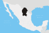
Coordinates: 26°54′37″N 101°25′20″W / 26.91028°N 101.42222°WCoordinates: 26°54′37″N 101°25′20″W / 26.91028°N 101.42222°W Country  Mexico
State Coahuila Municipality Monclova Founded 25 July 1577 Government - Type Municipio - Presidente Municipal Dr. Armando Castro (PRI) Elevation 620 m (2,034 ft) Population (2010) - Municipio 216,206 - Metro 294,191 - Metro density 29.88/km2 (77.4/sq mi) Time zone CST (UTC-6) - Summer (DST) CST (UTC-5) Codigo Postal 25700 Area code(s) +52-866 Website monclova.gob.mx Airport: Venustiano Carranza International Airport (LOV) Santiago de la Monclova, more commonly known as just Monclova in everyday speech, is a city and seat of the surrounding municipality of the same name in the northern Mexican state of Coahuila. According to the 2010 INEGI census there were 198,819 inhabitants in the city and 216,206 in the municipality. Its metropolitan area (Monclova, Frontera, Castaños) had 294,191 inhabitants and has a population density of 29.88 inhabitants per square kilometers. Monclova is the third largest city in Coahuila (after Saltillo and Torreón).
Contents
History
Established in 25 July 1577, Monclova become the first city in the region known as Coahuila, and later known as State of Coahuila.
During the colonial period and the first years of the 19th century, Monclova served as the capital of Nueva Extremadura. It remained the capital during the early years of Mexico's independence.
With the adoption of the 1824 Constitution, which created the state of Coahuila y Tejas, the capital was transferred to Saltillo. In 1828 this decision was overturned when Monclova was declared the capital of the new state, however the state legislature continued to convene in Saltillo. On March 9, 1833, the state legislature settled the dispute in Monclova's favour, and this decision was ratified by President Antonio López de Santa Anna on December 2, 1834.
With the enactment of the 1836 Constitutional Laws, whereby the federal republic was converted into a centralised one, the state of Coahuila y Tejas was divided into two departments, Coahuila and Tejas (or Texas, as it would later become), and Saltillo was finalized as Coahuila's capital.
Geography
Monclova sits at an altitude of 600m above sea level, but over the years the sand sediments of the city have sunk it 8 meters below the original level due to the weight of constructions.[citation needed] It is located at 26°54′37″N 101°25′20″W / 26.91028°N 101.42222°W, in the state's central region (Región Centro), in the east-central part of the state.
Climate
Monclova experiences a warm semi-arid climate, with a median yearly temperature of 21.8°C (71°F).
The median temperature of the coolest month, January, is 11.6°C (53°F), although the temperature can climb as high as 30°C during some evenings but remain below 0°C (32°F) some nights and mornings. In the 1970s the coolest temperature recorded was -4.2°C (24°F) on February 9, 1973. In the 1990s the same value was recorded on January 13, 1997. Since 2000 the lowest recorded was -2°C (28°F) on January 17, 2007. Probably the coldest snap in recent history took place on Christmas Day 1983, when the city's temperature plunged to -9.5°C (14°F).
Monclova Climate chart (explanation) J F M A M J J A S O N D 13185112274281324311629342058352264352255352174312044271617251120218Average max. and min. temperatures in °C Precipitation totals in mm Source: [1] Imperial conversion J F M A M J J A S O N D 0.564410.472450.282550.988611.193682.395722.595722.295702.988681.781610.777520.87046Average max. and min. temperatures in °F Precipitation totals in inches On the other hand, temperatures during late spring and summer can have bouts of extreme heat, with evenings above 40°C (104°F) for many consecutive days. In recent decades the hottest records have climbed as high as 43°C (111°F) on July 13, 2005 and 45°C (113°F) on May 4, 1984. However nighttime low temperatures are typically 15 degrees cooler than daytime highs, due to the very arid conditions. Even in July, the warmest month, temperatures have gotten as low as 10.6°C (51°F) in 1975. The median temperature July is 28.6°C (82°F). A typical summer day has a low around 21°C (70°F) and a high near 35°C (95°F).
In 1976 the wettest month on record took place in July, with 287.3 mm of rain, more than half the median yearly value of 411.3 mm; however the average wettest month is September with 74 mm. The warmer months of the year are typically wetter than the cooler ones. Cold fronts in winter have the possibility of drastically reducing temperatures in the area, and are responsible for the little rainfall of such period. Even snowfall has occurred in Monclova some winters, although most years it is a phenomenon reserved only to the nearby mountains. Precipitation occurs an average of 47 days, out of which 6 will be thunderstorms and at least one day with hail.
Economy
The city accounts for the highest production of steel in Mexico, hence its nickname The Steel Capital (La Capital del Acero, in Spanish). In 1942 the steel factory Altos Hornos de Mexico was founded, accelerating the industrial development of Monclova.
Tourism
Buildings and monuments
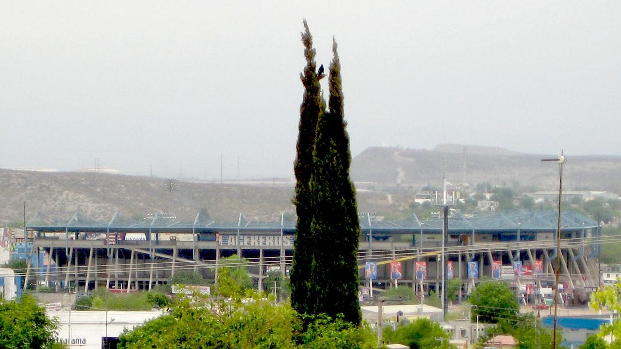
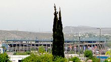 Stadium
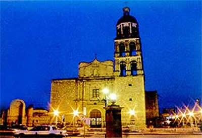
- The Santiago Apostol Parish Church - Construction of this building began in the second half of the eighteenth century. Its façade consists of carved cantera stone.
- The San Francisco de Asis Parish Church - St. Francis of Assisi Church, seventeenth century.
- Ermita de Zapopan Church - Due to damage caused during the revolution and to conserve original details like its bells and walls, restoration was carried out at the beginning of the nineteenth century.
- El Polvorin (The Powder Magazine) - Museum with collections of anthropology, biology, sociology, watercolor art, geology, mathematics, communications, archery, guns, other weapons, and Mexican sexual culture.
- Pape Museum Library - For 28 years, this cultural and recreational center, promoted by the Pape Foundation, has given seasonal expositions of artistic works. Its permanent exhibit chronologically illustrates the life and work of the couple Harold and Lou Pape. It also has an auditorium for 300 people where plays and musical concerts are performed. Next to the museum is the Harold R. Pape Library.
- Meteorological Observatory - The observatory is the largest in the state with a 16-inch opening. Controlled by a computer, it integrates a highly sophisticated video system that projects live images of the sun, the moon, and the planets onto a black and white screen. This observatory was constructed by the government to educate the people about the difference between astronomy and astrology.[citation needed]
Parks and gardens
- Xochipilli Park I and II - More than 20 hectares (49 acres) intended for relaxation and recreational activities form this original concept from the Papes. Its complete facilities include large sports and cultural spaces surrounded by green areas, lakes, rivers, fountains, and waterfalls.
- The Main Square
- The Zoo
Notable People from Monclova
- Mario García Torres, visual artist.
- Joakim Soria, relief pitcher for the Kansas City Royals
- Susana Zabaleta, actress, opera singer and judge on Televisa TV contests
References
- Link to tables of population data from Census of 2005 INEGI: Instituto Nacional de Estadística, Geografía e Informática
armando reyes castro el senes de la progreso
External links
- (Spanish) Official webpage
- (Spanish) Municipal information on Coahuila state website
Saltillo (capital) Topics Architecture · Climate · Culture · Demographics · Economy · Education · Geography · Government · History · Literature · Politics · Sports · Transportation · Tourist Attractions
Municipalities
and
(municipal seats)Abasolo (Abasolo) · Acuña (Ciudad Acuña) · Allende (Allende) · Arteaga (Arteaga) · Candela (Candela) · Castaños (Castaños) · Cuatrociénegas (Cuatrociénegas de Carranza) · Escobedo (Escobedo) · Francisco I. Madero (Francisco I. Madero) · Frontera (Ciudad Frontera) · General Cepeda (General Cepeda) · Guerrero (Guerrero) · Hidalgo (Hidalgo) · Jiménez (Jiménez) · Juárez (Juárez) · Lamadrid (Lamadrid) · Matamoros (Matamoros de la Laguna) · Monclova (Monclova) · Morelos (Morelos) · Múzquiz (Santa Rosa de Múzquiz) · Nadadores (Nadadores) · Nava (Nava) · Ocampo (Ocampo) · Parras (Parras de la Fuente) · Piedras Negras (Piedras Negras) · Progreso (Progreso) · Ramos Arizpe (Ramos Arizpe) · Sabinas (Sabinas) · Sacramento (Sacramento) · Saltillo (Saltillo) · San Buenaventura (San Buenaventura) · San Juan de Sabinas (Nueva Rosita) · San Pedro de las Colonias (San Pedro de las Colonias) · Sierra Mojada (Sierra Mojada) · Torreón (Torreón) · Viesca (Viesca) · Villa Unión (Villa Unión) · Zaragoza (Zaragoza)
Categories:- Populated places in Coahuila
- United States colonial and territorial capitals
- Populated places established in 1577


Wikimedia Foundation. 2010.