- Minneapolis, Kansas
-
Minneapolis, Kansas — City — Business District, in 2009 Location of Minneapolis, Kansas
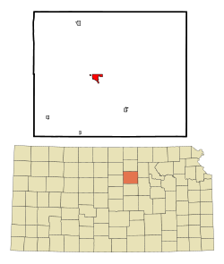
Coordinates: 39°7′29″N 97°42′19″W / 39.12472°N 97.70528°WCoordinates: 39°7′29″N 97°42′19″W / 39.12472°N 97.70528°W Country United States State Kansas County Ottawa Area – Total 1.7 sq mi (4.5 km2) – Land 1.7 sq mi (4.5 km2) – Water 0.0 sq mi (0.0 km2) Elevation 1,280 ft (390 m) Population (2010)[1] – Total 2,032 – Density 1,195.3/sq mi (461.5/km2) Time zone Central (CST) (UTC-6) – Summer (DST) CDT (UTC-5) ZIP code 67467 Area code(s) 785 FIPS code 20-47075[2] GNIS feature ID 0476284[3] Website City Website Minneapolis is a city in and the county seat of Ottawa County, Kansas, United States.[4] As of the 2010 census, the city population was 2,032.[1] Minneapolis is part of the Salina Micropolitan Statistical Area.
Contents
Geography
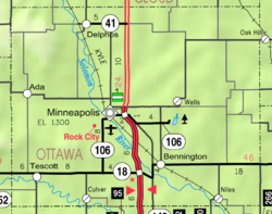
Minneapolis is located at 39°7′29″N 97°42′19″W / 39.12472°N 97.70528°W (39.124719, -97.705209)[5]. According to the United States Census Bureau, the city has a total area of 1.7 square miles (4.4 km2), all of it land.
Area attractions
- Rock City, park is located southwest of Minneapolis.
Demographics
Historical populations Census Pop. %± 1990 1,983 — 2000 2,046 3.2% 2010 2,032 −0.7% U.S. Decennial Census 
As of the census[2] of 2000, there were 2,046 people, 810 households, and 512 families residing in the city. The population density was 1,173.6 people per square mile (454.0/km²). There were 914 housing units at an average density of 524.3 per square mile (202.8/km²). The racial makeup of the city was 96.97% White, 1.32% African American, 0.24% Native American, 0.05% Asian, 0.29% from other races, and 1.12% from two or more races. Hispanic or Latino of any race were 1.52% of the population.
There were 810 households out of which 29.6% had children under the age of 18 living with them, 53.1% were married couples living together, 8.0% had a female householder with no husband present, and 36.7% were non-families. 33.3% of all households were made up of individuals and 18.9% had someone living alone who was 65 years of age or older. The average household size was 2.29 and the average family size was 2.92.
In the city the population was spread out with 22.9% under the age of 18, 7.5% from 18 to 24, 25.0% from 25 to 44, 21.5% from 45 to 64, and 23.1% who were 65 years of age or older. The median age was 41 years. For every 100 females there were 91.0 males. For every 100 females age 18 and over, there were 88.2 males.
The median income for a household in the city was $34,792, and the median income for a family was $43,750. Males had a median income of $29,028 versus $21,174 for females. The per capita income for the city was $17,628. About 3.7% of families and 9.7% of the population were below the poverty line, including 8.4% of those under age 18 and 16.8% of those age 65 or over.
Notable people
- George Washington Carver, who lived in the vicinity for a brief period.
- Rollin R. Rees, a U.S. Representative from Kansas
- Tanner Walle, singer/songwriter
See also
References
- ^ a b "2010 City Population and Housing Occupancy Status". U.S. Census Bureau. http://factfinder2.census.gov/faces/tableservices/jsf/pages/productview.xhtml?pid=DEC_10_PL_GCTPL2.ST13&prodType=table. Retrieved March 27, 2011.
- ^ a b "American FactFinder". United States Census Bureau. http://factfinder.census.gov. Retrieved 2008-01-31.
- ^ "US Board on Geographic Names". United States Geological Survey. 2007-10-25. http://geonames.usgs.gov. Retrieved 2008-01-31.
- ^ "Find a County". National Association of Counties. http://www.naco.org/Counties/Pages/FindACounty.aspx. Retrieved 2011-06-07.
- ^ "US Gazetteer files: 2010, 2000, and 1990". United States Census Bureau. 2011-02-12. http://www.census.gov/geo/www/gazetteer/gazette.html. Retrieved 2011-04-23.
Further reading
- History of the State of Kansas; William G. Cutler; A.T. Andreas Publisher; 1883. (Online HTML eBook)
- Kansas : A Cyclopedia of State History, Embracing Events, Institutions, Industries, Counties, Cities, Towns, Prominent Persons, Etc; 3 Volumes; Frank W. Blackmar; Standard Publishing Co; 944 / 955 / 824 pages; 1912. (Volume1 - Download 54MB PDF eBook),(Volume2 - Download 53MB PDF eBook), (Volume3 - Download 33MB PDF eBook)
External links
- City
- Schools
- USD 239, local school district
- Attractions
- Rock City, landmark
- Maps
- Minneapolis City Map, KDOT
- Ottawa County Map, KDOT
Municipalities and communities of Ottawa County, Kansas Cities Bennington | Culver | Delphos | Minneapolis | Tescott

Unincorporated
communitySumnerville
Categories:- Cities in Kansas
- County seats in Kansas
- Populated places in Ottawa County, Kansas
- Salina micropolitan area


Wikimedia Foundation. 2010.