- Mangonia Park, Florida
-
Mangonia Park, Florida — Town — Location of Mangonia Park in Palm Beach County, Florida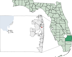
Coordinates: 26°45′29″N 80°4′26″W / 26.75806°N 80.07389°WCoordinates: 26°45′29″N 80°4′26″W / 26.75806°N 80.07389°W Country  United States
State  Florida
County Palm Beach Area – Total 0.7 sq mi (1.8 km2) – Land 0.7 sq mi (1.8 km2) – Water 0.0 sq mi (0.0 km2) Elevation 16 ft (5 m) Population (2000) – Total 1,283 – Density 1,809.7/sq mi (698.7/km2) Time zone Eastern (EST) (UTC-5) – Summer (DST) EDT (UTC-4) ZIP code 33407 Area code(s) 561 FIPS code 12-42900[1] GNIS feature ID 0286375[2] Mangonia Park is a town in Palm Beach County, Florida, United States. It is a part of Uptown West Palm, which also includes Riviera Beach & West Palm Beach. The population was 1,283 at the 2000 census. As of 2004, the population recorded by the U.S. Census Bureau was 1,289.[3]
The Town of Mangonia Park was established in 1947. It has a Town Manager-Town Council type of local government, with councilmembers elected to five "at-large" seats that serve three year staggered terms. Municipal elections are held in March of each year by the Palm Beach County Supervisor of Elections Office.
Contents
Geography
Mangonia Park is located at 26°45′29″N 80°04′26″W / 26.758122°N 80.073877°W.[4]
According to the United States Census Bureau, the town has a total area of 0.7 square miles (1.8 km2), all land.
Demographics
As of the census[1] of 2000, there were 1,283 people, 443 households, and 322 families residing in the town. The population density was 1,809.7 inhabitants per square mile (697.7/km²). There were 490 housing units at an average density of 691.2 per square mile (266.5/km²). The racial makeup of the town was 14.58% White (of which 12.2% were Non-Hispanic White,)[5] 76.70% African American, 0.70% Native American, 0.31% Asian, 6.16% from other races, and 1.56% from two or more races. Hispanic or Latino of any race were 9.12% of the population.
There were 443 households out of which 39.3% had children under the age of 18 living with them, 34.1% were married couples living together, 30.5% had a female householder with no husband present, and 27.3% were non-families. 17.8% of all households were made up of individuals and 4.5% had someone living alone who was 65 years of age or older. The average household size was 2.90 and the average family size was 3.20.
In the town the population was spread out with 31.3% under the age of 18, 9.4% from 18 to 24, 31.3% from 25 to 44, 20.1% from 45 to 64, and 7.9% who were 65 years of age or older. The median age was 32 years. For every 100 females there were 88.4 males. For every 100 females age 18 and over, there were 89.1 males.
The median income for a household in the town was $35,865, and the median income for a family was $34,688. Males had a median income of $21,083 versus $24,750 for females. The per capita income for the town was $14,864. About 16.7% of families and 19.2% of the population were below the poverty line, including 25.8% of those under age 18 and 21.1% of those age 65 or over.
As of 2000, speakers of English as a first language accounted for 80.47% of all residents, while Spanish comprised 11.04%, French Creole consisted of 7.61%, and the mother tongue of French made up 0.85% of the population.[6]
As of 2000, Mangonia Park had the ninety-first highest percentage of African American and black residents in the US, with 76.70% of the populace (tied with Hanley Hills, MO and Berkeley, MO.)[7] It had the eighteenth highest percentage of Haitian residents in the US, at 9.10% of the town's population (tied with Lauderhill,)[8] and the thirty-fourth highest percentage of Jamaican residents in the US, at 3.90% of its population (which tied with Redan, GA and Somerset, NJ.)[9] It also had the twenty-seventh most Guatemalans in the US, at 3.82% of all residents.[10]
References
- ^ a b "American FactFinder". United States Census Bureau. http://factfinder.census.gov. Retrieved 2008-01-31.
- ^ "US Board on Geographic Names". United States Geological Survey. 2007-10-25. http://geonames.usgs.gov. Retrieved 2008-01-31.
- ^ http://www.census.gov/popest/cities/tables/SUB-EST2004-04-12.xls
- ^ "US Gazetteer files: 2010, 2000, and 1990". United States Census Bureau. 2011-02-12. http://www.census.gov/geo/www/gazetteer/gazette.html. Retrieved 2011-04-23.
- ^ "Demographics of Mangonia Park, FL". MuniNetGuide.com. http://www.muninetguide.com/states/florida/municipality/Mangonia_Park.php. Retrieved 2007-11-14.
- ^ "MLA Data Center Results of Mangonia Park, FL". Modern Language Association. http://www.mla.org/map_data_results&state_id=12&county_id=&mode=place&zip=&place_id=42900&cty_id=&ll=&a=&ea=&order=r. Retrieved 2007-11-14.
- ^ "Ancestry Map of African-American Communities". Epodunk.com. http://www.epodunk.com/ancestry/African-American.html. Retrieved 2007-11-14.
- ^ "Ancestry Map of Haitian Communities". Epodunk.com. http://www.epodunk.com/ancestry/Haitian.html. Retrieved 2007-11-14.
- ^ "Ancestry Map of Jamaican Communities". Epodunk.com. http://www.epodunk.com/ancestry/Jamaican.html. Retrieved 2007-11-14.
- ^ "Ancestry Map of Guatemalan Communities". Epodunk.com. http://www.epodunk.com/ancestry/Guatemalan.html. Retrieved 2007-11-14.
External links
South Florida metropolitan area Largest city Counties
(by population)Cities and towns
100k-250kCities and towns
25k-99kAventura • Boca Raton • Boynton Beach • Coconut Creek • Cooper City • Coral Gables • Dania Beach • Davie • Deerfield Beach • Delray Beach • Doral • Greenacres • Hallandale Beach • Homestead • Jupiter • Lake Worth • Lauderdale Lakes • Lauderhill • Margate • Miami Beach • North Lauderdale • North Miami • North Miami Beach • Oakland Park • Palm Beach Gardens • Plantation • Riviera Beach • Sunrise • Tamarac • West Park • Weston • Wilton ManorsCities and towns
10k-25kA list of cities under 10,000 is available here. State of Florida
Topics - Delegations
- Environment
- Floridians
- Geography
- Government
- History
- State Parks
- Transportation
- Visitor Attractions
Society - Culture
- Crime
- Demographics
- Economy
- Education
- Politics
Regions Metro areas - Miami–Fort Lauderdale–Pompano Beach (Miami-Dade, Broward, Palm Beach)
- Tampa-St. Petersburg-Clearwater (Hernando, Hillsborough, Pasco, Pinellas)
- Orlando-Kissimmee-Sanford (Lake, Orange, Osceola, Seminole)
- Jacksonville (Duval, Clay, St. Johns, Nassau, Baker)
- North Port–Bradenton–Sarasota (Manatee, Sarasota)
- Cape Coral-Fort Myers (Lee)
- Lakeland-Winter Haven (Polk)
- Palm Bay-Melbourne-Titusville (Brevard)
- Deltona-Daytona Beach-Ormond Beach (Volusia)
- Pensacola-Ferry Pass-Brent (Escambia, Santa Rosa)
- Port St. Lucie (St. Lucie, Martin)
- Tallahassee (Gadsden, Jefferson, Leon, Wakulla)
- Ocala (Marion)
- Naples-Marco Island (Collier)
- Gainesville (Alachua, Gilchrist)
- Fort Walton Beach-Crestview-Destin (Okaloosa)
- Panama City-Lynn Haven-Panama City Beach (Bay)
- Punta Gorda (Charlotte)
- Sebastian-Vero Beach (Indian River)
- Palm Coast (Flagler)
Largest cities Counties - Alachua
- Baker
- Bay
- Bradford
- Brevard
- Broward
- Calhoun
- Charlotte
- Citrus
- Clay
- Collier
- Columbia
- DeSoto
- Dixie
- Duval
- Escambia
- Flagler
- Franklin
- Gadsden
- Gilchrist
- Glades
- Gulf
- Hamilton
- Hardee
- Hendry
- Hernando
- Highlands
- Hillsborough
- Holmes
- Indian River
- Jackson
- Jefferson
- Lafayette
- Lake
- Lee
- Leon
- Levy
- Liberty
- Madison
- Manatee
- Marion
- Martin
- Miami‑Dade
- Monroe
- Nassau
- Okaloosa
- Okeechobee
- Orange
- Osceola
- Palm Beach
- Pasco
- Pinellas
- Polk
- Putnam
- Santa Rosa
- Sarasota
- Seminole
- St. Johns
- St. Lucie
- Sumter
- Suwannee
- Taylor
- Union
- Volusia
- Wakulla
- Walton
- Washington
Categories:- Towns in Palm Beach County, Florida
- Populated places in Florida with African American majority populations


Wikimedia Foundation. 2010.