- Ocala, Florida
-
Ocala, Florida — City — Downtown Ocala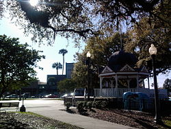

SealNickname(s): Horse Capital of the World; Lightning Capital of the World Motto: "God Be With Us" Location in Marion County and the state of Florida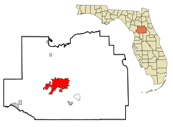
Coordinates: 29°11′16″N 82°7′50″W / 29.18778°N 82.13056°WCoordinates: 29°11′16″N 82°7′50″W / 29.18778°N 82.13056°W Country  United States
State  Florida
County  Marion
settled 1836 Incorporated (town) 4 February 1869 Incorporated (city) 28 January 1885 Government - Type Council-manager - Mayor Randy Ewers (R) - City Manager Rick Horst Area[1] - City 38.63 sq mi (100.1 km2) - Land 38.63 sq mi (100.1 km2) - Water 0 sq mi (0 km2) Elevation 104 ft (32 m) Population (2007)[2] - City 53,491 - Metro 316,183 Census Bureau estimate Time zone Eastern (EST) (UTC-5) - Summer (DST) EDT (UTC-4) ZIP codes 34470-34483 Area code(s) 352 FIPS code 12-50750[3] GNIS feature ID 0288030[4] Website www.ocalafl.org Ocala is a city in Marion County, Florida. As of 2007, the population recorded by the U.S. Census Bureau was 53,491.[2] It is the county seat of Marion County[5], and the principal city of the Ocala, Florida Metropolitan Statistical Area, which had an estimated 2007 population of 324,857.[6]
Contents
History
Ocala is located near the site of Ocale or Ocali, a major Timucua village and chiefdom during the 16th century. The modern city takes its name from the historical village, the name of which is believed to mean "Big Hammock" in the Timucua language.[7] Hernando de Soto passed through Ocale during his famous expedition through what is today the southeastern United States in 1539. Ocale is not mentioned in any later accounts; it appears to have been abandoned in the wake of de Soto's attack.
In 1827 the U.S. military outpost of Fort King was established near the present site of Ocala as a buffer between Seminoles and white settlers. The fort saw service during the Second Seminole War and later acted as the first courthouse for Marion County in 1844. Fort King was the genesis of the modern city of Ocala, which was established in 1846. Greater Ocala is known as the "Kingdom of the Sun".[8] Rail service reached Ocala in June 1881, encouraging economic development. Two years later, much of the Ocala downtown area was destroyed by fire on Thanksgiving Day, 1883. Buildings were rebuilt with brick, granite and steel rather than lumber. By 1888, Ocala was known state-wide as "The Brick City".
In December 1890, the Farmers' Alliance and Industrial Union, a forerunner of the Populist Party held its national convention in Ocala. At the convention, the Alliance adopted a platform that would become known as the "Ocala Demands". This platform included abolition of national banks, low interest government loans, free and unlimited coinage of silver, reclamation of excess railroad lands by the government, a graduated income tax, and direct election of United States senators. Most of the "Ocala Demands" were to become part of the Populist Party platform.
Ocala was an important center of citrus production until the Great Freeze of 1894-1895.
In the twentieth century, Ocala increased in prominence as a center for tourism in Florida. Important attractions included the Silver Springs Nature Theme Park, Wild Waters water park, and the now-defunct Western-themed Six Gun Territory, all in nearby Silver Springs, Florida. (See Six Gun Territory Gallery.) Silver Springs is a 350-acre (1.4 km2) nature theme park that surrounds the headwaters of the Silver River, the largest artesian spring formation in the world.
The first thoroughbred horse farm in Florida was created by Carl G. Rose in 1943. Earlier, in 1916, Rose had come to Florida from Indiana to oversee the first asphalt road ever constructed in the state. When he ran into problems with the asphalt, he improvised and experimented with one of Florida's abundant resources: limestone. He also realized that the Limestone would be a good source of nutrition for raising strong horses, so he took a gamble in 1943 and bought acreage along State Highway 200 at $10 per acre, which became Rosemere Farm. The next year one of his horses, Gornil, won at Miami's Tropical Park, making him the first Florida-raised thoroughbred to win a Florida race. Close on Rose's heels, the entrepreneur Bonnie Heath soon set up his own thoroughbred horse farm and produced the state's first Kentucky Derby winner. Both of these men have prominent Highways named after them in Ocala. Bonnie Heath Farm is now owned and operated by his son Bonnie Heath, III, and his wife Kim. Rosemere Farm was sold long ago, and Ocala's Paddock Mall and Central Florida College were built on the site.
In 1956, the Ocala area Thoroughbred industry received a boost when Needles became the first Florida-bred to win the Kentucky Derby. In 1978, Marion County-bred and -raised Affirmed won the Triple Crown. Today, Marion County is one of the major thoroughbred centers of the world, with over 1,200 horse farms in total and about 900 thoroughbred farms totaling some 77,000 acres (310 km2). Ocala is well known as the horse capital of the world,[9] one of only five cities (four in the USA and one in France) permitted under Chamber of Commerce guidelines to use this title based on annual revenue produced by the horse industry. There are some 44,000 jobs created by the breeding, training and related support brought about by the equine industry that generates over $2.2 billion in annual revenue. Ocala and "Postime Farms" also play host to one of the largest horse shows in the country. H.I.T.S or "Horses in the Sun" is a Dressage/Jumper event lasting about two months and brings with it some 6 to 7 million dollars to the local Marion county economy each year. There are over 100 different breeds aside from thoroughbreds including the Tennessee Walker, Paso Fino, Morgans, SaddleBreds, Drafts, and the American Quarter Horse. Other equine events in the area include cowboy mounted shooting by the Florida Outlaws, as well as endurance rides, barrel races, "extreme" cowboy events, jumper shows, trick shows, parades, draft pulls, and more.
Ocala began undergoing rapid growth in the 1970s with the development of the Interstate 75 and the founding of Disney World, located some 70 miles (110 km) southeast.
In the last decades of the twentieth century, the greater Ocala area experienced one of the highest growth rates in the country for a city its size. The population of Marion County in 2000 was over 250,000, up from under 100,000 in 1975. Much of the county's growth is attributable to the area's growing popularity as a retirement destination, primarily in two areas southwest and south of the city: the SR 200 corridor and The Villages, respectively.
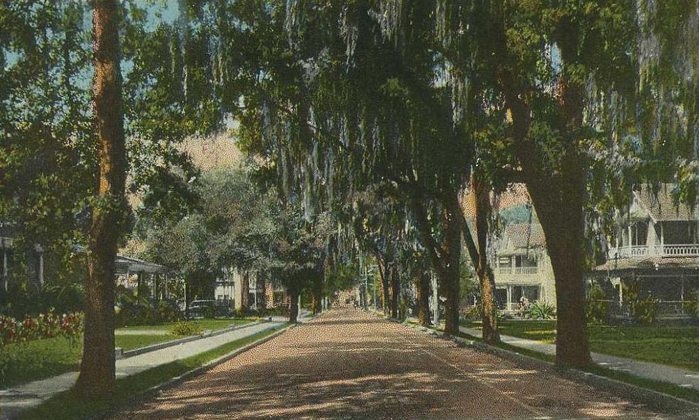
 Fort King Street in c. 1920
Many historic homes are preserved in Ocala's large residential Historic District, established in 1984. A focus of this district is East Fort King Street, featuring many excellent examples of Victorian architecture. Ocala structures on the National Register of Historic Places include the Coca Cola Building, the E. C. Smith House, East Hall, the Marion Hotel, Mount Zion A.M.E. Church, the Ritz Historic Inn, and Union Train Station.
The original Fort King site itself was designated a National Historic Landmark in 2004.
Government and politics
Ocala is governed by a five member board of councillors and a mayor, all of which are elected on a nonpartisan basis. Its charter was written in the council-manager form, leaving the mayor with few powers other than vetoing legislation passed by the council and tending to some duties involving the police department. The city manager handles most administrative and financial matters.[10] Although a small majority of the city's registered voters are Democrats,[11] Ocala's politics match those of the rest of Marion County in that all of its elected legislators - with one exception - are registered Republicans. In the 2008 presidential election, John McCain carried both the city and the county, the latter by a landslide, despite losing Florida as a whole to Barack Obama by a narrow margin.[12]
Geography
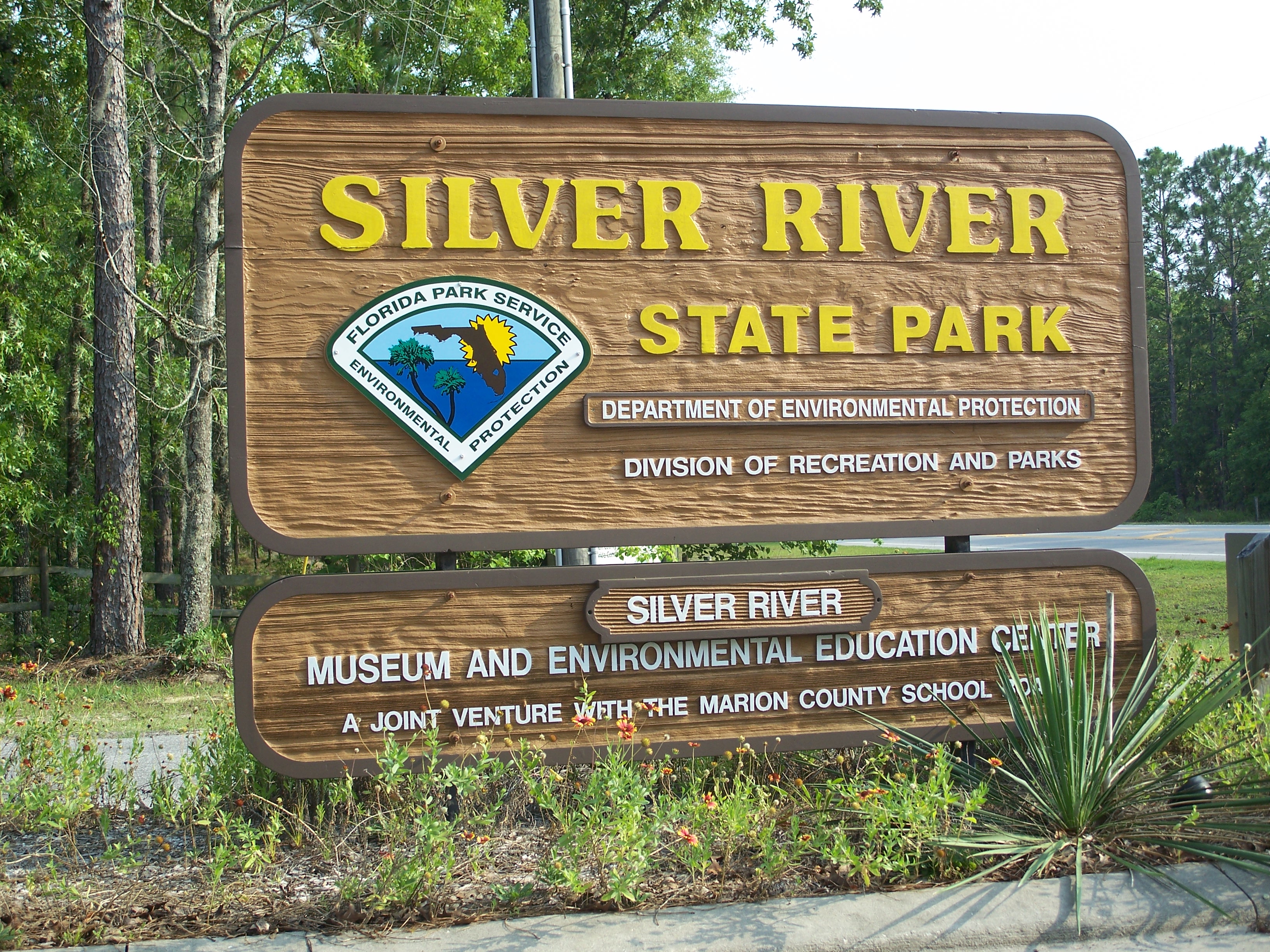
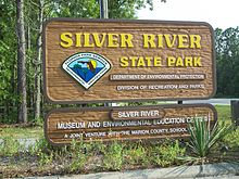 Silver River State Park
Ocala is located at 29°11′16″N 82°07′50″W / 29.187704°N 82.130613°W.[13]
According to the United States Census Bureau, the city has a total area of 38.63 square miles (100.1 km2), all land. The surrounding farms are famous for their thoroughbred horses, in terrain similar to Kentucky bluegrass. Ocala is also known for nearby Silver Springs, Florida, site of one of the largest artesian spring formations in the world and Silver Springs Nature Theme Park, one of the earliest tourist attractions in Florida.
The 110-mile (180 km) long Ocklawaha River flows north from Central Florida until it joins the St. Johns River near Palatka, Florida.
Marion County is also home to the Ocala National Forest which was established in 1908 and is now the second largest national forest in the state. The Florida Trail, also known as the Florida National Scenic Trail, cuts through Ocala National Forest.[14]
Silver River State Park was established in the early 1990s to preserve the areas around the Silver River to the east of Ocala near Silver Springs.
Climate
Ocala has two distinct seasons: the dry season (October–May) and the wet season (June–September). During the dry season, there is almost uninterrupted sunshine with very little rainfall. In January, the morning low temperatures are often in the 30s and 40s, but the cloudless sunny weather typically warms the dry air up to near 70 by the afternoon. During the wet season, afternoon thunderstorms are a daily occurrence. These storms are often severe (unofficially, Ocala is known to have more cloud-to-ground lightning per square mile than any other city in the world). The typical morning low temperatures during the wet season are in the 70's and typical daytime high temperatures are in the 90s. Due to the city being relatively far away from the moderating influence of the Atlantic Ocean and the Gulf of Mexico, Ocala's summertime temperatures are often the highest in the state while winter temperatures are often the lowest compared to other cities on the peninsula. Also, Ocala's distance from the Atlantic Ocean and the Gulf of Mexico means the city has more days of sunshine than Florida's coastal cities. This is, in part, why the Ocala/Marion County area is called "the kingdom of the sun." The last snowfall of any significance fell on December 24, 1989, when the city was struck by an ice and snow storm. However, the morning of January 9, 2010, there was a dusting of snow on the ground in city center. A plume of record cold air mixed with moisture caused wintry precipitation to erupt across northern and central Florida.
Climate data for Ocala, Florida Month Jan Feb Mar Apr May Jun Jul Aug Sep Oct Nov Dec Year Record high °F (°C) 88
(31)90
(32)95
(35)97
(36)102
(39)105
(41)100
(38)100
(38)98
(37)98
(37)90
(32)88
(31)105
(41)Average high °F (°C) 70
(21)73
(23)78
(26)83
(28)88
(31)91
(33)92
(33)92
(33)90
(32)84
(29)77
(25)72
(22)83
(28.0)Average low °F (°C) 46
(8)47
(8)52
(11)56
(13)63
(17)69
(21)71
(22)71
(22)69
(21)61
(16)53
(12)47
(8)58.8
(14.9)Record low °F (°C) 11
(−12)20
(−7)23
(−5)32
(0)45
(7)48
(9)58
(14)60
(16)45
(7)32
(0)23
(−5)15
(−9)11
(−12)Precipitation inches (cm) 3.55
(9.02)3.11
(7.90)4.02
(10.21)2.78
(7.06)3.55
(9.02)7.20
(18.29)6.20
(15.75)5.84
(14.83)5.60
(14.22)2.71
(6.88)2.47
(6.27)2.65
(6.73)49.68
(126.18)Source: The Weather Channel[15] Demographics
As of the census[3] of 2000, there were 45,943 people, 18,646 households, and 11,280 families residing in the city. The population density was 1,189.2 per square mile (459.2/km2). There were 20,501 housing units at an average density of 530.7 per square mile (204.9/km2). The racial makeup of the city was 72.86% White, 22.14% African American, 0.36% Native American, 1.22% Asian, 0.02% Pacific Islander, 1.81% from other races, and 1.59% from two or more races. Hispanic or Latino of any race were 5.74% of the population.
There were 18,646 households. 40.9% were married couples living together, 15.9% had a female householder with no husband present, and 39.5% were non-families. 33.0% of all households were made up of individuals and 15.0% had someone living alone who was 65 years of age or older. The average household size was 2.29 and the average family size was 2.91.
In the city the population was spread out with 23.2% under the age of 18, 9.3% from 18 to 24, 26.2% from 25 to 44, 20.9% from 45 to 64, and 20.4% who were 65 years of age or older. The median age was 39 years. For every 100 females there were 89.7 males. For every 100 females age 18 and over, there were 85.5 males.
Economy
The median income for a household in the city was $30,888, and the median income for a family was $38,190. Males had a median income of $29,739 versus $24,367 for females. The per capita income for the city was $18,021. About 13.2% of families and 18.1% of the population were below the poverty line, including 28.6% of those under age 18 and 9.8% of those age 65 or over.
Ocala is the headquarters of Emergency One, a worldwide designer and manufacturer of fire rescue vehicles.
Education
Ocala is home to the College of Central Florida.[16] It also has one of 21 campuses of Rasmussen College, an Higher Learning Commission regionally accredited post secondary institution.[17][18]
Sports
Ocala is home to Trinity Catholic High School, which holds the record for the longest high school football championship game in Florida history, going into triple overtime. on January 6, 2011, the mayor declared January 6 as Trinity Catholic Celtics Day, in honor of this feat.
Ocala, Florida was home Belleview Bulldogs in the FCSL before it folded in 2008. It is also home to one of the largest youth football leagues in the state in the MCYFL. Ocala is hosting the regional events for the Junior League in the Little League World Series in August 2010.
All America City
In 1995, Ocala was named an All-America City Award winner.[19]
Sister cities
See also: List of sister cities in FloridaOcala has two sister cities:
Transportation
Major roads
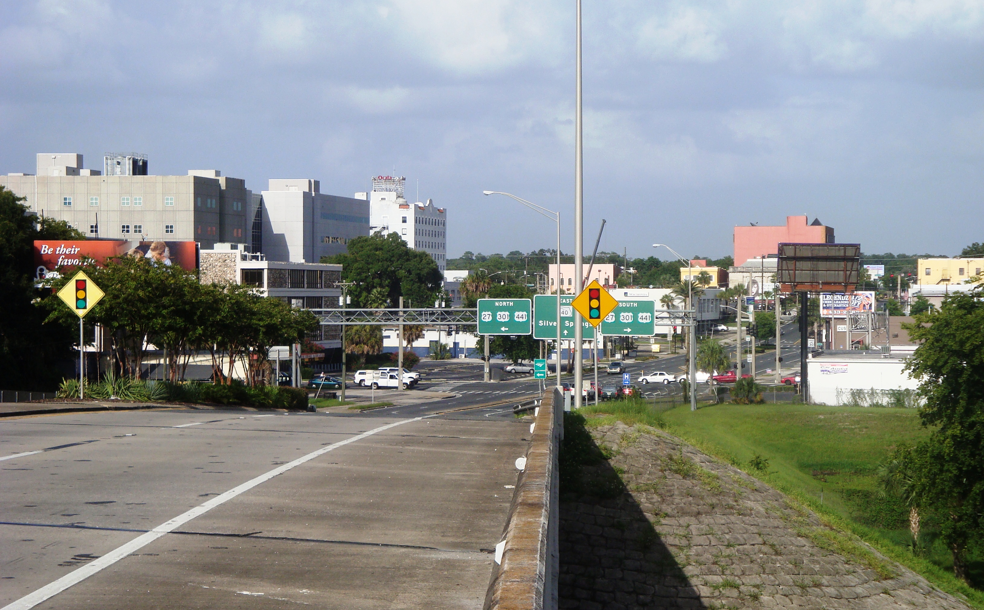
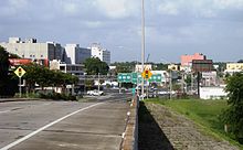 Eastbound SR 40 as it approaches US 27-301-441 in Ocala.
Several major highways pass through Ocala, including Interstate 75, U.S. Highway 27, U.S. Route 301, and U.S. Highway 441. Ocala was on the western leg of the historic Dixie Highway.
 Interstate 75 runs north and south across the western edge of the city, with interchanges at Florida SR 200(Exit 350), SR 40 (Exit 352), and US 27(Exit 354).
 U.S. Route 27 runs north and south throughout Ocala. It is multiplexed with US 301 and 441 until it reaches Florida SR 492(Northwest 10th Street), then makes a sharp turn onto NW 10th Street then curves northwest through Williston, Perry, Tallahassee, and beyond.
 U.S. Route 301 is the main local north and south road through Ocala. It is multiplexed with US 27 until it reaches Northwest 10th Street, and with US 441 throughout the city.
 U.S. Route 441 is the main local north and south road through Ocala. It is multiplexed with US 27 until it reaches Northwest 10th Street, and with US 301 throughout the city.
 State Road 492 runs east and west through the northern part of the city from the northern terminus of the US 27 multiplex with US 301-441 to close to the Silver Springs City Line.
 State Road 40 runs east and west through Ocala. It spans from Rainbow Lake Estates through Ocala National Forest to Ormond Beach in Volusia County, although a bi-county extension exists, spanning from Yankeetown in Levy County to Dunnellon, south of the western terminus of SR 40.
 State Road 464 runs east and west from FL 200 through the southeastern part of the city. Beyond the city limits, it continues southeast towards Florida State Road 35, and continues as a Marion County Road.
 State Road 200 runs northeast and southwest from Hernando in Citrus County through US 27-301-441 where it becomes a "hidden state road" along US 301 until it reaches Callahan, and is multiplexed with SR A1A into Fernandina Beach.
Other transportation
Ocala International Airport provides general aviation services to the community. Ocala Suntran provides bus service throughout select parts of the city. One of the major hubs for Suntran is the former Ocala Union Station, which served Amtrak trains until November 2004.
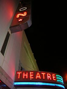 The Marion Theater
Fine arts
Ocala is the home for the Ocala Symphony Orchestra. The Ocala Symphony Orchestra, Inc., a non-profit organization, began in 1975, when a group of musicians and citizens set out to create a symphonic orchestra for the area. In the fall of 1976 a four-concert subscription season was initiated - a format that continues to this day. The Ocala Symphony Orchestra was later incorporated in the State of Florida and recognized by the IRS as a 501c3 non-profit corporation.
Also, the Ocala Civic Theatre is located in Ocala, and it presents professional-quality, live productions at an affordable price. Ocala Civic Theatre produces more than twelve fully staged productions each season, in addition to hosting touring companies. The Theatre offers a year-round education program that reaches over 1000 students each year. Both skills classes and performance classes are offered to students ages 4-18. This volunteer-based organization is one of the largest community theatres in the state and serves more than 50,000 Marion, Citrus and Lake County residents each season.
See also
- Jumbolair
- United Hebrews of Ocala
- Star-Banner
- List of sites and peoples visited by the Hernando de Soto Expedition
- Ocala National Forest
- Appleton Museum of Art
References
- ^ "Florida by Place. Population, Housing, Area, and Density: 2000". US Census Bureau. http://factfinder.census.gov/servlet/GCTTable?_bm=y&-geo_id=04000US12&-_box_head_nbr=GCT-PH1&-ds_name=DEC_2000_SF1_U&-format=ST-7. Retrieved 2007-11-19.
- ^ a b "Annual Estimates of the population for the Incorporated Places of Florida" (XLS). US Census Bureau. http://www.census.gov/popest/cities/tables/SUB-EST2007-04-12.xls. Retrieved 2008-07-11.
- ^ a b "American FactFinder". United States Census Bureau. http://factfinder.census.gov. Retrieved 2008-01-31.
- ^ "US Board on Geographic Names". United States Geological Survey. 2007-10-25. http://geonames.usgs.gov. Retrieved 2008-01-31.
- ^ "Find a County". National Association of Counties. http://www.naco.org/Counties/Pages/FindACounty.aspx. Retrieved 2011-06-07.
- ^ "Annual Estimates of the Population of Metropolitan and Micropolitan Statistical Areas: April 1, 2000 to July 1, 2007" (XLS). U.S. Census Bureau. http://www.census.gov/population/www/estimates/metro_general/2007/CBSA-EST2007-01.xls. Retrieved 2008-07-11.[dead link]
- ^ "Historic Highlights". City of Ocala. Archived from the original on 2008-01-14. http://web.archive.org/web/20080114053631/http://www.ocalafl.org/COO.aspx?id=584. Retrieved 2007-11-19.
- ^ McCarthy, Kevin; Jernigan, Ernest (2001). Ocala. p. 11. ISBN 0738513776.
- ^ The Horse Capital of the World
- ^ "Ocala City Charter" (XLS). City of Ocala. http://www.ocalafl.org/uploadedFiles/Support_Services/City_Clerk/Elections_Information/Mayor_Duties.pdf. Retrieved 2010-02-03.
- ^ "2009 City of Ocala Run-Off Election Results" (XLS). Marion County Department of Elections. http://www.votemarion.com/. Retrieved 2010-02-03.
- ^ "2008 General Election Results" (XLS). Marion County Department of Elections. http://www.votemarion.com/ersummary.aspx?eid=29. Retrieved 2010-02-03.
- ^ "US Gazetteer files: 2010, 2000, and 1990". United States Census Bureau. 2011-02-12. http://www.census.gov/geo/www/gazetteer/gazette.html. Retrieved 2011-04-23.
- ^ "The Florida Trail in the Ocala National Forest". Florida Department of Environmental Protection. http://www.dep.state.fl.us/gwt/guide/regions/crossflorida/trails/ocala_nat_forest.htm. Retrieved 2007-11-19.
- ^ "Ocala, Florida Weather". The Weather Channel. http://weather.yahoo.com/Ocala-Florida-United-States/USFL0355/statistics.html.
- ^ Central Florida Community College Campuses
- ^ Rasmussen College Campuses
- ^ Accreditation
- ^ "Past Winners of the All-America City Award". National Civic League. Archived from the original on 2007-10-11. http://web.archive.org/web/20071011233218/http://ncl.org/aac/past_winners/past_winners.html. Retrieved 2007-11-19.
- ^ "Friends Across the Ocean". City of Ocala. http://www.ocalafl.org/COO3.aspx?id=1009. Retrieved 18 April 2011.
- ^ "San Rossore Officially Sister City To Ocala". Thoroughbred Times. http://www.thoroughbredtimes.com/international-news/2004/April/20/San-Rossore-officially-sister-city-to-Ocala.aspx. Retrieved 2007-07-16. ""This event is just the beginning of a nice relationship between the city of Ocala and the city of Pisa and San Rossore," Fontanelli said in Italian during the ceremony."
External links
- City of Ocala, Florida
- Historic Ocala Preservation Society
- Marion County Library System
- Ocala Banner, the East Florida Banner, and the Southern Sun, historical newspapers serving Ocala, Florida, full text and images openly online in the Florida Digital Newspaper Library
- Star-Banner, daily newspaper for Ocala
- Ocala/Marion Chamber of Commerce
Municipalities and communities of Marion County, Florida County seat: Ocala Cities 
Towns CDP Unincorporated
communitiesAnthony | Boardman | Candler | Citra | Dallas | Eastlake Weir | Emathla | Eureka | Evinston‡ | Fairfield | Fellowship | Flemington | Fort McCoy | Huntington | Irvine | Kendrick | Lowell | Lynne | Marion Oaks | Martel | Martin | Moss Bluff | Ocklawaha | Orange Lake | Orange Springs | Rainbow Lake Estates | Salt Springs | Santos | Shady | Silver Springs | Sparr | Summerfield | Weirsdale | Zuber
Footnotes ‡This populated place also has portions in an adjacent county or counties
Categories:- Cities in Marion County, Florida
- County seats in Florida
- Ocala, Florida


Wikimedia Foundation. 2010.