- Dunnellon, Florida
-
Dunnellon, Florida — City — The former Atlantic Coast Line Railroad depot in Dunnellon, Florida.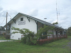 Location in Marion County and the state of Florida
Coordinates: 29°3′N 82°27′W / 29.05°N 82.45°WCoordinates: 29°3′N 82°27′W / 29.05°N 82.45°W Country  United States
State  Florida
County Marion Area - Total 7.4 sq mi (19.3 km2) - Land 7 sq mi (18.3 km2) - Water 0.4 sq mi (1 km2) Elevation 49 ft (15 m) Population (2000) - Total 1,898 - Density 256.5/sq mi (98.3/km2) Time zone Eastern (EST) (UTC-5) - Summer (DST) EDT (UTC-4) ZIP codes 34430-34432 Area code(s) 352 FIPS code 12-18675[1] GNIS feature ID 0281879[2] Dunnellon is a city in Marion County, Florida, United States. The population was 1,898 at the 2000 census. As of 2004, the population recorded by the U.S. Census Bureau is 1,951.[1] It is part of the Ocala Metropolitan Statistical Area.
Contents
Geography
Dunnellon is located at 29°3'N 82°27'W (29.0500, -82.4555), 76 miles (122 km) due north of Tampa.
According to the United States Census Bureau, the city has a total area of 7.4 square miles (19 km2). 7.1 square miles (18 km2) of it is land and 0.4 square miles (1.0 km2) of it (5.11%) is water.
Demographics
As of the census[1] of 2000, there were 1,898 people, 950 households, and 555 families residing in the city. The population density was 269.3 inhabitants per square mile (103.9/km²). There were 1,128 housing units at an average density of 160.0 per square mile (61.8/km²). The racial makeup of the city was 85.72% White, 11.85% African American, 0.11% Native American, 0.53% Asian, 0.05% Pacific Islander, 0.47% from other races, and 1.26% from two or more races. Hispanic or Latino of any race were 1.79% of the population.
There were 950 households out of which 18.5% had children under the age of 18 living with them, 44.6% were married couples living together, 11.4% had a female householder with no husband present, and 41.5% were non-families. 37.3% of all households were made up of individuals and 24.4% had someone living alone who was 65 years of age or older. The average household size was 2.00 and the average family size was 2.59.
In the city the population was spread out with 17.2% under the age of 18, 5.1% from 18 to 24, 17.7% from 25 to 44, 24.6% from 45 to 64, and 35.5% who were 65 years of age or older. The median age was 53 years. For every 100 females there were 80.9 males. For every 100 females age 18 and over, there were 75.8 males.
The median income for a household in the city was $27,386, and the median income for a family was $35,313. Males had a median income of $29,605 versus $22,045 for females. The per capita income for the city was $17,905. About 10.4% of families and 15.5% of the population were below the poverty line, including 26.7% of those under age 18 and 11.3% of those age 65 or over.
History
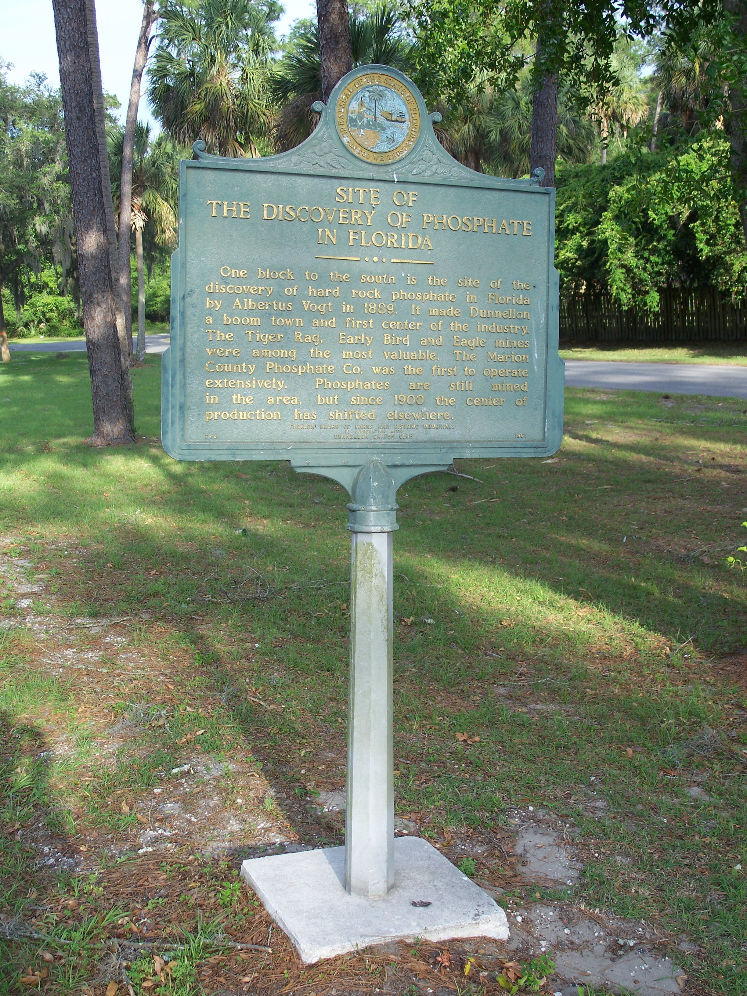
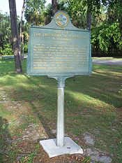 Plaque marking the discovery of Phosphate in Dunnellon
Dunnellon was founded in 1887. In 1889, phosphate was discovered in the area, leading to an expansion of the area until the early 1910s.[3] The original mining took place in and around the Rainbow River (formerly called 'Blue Run'), using the river's natural flow to transport phosphates. What is now the 'Blue Cove' subdivision, was one of the original mining pits.[citation needed]
Areas in and around Dunnellon served as filming locations for the 2001 horror film Jeepers Creepers, with a great deal of location work on Tiger Trail, the road to Dunnellon High School, officially known as SW 180th Avenue Rd., just outside of Rainbow Springs State Park.
See also
References
- ^ a b "American FactFinder". United States Census Bureau. http://factfinder.census.gov. Retrieved 2008-01-31.
- ^ "US Board on Geographic Names". United States Geological Survey. 2007-10-25. http://geonames.usgs.gov. Retrieved 2008-01-31.
- ^ Dinkins, J. Lester (1969). Dunnellon: Boomtown of the 1890's. Great Outdoors Publishing Co.. pp. 72. ISBN 0820010162.
External links
Municipalities and communities of Marion County, Florida County seat: Ocala Cities 
Towns CDP Unincorporated
communitiesAnthony | Boardman | Candler | Citra | Dallas | Eastlake Weir | Emathla | Eureka | Evinston‡ | Fairfield | Fellowship | Flemington | Fort McCoy | Huntington | Irvine | Kendrick | Lowell | Lynne | Marion Oaks | Martel | Martin | Moss Bluff | Ocklawaha | Orange Lake | Orange Springs | Rainbow Lake Estates | Salt Springs | Santos | Shady | Silver Springs | Sparr | Summerfield | Weirsdale | Zuber
Footnotes ‡This populated place also has portions in an adjacent county or counties
Categories:- Cities in Marion County, Florida


Wikimedia Foundation. 2010.