- New Utrecht Reformed Church
-
New Utrecht Reformed Church and BuildingsSteeple
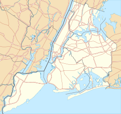
Location: 18th Ave. and 83rd St., New York, New York Coordinates: 40°36′30″N 74°0′3″W / 40.60833°N 74.00083°WCoordinates: 40°36′30″N 74°0′3″W / 40.60833°N 74.00083°W Area: less than one acre Built: 1828 Architect: Valk, Lawrence; Et al. Architectural style: Shingle Style, Georgian, Richardsonian Romanesque Governing body: Private NRHP Reference#: 80002634[1]
New Utrecht Reformed Church Complex (Boundary Increase)Location: 8523 16th Ave., Brooklyn, New York Area: less than one acre Built: 1653 Governing body: Private NRHP Reference#: 01000126[1] Added to NRHP: March 5, 2001 Added to NRHP: April 09, 1980 New Utrecht Reformed Church is the fourth oldest church in Brooklyn, New York. The church was established in 1677 in the town of New Utrecht and is affiliated with the Reformed Church in America, a Protestant denomination. The present church was built in 1828 of stones taken from the original church built in 1700. The parish house was built in 1892 and the parsonage in 1906. The Liberty Pole, the sixth on the site of the present church, was originally erected in 1783 at the end of the Revolutionary War to harass departing British troops. The cemetery was built in 1654; 1300 dead are interred there.
The church received landmark status in 1966; the parish house and the cemetery received landmark status in 1998. Both the church and the cemetery are listed in the National Register of Historic Places.[2][3]
References
- ^ a b "National Register Information System". National Register of Historic Places. National Park Service. 2009-03-13. http://nrhp.focus.nps.gov/natreg/docs/All_Data.html.
- ^ Holly Huckins, Joan Olshansky, and Elizabeth Spencer-Ralph (September 1979). "National Register of Historic Places Registration:New Utrecht Reformed Church Complex". New York State Office of Parks, Recreation and Historic Preservation. http://www.oprhp.state.ny.us/hpimaging/hp_view.asp?GroupView=3076. Retrieved 2011-02-20. See also: "Accompanying seven photos". http://www.oprhp.state.ny.us/hpimaging/hp_view.asp?GroupView=3074.
- ^ Peter Shaver (October 1997). "National Register of Historic Places Registration:New Utrecht Reformed Church Complex (Boundary Increase)". New York State Office of Parks, Recreation and Historic Preservation. http://www.oprhp.state.ny.us/hpimaging/hp_view.asp?GroupView=3366. Retrieved 2011-02-20. See also: "Accompanying three photos". http://www.oprhp.state.ny.us/hpimaging/hp_view.asp?GroupView=3365.
External links
- New Utrecht Reformed Church
- Friends of Historic New Utrecht
- New York City Landmarks Commission - New Utrecht Church
- New York City Landmarks Commission - New Utrecht Cemetery
- New Utrecht Reformed Church at Historic Marker Database
See also
- New Utrecht
New York City Historic Sites NRHP: Manhattan – Brooklyn – Queens – Staten Island – Bronx • NHL: New York State
NYC: Manhattan – Brooklyn – Queens – Staten Island – Bronx
Categories:- Churches in Brooklyn
- 1677 establishments
- Religious organizations established in the 1670s
- Calvinist organizations established in the 17th century
- Protestant congregations established in the 17th century
- Properties of religious function on the National Register of Historic Places in New York City
- Reformed Church in America churches
- Former Dutch Reformed churches in New York
- New York City building and structure stubs
- Kings County, New York Registered Historic Place stubs
Wikimedia Foundation. 2010.


