- Nilgiris district
-
Nilgiris District — district — 
Coordinates Country India State Tamil Nadu District(s) Nilgiris Subdistrict(s) Udhagamandalam, Coonoor, Kundah, Kotagiri, Gudalur, Pandalur ' February 1882 Headquarters Udhagamandalam Largest city Udhagamandalam Collector & District Magistrate Tmt. Archana Patnaik IAS Legislature (seats) elected (3) Population
735,071[1] (2011[update])
• 421.97 /km2 (1,093 /sq mi)
• 454,609 (2001[update])Sex ratio M-49.6%/F-50.4% ♂/♀ Literacy
• Male
• Female80.01%%
• 83.9%%
• 74.26%%Official languages Tamil Time zone IST (UTC+05:30) Area
• Elevation
• Coastline2,452.5 square kilometres (946.9 sq mi)
• 2,789 metres (9,150 ft)
• 0 kilometres (0 mi)Climate
• Precipitation
Temperature
• Summer
• Winter
• 3,520.8 mm (138.61 in)
• 0–0 °C (32–32 °F)
• 6 °C (43 °F)
• 0–0 °C (32–32 °F)Central location: 11°00′N 76°8′E / 11°N 76.133°E Website Official website of District Collectorate, Nilgiris The Nilgiris District (Tamil: நீலகிரி மாவட்டம்) is in the Indian state of Tamil Nadu. Nilgiri (Tamil : நீலகிரி or Blue Mountains when translated into English) is also the name given to a range of mountains spread across the states of Tamilnadu as well as Karnataka and Kerala. The Nilgiri Hills are part of a larger mountain chain known as the Western Ghats. The highest point is the mountain of Doddabetta, with a height of 2,623 m. The district is mainly contained within this mountain range. The district headquarters is Udhagamandalam, popularly known as Ooty. It was ranked first in a comprehensive Economic Environment index ranking of districts in Tamil Nadu not including Chennai prepared by Institute for Financial Management and Research in August 2009.[2]
As of 2011 it is the second least populous district of Tamil Nadu (out of 32), after Perambalur.[3]
Contents
History
 A 1917 photo of Eucalyptus globulosum plantation
The Nilgiri hills have a history going back a good many centuries. It is not known why they were called the Blue Mountains. Several sources cite the reason as the smoky haze enveloping the area, while other sources say it is because of the kurunji flower, which blooms every twelve years giving the slopes a bluish tinge.
It was originally tribal land and was occupied by the Todas around what is now the Ooty area, and by the Kotas around what is now the Kotagiri(Kothar Keri) area. The Badagas are one of the major non tribal OBC (other backward community) population in the district who reside in the mountain. Although the Nilgiri hills are mentioned in the Ramayana of Valmiki (estimated by Western scholars to have been recorded in the second century BCE), they remained all but undiscovered by Europeans until 1602. This was when the first European set foot into the jungles. A Portuguese priest going by the name of Ferreiri resolved to explore the hills and succeeded. He came upon a community of people calling themselves the "Toda." This priest seems to have been the only European to have explored this area. The Europeans in India more or less seem to have ignored the ghats for some two hundred or more years.
It was only around the beginning of the 1800s that the English unsuccessfully considered surveying this area. Around 1810 or so the East India Company decided to delve into the jungles here. An Englishman Francis Buchanan made a failed expedition. John Sullivan who was then the Collector of Coimbatore, just south of the Nilgiris, sent two surveyors to make a comprehensive study of the hills. They went as far as the lower level of Ooty, but failed to see the complete valley. The two men were Keys and Macmohan (their first names seem to be lost to the annals of history) and their mission was significant because they were the first Englishmen to set foot in the Nilgiri hills which soon led to the complete opening up of the area.
The original discovery however, is attributed to J.C. Whish and N.W. Kindersley, working for the Madras Civil Service, who made a journey in 1819 and who reported back to their superiors that they had discovered "the existence of a tableland possessing a European climate."
The first European resident of the hills was John Sullivan, the Collector of Coimbatore, who went up the same year and built himself a home. He also reported to the Madras Government the appropriateness of the climate; Europeans soon started settling down here or using the valley for summer stays. The complete valley became a summer resort. Later on the practice of moving the government to the hills during summer months also started. By the end of the 19th century, the Nilgiri hills were completely accessible with the laying of roads and the railway line.
Geography and climate
The district has an area of 2,452.50 km2.[4] The district is basically a hilly region, situated at an elevation of 2000 to 2,600 meters above MSL. Almost the entire district lies in the Western ghats. Its latitudinal and longitudinal dimensions being 130 KM (Latitude : 10 - 38 WP 11-49N) by 185 KM (Longitude : 76.0 E to 77.15 E). The Nilgiris district is bounded by Mysore district of Karnataka and Wayanad district of Kerala in the North, Malappuram and Palakkad districts of Kerala in the West, Coimbatore district of Tamil Nadu in the South and Erode district of Tamil Nadu and Chamarajanagar district of Karnataka in the East. In Nilgiris district the topography is rolling and steep. About 60% of the cultivable land falls under the slopes ranging from 16 to 35%.
The altitude of the Nilgiris results in a much cooler and wetter climate than the surrounding plains, so the area is popular as a retreat from the summer heat. During summer the temperature remains to the maximum of 25°C and reaches a minimum of 10°C. During winter the temperature reaches a maximum of 20°C and a minimum of 0°C.[4] The rolling hills of the Downs look very similar to the Downs in Southern England, and were used for similar activities such as hunting.
 The Nilgiris was preferred by the British for its 'English-like' climate
The district usually receives rain both during South West Monsoon and North East Monsoon. The entire Gudalur and Pandalaur, Kundah Taluks and portion of Udhagamandalam Taluk receive rain by the South West Monsoon and some portion of Udhagamandalam Taluk and the entire Coonoor and Kotagiri Taluks are benefited by the rains of North East Monsoon. There are 16 rainfall registering stations in the district The average annual rainfall of the district is 1,920.80 mm.[4]
The principal town of the area is Ootacamund, or Udhagamandalam, which is the district capital. The town also has several buildings which look very "British", particularly the Churches. There is even a road junction known as Charing Cross. The other main towns in the Nilgiris are Coonoor, Kotagiri, Gudalur and Aruvankadu. The famous tourist spot in Coonoor are Lambsrock and Sims park. In Sims park, a "Fruit Show" is conducted during summer. All the varieties of fruit are displayed during that time. This park is situated on the way to Kotagiri.
District administration
The Nilgiris District comprises six taluks viz., Udhagamandalam, Kundah, Coonoor, Kotagiri, Gudalur and Pandalur. These taluks are divided in to four Panchayat Unions viz., Udhagamandalam, Coonoor, Kotagiri and Gudalur besides two Municipalities, Wellington Contonment and Aruvankadu Township. The District consists of 56 Revenue Villages and 15 Revenue Firkas. There are two Revenue Divisional in this district viz., Coonoor and Gudalur. There are 35 Village Panchayat and 13 Town Panchayat in this district.[4]
Demographics
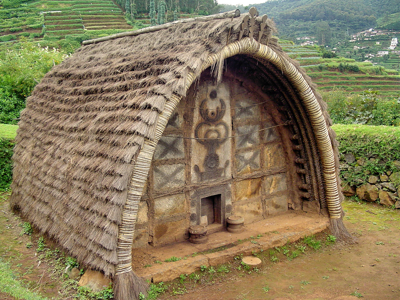
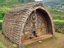 Hut of Toda tribe in the Nilgiris
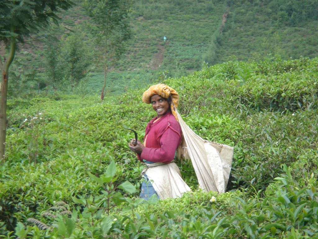
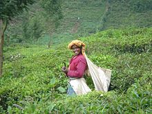 A tea picker in the Nilgiris
According to the 2011 census Nilgiris district has a population of 735,071,[3] roughly equal to the nation of Guyana[5] or the US state of Alaska.[6] This gives it a ranking of 495th in India (out of a total of 640).[3] The district has a population density of 288 inhabitants per square kilometre (750 /sq mi) .[3] Its population growth rate over the decade 2001-2011 was -3.55 %.[3] The Nilgiris has a sex ratio of 1041 females for every 1000 males,[3] and a literacy rate of 85.65 %.[3]
There are several tribes living in the Nilgiris, whose origins are uncertain. The best known of these are the Toda and Kota people, whose culture is based upon cattle, and whose red, black and white embroidered shawls, and silver jewelry is much sought after. The district is also home to the Paniya tribes and the Badaga people.
As per the 2001 Census, Hindus formed the majority of the population (78.60%), followed by Christians (11.45%), Muslims (9.55%) and others (0.4%).[7]
Languages
Among the languages spoken in the district is Badaga,written in the Tamil script and spoken by about 245 000 Badagas in 200 villages in the Nilgiris.[8]
Tamil is the principal language spoken in the Nilgiris. Many people speak and understand English. Kannada, Malayalam and Hindi are also used to an extent. The Nilgiris is also home to the Toda language, spoken by the Toda people and Kota language is spoken by Kota Tribes. The language of Paniya is spoken in the western parts of the district where the Paniya tribes live.
Basic infrastructure
Transport
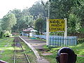
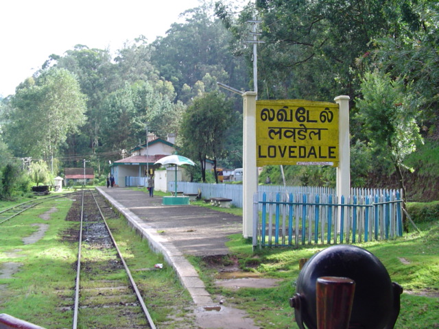
 The Nilgiri Mountain Railway
The Nagapattinam - Gudalur National Highway Passes through this district. The Nilgiri Ghat Roads link the district with the nearest cities in Tamilnadu, Kerala and Karnataka. All the taluks are connected with Major District Roads. The village roads are maintained by Panchayat Union. The Nilgiri Mountain Railway from Mettupalayam to Udhagamandalam via Coonoor, is a great tourist attraction. It was used in the film A Passage to India as the railway to the caves. It is a rack railway as far as Coonoor. The Nilgiri Mountain Railway, is now a UNESCO World Heritage Site.[9] This services many of the populated areas of the district including Coonoor, Wellington, Aruvankadu, Ketti, Lovedale and Ooty. There is no sea port or Airport in the district. The nearest international airport to the Nilgiris is at Coimbatore.
Electricity
There are 8 Hydel Power Houses in this district.[4]
1. Pykara Power House
2. Pykara Micro Power House
3. Moyar Power House
4. Kundah Power House - I
5. Kundah Power House -II
6. Kundah Power House - III
7. Kundah Power House - IV
8. Kundah Power House - V
9. Kateri hydro-electric system
Health infrastructure
There are one District Head Quarters Government Hospital, 5 Taluk Hospitals, 28 Primary Health Centres, 194 Health Sub-Centres and 5 Plague circles in the district.[4]
Agriculture
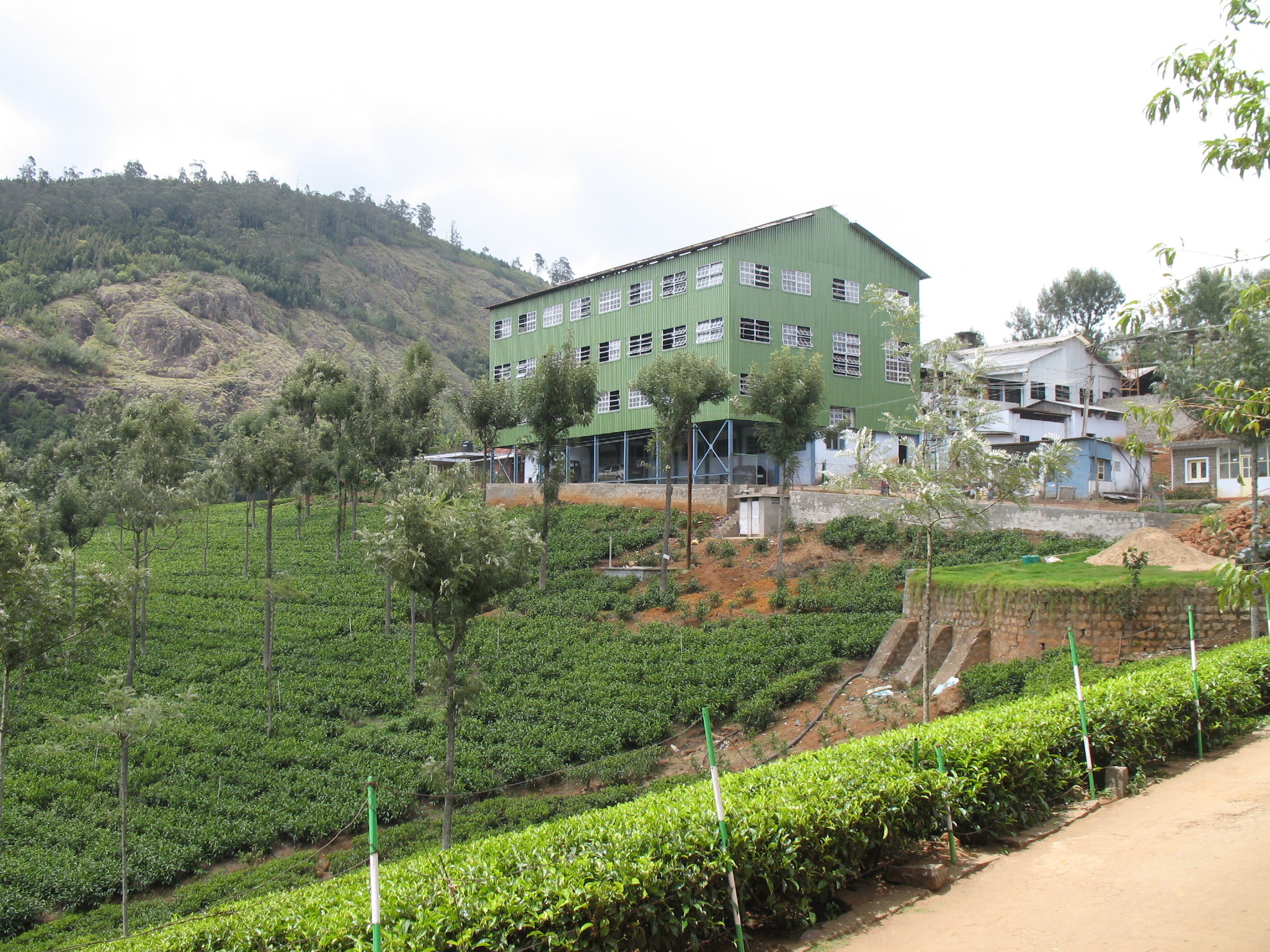
 A Tea factory next to a tea plantation
The Nilgiris District is basically a Horticulture District[4] and the entire economy of the district depends upon the success and failure of Horticulture Crops like Potato, Cabbage, Carrot, Tea, Coffee, Spices and Fruits. The main cultivation is plantation Crops, viz., Tea and Coffee. Tea is grown at elevations of 1,000 to above 2,500 metres. The area also produces Eucalyptus oil and temperate zone vegetables. Potato and other vegetables are raised in Udhagai and Coonoor Taluks. Paddy and Ginger are grown in Gudalur and Pandalur Taluks. Paddy is also grown in Thengumarahada area in Kotagiri Taluk. Besides these crops, Ragi, Samai, Wheat, Vegetables etc., are also grown in small extent throughout the district. There are no irrigation schemes in this district. The crops are mainly rain fed. Check Dams have been constructed wherever it is possible to exploit natural springs.
Ecoregions
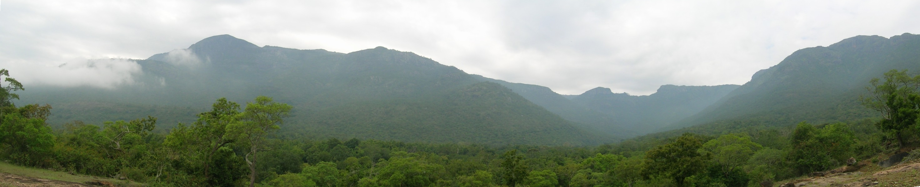
 Sigur Ghat
 A view of the Nilgiri hills
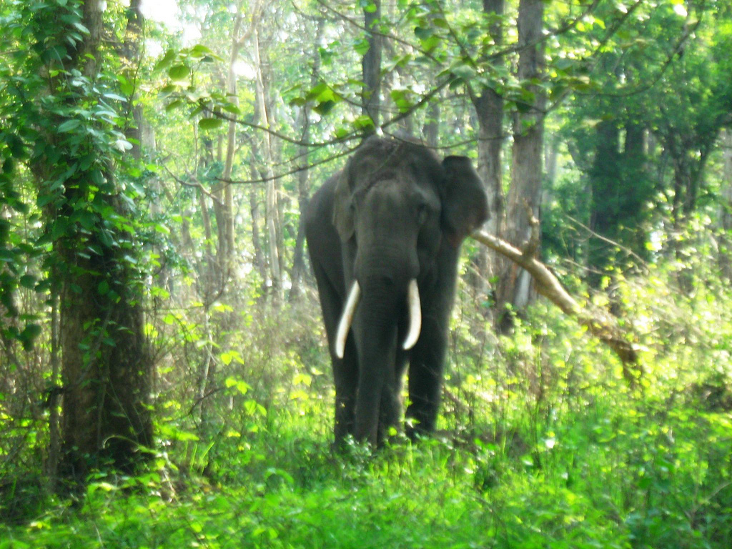
Two ecoregions cover portions of the Nilgiris. The South Western Ghats moist deciduous forests lie between 250 and 1000 meters elevation. These forests extend south along the Western Ghats range to the southern tip of India. These forests are dominated by a diverse assemblage of trees, many of whom are deciduous during the winter and spring dry season. These forests are home to the largest herd of Asian Elephants in India, who range from the Nilgiris across to the Eastern Ghats. The Nilgiris and the South Western Ghats is also one of the most important tiger habitats left in India.
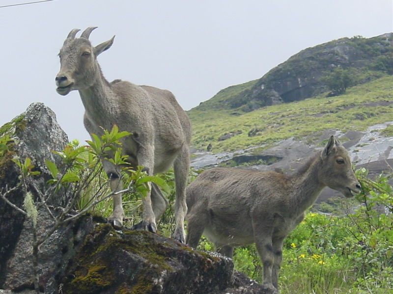
The South Western Ghats montane rain forests ecoregion covers the portion of the range above 1000 meters elevation. These evergreen rain forests are among the most diverse on the planet. Above 1500 meters elevation, the evergreen forests begin to give way to stunted forests, called sholas, which are interspersed with open grassland. These grasslands are the home to the endangered Nilgiri Tahr, which resembles a stocky goat with curved horns. The Nilgiri Tahrs are found only in the montane grasslands of the South Western Ghats, and number only about 2000 individuals.
 Nilgiri Tahr in The Nilgiris
Three national parks protect portions of the Nilgiris. Mudumalai National Park lies in the northern part of the range where Kerala, Karnataka, and Tamil Nadu meet, and covers an area of 321 km². Mukurthi National Park lies in the southwest of the range, in Kerala, and covers an area of 78.5 km², which includes intact shola-grassland mosaic, habitat for the Nilgiri tahr. Silent Valley National Park is just to the south and contiguous with these two parks, and covers an area of 89.52 km². Outside of these parks much of the native forest has been cleared for grazing cattle, or has been encroached upon or replaced by plantations of tea, Eucalyptus, Cinchona and Acacia. The entire range, together with portions of the Western Ghats to the northwest and southwest, was included in the Nilgiri Biosphere Reserve in 1986, India's first biosphere reserve.
In January 2010, the Nilgiri Declaration set out a wide range environmental and sustainable development goals to be reached by 2015.
The region has also given its name to a number of bird species, including the Nilgiri Pipit, Nilgiri Woodpigeon and Nilgiri Blackbird.
Tourism
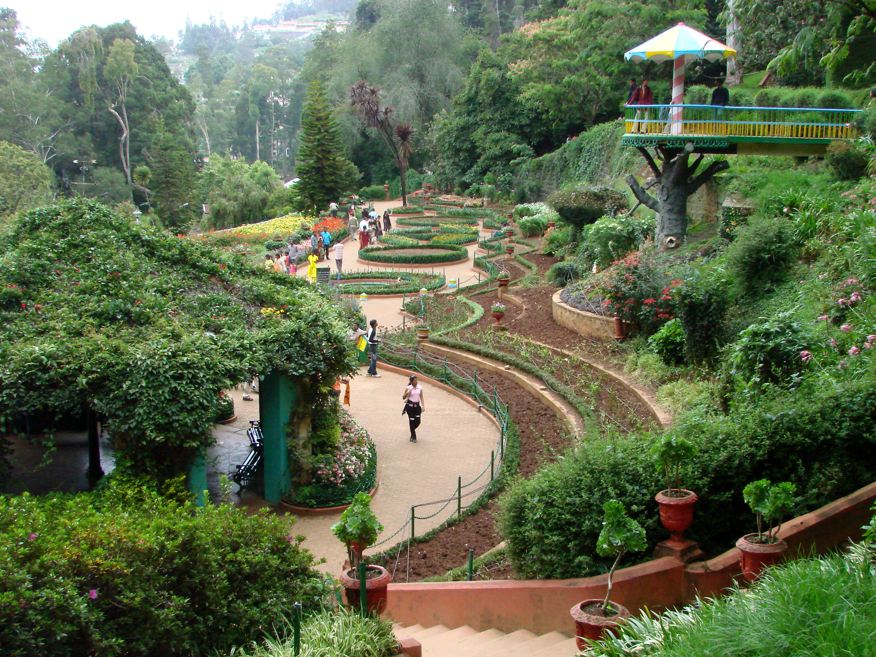
 Botanical garden at Ooty
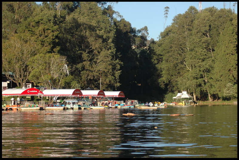
Tourism is an important source of revenue for the Nilgiris. The district is home to many beautiful hill stations popular with tourists who flock to them during Summer. Some of the popular hill stations are Udhagamandalam (district headquarters), Coonoor and Kothagiri. The Nilgiri Mountain Train or popularly known as the Toy Train is popular amongst tourists as the journey offers spectacular and breathtaking views of the hills and forests. Mudumalai National Park is popular with wildlife enthisiasts, campers and backpackers. The annual flower show organized by the Government of Tamil Nadu at the Botanical Garden in Ooty is a much awaited event every year, known for its grand display of roses. Nilgiris is renowned for its Eucalyptus oil and Tea. Tourists are also attracted to study the lifestyles of the various tribes living here and to visit the sprawling tea and vegetable plantations along the hill slopes. Other popular tourist destinations in the district are Pykara Waterfalls and Lake, Avalanche and Doddabetta peak.
Photo gallery
-

Greenery in Nilgiri Hills
-
Lovedale railway station
-

Tea Plantations
-

Vegetable Plantation
-

Elephant at Mudumalai National Park
-

Ooty Lake
-

Emerald Lake
-

Houses at Ooty
See also
References
- ^ "2011 Census of India" (Excel). Indian government. 16 April 2011. http://www.censusindia.gov.in/2011-prov-results/prov_data_products_tamilnadu.html.
- ^ "Study on districts ranked Madurai low, Government irked". Times of India (Chennai): pp. 1. 22 September 2009.
- ^ a b c d e f g "District Census 2011". Census2011.co.in. 2011. http://www.census2011.co.in/district.php. Retrieved 2011-09-30.
- ^ a b c d e f g Welcome to Nilgiris
- ^ US Directorate of Intelligence. "Country Comparison:Population". https://www.cia.gov/library/publications/the-world-factbook/rankorder/2119rank.html. Retrieved 2011-10-01. "Guyana 744,768"
- ^ "2010 Resident Population Data". U. S. Census Bureau. http://2010.census.gov/2010census/data/apportionment-pop-text.php. Retrieved 2011-09-30. " Alaska 710,231"
- ^ http://www.census.tn.nic.in/religion.aspx
- ^ M. Paul Lewis, ed (2009). "Badaga: A language of India". Ethnologue: Languages of the World (16th edition ed.). Dallas, Texas: SIL International. http://www.ethnologue.com/show_language.asp?code=bfq. Retrieved 2011-09-28.
- ^ Official UNESCO list of World Heritage Sites - Mountain Railways of India
External links

Wayanad district, Kerala Chamarajanagar district, Karnataka Malappuram district, Kerala 
Erode district  Nilgiris district

Palakkad district, Kerala Coimbatore district Nilgiris district District Headquarters 
State Divisions Coonoor · GudalurTaluks Revenue blocks Indigenous Tribes Badagas · TodasTallest Peaks Places of interest Mudumalai Wildlife Sanctuary · Nilgiri Mountain Railway · Ooty Lake · Ooty Botanical Gardens · Rose gardenCities and towns · People · Villages · Nilgiri mountains
Mountains and Plateaus Himalayas · Western Ghats · Eastern Ghats · Aravalli Range · The Nilgiris · Vindhya Range · Satpura Range · Garo Hills · Shivalik Hills · Mahabharat Range · Khasi Hills · Annamalai Hills · Cardamom Hills · Sulaiman Mountains · Toba Kakar Range · Karakoram · Hindu Kush · Chittagong Hill Tracts · Deccan Plateau · Thar Desert · Makran · Chota Nagpur · Naga Hills · Mysore Plateau · Ladakh Plateau · Gandhamardan HillsLowlands and Islands Indo-Gangetic plain · Indus River Delta · Ganges Basin · Ganges Delta · Terai · Atolls of Maldives · Coromandel Coast · Konkan · Lakshadweep · Andaman and Nicobar Islands · Sundarbans · Greater Rann of Kutch · Little Rann of Kutch · Protected areas in Tamil NaduCountries  State of Tamil NaduCapital: Chennai
Topics - Cinema
- Cuisine
- Economy
- Government
- History
- Language
- Literature
- Music
- People
- Politics
- Temples
- Wildlife
- Tourism
State symbols - State bird:
 Emerald Dove
 - State Animal:
 Nilgiri Tahr
 - State Tree:
 Palm Tree
 - State flower:
 Gloriosa Lily
Districts - Ariyalur
- Chennai
- Coimbatore
- Cuddalore
- Dharmapuri
- Dindigul
- Erode
- Kanchipuram
- Kanyakumari
- Karur
- Krishnagiri
- Madurai
- Nagapattinam
- Namakkal
- Perambalur
- Pudukkottai
- Ramanathapuram
- Salem
- Sivaganga
- Thanjavur
- The Nilgiris
- Theni
- Thoothukudi
- Tiruchirapalli
- Tirunelveli
- Tiruppur
- Tiruvallur
- Tiruvannamalai
- Tiruvarur
- Vellore
- Viluppuram
- Virudhunagar
Major cities - Chennai
- Coimbatore
- Erode
- Madurai
- Salem
- Tiruchirapalli
- Tirunelveli
- Tiruppur
- Tuticorin
- Vellore
Protected
areasBiosphere reserves - Agasthyamalai Biosphere Reserve
- Gulf of Mannar Biosphere Reserve
- Nilgiri Biosphere Reserve
National parks - Guindy National Park
- Gulf of Mannar Marine National Park
- Indira Gandhi National Park
- Mudumalai National Park
- Mukurthi National Park
- Palani Hills National Park
Wildlife sanctuaries - Grizzled Squirrel Wildlife Sanctuary
- Kanyakumari Wildlife Sanctuary
- Point Calimere Wildlife and Bird Sanctuary
- Sathyamangalam Wildlife Sanctuary
- Vallanadu Wildlife Sanctuary
Bird sanctuaries - Chitrangudi
- Kanjirankulam
- Karaivetti
- Karikili
- Koothankulam
- Melaselvanur - Kilaselvanur
- Pulicat Lake
- Udayamarthandapuram
- Vaduvur
- Vedanthangal
- Vellode
- Vettangudi
Tiger reserves - Anaimalai Tiger Reserve
- Kalakkad Mundanthurai Tiger Reserve
- Mudumalai Tiger Reserve
Conservation reserves Categories:- Nilgiris District
- Districts of Tamil Nadu
- Geography of Kerala
- Mountains of Tamil Nadu
-


Wikimedia Foundation. 2010.