- Netravati River
-
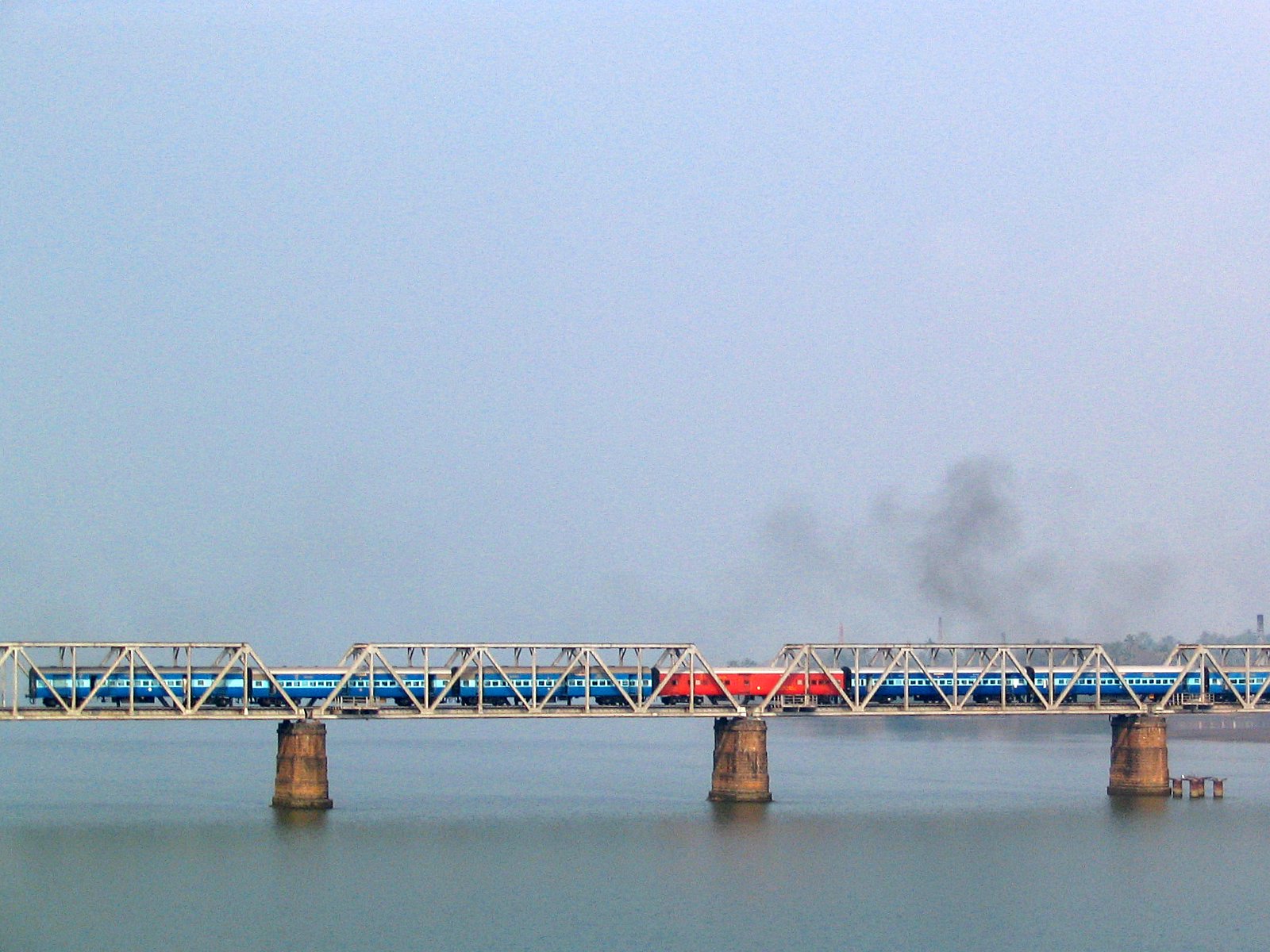
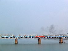 The Netravati railway bridge serves as the gateway to Mangalore.
 A Panoramic View of Nethravathi River in Bantwal
The Netravati River (Tulu: ನೇತ್ರಾವತಿ ತುದೆ )(Kannada: ನೇತ್ರಾವತಿ) (or Nethravathi River) has its origins at Gangamoola in Kudremukh in Chikkamagaluru district of Karnataka, India. This river flows through the famous pilgrimage place Dharmasthala and considered as one of the Holy rivers of India. It merges with the Kumaradhara River at Uppinangadi before flowing to the Arabian Sea,south of Mangalore city. This river is the main source of water to Bantwal and Mangalore. The Netravathi railway bridge is one of the known bridges which serves as the gateway to Mangalore.
Earlier in the last century it was called as Buntwal River due to the important town of Bantwal on its banks. A reference to the River Nettrawutti, as it is mentioned in the book can be seen in the "Gazetteer of Southern India", published in 1855, as unfordable during South-West Monsoon. It has apparent breadth of about 200 yards with a bed encumbered by large rocky masses chiefly of hornblende rock, containing spangles of mica and small garnets. Sienites also occurs, fragments of a beautiful pegmatite with flesh coloured feldspar are seen in the beds of rivulets. The Netravati River is navigable by small country craft for many miles.
Many a times in the past Bantwal was submerged during the monsoon by overflowing river Netravati. Many had left the town and settled elsewhere and prospered. The major floods was as remembered by the elders of the town in 1928 and 1974.
Contents
Course
Netravati river originates in the Western Ghats near Ballalrayana Durga in Karnataka State. The river drains an area of about 1,353 square miles.[1] Kumaradhara River which originates in the Subramanya range of western ghats meets Netravati river near Uppinangadi village.[2]
Controversy
Many mini hydel projects are set up on this river causing damage to environment of this eco sensitive region and many are yet to come. Recently there was controversy regarding this river. There is a proposal to change the path of the river , so that dry lands above the western ghats can be irrigated.[3] Changing the path of the river might lead to unforeseen environmental disasters according to some experts. For example , it might affect the marine life,the expert say, due to reduwhich is full of natural resources,flowing into the sea. Also some opposition has come up for proposed hydro electric projects on Netravathi river.[4]
References
- ^ Minutes of proceedings of the Institution of Civil Engineers, Volume 174. Institution of Civil Engineers (Great Britain). pp. 41.
- ^ Sir William Wilson Hunter. The imperial gazetteer of India, Volume 5. pp. 471.
- ^ "Minister promises help for Netravathi scheme". Chennai, India: The Hindu. 2009-07-20. http://www.hindu.com/2009/07/20/stories/2009072059920600.htm. Retrieved 2010-02-01.
- ^ "Netravathi diversion project opposed". The Hindu. http://www.hinduonnet.com/2003/02/22/stories/2003022203070300.htm. Retrieved 2010-02-01.
See also
Hydrology of Karnataka Rivers Amarga • Amarja • Arkavathy • Bhadra • Chakra • Dandavathi • Gangavalli • Ghataprabha • Gurupura • Hemavati • Honnuhole • Kabini • Kali • Kaveri • Kedaka • Krishna • Kubja • Kumaradhara • Lakshmana Tirtha • Malaprabha • Manjira River • Netravati • Palar • Panchagangavalli • Penner • Ponnaiyar • Shambavi • Sharavathi • Shimsha • Souparnika • Tunga • Tungabhadra • Varada • Varahi • Vedavathi • VrishabhavathiWaterfalls Abbey • Barkana • Chunchanakatte • Devaragundi • Godchinamalaki • Gokak • Hebbe • Irupu • Jog • Kalhatti • Kuchikal • Magod • Mallalli • Muthyalamaduvu • Sathodi • Shivanasamudra or Cauvery • Shivganga • Unchalli • Vajrapoha • VarapohaLakes Harangi • Hebbal • Hesaraghatta • Honnamana Kere • Krishna Raja Sagara • Kukkarahalli • Pampa Sarovar • Thippagondanahalli • VibhutipuraBeaches Dams See also Kerala • Tamil Nadu • Andhra Pradesh • MaharashtraCoordinates: 12°50′N 74°52′E / 12.833°N 74.867°E
Categories:- Rivers of Karnataka
- Karnataka geography stubs
Wikimedia Foundation. 2010.