- Chembra Peak
-
Chembra 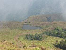
Lake en route to the top of Chembra PeakElevation 2,100 m (6,890 ft) Translation ചെമ്പ്ര കൊടുമുടി (Malayalam) Location Kerala, India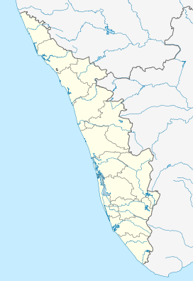
 Chembra
Range Western Ghats Coordinates 11°33′44″N 76°03′49″E / 11.56222°N 76.06361°ECoordinates: 11°33′44″N 76°03′49″E / 11.56222°N 76.06361°E Climbing Easiest route Hike Chembra Peak (Malayalam: ചെമ്പ്ര കൊടുമുടി) is the highest peak in Wayanad, at 2,100 metres (6,900 ft) above sea level.[1] Chembra is located near the town of Meppady and is 8 km south of Kalpetta. It is part of the Wayanad hill ranges in Western Ghats, adjoining the Nilgiri Hills in Tamilnadu and Vellarimala in Kozhikode district in Kerala. Chembra peak is accessible by foot from Meppady. District Tourism Promotion Council provides guides and trekking equipments on hire charges to the tourists.[2] Permission from the forest office in Meppady is required for trekking up to Chembra Peak. A heart shaped lake on the way to the top of the peak is a major tourist attraction. The lake is believed to have never dried up. You can find the lake half way to the peak, after getting to the lake you need to trek another half way which is through the dense trees of about one to two km. A 5 km journey from Meppadi town through tea estates to Erumakkolli.
Transportation
One can reach the forest office, from where a pass has to be acquired to trek the mountain. Also services of guide can be availed which might be very useful. The trek to the top takes 3 hours, and one can see almost the whole of Wayanad and parts of Malappuram, Kozhikkode and Nilgiri districts.
Chembra is located in Meppadi (Meppady) Panchayath, 11 km off NH212 (Kollegal - Mysore - Kozhikode). For people who prefer public transport, KSRTC (both Kerala & Karnataka) and a lot of private companies operate overnight deluxe buses between Kozhikode (aka Calicut) and Bengaluru. People taking buses can get down at Kalpetta and catch another bus to Meppadi. Meppadi is 11 km from Chundale, in the SH29, connecting Chundale to Ooty.
References
- ^ "Official Website of Kerala Tourism". http://keralatourism.gov.in/index.php?source=desti&destid=6636014&catid=&zone=1. Retrieved 2007-10-01.
- ^ "Keralam.com site". http://www.keralam.com/keralam_travelandtour_touristattarctions.htm. Retrieved 2007-10-01.
External links
- Tourism Promotion Council for Wayanad District
- Chembra in usandeep.com
- Coffeaaroma Resort in Chembra Peak
Categories:- Western Ghats
- Mountains of Kerala


Wikimedia Foundation. 2010.