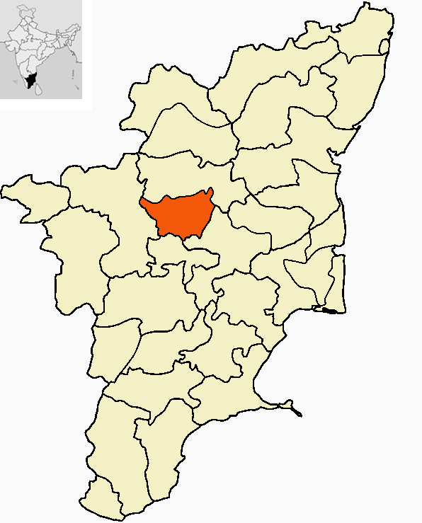
- Namakkal district
-
This article is about the district. For its eponymous headquarters, see Namakkal.
Namakkal District
நாமக்கல் மாவட்டம்
— district — Kolli hills
Coordinates 11°13′8.4″N 78°10′1.2″E / 11.219°N 78.167°ECoordinates: 11°13′8.4″N 78°10′1.2″E / 11.219°N 78.167°E Country India State Tamil Nadu Subdistrict(s) Namakkal, Paramathi Velur, Rasipuram, Thiruchengode. Nearest city Salem,Trichy,Erode Collector J Kumaragurubaran, IAS Municipal Corporations Namakkal Municipalities Town Panchayats Official languages Tamil Time zone IST (UTC+05:30) Central location: 11°13′N 78°10′E / 11.217°N 78.167°E Website Official website of Dharmapuri District Namakkal District (Tamil: நாமக்கல் மாவட்டம்) is an administrative district in the state of Tamil Nadu, India. The district was bifurcated from Salem District with Namakkal town as Head Quarters on 25-07-1996 and started to function independently from 01-01-1997. The district has 4 taluks (subdivisions); Tiruchengode, Namakkal, Rasipuram and Velur (in descending order of population) and has two Revenue Divisions; Namakkal and Tiruchengode. It was ranked second in a comprehensive Economic Environment index ranking of districts in Tamil Nadu not including Chennai prepared by Institute for Financial Management and Research in August 2009. It was major source of Tamil Nadu Economy[2]
Contents
History
After the struggle between the Cheras, Cholas and Pandyas, the Hoysalas rose to power and had the control till the 14th century followed by Vijayanagara Empire till 1565 AD. Then the Madurai Nayakas came to power in 1623 AD. Two of the Poligans of Tirumalai Nayak namely, Ramachandra Nayaka and Gatti Mudaliars ruled the Salem area. The Namakkal fort is reported to have been built by Ramchandra Nayaka. After about 1635 AD, the area came successively under the rule of Muslim Sultans of Bijapur and Golkonda, Mysore kings and then the Marattas, when about the year 1750 AD Hyder Ali came to power. During this period, it was a history of power struggle between Hyder Ali and later Tippu Sultan, with the British.
Geography
Namakkal district is bounded by Salem district on the north; on the east by Attur taluk of Salem district, Perambalur and Tiruchirapalli District's; by Karur district on the south and on the west by Erode district.[3]
 View of Kolli Hills
Namakkal District comes under the North Western Agro climatic zone of Tamil Nadu. It is situated in the dividing portion of two watersheds between Cauvery and the Vellar System with the Taluks of Attur, Rasipuram and Namakkal on the East and Salem, Omalur and Mettur on the West. Tiruchengode taluk alone is placed under Western Agro-climatic zone.[4]
Besides the above two zones, Kolli and a few isolated hills and ridges are scattered over Namakkal, Rasipuram and Tiruchengode and along with the valleys and rolling hills, make up the characteristic topography of the district.
Demographics
According to the 2011 census Namakkal district has a population of 1,721,179,[5] roughly equal to the nation of The Gambia[6] or the US state of Nebraska.[7] This gives it a ranking of 282nd in India (out of a total of 640).[5] The district has a population density of 506 inhabitants per square kilometre (1,310 /sq mi) .[5] Its population growth rate over the decade 2001-2011 was 15.25 %.[5] Namakkal has a sex ratio of 986 females for every 1000 males,[5] and a literacy rate of 74.92 %.[5]
It is 36.51% urbanised as per Census 2001.[8] The literacy level of Namakkal district according to figures available for the year 1996 is 48.97% with male literacy level being more than the female literacy level. It is also observed while the male literacy level has grown steadily from 51.85% in 1981 to 57.61% in 1996, there has been a significant increase of female literacy level from 27.51% in 1981 to 39.89% in 1996.[9]
Industry
The main occupation in the district is agriculture. The cultivation generally depends on monsoon rains, wells and tanks. Nearly 90 percent of the cultivated area is under food crops. The principal cereal crops of this district are paddy, cholam, cumbu and ragi. Panivaragu, Kuthianally, Samai Varagu and Thinai are some of the millets cultivated. Among pulses, the major crops are redgram, blackgram, greengram and horsegram. Among oil seeds groundnut, castor and gingelly (sesame) occupy important places. Of the commercial crops, sugarcane, cotton and tapioca are some of the important crops. Tapioca is used for the manufacture of sago.[9]
Namakkal district is noted for Truck and Lorry external body building which dates back to 1956. Throughout India Tiruchengode is known for its Body Building industry for Trucks, Trailers, Tankers and Rig Unit. Finished trucks and Rig Units are even exported to foreign countries from Namakkal. Nearly 25000 people are employmed either directly and indirectly in truck body building activity and about 300 units in Namakkal and 100 Units in Tiruchengode are engaged in this activity.[4]
Poultry development has been rather phenomenal in the district of Namakkal.[9] The district is also well known for its poultry and dairy industries, accounting for a bulk of supply of poultry products to neighbouring industries. In fact, Namakkal produces about 65% of the egg output of Tamil Nadu.[10]
Tourism
Namakkal Rock Fort
The Rock Fort is on the summit of the rock, and the remnants in brick and stone still bear the brunt of the skirmishes to lay seize to the fort by the Cholas in the 9th Century.[4] There are two rock–cut cave temples located on both sides of the hill dedicated to Narasimhaswamy and Ranganathasamy. There is also an 18 feet tall Hanuman statue carved out of a single stone at the Hanuman Temple.[11]
Tiruchengode
Tiruchengode is 35 km from Namakkal. It is one of the seven Sivasthalams in Kongunadu. The Arthanareeswarar Temple is located on a hill. The presiding deity is depicted as half-male and half-female, vertically to represent Shiva and Parvati worshipped as one form. It is considered one of the oldest temples in this region.
Tiruchegode is the olden Poondurainadu in Kongunadu. Tiruchengode olden name is Thirukodimadachengondurur.
Borewells and Textile are the main business in Tiruchengode. Lorry body building is famous in this place.
Kollimalai Hills
Kollimalai Hills are situated on Eastern Ghats at an altitude of 1200 mts in the Namakkal District and are 45 km from Namakkal town. The Kollimalai Hills are known for medicinal herbs and plants that grow in abundance on the hill slopes. The Arapaleswarar Temple, the Horticulture Farm, the Herbal Farm, Agaya Gangai waterfalls, Boat house, Peryaswamy Temple, View Point and the Telescope House are the places to visit for the interested tourist. The Valvil Ori festival is organised here every year during the month of August.[11]
Transport
Transport is the major field of work in Namakkal; Large number of bulk carriers and Lorries run through all over India from Namakkal. In south India 80% bulk carriers operated from here, It covers Tamil Nadu, Puducherry, Andhra Pradesh, Karnataka, Goa, Kerala, Maharashtra and other states. A lot of lorry (truck) body building workshops are located in Namakkal. Egg production in this district is large, so transport facilities are good. It is the main centre for linking other districts via bus routes especially to the North side (Salem, Villupuram, Dharmapuri, Krishnagiri, Bangalore), East side (Tiruchirapalli, Thanjavur), South side (Karur, Dindugal, Madurai, Tiunelveli, Kanyakumari) and the West side (Erode, Coimbatore, Tirupur, Udhagamandalam (Ooty))
Villages
Paramathi-velur & Pothanur - One of the well known town in this district. The town possess most ares of irrigated fields. Agriculture is the major occupation of people. Paddy, sugarcane, banana, coconut tress, Manjal and Vettrillai are majorly cultiveted by the people. Parotta is one of the famous food in the hotels of this area next to virudunagar parotta's. Non-veg special Duck curry's are mostly served in the hotels of this area which are the famous for its taste.
Perumampalayam - (Namakkal to Senthamangalam) at 8th KM, Near to Muthugapatty..
Solasiramani - River Kaveri
Marappam Palayam Pudur - River Kaveri
Selur-Sanarpalayam ( Paramathi-velur to Jaderpalayam root) at 10th Kilometer.
Chinna Veppanatham ( Namakkal to Tiruchy Highway) at 4th Kilometer.
Namagiripettai( Rasipuram to Attur Road ) at 10th Kilometer.
Salapalayam ( Namakkal to Thuraiyur Highway) at 5th Kilometer.
Pavithram pudur ( East end of Namakkal District towards Turaiyur) at 28'th KM
Konur ( Namakkal to Paramathi-Velur route,well known for Pon kaali Amman temple ) at 11'th KM from both sides.
Veppadai(salem to erode road) Vallipuram(Namakkal to Karur road) Pavithram pudur East end of Namakkal District it is placed in 28th KM 20 km form namakkal
References
- ^ www.tn.gov.in
- ^ "Study on districts ranked Madurai low, Government irked". Times of India (Chennai): pp. 1. 22 September 2009.
- ^ Namakkal District profile, SouthIndia Online
- ^ a b c Namakkal District, Govt of Tamil Nadu
- ^ a b c d e f "District Census 2011". Census2011.co.in. 2011. http://www.census2011.co.in/district.php. Retrieved 2011-09-30.
- ^ US Directorate of Intelligence. "Country Comparison:Population". https://www.cia.gov/library/publications/the-world-factbook/rankorder/2119rank.html. Retrieved 2011-10-01. "Gambia, The 1,797,860 July 2011 est."
- ^ "2010 Resident Population Data". U. S. Census Bureau. http://2010.census.gov/2010census/data/apportionment-pop-text.php. Retrieved 2011-09-30. "Nebraska 1,826,341"
- ^ CensusIndiaMaps
- ^ a b c Namakkal District Environment Profile, AIMS
- ^ http://www.tn.gov.in/deptst/animalhusbandry.pdf
- ^ a b Tamil Nadu Tourism
External links
- Namakkal District news in Tamil
- Namakkal District
- Namakkal District website
- Namakkal District Water Supply Status (Tamilnadu Water Supply and Drainage Board)

Salem district Erode district 
Tiruchirappalli district  Namakkal district

Karur district Namakkal district District Headquarters Taluks Blocks Namakkal · Erumaipatti · Rasipuram · Thiruchengode · ElachipalayamKabilamalai · Kolli Hills · Mallasamudram · Mohanur · Namagiripet
Pallipalayam · Paramathi · Puduchatram · Sendamangalam · VennandurRivers Kaveri · Aiyaru · Karipottan · ThirumanimutharuCategories:


Wikimedia Foundation. 2010.