- Kanchipuram district
-
This article is about the district. For its eponymous headquarters, see Kanchipuram.
Kanchipuram District — district — 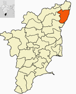
Coordinates Country India State Tamil Nadu District(s) Kanchipuram Subdistrict(s) Chengalpattu, Cheyyur, Kanchipuram, Madurantakam, Sriperumpudur, Tambaram, Thirukachukundram and Uthiramerur ' July 1, 1997 Headquarters Kanchipuram Largest city Kanchipuram Collector & District Magistrate S. Sivashanmuga Raja IAS Legislature (seats) elected (9) Parliamentary constituency Chengalpattu, Sriperumbudur (SC), Chennai - South Population
3,990,897[1] (2011[update])
• 908 /km2 (2,352 /sq mi)
• 1,534,841 (2001[update])Sex ratio M-50.6%/F-49.4% ♂/♀ Literacy
• Male
• Female67.84%%
• 74.72%%
• 60.78%%Official languages Tamil Time zone IST (UTC+05:30) Area
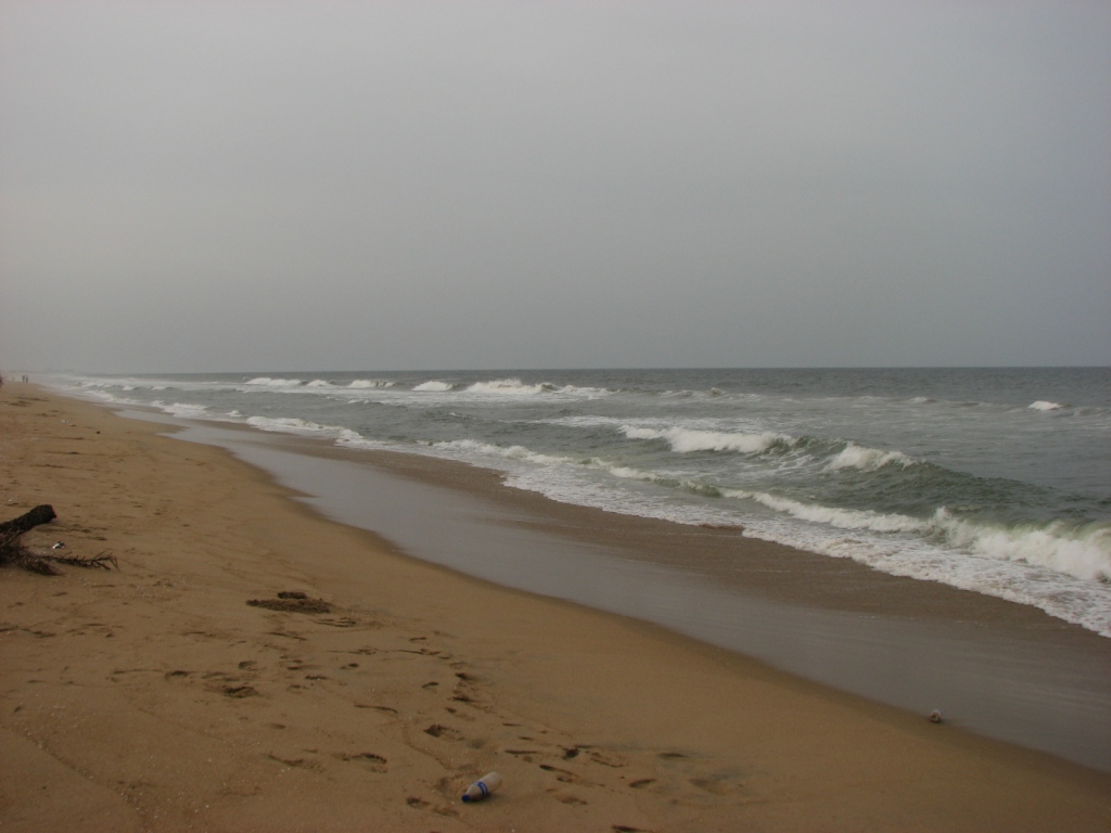
• Coastline
4,393 square kilometres (1,696 sq mi)
• 87.2 kilometres (54.2 mi)
Climate
• Precipitation
Temperature
• Summer
• Winter
• 1,213 mm (47.8 in)
• 36.6 °C (97.9 °F)
• 19.8 °C (67.6 °F)Central location: 11°50′N 78°00′E / 11.833°N 78°E Website Official website of District Collectorate, Kanchipuram Kanchipuram district (Tamil: காஞ்சிபுரம் மாவட்டம்) is a district in the northeast of the state of Tamil Nadu in India. It is bounded in the west by Vellore and Thiruvannamalai districts, in the north by Thiruvallur District and Chennai District, in the south by Viluppuram District and in the east by the Bay of Bengal. It lies between 11° 00' to 12° 00' latitudes and 77° 28' to 78° 50' longitudes. The district has a total geographical area of 4,432 km2 (1,711 sq mi) and coastline of 57 km (35 mi). The town of Kanchipuram is the district headquarters. It is the second most populous district of Tamil Nadu (out of 32), after Chennai.[2]
The district produces over 15,000 engineering graduates every year, same as Gujarat state.[3]
Contents
History

The history of Kanchi can be traced back to several centuries before the advent of the Christian era. The place finds its name in Patanjali's Mahabhashya, written in the 2nd century BC. Manimekalai, the famous Tamil classic, and Perumpanattu Padai, a great Tamil poetical work, vividly describe Kanchipuram city, as it was at the beginning of the Christian era. Pathupattu, one of the sangam literatures, reads that the king Thondaiman Ilandirayan ruled this town around 2500 years ago.
Kancheepuram District had been administered by the Pallavas, Cholas, Vijayanagar rulers and the British before Independence. It was a part of Tondaimandalam, a division of the ancient Tamil country, roughly comprising the present day districts of Kancheepuram, Chennai, Tiruvallur, Vellore and Thiruvannamalai. The capital of Thondaimandalam was Kancheepuram city. From the 3rd to the 9th century AD. Kanchi was the capital of the Pallavas who ruled over the territory extending from the river Krishna in the north to the river Kaveri in the south. The Pallavas fortified the city with ramparts, moats, etc., with wide and well laid out roads and fine temples. They were a great maritime power with contacts with far-off China, Siam, Fiji, etc., through their chief Port Mamallapuram (Mahabalipuram). The Cholas ruled this region from the 10th century to the 13th century. Kings of Vijayanagar dynasty ruled from 14th century to 17th century.
Kanchi was a major seat of Tamil learning as well as an important place of pilgrimage for Buddhists, Jains and Hindus. Kalidasa has described it to be the best among the cities (Nagareshu Kanchi), just as Jati (jasmine) is the sweetest amongst the flowers, Rambha the most beautiful amongst women and Grihasthasrama the most ideal amongst the four asramas of human life. One of the kings of Kanchi, Mahendravarman-I, was a great scholar and musician, a man of great intelligence and also a great playwright. Yuan Chwang, the great Chinese traveler, visited Kanchipuram city in the 7th century and said that this city was 6 miles in circumference and that its people were famous for bravery and piety as well as for their love of justice and veneration for learning. He further recorded that Buddha had visited the place. As regards learning, Kanchi stood second in glory only to Banaras. Once the seat of learning and religious fervour, it started its climb down with the Mughal invasions followed by three centuries of colonial rule under the British.
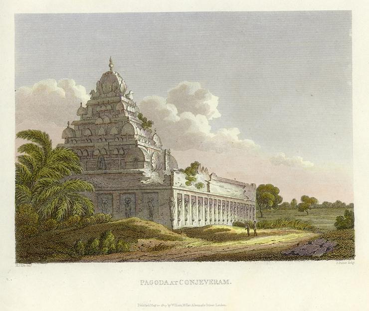
 An 1811 engraving of a temple in Kanchipuram
The British coined the name Conjeevaram, the anglicised version of Kancheepuram. Under the British regime, a Collector to the district was appointed for the first time in 1788 AD. The district was further split up into two divisions, Northern and Southern, and was placed under the administration of two Collectors. The Collectors during 1790's were Clerk and Balfour. Lionel Place, the Collector in 1794-1799, created the posts of Sharistadars, who came under the control of the Collector. Clerks were also appointed to assist the Sharistadars. The famous Madurantakam and Uthiramerur tanks were created by Place. Hodgson, who was Head Assistant to Place, succeeded him as the Collector. The place he resided at Kancheepuram is still known in the name of Hodgsonpet. In 1800, Hodgson was succeeded by his Senior Assistant, Greenway.
In the 19th century, Karunguzhi became the headquarters of the district and it remained so up to 1859 when it was shifted to 'Home Garden' Saidapettai, except for a short spell from 1825-1835 during which Kancheepuram served as the district headquarters. From 1859 to 1968, the Collector's office was located in Saidapettai.
Post Indian Independence, Kancheepuram city became the headquarters of Chengalpattu district with effect from 1 July 1968. Then the Chengalpattu-MGR district was split into two as Kancheepuram and Tiruvallur Districts from 01.07.1997. Thus the new Kancheepuram District was formed from 01.07.1997, consisting of 8 Taluks, viz, Kancheepuram, Sriperumbudur, Uthiramerur, Chengalpattu, Tambaram, Tirukalukundram, Madrandakam and Cheyyur.[4]
Geography
 Coastline at Injambakkam
Kancheepuram district is situated on the North East coast of Tamil Nadu. It is bound by Bay of Bengal in the East, Vellore and Thiruvannamalai districts in the west, Thiruvallur and Chennai districts in the north, and Villuppuram district in the south. It lies between 11° 00' to 12° 00' latitudes and 77° 28' to 78° 50' longitudes. The district has a total geographical area of 4,43,210 hectares and a coastline of 57 km. The table below shows the maximum and minimum temperatures experienced in the district during different seasons.
Summer Winter Max. 45.0 °C (113.0 °F) 28.7 °C (83.7 °F) Min. 21.1 °C (70.0 °F) 14.0 °C (57.2 °F) The pre-monsoon rainfall is almost uniform throughout the district. The coastal regions receive more rainfall than the interior ones. The district is mainly dependent on the monsoon rains. Failure of monsoon leads to distress condition. Northeast and Southwest monsoon are the major donors, with 54% and 36% contribution each to the total annual rainfall. During normal monsoon, the district receives a rainfall of 1200 mm.
The Palar river is the most important river running through the district. Through most of the year it remains dry, attributed to the construction of dams across the river in Andhra Pradesh. There are only a few hills of considerable elevation in the district. The southern part of Maduranthakam taluk contains small hills. The total forest area in the district is 23,586 hectares.
Climate
Climate data for Chennai Month Jan Feb Mar Apr May Jun Jul Aug Sep Oct Nov Dec Year Average high °C (°F) 28.4
(83.1)29.9
(85.8)31.9
(89.4)33.6
(92.5)36.4
(97.5)36.6
(97.9)34.7
(94.5)33.9
(93.0)33.5
(92.3)31.4
(88.5)29.2
(84.6)28.1
(82.6)32.3 Average low °C (°F) 20.6
(69.1)21.2
(70.2)23.1
(73.6)25.9
(78.6)27.6
(81.7)27.2
(81.0)25.9
(78.6)25.3
(77.5)25.3
(77.5)24.3
(75.7)22.8
(73.0)21.6
(70.9)24.2 Rainfall mm (inches) 20.3
(0.799)16.4
(0.646)6.7
(0.264)10.3
(0.406)44.9
(1.768)76.2
(3)106.8
(4.205)133.5
(5.256)131.6
(5.181)307
(12.09)382.5
(15.059)167.7
(6.602)1,403.9
(55.272)Avg. rainy days 1.9 1.3 .4 1.3 2.0 7.6 9.8 10.9 10.0 12.1 11.8 6.9 76 Sunshine hours 269.7 271.2 294.5 291.0 279.0 204.0 186.0 192.2 198.0 195.3 183.0 204.6 2,768.5 Source no. 1: WMO [5] Source no. 2: HKO (sun only, 1971–1990) [6] Governance
Kancheepuram, the temple town, is the district headquarters. For administrative purpose, the district has been divided into 3 revenue divisions consisting of 8 taluks with 1214 revenue villages. For development purpose, it is divided into 13 development blocks with 648 Village Panchayats.[7]
Demographics
According to the 2011 census Kanchipuram district has a population of 3,990,897,[2] roughly equal to the nation of Liberia[8] or the US state of Oregon.[9] This gives it a ranking of 59th in India (out of a total of 640).[2] The district has a population density of 927 inhabitants per square kilometre (2,400 /sq mi) .[2] Its population growth rate over the decade 2001-2011 was 38.69 %.[2] Kancheepuram has a sex ratio of 985 females for every 1000 males,[2] and a literacy rate of 85.29 %.[2]
The Kancheepuram district had a population of 28,77,468 as of 2001. It is 53.34% urbanised.[10]
The literacy of the district is 77.61%.
Economy
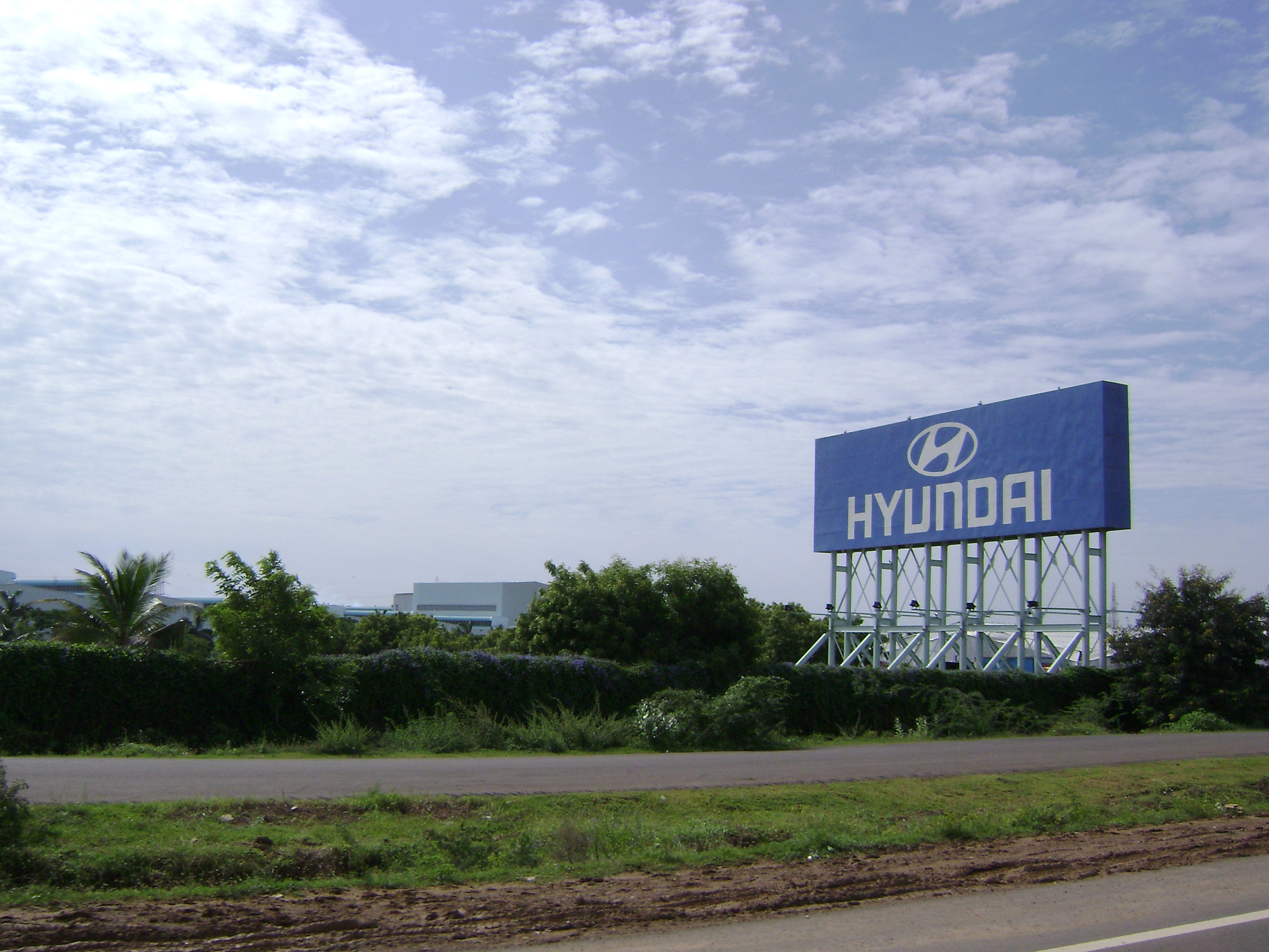
 Hyundai's manufacturing plant at Irungattukottai, near Sriperumbudur
Agriculture is the main occupation of the people with 47% of the population engaged in it. Paddy is the major crop cultivated in this district. Groundnuts, Sugarcane, Cereals & Millets and Pulses are the other major crops cultivated. 76.50 Metric Tonnes lands are cultivated in Fuel wood and 8.039 Tonnes in Cashew. Palar river along with Tanks and wells are the main sources of irrigation in this district.
Kancheepuram is also known as 'Silk City' and 'Temple City', since one of the main professions of the people living in and around is weaving silk sarees. The silk weavers of Kanchi settled more than 400 years ago and have given it an enviable reputation as the producer of the best silk sarees in the country.
Kanchipuram is also one of the most industrialized districts in the country, thanks to its proximity to the state capital Chennai. Areas surrounding Sriperumbudur have turned out to become one of the largest manufacturing hubs of India. The district is home to the manufacturing units of Hyundai, Ford, Mitsubishi, Nokia, Samsung, Dell, Saint Gobain etc... The district is also at the center of the Information Technology boom in India. Many multinational IT companies like Tata Consultancy Services (TCS), Infosys, Wipro Technologies, Cognizant Technology Solutions etc... have set up their offices in Kanchipuram district. TCS and Infosys have built huge offices with capacities of 22,000 and 25,000 employees respectively.
Places of interest
Kanchipuram
Kanchipuram is a spectacular Temple city known as city of thousand temples which reflects the Glorious Traditions of South India with its noted temples. The 192 feet high temple tower of Ekamabaranadhar temple and the 100-pillar mandabam (building) in Varadaraja Perumal temple in this town are famous, and are considered marvels of the architectural techniques of Vijayanagara Dynasty. The British Viceroy Robert Clive, who is responsible for the British rule in India, had exclaimed the architectural techniques of Varadharaja perumal temple and presented a fabulous jewelry to this temple. Today, apart from its temples, this small town is also known for its thriving handloom industry. The city is quite famous for its silk sarees, considered to be one of the best varieties of silk sarees. Walajapet near Kanchipuram is also famous for silk saree weaving.
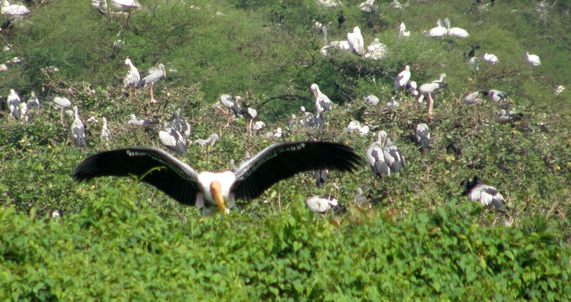
Vedanthangal
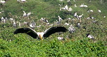 Birds at Vadanthangal bird sanctuary
It is one of the major Water Bird Sanctuaries in India, 48 km from Kanchipuram. Storks, Egrets, Cormorants, Darter, Flamingos, Pelicans, moor hens, herons, kingfishers, sandpipers, white ibis, spoonbills, swans and grey wagtails are some of the birds which arrive here during season. The best time to visit is between October and March, when a large number of migratory birds visit. The birds can be viewed from the bank or from the watch tower.
Muttukadu
This is a large lake formed out of the backwaters from Bay of Bengal. It has boating and wind surfing facilities. It is located at a distance of 80 km from Kanchipuram . The backwaters of Muttukkadu have been developed by the Tamil Nadu Tourism Development Corporation to serve as a picnic spot and a center for water sports. Training and demonstration programmes are also organised for beginners.
Mamallapuram
It was a flourishing port town during the time of Pallavas. This is one of the main tourist places in kanchipuram. The monuments of Mamallapuram are excellent specimen of Dravidian temple architecture and Pallava art. The group of sculptures in Mamallapuram are listed out by [UNESCO]as World Heritage Sites.
Covelong
This is a small fishing village 40 km from Chennai on the Mahabalipuram road. There are the remains of a fort, which now functions as a luxury beach resort. Facilities for windsurfing and swimming are available here. A dargah and an ancient church are also located here.
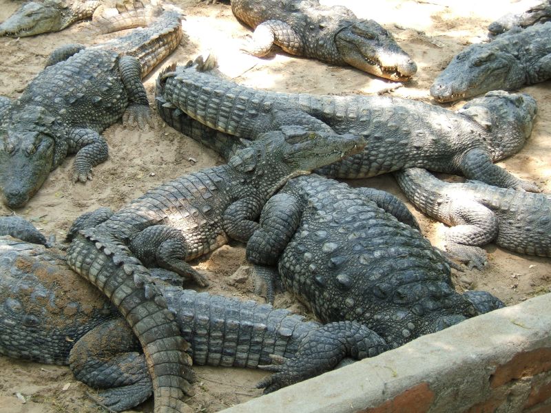
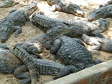 Crocodiles in Crocodile Bank
Dakshina Chitra
Dakshina Chitra has relocated 18th, 19th and early 20th century houses and re-created village streets and work places providing authentic insights into the domestic architecture, spatial organisation, life-styles and character of the essential Tamil or Keralite or Andhrite or Kannadiga.
The Crocodile Bank
Just 14 km from Mamallapuram is this crocodile breeding center. At this center, about 5000 crocodiles of 6 different species, alligators & other reptiles are bred in captivity, kept in open, marshy enclosures. There is also a snake farm where anti venom is produced and there is a regular venom extraction show.[11]
References
- ^ "2011 Census of India" (Excel). Indian government. 16 April 2011. http://www.censusindia.gov.in/2011-prov-results/prov_data_products_tamilnadu.html.
- ^ a b c d e f g "District Census 2011". Census2011.co.in. 2011. http://www.census2011.co.in/district.php. Retrieved 2011-09-30.
- ^ CII launches Chennai zone
- ^ History of Kanchipuram
- ^ "World Weather Information Service - Chennai". World Meteorological Organisation. http://worldweather.wmo.int/066/c00527.htm. Retrieved 2011-05-04.
- ^ "Climatological Information for Madras, India". Hong Kong Observatory. http://www.hko.gov.hk/wxinfo/climat/world/eng/asia/india/madras_e.htm. Retrieved 2011-05-04.
- ^ kanchipuram profile
- ^ US Directorate of Intelligence. "Country Comparison:Population". https://www.cia.gov/library/publications/the-world-factbook/rankorder/2119rank.html. Retrieved 2011-10-01. "Liberia 3,786,764 July 2011 est."
- ^ "2010 Resident Population Data". U. S. Census Bureau. http://2010.census.gov/2010census/data/apportionment-pop-text.php. Retrieved 2011-09-30. "Oregon 3,831,074"
- ^ Census GIS India
- ^ Tourism in Kanchipuram
External links

Vellore district Chennai district Tiruvannamalai district 
Bay of Bengal  Kanchipuram district

Viluppuram district Kanchipuram district District Headquarters 
Country State Region Taluks Municipalities Alandur · Anakaputhur · Chengalpattu · Kanchipuram · Maduranthakam · Maraimalai Nagar · Pallavaram · Pammal · Puzhuthivakkam · Tambaram
History Pallavas · Medieval Cholas · Later Cholas · Later Pandyas · Delhi Sultanate · Madurai Sultanate · Vijayanagar Empire · Carnatic Kingdom · Company Raj · British RajPlaces of interest Arignar Anna Zoological Park · Ashtabujakaram, Kanchipuram · Cholamandal Artists' Village · Dakshinchitra · Descent of the Ganges, Mamallapuram · Ekambareswarar Temple, Kanchipuram · V. G. P. Golden Beach · Kailasanathar Temple, Kanchipuram · Kalyana Varadharaja Perumal Temple, Kanchipuram · Kamakshi Amman Temple, Kanchipuram · Kundrathur Murugan Temple, Kundrathur · Madras Atomic Power Station, Kalpakkam · Madras Crocodile Bank Trust · Neervalur, Kanchipuram · Pancha Rathas, Mamallapuram · Rajiv Gandhi Memorial, Sriperumbudur · Shore Temple, Mamallapuram · St. Thomas Mount · Subrahmanya Temple, Saluvankuppam · Thirukadalmallai, Mamallapuram · Thirukazhukundram · Tirusoolanathar Temple, Tirusoolam · Tiruththanka, Kanchipuram · Tiruvekkaa, Kanchipuram · Tiruvelukkai, Kanchipuram · Varadharaja Perumal Temple, Kanchipuram · Varaha Cave Temple, Mamallapuram · Vedanthangal Bird SanctuaryReligious and monastic institutions Universities Cities and Towns · Villages · PeopleCategories:


Wikimedia Foundation. 2010.