- Frobisher Bay Air Base
-
For current usage of the base, see Iqaluit Airport.
Frobisher Bay Air Base Frobisher Bay 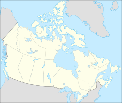
 Frobisher Bay Air Base
Type Air Force Station Coordinates 63°45′21″N 068°32′23″W / 63.75583°N 68.53972°WCoordinates: 63°45′21″N 068°32′23″W / 63.75583°N 68.53972°W Built 1942 In use 1942-1963 Frobisher Bay Air Base is a former United States Air Force facility adjacent to the town of Iqaluit, Nunavut (formerly Frobisher Bay, Northwest Territories); 1,299 mi (2,091 km) north of Ottawa, Ontario. It was closed in 1963.
Contents
History
World War II
During World War II, the United States established a weather/radio station at this site, code-named "Crystal II". It was one of three "Crystal" weather sites in the Canadian Arctic Region, Fort Chimo (now Kuujjuaq), Quebec being "Crystal I", and a station on Padloping Island being "Crystal III". A detachment of the 8th Weather Squadron, Air Transport Command (ATC) took up residence at the station on 1 October 1942.[1] The initial mission of the Crystal sites was to provide long-range weather information to the combat forces then building up in the United Kingdom.
Beginning in 1943, the North Atlantic Division, ATC, constructed an airstrip at Crystal II as part of the Crimson Route for ferrying aircraft between the United States and Great Britain. The airfield at Crystal II was known as ATC Station #10.[2] It was planned to be a transport hub between the Eastern Route, which originated at Presque Isle Army Airfield, Maine and the Central Route, which originated at Romulus Army Airfield (Detroit Airport), Michigan. From Crytstal II, the aircraft would be ferried across over Baffin Island; Greenland; Iceland and delivered to Scotland. The development of the Mid-Atlantic Transport through the Azores led to the cancellation of the Crystal Route project in 1943. The United States presence at Crystal I was reduced to a skeleton weather squadron. [3]
The use of Frobisher Bay declined with the end of World War II, with jurisdiction of the facility being transferred to Military Air Transport Service (MATS) in 1948, under its Air Weather Service (ARS). A small detachment of communications personnel of the 135th Army Airways Communications Service Squadron remained manning a communications station, along with the cadre of the original 8th Weather Squadron. The airfield remained open for use by transient aircraft and for MATS to airlift supplies and equipment to the site. During the recovery of the crew of the downed B-29 Kee Bird in 1947, aircraft were flown to Crystal II to assist in the rescue, if needed. The station was inactivated on 1 September 1950.[4][5]
Cold War
The advantages of having airfields in the high latitudes of North America was realized with the advent of the Cold War and the possibility of the Soviet Union using great circle routes over the Arctic to send manned bombers to attack the United States. Northeast Air Command reactivated the base on 1 October 1951 and established the 6603d Air Base Wing as the host unit under the 64th Air Division. Under USAF control, the former Crystal II base became known as Frobisher Bay Air Base.
Strategic Air Command (SAC) became a major tenant organization at Frobisher AB. It was used by SAC to support "Project Nanook", the ongoing strategic reconnaissance mission over the Arctic to map the region and develop navigation routes for SAC to transit the Arctic Region in the event active hostilities erupted. Very long range reconnaissance aircraft (primarily RB-29s) would use Frobisher as a refueling stop and as an emergency airfield. The facilities at Crystal II were also used during the construction of Thule Air Base, Greenland. The MATS Air/Sea Rescue Service was also assigned to Frobisher Bay AB as a tenant organization, with the 54th Air Rescue Squadron operating from the base.
In the early 1950s, plans for the building of the Distant Early Warning Line (DEW Line), a system of early warning Radar stations in the high latitudes of North America were being developed. A radar station was built by the United States at Frobisher Bay beginning in 1953 63°46′50″N 068°32′38″W / 63.78056°N 68.54389°W , with the Northeast Air Command (NEAC) activating the 926th Aircraft Control and Warning Squadron at a radar site approximately a mile to the north of the airfield and station complex. The radar site operated the following radars:
- Search Radars: AN/FPS-3C, AN/FPS-502, AN/FPS-20A
- Height Radars: AN/TPS-502
As a GCI base, the 926th's role was to guide interceptor aircraft toward unidentified intruders picked up on the unit's radar scopes. These interceptors were assigned to the 64th Air Division at Goose AFB, Labrador.
In 1954, an agreement between the United States and Canada led to the formal agreement to construct the DEW Line, and survey crews used Frobisher Bay to survey sites for the radar stations across the Canadian Arctic from Frobisher Bay to the Alaska/Yukon Territory and east into Greenland. The United States Army Corps of Engineers deployed the 826th Engineering Aviation Battalion to the base in 1954 to support the project.
Frobisher Bay AB became an important staging point, as supplies and equipment for the construction of the DEW Line were shipped via naval transport ships to the port facilities at the base. Large numbers of MATS transport aircraft brought essential equipment and personnel to the base, which was used as a support facility. At one time Frobisher Bay AB saw 300 aircraft movements a day. Once the DEW Line opened in 1957 the number of aircraft using the base subsided and a second hiatus visited Frobisher Bay. A detachment of the ADC 4601st Support Group from Paramus, New Jersey operated from the base supporting the numerous DEW line stations.
The development of aerial refueling with the introduction of the KC-97 Stratotanker and also the opening of the large runway at Thule AB for use by intercontinental bombers such as the B-36 and B-47 (neither of which could use the relatively short runway at Frobisher Bay) led SAC to close its facilities in 1953.
In 1957 NEAC was inactivated and Air Defense Command (AD) assumed jurisdiction of the facility. The 4733d Air Defense Group took over as host unit from the NEAC 6603d ABW, including control of the 926th AC&W Suadron. A detachment from the SAC 4082d Strategic Wing from Goose AFB, Labrador, also took up station at Frobisher Bay AB
With the completion of DEW line construction, Frobisher Bay became something of a backwater, with SAC transient aircraft using the base for staging KC-97 tankers and also using it for tactical airlift operations to and from its bases in Greenland. MATS cargo flights used the airfield for transshipments of equipment and supplies, also logistically supporting the base and personnel transport, (usually operated by 1607th Air Transport Wing C-124 Globemaster IIs from Dover AFB). The 4733d ADG was downgraded, being replaced by the 4085th Air Base Squadron on 1 May 1958 to manage support issues at the base.
Most of the ADC functions at Frobisher Bay Air Base were taken over by the Goose Air Defense Sector at Goose AB on 1 April 1960. ADC inactivated the radar station on 1 November 1961, ending the surveillence mission of the base. The facility was closed by SAC in 1963, shifting its operations to Thule AB.
Closure
When the USAF closed its base in 1963, Iqaluit Airport continued as a commercial airport.
See also
- List of USAF Aerospace Defense Command General Surveillance Radar Stations
References
 This article incorporates public domain material from websites or documents of the Air Force Historical Research Agency.
- A Handbook of Aerospace Defense Organization 1946 - 1980, by Lloyd H. Cornett and Mildred W. Johnson, Office of History, Aerospace Defense Center, Peterson Air Force Base, Colorado
- Winkler, David F. (1997), Searching the skies: the legacy of the United States Cold War defense radar program. Prepared for United States Air Force Headquarters Air Combat Command.
External links
 Strategic Air Command (SAC)
Bases Active
(MAJCOM)CONUSAltus (AETC) • Andersen (PACAF) • Andrews (AMC) • Barksdale (ACC) • Beale (ACC) • Bolling (AFDW) • Cannon (AFSOC) • Columbus (AETC) • Davis-Monthan (ACC) • Dyess (ACC) • Eielson (PACAF) • Ellsworth (ACC) • Eglin (AFMC) • F. E. Warren (AFSPC) • Fairchild (AMC) • Forbes (ANG) • Grand Forks (AMC) • Grissom (AFRC) • Homestead (AFRC) • Lincoln (ANG) • Little Rock (AETC) • MacDill (AMC) • Malmstrom (AFSPC) • March (AFRC) • McChord (AMC) • McConnell (AMC) • McGuire (AMC) • Minot (ACC) • Mountain Home (ACC) • Nellis (ACC) • Offutt (ACC) • Patrick (AFSPC) • Pease (ANG) • Rickenbacker (ANG) • Robins (AFMC) • Seymour Johnson (ACC) • Sheppard (AETC) • Selfridge (ANG) • Travis (AMC) • Vandenburg (AFSPC) • Westover (AFRC) • Whiteman (ACC) • Wright-Patterson (AFMC)
OverseasRAF Alconbury (USAFE) • Diego Garcia (RAF) • Kadena (PACAF) • RAF Fairford (USAFE) • RAF Lakenheath (USAFE) • RAF Mildenhall (USAFE) • Thule (AFSPC)
InactiveCONUSAmarillo • Bergstrom • Biggs • Bong (unbuilt) • Calumet Air Force Base • Carswell • Castle • Chennault • Clinton-Sherman • Dow • Eaker • Glasgow • Grand Island (AAF) • Griffiss • Hunter • K. I. Sawyer • Kearney • Kincheloe • Larson • Loring • Lowry • Mather • McCoy • Plattsburgh • Presque Isle • Ramey • Shilling • Stead • Turner • Walker • Wurtsmith
OverseasRAF Bassingbourn • Ben Guerir • Boulhaut • RAF Brize Norton • RAF Bruntingthorpe • RAF Burtonwood • RAF Chelveston • RAF Greenham Common • Goose Bay • Ernest Harmon • RAF High Wycombe • RAF Upper Heyford • Torrejón • RAF Manston • Morón • Nouasseur • RAF Scampton • RAF Sculthorpe • Sidi Slimane • RAF South Ruislip • U-Tapao • RAF Waddington • RAF Woodbridge • RAF Wyton • Zaragoza

Units Air ForcesSecond Air Force • Eighth Air Force • Fifteenth Air Force • Sixteenth Air Force • Twentieth Air ForceDivisions AirStrategic
AerospaceStrategic Missile13thReconnaissance6th Strategic Reconnaissance • 26th Strategic Reconnaissance • 55th Strategic Reconnaissance • 544th Aerospace Reconnaissance TechnicalAerospaceAFCONMAJCOM3918th • 3920th • 3960th • 3970th • 3973d • 4026th • 4038th • 4039th • 4042d • 4043d • 4047th • 4080th • 4081st • 4082d • 4083d • 4123d • 4126th • 4128th • 4130th • 4133d • 4134th • 4135th • 4136th • 4137th • 4138th • 4141st • 4157th • 4158th • 4170th • 4228th • 4238th • 4239th • 4241st • 4245th • 4252nd • 4258th • 4321stSupportUSAAF
Groups
*=Initial Assigned
Unit Upon SAC's
ActivationBombardmentFighter27th (6/47) • 55th (2/47)Reconnaissance91st Strategic Reconnaissance (1/47)Major
weapon
systemsBombersCommand
& ControlFightersMissilesReconnaissanceTankersTransportCommanders Emblems Strategic Air Command Emblem Gallery (On Wikimedia Commons)Bases CONUSAdair · Beale · Bong (unbuilt) · Charleston · Davis-Monthan · Dobbins · Dover · Dow · Duluth · England · Ent · Ethan Allen · Fairfax · Fort Lee · Geiger · George · Glasgow · Grand Forks · Grenier · Griffiss · Gunter · Hamilton · Hancock · Homestead · Hurlburt · Imeson · K.I. Sawyer · Kincheloe · Kingsley · Kirtland · Larson · Luke · March · Malmstrom · McCoy · McChord · McClellan · McGhee Tyson · McGuire · Minneapolis-St. Paul · Minot · Mitchel · New Castle · Niagara Falls · Norton · O'Hare · Oklahoma City · Otis · Oxnard · Paine · Perrin · Peterson · Pittsburgh · Pope · Portland · Presque Isle · Richards-Gebaur · Selfridge · Seymour Johnson · Sioux City · Snelling · Stead · Stewart · Suffolk County · Tinker · Travis · Truax · Tyndall · Vandenburg · Webb · Westover · Willow Run · Wright-Patterson · Wurtsmith · Youngstown
OverseasErnest Harmon · Frobisher Bay · Goose Bay · Keflavik · Pepperrell · Thule · Topsham

Stations CONUSAlmaden · Charleston · Clear · Cross City · Benton · Empire · Mill Valley · Montauk · Mount Hebo · North Truro · Point Arena · Rye · Thomasville · Watertown
OverseasAlbrook
Air
Defense
unitsForcesAir
DivisionsSectorsAlbuquerque · Bangor · Boston · Chicago · Detroit · Duluth · Goose · Grand Forks · Great Falls · Iceland · Kansas City · Los Angeles · Minot · Montgomery · New York · Oklahoma City · Phoenix · Portland · Reno · Sault Sainte Marie · San Francisco · Seattle · Sioux City · Spokane · Stewart · Syracuse · Washington
WingsGroups1st · 4th · 10th · 14th · 15th · 23rd · 32nd · 33rd · 50th · 52nd · 53rd · 54th · 56th · 57th · 73rd · 78th · 79th · 81st · 82nd · 84th · 325th · 326th · 327th · 328th · 329th · 337th · 355th · 408th · 412th · 414th · 473rd · 475th · 476th · 478th · 500th · 501st · 502d · 503d · 507th · 514th · 515th · 516th · 517th · 518th · 519th · 520th · 521st · 525th · 527th · 528th · 529th · 530th · 533d · 534th · 564th · 566th · 567th · 568th · 575th · 678th · 701st · 4676th · 4700th · 4721st · 4722d · 4727th · 4728th · 4729th · 4730th · 4731st · 4732d · 4733d · 4734th · 4735th · 4756th
SquadronsAerospace Defense Command Fighter Squadrons · Aircraft Control and Warning Squadrons
Major
weapon
systemsElectronicFightersMissiles1 · 2 · 3 · 4 · 5
ShipsGuardian · Interceptor · Interdictor · Interpreter · Investigator · Locator · Lookout · Outpost · Pickett · Protector · Scanner · Searcher · Skywatcher · Tracer · Watchman · Vigil
Miscellaneous Air Defense Command Emblem Gallery (On Wikimedia Commons) · General Surveillance Radar StationsCategories:- Closed facilities of the United States Air Force
- Defunct airports in Nunavut
- Buildings and structures in Iqaluit
- Transportation in Iqaluit
- USAAF Air Transport Command Airfields - North America
- Airfields of the United States Army Air Forces in Canada

Wikimedia Foundation. 2010.