- Benton Air Force Station
-
Benton Air Force Station 
Part of Air Defense Command (ADC) 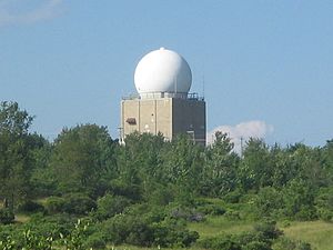
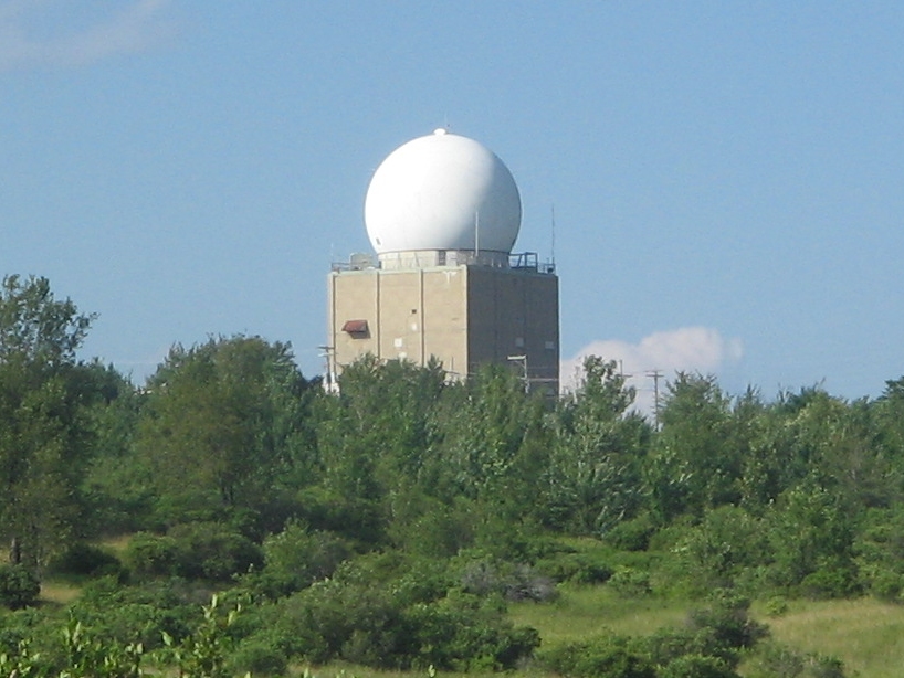
The radar dome in 2010, as seen from the Hayfields in Ricketts Glen State ParkType Air Force Station Coordinates 41°21′30″N 076°17′40″W / 41.35833°N 76.29444°W Location code ADC ID: P-30 NORAD ID: Z-30 Built 1951 In use 1951-1975 Controlled by United States Air Force Garrison 648th Radar Squadron 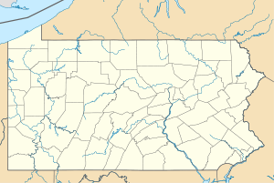
 Benton AFSLocation of Benton AFS, Pennsylvania
Benton Air Force Station was a Cold War era Aerospace Defense Command radar facility in Colley Township, Sullivan County, Pennsylvania. The station was operational from 1951 until 1975.
The radar at Benton Air Force Station scanned skies in the United States from Massachusetts south to Virginia and east over the Atlantic Ocean.[1] The station was manned by airmen from the 648th Aircraft Control Squadron at Fort Indiantown Gap.
Benton Air Force Station was converted to the Red Rock Job Corps Center in 1978[1] and is now part of Ricketts Glen State Park a Pennsylvania state park.[2]
Contents
History
Benton Air Force Station (Also known as Mud Pond) was part of the last batch of twenty-three radar stations constructed as part of the Air Defense Command permanent network. Construction on the 98-acre (40 ha) facility began in 1950 and was completed on September 21, 1951.
Earlier stationed at Mud Pond, Pennsylvania, the 648th Aircraft Control and Warning Squadron began operations with AN/CPS-6B radar scanners and barracks for the airmen or "scope dopes" who operated the radar station.[1][3] The radar operators worked around the clock and could scramble jets from Air Forces bases in New York and New Jersey.[1] The facility was moved to Ricketts Glen State Park, Pennsylvania by 1 February 1952. On 1 December 1953, the Ricketts Glen facility was redesignated as Benton Air Force Station.
Upgrades to the station in 1958 made it possible for Benton AFS to join the Semi Automatic Ground Environment (SAGE) system, initially feeding data to DC-02 at Stewart AFB, New York. After joining, the squadron was re-designated as the 648th Radar Squadron (SAGE) on 1 February 1959. In August 1958, the SAGE information feed was switched to DC-03 at Syracuse AFS, then in September 1963 SAGE data was sent back to DC-02.[3] The system connected a series of long-range radar stations such as the one at Benton Air Force Station with control centers by sending data through the telephone system. Data collected at the control center was sent back to the stations in images on cathode ray tubes.[1]
Further improvements in the 1960s included the installation of an AN/FPS-35 radar atop a five-story structure that still stands. The new unit weighed 70 tons and was painted in a red/white checkerboard pattern.
In addition to the main facility, Benton operated two unmanned AN/FPS-14 (P-30E) and AN/FPS-18 (P-30F) Gap Filler sites:[3]
- Ulysses, Pennsylvania (P-30E) 41°52′48″N 077°42′51″W / 41.88°N 77.71417°W
- Joliett, Pennsylvania (P-30F) 40°36′32″N 076°27′42″W / 40.60889°N 76.46167°W
The gap fillers covered areas of mountainous Pennsylvania that could not be scanned by the facilities at Benton Air Force Station. Both building and radar towers are still extant.[1]
The AN/FPS-35 was one of the most powerful radar units in the world at the time. But it was not foolproof. Once the AN/FPS-35 was jammed and the men stationed at Benton could not figure out why. Officials from the U.S. government and Sperry Corporation, the manufacturer, had to be called to Colley Township to investigate the situation. Sperry thought that it was impossible to "jam" the radar, but once almost every morning for a half-hour, the "scopes would light up like light bulbs."[1] The jamming of the radar made it impossible to read the radar. Investigators stopped traffic on nearby Pennsylvania Route 487 and questioned drivers. Ultimately, direction-finding equipment pointed to a malfunctioning UHF tuner on a television set in the housing area where "the lady of the house sometimes watched a soap opera on one of the local channels".[1] The UHF tuner was replaced. The power to the radar facilities was separated from the power to the housing and, coupled with the new UHF, the jamming problem was solved.[1]
Closing and conversion
Benton Air Force station was deactivated in June 1975. The radar facilities remain and are operated by the Federal Aviation Administration as an auxiliary service for the nearby Wilkes-Barre/Scranton International Airport.[1][3] The remaining buildings and barracks were converted to the Red Rocks Job Corps Center which is part of the Job Corps,[1][3] a program administered by the United States Department of Labor that offers free-of-charge education and vocational training to youth ages 16 to 24.[4]
Air Force units and assignments
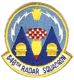 Emblem of the 648th Radar Squadron
Units:
- 648th Aircraft Control and Warning Squadron, activated on 30 Apr 1948 at Pine Camp, New York
- Moved in December 1949 to Indiantown Gap AIN, Pennsylvania
- Moved ca. 1 January 1951 to Mud Pond, Pennsylvania
- Moved to Ricketts Glen State Park, Pennsylvania on 1 February 1952
- Site redesignated Benton Air Force Station, 1 December 1953.
- Redesignated 648th Radar Squadron (SAGE), 1 February 1959
- Redesignated 648th Radar Squadron, 1 February 1974
- Inactivated on 30 June 1975
Assignments:
- 503d Aircraft Control and Warning Group, 20 April 1948
- 26th Air Division, 6 February 1952
- 4710th Defense Wing, 10 February 1953
- 4709th Defense Wing, 30 June 1953
- 4707th Air Defense Wing, 8 July 1956
- 4622d Air Defense Wing, 18 October 1956
- Boston Air Defense Sector, 8 January 1957
- Syracuse Air Defense Sector, 15 August 1958
- Boston Air Defense Sector, 4 September 1963
- 35th Air Division, 1 April 1966
- 21st Air Division, 19 November 1969-30 June 1975
See also
- List of USAF Aerospace Defense Command General Surveillance Radar Stations
References
 This article incorporates public domain material from websites or documents of the Air Force Historical Research Agency.
- ^ a b c d e f g h i j k Bartizek, Ron (November 13, 2005). "A Cold War outpost: Radar installation was part of North American defense system scanning for sneak attacks". The Times Leader: p. 1B. http://www.radomes.org/museum/documents/BentonAFSPAlookingback.html. Retrieved May 20, 2010.
- ^ "Ricketts Glen State Park Official map" (pdf). Pennsylvania Department of Conservation and Natural Resources. http://www.dcnr.state.pa.us/stateparks/parks/rickettsglen/rickettsglen_mini.pdf. Retrieved 2010-05-20.
- ^ a b c d e "Air Defense Radar Stations: Information for Benton AFS, Pennsylvania". Radomes.org. http://www.radomes.org/museum/showsite.php?site=Benton+AFS,+PA. Retrieved 2010-05-31.
- ^ "What Is Job Corps?". Job Corps. September 25, 2009. http://recruiting.jobcorps.gov/en/about.aspx. Retrieved May 21, 2010.
- Cornett, Lloyd H. and Johnson, Mildred W., A Handbook of Aerospace Defense Organization 1946 - 1980, [1] Office of History, Aerospace Defense Center, Peterson AFB, CO (1980).
- Winkler, David F. & Webster, Julie L., Searching the Skies, The Legacy of the United States Cold War Defense Radar Program, [2] US Army Construction Engineering Research Laboratories, Champaign, IL (1997).
- Information for Benton AFS, PA
External links
Bases CONUSAdair · Beale · Bong (unbuilt) · Charleston · Davis-Monthan · Dobbins · Dover · Dow · Duluth · England · Ent · Ethan Allen · Fairfax · Fort Lee · Geiger · George · Glasgow · Grand Forks · Grenier · Griffiss · Gunter · Hamilton · Hancock · Homestead · Hurlburt · Imeson · K.I. Sawyer · Kincheloe · Kingsley · Kirtland · Larson · Luke · March · Malmstrom · McCoy · McChord · McClellan · McGhee Tyson · McGuire · Minneapolis-St. Paul · Minot · Mitchel · New Castle · Niagara Falls · Norton · O'Hare · Oklahoma City · Otis · Oxnard · Paine · Perrin · Peterson · Pittsburgh · Pope · Portland · Presque Isle · Richards-Gebaur · Selfridge · Seymour Johnson · Sioux City · Snelling · Stead · Stewart · Suffolk County · Tinker · Travis · Truax · Tyndall · Vandenburg · Webb · Westover · Willow Run · Wright-Patterson · Wurtsmith · Youngstown
OverseasErnest Harmon · Frobisher Bay · Goose Bay · Keflavik · Pepperrell · Thule · Topsham

Stations CONUSAlmaden · Charleston · Clear · Cross City · Benton · Empire · Mill Valley · Montauk · Mount Hebo · North Truro · Point Arena · Rye · Thomasville · Watertown
OverseasAlbrook
Air
Defense
unitsForcesAir
DivisionsSectorsAlbuquerque · Bangor · Boston · Chicago · Detroit · Duluth · Goose · Grand Forks · Great Falls · Iceland · Kansas City · Los Angeles · Minot · Montgomery · New York · Oklahoma City · Phoenix · Portland · Reno · Sault Sainte Marie · San Francisco · Seattle · Sioux City · Spokane · Stewart · Syracuse · Washington
WingsGroups1st · 4th · 10th · 14th · 15th · 23rd · 32nd · 33rd · 50th · 52nd · 53rd · 54th · 56th · 57th · 73rd · 78th · 79th · 81st · 82nd · 84th · 325th · 326th · 327th · 328th · 329th · 337th · 355th · 408th · 412th · 414th · 473rd · 475th · 476th · 478th · 500th · 501st · 502d · 503d · 507th · 514th · 515th · 516th · 517th · 518th · 519th · 520th · 521st · 525th · 527th · 528th · 529th · 530th · 533d · 534th · 564th · 566th · 567th · 568th · 575th · 678th · 701st · 4676th · 4700th · 4721st · 4722d · 4727th · 4728th · 4729th · 4730th · 4731st · 4732d · 4733d · 4734th · 4735th · 4756th
SquadronsAerospace Defense Command Fighter Squadrons · Aircraft Control and Warning Squadrons
Major
weapon
systemsElectronicFightersMissiles1 · 2 · 3 · 4 · 5
ShipsGuardian · Interceptor · Interdictor · Interpreter · Investigator · Locator · Lookout · Outpost · Pickett · Protector · Scanner · Searcher · Skywatcher · Tracer · Watchman · Vigil
Miscellaneous Air Defense Command Emblem Gallery (On Wikimedia Commons) · General Surveillance Radar StationsCategories:- Radar networks
- Radar stations of the United States Air Force
- Military facilities in Pennsylvania
- Aerospace Defense Command
- SAGE sites
- Closed facilities of the United States Air Force
- Buildings and structures in Sullivan County, Pennsylvania

Wikimedia Foundation. 2010.