- Olathe Air Force Station
-
Olathe Air Force Station 
Part of Air Defense Command (ADC) Type Air Force Station Coordinates 38°50′06″N 094°54′16″W / 38.835°N 94.90444°W Location code ADC ID: P-72, NORAD ID: Z-72 Built 1951 In use 1951-1968 Controlled by  United States Air Force
Garrison 738th Aircraft Control and Warning (latr Radar) Squadron 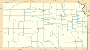
 Olathe AFSLocation of Olathe AFS, Kansas
Olathe Air Force Station is a former United States Air Force radar station that was located in Gardner, Kansas. It was located next to Naval Air Station Olathe, now the grounds of New Century AirCenter.
Contents
History
In 1950 the United States Air Force Air Defense Command selected Olathe NAS as a site for one of twenty-eight radar stations built as part of the second segment of the permanent ADC general radar surveillance network for the United States. Prompted by the start of the Korean War, on July 11, 1950, the Secretary of the Air Force asked the Secretary of Defense for approval to expedite construction of the second segment of the permanent network. Olathe was to provide defense radar coverage of the Kansas City area.
Receiving the Defense Secretary’s approval on July 21, the Air Force directed the Army Corps of Engineers to proceed with construction of a radar station on the western part of the ground station, about a mile from the runway and ramp/hangars being used by the Navy. Additional housing units were also constructed at Olathe to accommodate the Air Force personnel. The Federalized Utah Air National Guard 130th Aircraft Control and Warning Squadron was assigned to the site on 1 June 1951 at the facilities of the 2472d Air Force Reserve Training Command, and initially the station functioned as a Ground control intercept (GCI) and warning station. As a GCI station, the squadron's role was to guide interceptor aircraft toward unidentified intruders picked up on the unit's radar scopes. It was relieved from active duty and returned to control of the State of Utah on 1 February 1953.
The Ground Air Transmitting Receiving (GATR) Site for communications was located at 38°50′27″N 094°54′19″W / 38.84083°N 94.90528°W, approximately 0.4 miles north from the main site. Normally the GATR site was connected by a pair of buried telephone cables, with a backup connection of dual telephone cables overhead. The Coordinate Data Transmitting Set (CDTS) (AN/FST-2) at the main site converted each radar return into a digital word which was transmitted by the GATR via microwave to the Control Center.
The national guardsmen were replaced by the 738th Aircraft Control and Warning Squadron (AC&W) was activated at was was designated by ADC as Olathe Air Force Station, being designated P-72. The squadron began operations in using AN/CPS-4 and AN/FPS-3 radars. The AN/CPS-4 soon was replaced by an AN/FPS-4 set that in turn was superseded by a pair of AN/FPS-6A sets in 1958. In 1958 this site also replaced the AN/FPS-3 set with an AN/FPS-20 search radar.
Olathe AFS used these radars in conjection with the Nike missile Army Air-Defense Command Post (AADCP) KC-65DC (1959-1969). [1]
In 1958, the United States Army established an Air-Defense Command Post (AADCP) KC-65DC with the Air Force radar station at Olathe for Nike missile command-and-control functions as part of the Kansas City Defense Area. The site was equipped with the AN/GSG-5(V) BIRDIE solid-state computer system. The Army radars were fully integrated with the Air Force network, and both Army and Air Force personnel operated the radars.
In addition to the main facility, Olathe AFS operated the AN/FPS-14 Gap Filler site:
- Garlan, KS (P-72A) 37°45′40″N 094°38′51″W / 37.76111°N 94.6475°W
In late 1959 this station was also performing air-traffic-control duties for the Federal Aviation Administration (FAA). In the early 1960s the search radar was upgraded and redesignated as an AN/FPS-66. During late January 1961 Olathe AFS joined the Semi Automatic Ground Environment (SAGE) system, feeding data to DC-22 at Sioux City AFS, Iowa. After joining, the squadron was re-designated as the 793d Radar Squadron (SAGE) on 1 February 1962.
The radar squadron provided information 24/7 the SAGE Direction Center where it was analyzed to determine range, direction altitude speed and whether or not aircraft were friendly or hostile. On 31 July 1963, the site was redesignated as NORAD ID Z-72. Over the years, the equipment at the station was upgraded or modified to improve the efficiency and accuracy of the information gathered by the radars.
In September 1968 the Air Force deactivated the 738th Radar Squadron due to budget reductions and a general phase-down of Air Defense Command. The Army inactivated the Nike-Hercules AADCP in 1969[2][3][4]
See also
- List of USAF Aerospace Defense Command General Surveillance Radar Stations
References
 This article incorporates public domain material from websites or documents of the Air Force Historical Research Agency.
- ^ Wikimapia: Nike Site KC-65DC
- ^ This article incorporates public domain material from websites or documents of the Air Force Historical Research Agency.
- ^ A Handbook of Aerospace Defense Organization 1946 - 1980, by Lloyd H. Cornett and Mildred W. Johnson, Office of History, Aerospace Defense Center, Peterson Air Force Base, Colorado
- ^ Winkler, David F. (1997), Searching the skies: the legacy of the United States Cold War defense radar program. Prepared for United States Air Force Headquarters Air Combat Command.
External links
Bases CONUSAdair · Beale · Bong (unbuilt) · Charleston · Davis-Monthan · Dobbins · Dover · Dow · Duluth · England · Ent · Ethan Allen · Fairfax · Fort Lee · Geiger · George · Glasgow · Grand Forks · Grenier · Griffiss · Gunter · Hamilton · Hancock · Homestead · Hurlburt · Imeson · K.I. Sawyer · Kincheloe · Kingsley · Kirtland · Larson · Luke · March · Malmstrom · McCoy · McChord · McClellan · McGhee Tyson · McGuire · Minneapolis-St. Paul · Minot · Mitchel · New Castle · Niagara Falls · Norton · O'Hare · Oklahoma City · Otis · Oxnard · Paine · Perrin · Peterson · Pittsburgh · Pope · Portland · Presque Isle · Richards-Gebaur · Selfridge · Seymour Johnson · Sioux City · Snelling · Stead · Stewart · Suffolk County · Tinker · Travis · Truax · Tyndall · Vandenburg · Webb · Westover · Willow Run · Wright-Patterson · Wurtsmith · Youngstown
OverseasErnest Harmon · Frobisher Bay · Goose Bay · Keflavik · Pepperrell · Thule · Topsham

Stations CONUSAlmaden · Charleston · Clear · Cross City · Benton · Empire · Mill Valley · Montauk · Mount Hebo · North Truro · Point Arena · Rye · Thomasville · Watertown
OverseasAlbrook
Air
Defense
unitsForcesAir
DivisionsSectorsAlbuquerque · Bangor · Boston · Chicago · Detroit · Duluth · Goose · Grand Forks · Great Falls · Iceland · Kansas City · Los Angeles · Minot · Montgomery · New York · Oklahoma City · Phoenix · Portland · Reno · Sault Sainte Marie · San Francisco · Seattle · Sioux City · Spokane · Stewart · Syracuse · Washington
WingsGroups1st · 4th · 10th · 14th · 15th · 23rd · 32nd · 33rd · 50th · 52nd · 53rd · 54th · 56th · 57th · 73rd · 78th · 79th · 81st · 82nd · 84th · 325th · 326th · 327th · 328th · 329th · 337th · 355th · 408th · 412th · 414th · 473rd · 475th · 476th · 478th · 500th · 501st · 502d · 503d · 507th · 514th · 515th · 516th · 517th · 518th · 519th · 520th · 521st · 525th · 527th · 528th · 529th · 530th · 533d · 534th · 564th · 566th · 567th · 568th · 575th · 678th · 701st · 4676th · 4700th · 4721st · 4722d · 4727th · 4728th · 4729th · 4730th · 4731st · 4732d · 4733d · 4734th · 4735th · 4756th
SquadronsAerospace Defense Command Fighter Squadrons · Aircraft Control and Warning Squadrons
Major
weapon
systemsElectronicFightersMissiles1 · 2 · 3 · 4 · 5
ShipsGuardian · Interceptor · Interdictor · Interpreter · Investigator · Locator · Lookout · Outpost · Pickett · Protector · Scanner · Searcher · Skywatcher · Tracer · Watchman · Vigil
Miscellaneous Air Defense Command Emblem Gallery (On Wikimedia Commons) · General Surveillance Radar StationsCategories:- SAGE sites
- Radar stations of the United States Air Force
- Aerospace Defense Command
- Closed facilities of the United States Air Force
- Radar networks

Wikimedia Foundation. 2010.