- Marysville, Kansas
-
Marysville, Kansas — City — Marysville water tower, 2009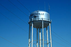 Location of Marysville, Kansas
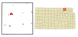 Detailed map of Marysville, Kansas
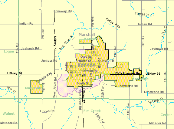
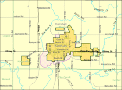
Coordinates: 39°50′41″N 96°38′33″W / 39.84472°N 96.6425°WCoordinates: 39°50′41″N 96°38′33″W / 39.84472°N 96.6425°W Country United States State Kansas County Marshall Area – Total 3.3 sq mi (8.5 km2) – Land 3.3 sq mi (8.4 km2) – Water 0.0 sq mi (0.0 km2) Elevation 1,161 ft (354 m) Population (2010)[1] – Total 3,294 – Density 998.2/sq mi (385.4/km2) Time zone Central (CST) (UTC-6) – Summer (DST) CDT (UTC-5) ZIP codes 66508, 66555 Area code(s) 785 FIPS code 20-45050[2] GNIS feature ID 0472911[3] Website City Website Marysville is a city in and the county seat of Marshall County, Kansas, United States.[4] As of the 2010 census, the city population was 3,294.[1]
Contents
History
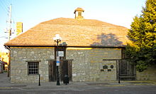 Pony Express Station, 2010
In 1851, Francis J. (Frank) Marshall of Weston, Missouri arrived on the bank of the Big Blue River. He came here to establish a trading post and to operate a ferry. On November 11, 1854 Marshall opened the first civilian Post Office in the Territory of Kansas. Marshall lent his name to the county, and Marysville was named to honor his wife Mary.[citation needed]
Mr. Marshall charged up to $5.00 per wagon and 25 cents per head of livestock to use his rope powered ferry across the Big Blue river, which operated until replaced by a bridge in 1864. He was a pro slavery candidate for governor in 1857.[citation needed]
Marysville was located on the Oregon Trail, the Mormon Trail, and the route of the Pony Express, the St. Joe Road, the Overland Stage, The Military Road, and the Otoe-Missouria Trail. British explorer Richard Francis Burton en route to California in 1860 noted: "Passing by Marysville, in old maps Palmetto City, a country-town which thrives by selling whiskey to ruffians of all descriptions ..."[5] The old Pony Express Station still stands in downtown Marysville.[citation needed]
Marysville owes much of its prosperity to the Union Pacific Railroad. The railroad has been a major employer in the town for nearly 100 years. Over 60 trains pass through the town daily and the railroad recently completed an underpass which redirects the tracks below US-36, rather than crossing the highway and backing up traffic.[citation needed]
Marysville is also known as the "Black Squirrel City" due to an isolated community of all-black squirrels that make their homes in the town. The squirrels are said to be the result of escapees from a traveling circus.[6]
Geography
Marysville is located at 39°50′41″N 96°38′33″W / 39.84472°N 96.6425°W (39.844624, -96.642505).[7] According to the United States Census Bureau, the city has a total area of 3.3 square miles (8.5 km2), of which, 3.3 square miles (8.5 km2) of it is land and 0.31% is water.
Demographics
Historical populations Census Pop. %± 1990 3,359 — 2000 3,271 −2.6% 2010 3,294 0.7% U.S. Decennial Census As of the census[2] of 2000, there were 3,271 people, 1,437 households, and 865 families residing in the city. The population density was 1,004.2 people per square mile (387.4/km²). There were 1,614 housing units at an average density of 495.5 per square mile (191.2/km²). The racial makeup of the city was 98.04% White, 0.15% African American, 0.34% Native American, 0.49% Asian, 0.15% from other races, and 0.83% from two or more races. Hispanic or Latino of any race were 0.73% of the population.
There were 1,437 households out of which 26.9% had children under the age of 18 living with them, 51.1% were married couples living together, 6.5% had a female householder with no husband present, and 39.8% were non-families. 36.5% of all households were made up of individuals and 20.2% had someone living alone who was 65 years of age or older. The average household size was 2.19 and the average family size was 2.87.
In the city the population was spread out with 22.7% under the age of 18, 7.1% from 18 to 24, 24.6% from 25 to 44, 22.2% from 45 to 64, and 23.4% who were 65 years of age or older. The median age was 42 years. For every 100 females there were 89.7 males. For every 100 females age 18 and over, there were 85.3 males.
The median income for a household in the city was $31,250, and the median income for a family was $40,427. Males had a median income of $28,065 versus $18,063 for females. The per capita income for the city was $19,196. About 5.7% of families and 8.5% of the population were below the poverty line, including 8.5% of those under age 18 and 4.3% of those age 65 or over.
Notable people
- Kenneth W. Dam, Deputy Secretary of State (1982–1985)
- Ralph Nelson Elliott, accountant
- Louis T. Hardin, a.k.a. Moondog, composer, musician and poet
- Michael McClure, poet and playwright
- Kendra Wecker, collegiate and professional basketball player
See also
References
- ^ a b "2010 City Population and Housing Occupancy Status". U.S. Census Bureau. http://factfinder2.census.gov/faces/tableservices/jsf/pages/productview.xhtml?pid=DEC_10_PL_GCTPL2.ST13&prodType=table. Retrieved March 27, 2011.
- ^ a b "American FactFinder". United States Census Bureau. http://factfinder.census.gov. Retrieved 2008-01-31.
- ^ "US Board on Geographic Names". United States Geological Survey. 2007-10-25. http://geonames.usgs.gov. Retrieved 2008-01-31.
- ^ "Find a County". National Association of Counties. http://www.naco.org/Counties/Pages/FindACounty.aspx. Retrieved 2011-06-07.
- ^ Richard Burton, (1862) The Look of the West 1860, Lincoln: Univ. Nebraska Press, reprint, n.d., p.36.
- ^ "Marysville community home page". Blue Skyways. http://skyways.lib.ks.us/towns/Marysville/. Retrieved 2007-06-10.
- ^ "US Gazetteer files: 2010, 2000, and 1990". United States Census Bureau. 2011-02-12. http://www.census.gov/geo/www/gazetteer/gazette.html. Retrieved 2011-04-23.
Further reading
- History of the State of Kansas; William G. Cutler; A.T. Andreas Publisher; 1883. (Online HTML eBook)
- Kansas : A Cyclopedia of State History, Embracing Events, Institutions, Industries, Counties, Cities, Towns, Prominent Persons, Etc; 3 Volumes; Frank W. Blackmar; Standard Publishing Co; 944 / 955 / 824 pages; 1912. (Volume1 - Download 54MB PDF eBook),(Volume2 - Download 53MB PDF eBook), (Volume3 - Download 33MB PDF eBook)
External links
- City
- City of Marysville
- Marysville - Directory of Public Officials
- Marysville - Information
- Marysvillepedia
- Schools
- USD 364, local school district
- Maps
- Marysville City Map, KDOT
- Marshall County Map, KDOT
Municipalities and communities of Marshall County, Kansas Cities Axtell | Beattie | Blue Rapids | Frankfort | Marysville | Oketo | Summerfield | Vermillion | Waterville

Townships Balderson | Bigelow | Blue Rapids | Blue Rapids City | Center | Clear Fork | Cleveland | Cottage Hill | Elm Creek | Franklin | Guittard | Herkimer | Lincoln | Logan | Marysville | Murray | Noble | Oketo | Richland | Rock | St. Bridget | Vermillion | Walnut | Waterville | Wells
Unincorporated
communitiesGhost towns Bigelow | Irving
Categories:- Cities in Kansas
- County seats in Kansas
- Populated places in Marshall County, Kansas
- Pony Express stations
- Populated places established in 1851


Wikimedia Foundation. 2010.