- Mankato, Kansas
-
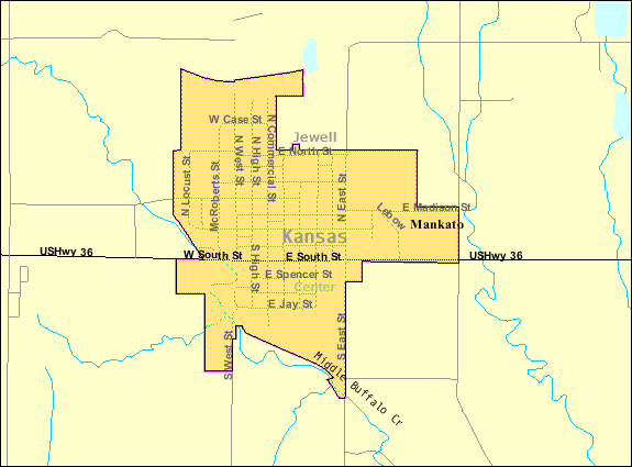
Mankato, Kansas — City — Location of Mankato, Kansas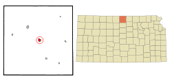 Detailed map of Mankato, Kansas
Coordinates: 39°47′14″N 98°12′33″W / 39.78722°N 98.20917°WCoordinates: 39°47′14″N 98°12′33″W / 39.78722°N 98.20917°W Country United States State Kansas County Jewell Area – Total 1.0 sq mi (2.6 km2) – Land 1.0 sq mi (2.6 km2) – Water 0.0 sq mi (0.0 km2) Elevation 1,775 ft (541 m) Population (2010)[1] – Total 869 – Density 869/sq mi (335.5/km2) Time zone Central (CST) (UTC-6) – Summer (DST) CDT (UTC-5) ZIP code 66956 Area code(s) 785 FIPS code 20-44300[2] GNIS feature ID 0471996[3] Website www.MankatoKS.com Mankato is a city in and the county seat of Jewell County, Kansas, United States.[4] As of the 2010 census, the city population was 869.[1]
Contents
Geography
Mankato is located at 39°47′14″N 98°12′33″W / 39.78722°N 98.20917°W (39.787220, -98.209274)[5]. According to the United States Census Bureau, the city has a total area of 1.0 square mile (2.6 km2), all of it land.
Demographics
Historical populations Census Pop. %± 1990 1,037 — 2000 976 −5.9% 2010 869 −11.0% U.S. Decennial Census As of the census[2] of 2000, there were 976 people, 436 households, and 256 families residing in the city. The population density was 964.0 people per square mile (373.1/km²). There were 509 housing units at an average density of 502.7 per square mile (194.6/km²). The racial makeup of the city was 98.67% White, 0.10% Asian, 0.20% from other races, and 1.02% from two or more races. Hispanic or Latino of any race were 0.92% of the population.
There were 436 households out of which 24.1% had children under the age of 18 living with them, 52.5% were married couples living together, 5.3% had a female householder with no husband present, and 41.1% were non-families. 39.0% of all households were made up of individuals and 21.3% had someone living alone who was 65 years of age or older. The average household size was 2.14 and the average family size was 2.86.
In the city the population was spread out with 21.8% under the age of 18, 4.5% from 18 to 24, 21.1% from 25 to 44, 23.0% from 45 to 64, and 29.6% who were 65 years of age or older. The median age was 46 years. For every 100 females there were 95.2 males. For every 100 females age 18 and over, there were 87.5 males.
The median income for a household in the city was $29,286, and the median income for a family was $41,429. Males had a median income of $30,000 versus $17,813 for females. The per capita income for the city was $17,457. About 4.9% of families and 9.2% of the population were below the poverty line, including 9.0% of those under age 18 and 10.5% of those age 65 or over.
Notable people
- Wint Smith (1892–1976) congressman representing Kansas 1947-61 [6]
References
- ^ a b "2010 City Population and Housing Occupancy Status". U.S. Census Bureau. http://factfinder2.census.gov/faces/tableservices/jsf/pages/productview.xhtml?pid=DEC_10_PL_GCTPL2.ST13&prodType=table. Retrieved March 6, 2011.
- ^ a b "American FactFinder". United States Census Bureau. http://factfinder.census.gov. Retrieved 2008-01-31.
- ^ "US Board on Geographic Names". United States Geological Survey. 2007-10-25. http://geonames.usgs.gov. Retrieved 2008-01-31.
- ^ "Find a County". National Association of Counties. http://www.naco.org/Counties/Pages/FindACounty.aspx. Retrieved 2011-06-07.
- ^ "US Gazetteer files: 2010, 2000, and 1990". United States Census Bureau. 2011-02-12. http://www.census.gov/geo/www/gazetteer/gazette.html. Retrieved 2011-04-23.
- ^ "Smith, Wint". Biographical Directory of the United States Congress. http://bioguide.congress.gov/scripts/biodisplay.pl?index=S000640. Retrieved 2011-08-04.
Further reading
- History of the State of Kansas; William G. Cutler; A.T. Andreas Publisher; 1883. (Online HTML eBook)
- Kansas : A Cyclopedia of State History, Embracing Events, Institutions, Industries, Counties, Cities, Towns, Prominent Persons, Etc; 3 Volumes; Frank W. Blackmar; Standard Publishing Co; 944 / 955 / 824 pages; 1912. (Volume1 - Download 54MB PDF eBook),(Volume2 - Download 53MB PDF eBook), (Volume3 - Download 33MB PDF eBook)
External links
- City
- Schools
- USD 107, local school district
- Maps
- Mankato City Map, KDOT
- Jewell County Map, KDOT
Municipalities and communities of Jewell County, Kansas County seat: MankatoCities 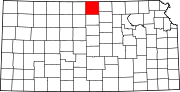
Townships Unincorporated
communitiesCategories:- Cities in Kansas
- County seats in Kansas
- Populated places in Jewell County, Kansas


Wikimedia Foundation. 2010.