- Coleraine
-
For other uses, see Coleraine (disambiguation).
Coordinates: 55°07′59″N 6°39′40″W / 55.133°N 6.661°W
Coleraine Scots: Cowlrain or Cowlraine[1][2][3][4] Irish: Cúil Raithin 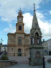
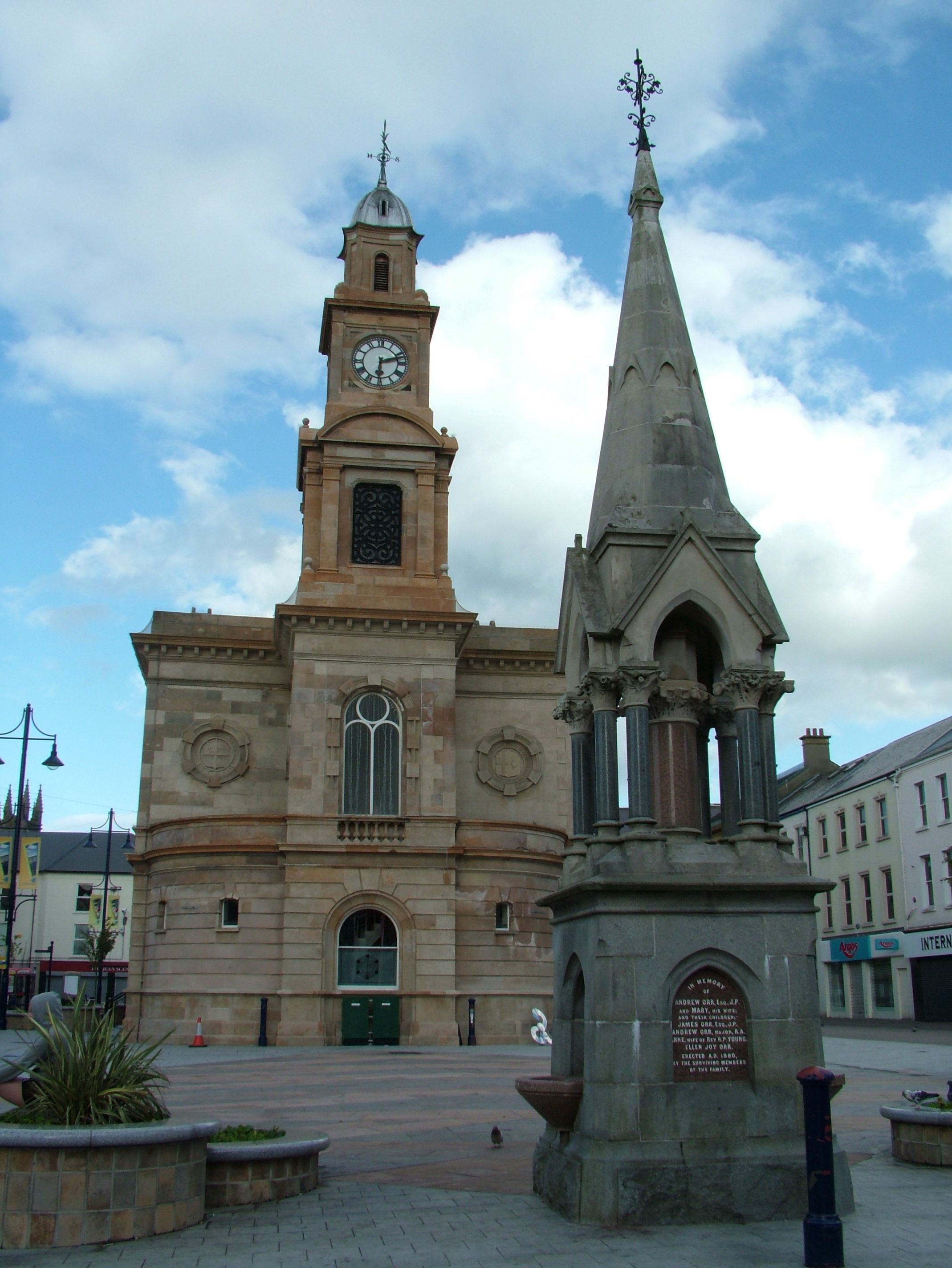
Coleraine town hall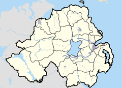

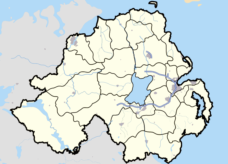
Coleraine shown within Northern IrelandPopulation 24,089 (2001 Census) Irish grid reference C844328 District Coleraine County County Londonderry Country Northern Ireland Sovereign state United Kingdom Post town COLERAINE Postcode district BT51, BT52 Dialling code 028 Police Northern Ireland Fire Northern Ireland Ambulance Northern Ireland EU Parliament Northern Ireland UK Parliament East Londonderry NI Assembly East Londonderry List of places: UK • Northern Ireland • County Londonderry Coleraine (pronounced /kəʊl reɪn/, from Irish: Cúil Raithin meaning "nook of the ferns"[5]) is a large town near the mouth of the River Bann in County Londonderry, Northern Ireland. It is 55 miles (88.5 km) northwest of Belfast and 30 miles (48.3 km) east of Derry, both of which are linked by major roads and railway connections. City of Derry Airport, 25 miles (40.2 km) to the west, Belfast International Airport, the main regional airport to the south and George Best Belfast City Airport to the south–east are all relatively accessible from Coleraine.
Contents
Description
Coleraine had a population of 24,042 people in the 2001 Census. Disposable income is well above the Northern Ireland average. The North Coast (Coleraine and Limavady) area has the highest property prices in Northern Ireland, higher indeed than those of affluent South Belfast.[6] Championship golf courses, scenic countryside and a host of leisure facilities and attractions are all on the doorstep. It has an attractive town centre, a marina and the prestigious Riverside theatre. Coleraine, during the day is a busy town, however at night the town is relatively quiet, with much of the night life in the area located in the nearby seaside towns of Portrush and Portstewart.
Coleraine is situated at the lowest bridgeable point of the River Bann, where the river is a quarter of a mile wide. The town square is called 'The Diamond' and is the location of the Town Hall. St. Patrick's Church of Ireland is situated nearby. The University of Ulster campus was built in the 1960s but is one of the better pieces of architecture from that era and has brought a high quality theatrical space to the town in the form of the Riverside Theatre, where the quality of production often belies the small size of the town.
Coleraine is the major commercial centre in the North West of Northern Ireland and has been designated as a major growth area in the Northern Ireland Development Strategy. Although the population of the town is only 24,000, Coleraine has a large catchment area. The town also has the advantage of being near some of the most extraordinary landscape in the whole of Europe. In 2002, Coleraine won the Best Kept Town and Ulster in Bloom awards. In 2003, it was selected to represent Northern Ireland in the prestigious Britain in Bloom competition. In the 2010 SuperValu Best Kept Awards Coleraine was named the Best Kept Large Town in Northern Ireland, this is a prestigious award which commends towns throughout Northern Ireland for their work to improve the local environment. It has its own local radio station: Q97.2FM
History
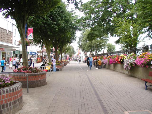
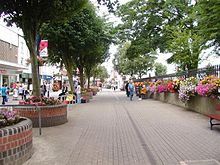 A pedestrian area in Coleraine
Coleraine has a long history of settlement. The Mesolithic site at Mount Sandel, which dates from approximately 5935 BC[7] is some of the earliest evidence of human settlement in Ireland.[8]
The Tripartite Life of Saint Patrick records how the town got its name. When Patrick arrived in the neighbourhood, he was received with great honour and hospitality by the local chieftain, Nadslua, who offered him a piece of ground on which to build a church. The spot was next to the river Bann and was overgrown with ferns, which were being burned by some boys to amuse themselves. This incident led to the area being called Cúil Raithin ("nook of ferns"), which was later anglicized as Colrain, Colerain and Coleraine. It was translated by Colgan into Latin as Secessus Filicis.
The town was one of the two urban communities developed by the London Companies in County Londonderry (hence, Londonderry) in the Plantation of Ulster at the start of the 17th century. The slightly skewed street pattern of Coleraine's town centre is legacy of that early exercise in town planning, along with traces of the lines of the ramparts that provided the Plantation town with its defences. In 1637 the Surveyor General of Customs issued a report compiled from accounts of customs due from each port and their "subsidiary creeks". Of the Ulster ports on the list, Carrickfergus was first, followed by Bangor, Donaghadee, and Strangford. Carlingford and Coleraine each had £244 customs due and had equal ranking.[9]
With some industrialisation, the expansion of the river port, and the development of the railway, the town expanded significantly throughout the 19th century and into the early part of the 20th century. Coleraine steadily expanded after the Second World War. The population doubled due to major industrial development on extensive suburban sites, the decision to site the New University of Ulster (now known as the University of Ulster) in the town, the expansion of commerce and the development of sporting and recreational facilities. There has been a steady expansion of the urban area from the mid 20th century compact town of less than 1¼ square miles (2 km²), to the present much more dispersed town of about 7 square miles (11 km²). During the Northern Irish Troubles 13 people were killed in or near Coleraine, ten of them in two separate car bomb explosions.
Since 1980 growth has continued but at a slightly more modest pace. In the twenty years to 2001 the town’s population increased by 22% to approximately 24,000 but the rate of increase fell from 12% in the 1980s to 8% in the 1990s.[10]
The Troubles
Main article: The Troubles in ColeraineGovernance
Coleraine has the headquarters of Coleraine Borough Council which are situated overlooking the River Bann.
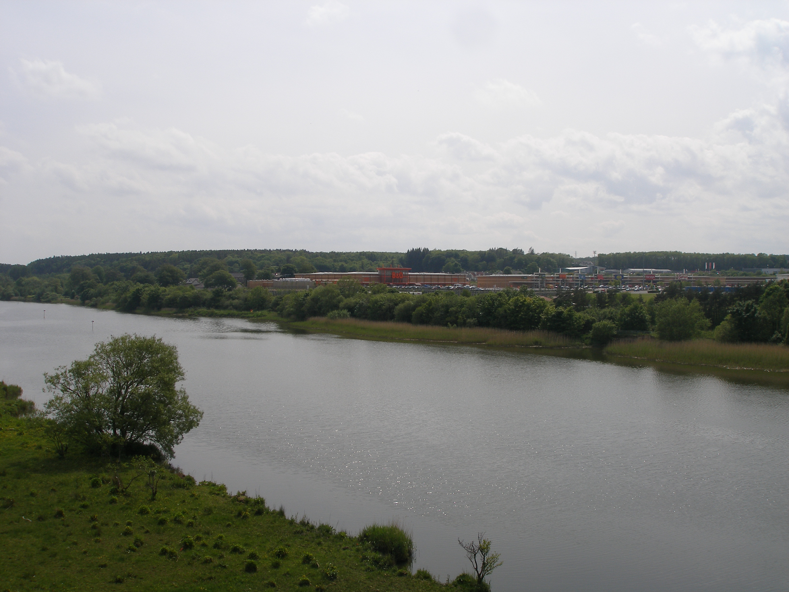
 Overlooking the River Bann
The Borough Council area together with the neighbouring district of Limavady, forms the East Londonderry constituency for elections to the Westminster Parliament and Northern Ireland Assembly, despite some of the borough being in County Antrim.
The Unionist-controlled Coleraine Borough Council operates a rotation for position of Mayor/Deputy Mayor between the Ulster Unionist Party (UUP), Democratic Unionist Party and the nationalist Social Democratic and Labour Party (SDLP).
Tourism
Coleraine is the main town of the world famous Causeway Coast, which attracts over two million visitors per year, spending in excess of £37 million .[11] The world famous Giant's Causeway is a twenty–five minute bus ride away. The distillery village of Bushmills is well-served by buses from the town and there is a narrow-gauge steam train running in the summer from Bushmills to the Giant's Causeway. Portrush, which is part of the Borough. The train journey takes approximately fifteen minutes from the town to the Causeway. Also north of Coleraine is the spectacularly scenic coastal town of Portstewart, with fine sandy beach and coastal walks.
North-west of Coleraine lies the small village of Castlerock, with a beach which is essentially a continuation of the beach at Portstewart, separated by the River Bann. Also nearby is the huge beach at Benone Strand and Mussenden Temple, built by Frederick Augustus Hervey, an 18th century Anglican bishop atop a precipitate cliff and overlooking County Donegal in one direction and Scotland in another. The National Trust managed Downhill forest was part of the Bishop's Palace, and although the Palace itself is now a ruin the gardens are a wonderful place full of strange hidden lakes and gloriously tended flower gardens.
Climate
As with the rest of the British Isles, Coleraine experiences a maritime climate with cool summers and mild winters. The nearest official Met Office weather station for which online records are available is at nearby Coleraine university[12], about 1 mile North of the town centre. However, observations ceased a few years ago and the nearest current Met Office weather observing station is at Movanagher, about 12 miles to the south. Rainfall at Coleraine typically peaks at over 100mm during the month of October. The driest month is May, with an average of under 60mm.[13] On average, 173 days of the year will report at least 1mm of rain, ranging from 18 days in January to 11 days during June.
Climate data for Coleraine University, 1971-2000 23m asl (Weather station 1 mile (2 km) to the North of Coleraine town centre) Month Jan Feb Mar Apr May Jun Jul Aug Sep Oct Nov Dec Year Average high °C (°F) 6.9
(44.4)7.1
(44.8)9.2
(48.6)11.9
(53.4)15.9
(60.6)16.9
(62.4)18.0
(64.4)17.8
(64.0)16.8
(62.2)12.9
(55.2)9.8
(49.6)7.3
(45.1)12.54
(54.58)Average low °C (°F) 1.6
(34.9)1.6
(34.9)2.8
(37.0)3.9
(39.0)6.0
(42.8)9.0
(48.2)11.0
(51.8)10.7
(51.3)8.8
(47.8)6.7
(44.1)3.7
(38.7)2.0
(35.6)5.65
(42.17)Source: YR.NO[14] Places of interest
The east side of the town is distinguished by Mountsandel Forest, which contains the impressive Mount Sandel fort, an ancient site which has been claimed as the oldest site of human settlement in Ireland. Here wooden houses dating from about 7000 BC were uncovered .[15][16] The fort can be accessed via Mountsandel forest, the closest entrance being the side near the Coleraine Courthouse. There is another fort about 2 miles south from Mountsandel one near a small village called the Loughan.
Notable people
- Well-known people from Coleraine include the actor James Nesbitt, the novelist Maggie O'Farrell, David Cunningham from the band The Flying Lizards, the Ulster and Ireland rugby union player Andrew Trimble, British ladies' figure skating champion Jenna McCorkell, Folk Singer Damien O' Kane and Olympic Rower Alan Campbell.
- Coleraine was also the home of Andrew Bonar Law, Prime minister of the United Kingdom for a short period in the 1920s. He lived in the manse beside the 1st Coleraine Presbyterian Church on Abbey Street.
- Dave McElfatrick, co-writer of acclaimed comic Cyanide & Happiness is a native of the town.
- Suspected serial killer John Bodkin Adams, lived in Coleraine (in the Mountsandel area) from 1911 to 1916 and attended the Coleraine Academical Institution. He became a general practitioner and worked in Eastbourne from 1922. He was charged in 1957 with the murder of 2 patients but was acquitted. He was, however, suspected of causing the death of 163 other patients.[17]
- The ancestors of James Knox Polk, 11th President of the United States, were among the first Ulster-Scots settlers, emigrating from Coleraine in 1680 to become a powerful political family in Mecklenburg County, North Carolina.
- Davy Boyle, the Caring Caretaker, caretaker of Coleraine Town Hall has for years been raising large amounts of money for charity. Every year he undertakes a 'sit out' in December[18] and he has received an MBE for his efforts.
- W. Speedy Moore, a musician, a storyteller, a fisherman, and an award-winning journalist who received the MBE and saw his achievements as a must-read columnist for The Coleraine Chronicle earn the reading of a special citation in the British House Of Commons.[19]
- Noted mathematical physicist Sir Thomas Ranken Lyle, pioneer of X-ray technology in Australia and former Ireland international rugby union player.
- Jayne Wisener, best known for playing the role of Johanna, in Sweeney Todd: The Demon Barber of Fleet Street grew up in Coleraine, where she attended Coleraine High School for girls.
Education
Coleraine has an outstanding variety of educational institutions at all levels.
Primary and Secondary Schools
The local schools include:
- Saint John's Primary School
- Irish Society's Primary School
- Coleraine Academical Institution: Grammar school for boys
- Coleraine College
- Saint Joseph's Co-educational Roman Catholic Secondary School
- Coleraine High School: Grammar school for girls
- D.H Christie Memorial Primary School
- Killowen Primary School
- Loreto College, Coleraine: Co-educational Roman Catholic grammar school
- Millburn Primary School
- Saint Malachy's Primary School
- North Coast Integrated College: Non-denominational
- Macosquin Primary School
Tertiary
Coleraine is the location of a University of Ulster campus and houses the university's administration buildings. It is the original campus of what was originally the New University of Ulster which merged with the former Ulster Polytechnic at Jordanstown just north of Belfast in the early 1980s to form the present-day institution. It is noted as a world-class centre of research for biomedical sciences.
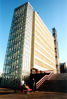
 Coleraine is the primary campus of the University of Ulster
The Causeway Institute is a College of Further and Higher Education based in Coleraine, with another campus in nearby Ballymoney.
Transport
- Coleraine railway station opened on 4 December 1855 and was closed for goods traffic on 4 January 1965.[20]
Sport
Coleraine itself contains Coleraine Rugby Club, established in 1921, Coleraine F.C., established in 1927 and currently in the IFA Premiership and CLG Eoghan Rua established in 1957. Coleraine is one of the hosting towns for the Milk Cup. Coleraine also makes part of the circuit for the North West 200, a series of motorcycle road races organised by the Coleraine and District Motor Club.
Coleraine Cricket Club plays in the North West Senior League.
Within the local area, but not within Coleraine are a number of well known golf courses including Castlerock Golf Club, Royal Portrush Golf Club and Portstewart Golf Club.
Coleraine has a significant equestrian fraternity, with a number of clubs in the vicinity - of particular interest is RDA Coleraine (Riding for the Disabled Association (Coleraine & District Group), which provides Riding opportunities for persons with a physical and/or learning disability at their £1.75 million RDA Causeway Coast Arena at Castleroe (see website www.rdacoleraine.org). The new Arena was funded by SportNI, Coleraine Borough Council, and by donations from the people of the District. The conditions of grant aid included the provision of a first class sporting arena for RDA, the equestrian fraternity, and other sporting activities. Especially important is the development of The OWLS Sports Club (Opportunities Without Limits), which will coordinate the development of a range of different sporting opportunities for persons with physical and/or learning eisabilities, and in many cases their siblings. To facilitate this process SportNI has funded the provision of a Sports Development Officer (contactable via the website above).
2001 Census
Coleraine is classified as a Large Town (i.e. with population between 18,000 and 75,000 people).[21] On Census day (29 April 2001) there were 24,089 people living in Coleraine. Of these:
- 24.6% were aged under 16 years and 16.4% were aged 60 and over
- 47.3% of the population were male and 52.7% were female
- 22.7% were from a Catholic background and 73.5% were from a Protestant background
- 4.7% of people aged 16–74 were unemployed.
For more details see: NI Neighbourhood Information Service
Coleraine internationally
As with many Northern Irish towns, Coleraine is duplicated across the world - Coleraine in Minnesota, United States for example. In 1853, a surveyor named Lindsay Clarke was working on a township called Bryans Creek Crossing in Victoria, Australia. He renamed the town Coleraine.[22]
A wine from New Zealand, Te Mata Estate's Coleraine Cabernet/Merlot, is named after the town.[23]
The Zomba Action Project is a charity founded in 2003 under the guidance of Coleraine Borough Council to aid the municipality of Zomba in southern Malawi, which aims to help some of the citizens of that region to build a better life for themselves and their children. The region was chosen due to the historical connections between the Presbyterian and Catholic churches and Malawi, sustained by a number of specific local contacts. Donations have been used to fund computers, education, medical and other projects.[24]
A street in Montreal, Canada is named Coleraine in Pointe-Saint-Charles, which once was an Irish neighbourhood
See also
- Coleraine cheddar
- County Coleraine
- List of towns in Northern Ireland
- List of villages in Northern Ireland
- O'Cahan
- University of Ulster
- Triangle Area, Northern Ireland
References
- ^ North/South Ministerial Council – 2003 annual report in Ulster-Scots
- ^ North/South Ministerial Council – 2001 annual report in Ulster-Scots
- ^ Ulster-Scots guide to Beaghmore stone circles – Department of the Environment
- ^ Yeirly Report 2007 Tourism Ireland.
- ^ Flanaghan, Deirdre & Laurence; Irish Place Names, page 194. Gill & Macmillan, 2002. ISBN 0-7171-3396-6
- ^ University of Ulster Quarterly House Price Index report produced in partnership with Bank of Ireland and the Northern Ireland Housing Executive - March 2006
- ^ The Statesman's Yearbook 2007, Macmillan Publishing, page 678, edited by Barry Turner, ISBN 10-1403992762/ISBN 13-97814039092765
- ^ C.Michael Hogan. 2011. Celtic Sea. eds. P.Saundry & C.Cleveland. Encyclopedia of Earth. National Council for Science and the Environment. Washington DC.
- ^ O'Sullivan, Aidan & Breen, Colin (2007). Maritime Ireland. An Archaeology of Coastal Communities. Stroud: Tempus. p. 212. ISBN 978-0-7524-2509-2.
- ^ http://www.planningni.gov.uk/areaplans_policy/plans/Northern/draft_plan/Volume2/Part5/Coleraine/DevelopmentContext.htm Planning service Draft Northern Area Plan, Accessed 27 December 2006
- ^ "Investing in Coleraine". Capital of the Causeway Coast. Archived from the original on 2007-06-07. http://web.archive.org/web/20070607212748/http://www.coleraine.co.uk/htmlsite/investing.asp?step=2&id=4&pstring=4. Retrieved 2007-09-14.
- ^ "Station locations". MetOffice. http://www.metoffice.gov.uk/climate/uk/ni/images/locations.jpg/.
- ^ "Coleraine Rainfall". MetOffice. http://www.metoffice.gov.uk/climate/uk/ni/images/coleraineuniversity_rainfall.gif/.
- ^ "Coleraine 1971-2000 averages". YR.NO. http://www.yr.no/place/United_Kingdom/Northern_Ireland/Coleraine/statistics.html. Retrieved 20 sep 2011.
- ^ "Mount Sandel, Ireland". about.com. http://archaeology.about.com/od/mesolithicarchaic/a/mount_sandel.htm. Retrieved 2007-09-14.
- ^ "Prehistory". Causeway Coast and Glens Heritage Trust. Archived from the original on 2007-09-22. http://web.archive.org/web/20070922074601/http://www.ccght.org/environmental_management/cultural_heritage/prehistory/. Retrieved 2007-09-14.
- ^ Cullen, Pamela V., "A Stranger in Blood: The Case Files on Dr John Bodkin Adams", London, Elliott & Thompson, 2006, ISBN 1-904027-19-9
- ^ Davy and his 'dreamcoat'! Coleraine Times website 2009-11-18 Retrieved 2009-12-04
- ^ Speedy Moore: He touched all our lives Coleraine Times website 2008-08-05 Retrieved 2011-08-28
- ^ "Coleraine station" (PDF). Railscot - Irish Railways. http://www.railscot.co.uk/Ireland/Irish_railways.pdf. Retrieved 2007-08-30.
- ^ http://www.nisra.gov.uk/archive/urbanreport.pdf NI Statistics and Research Agency (NISRA). Accessed 27 December 2006
- ^ http://www.smh.com.au/news/Victoria/Coleraine/2005/02/17/1108500206358.html Accessed on 27 December 2006
- ^ "Te Mata - COLERAINE CABERNET/MERLOT". http://www.temata.co.nz/index.php?Cid=100092&Aid=60. Retrieved 2008-05-15.
- ^ "Zomba". Coleraine Borough Council Web Site. Coleraine Borough Council. http://www.colerainebc.gov.uk/zomba/show.php?s=1&id=4. Retrieved 2008-06-14.
External links
- Activ Coleraine - an online guide to Coleraine
- Coleraine Borough Council
- Coleraine Community Safety Partnership
- Coleraine Youth Forum
- River Bann, Ireland - Coleraine visitor information
Towns in Northern Ireland List of towns by population Large Antrim · Ballymena · Bangor · Carrickfergus · Coleraine · Larne ·
Lisburn · Lurgan · Newry · Newtownabbey · Newtownards · Omagh · Portadown
Medium Small Ballycastle · Ballyclare · Ballymoney · Ballynahinch · Carryduff · Coalisland · Comber · Donaghadee ·
Drumore · Kilkeel · Magherafelt · Newcastle · Portrush · Portstewart · Randalstown · WarrenpointCategories:- Coleraine
- Towns in County Londonderry
- University towns in the United Kingdom


Wikimedia Foundation. 2010.