- Newtownabbey
-
Coordinates: 54°39′25″N 5°54′25″W / 54.657°N 5.907°W
Newtownabbey Irish: Baile Nua na Mainistreach 
Overlooking the Rathcoole area of Newtownabbey from Cavehill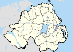

Newtownabbey shown within Northern IrelandPopulation 62,056 (2001 Census) District Newtownabbey County County Antrim Country Northern Ireland Sovereign state United Kingdom Post town NEWTOWNABBEY Postcode district BT36, BT37 Dialling code 028 Police Northern Ireland Fire Northern Ireland Ambulance Northern Ireland EU Parliament Northern Ireland NI Assembly East Antrim List of places: UK • Northern Ireland • Antrim Newtownabbey is a large town north of Belfast in County Antrim, Northern Ireland. Sometimes considered to be a suburb of Belfast, it is separated from the rest of the city by Cavehill and Fortwilliam golf course. At the 2001 Census, Newtownabbey Urban Area had a population of 62,056, making it the fourth largest settlement in Northern Ireland.
Most of Newtownabbey is composed of housing estates. It is also home to many engineering and computer industries. Retail and leisure facilities include Abbey Centre, Northcott Shopping Centre and Glengormley Moviehouse. The main campus for the University of Ulster is based in the Jordanstown area of Newtownabbey.
Contents
History
Newtownabbey Urban Area covers the former civil parish of Carnmoney. It was formed by the merging of seven villages; Carnmoney, Glengormley, Jordanstown, Monkstown, Whiteabbey, Whitehouse and Whitewell. It was brought into being on 1 April 1958.
In 1973, Ballyclare and its rural hinterland were added to the Newtownabbey Urban District Council to form the new Newtownabbey District Council, which was later awarded the status of borough.
The government has proposed new council structures for all of Northern Ireland. As a result, Newtownabbey Borough Council will be subsumed into Inner East Council.[1]
The Troubles
For more information see The Troubles in Newtownabbey, which includes a list of incidents in Newtownabbey during The Troubles resulting in two or more fatalities.
Geography
 The Glengormley area of Newtownabbey from Cavehill
Townlands
Below is a list of townlands that are within Newtownabbey's urban area, alongside their likely etymologies.
- Ballybought (from Irish: Baile Bocht, meaning "poor town")*
- Ballyduff (historically Ballymacelduffe; from Baile Mhic Giolla Dhuibh meaning "MacElduff's townland")*
- Ballygolan (historically Ballingowlan; from Baile an Ghabhláin or Baile Gobhláin meaning "townland of the fork")*
- Ballyhenry (from Baile Enri meaning "Henry's townland")*
- Ballyvesey (from Baile Feasoighe meaning "Vesey's townland")*
- Ballywonard (from Baile Mhuine Ard meaning "townland of the high thicket")*
- Carnmoney (from Carn Monaidh meaning "cairn of the bog")*
- Collinward (from Coll an Bháird meaning "the bard's hazel")*
- Croghfern (historically Ballycurraghfarny; from Cruach Fearna meaning "stack of the alder" or Currach Fearnaí meaning "marsh of the place of alders")*
- Drumnadrough (from Druimainn Dorcha meaning "dark ridge" or Druim na gCruach meaning "ridge of the stacks")
- Dunanney (from Dún Aine meaning "Aine's stronghold")*
- Glengormley (from Gleann Ghormlaithe meaning "blue-grey valley")*
- Jordanstown (historically Ballyjordan and Ballyjurdan; from Baile Mhic Shiúrtáin meaning "MacShiúrtáin's townland")
- Mallusk or Molusk (historically Moyvluske and Moyvliske; from Maigh Bhloisce meaning "Bloisce's plain")*
- Monkstown (historically Ballynamanagh; from Baile na Manach meaning "townland of the monks")
- Whiteabbey
- Whitehouse, part of which includes Merville Garden Village
* citation for derivations [2]
The following housing estates have Irish-derived names, although they are not named after townlands:[3]
Electoral wards
- University
(Rostulla, Hawthorne, Jordanstown, Monkstown, Ballyduff, Carnmoney and Mossley)
- Ballyclare
(Ballyclare North, Ballyclare South, Ballyrobert, Doagh and Ballynure)
- Macedon
(Cloughfern, Coole, Dunanney, Valley, Abbey and Whitehouse)
- Antrim Line
(Mallusk, Colinbridge,Hightown, Ballyhenry, Burnthill, Glengormley and Glebe)
Demography
Newtownabbey Urban Area is classified as a large town (i.e. with population between 18,000 and 75,000 people) by the Northern Ireland Statistics and Research Agency (NISRA)[4] and is within the Belfast Metropolitan Urban Area (BMUA). On Census day (29 April 2001) there were 62,056 people living in Newtownabbey. Of these:
- 21.8% were aged under 16 years and 19.1% were aged 60 and over
- 48.1% of the population were male and 51.9% were female
- 19.4% were from a Catholic background and 76.2% were from a Protestant background.
- 3.2% of people aged 16–74 were unemployed.
For more details see: Northern Ireland Neighbourhood Information Service[5]
Education
- Higher-level education
- University of Ulster at Jordanstown (UUJ)
- Northern Regional College (NRC)
- Secondary-level education
- Belfast High School
- Edmund Rice College
- Glengormley High School
- Monkstown Community School
- Newtownabbey Community High School
- Primary-level education
- Abbots Cross Primary School
- Ashgrove Primary School[6]
- Carnmoney Primary School[7]
- EarlView Primary School
- Glengormley Integrated Primary School
- Hazelwood Integrated Primary School
- HillCroft Special Needs School
- Hollybank Primary School
- Jordanstown Schools for the Deaf and Blind
- Kings Park Primary School
- Mossley Primary School
- Rosstulla Special School
- St Bernard's Primary School
- St James’s Primary School
- St MacNissi's Primary School
- St Mary's on the Hill Primary School
- Thornfield House School
- Whiteabbey Primary School
- Whitehouse Primary School
Sport
- Academy Cricket Club
- Cliftonville Cricket Club
- St Enda's GAC
- Others
- Belfast International Sports Club
- Valley Ju-jitsu Club (WJJF)
Churches
- Abbey Presbyterian Church
- Monkstown Baptist Church
- Saint James’s Catholic Church
- St. Patrick's Church (Church of Ireland)
- The Church of Jesus Christ of Latter-day Saints
- Whiteabbey Congregational Church
- Whiteabbey Methodist Church
- Whiteabbey Presbyterian Church
- The Church of the Good Shepherd (United Church of Ireland and Methodist)
- Trinity Reformed Presbyterian Church
Transport
Newtownabbey is linked to the M2 motorway (which passes through it) and the M5 motorway (which begins at its southeastern edge). It is also served by two railway stations: Jordanstown railway station on the Belfast–Larne railway line and Whiteabbey railway station on the Belfast–Derry railway line.
Twin towns
Newtownabbey is twinned with:
Newtownabbey has one sister city, as designated by Sister Cities International:
References
- ^ Local Government Boundaries Commissioner for Northern Ireland Provisional Recommendations
- ^ "Northern Ireland Placenames Project". http://www.placenamesni.org/Index.html. Retrieved 12 June 2010.
- ^ Placenames Database of Ireland
- ^ Northern Ireland Statistics and Research Agency website.
- ^ Northern Ireland Neighbourhood Information Service website.
- ^ Schools Web Directory entry for Ashgrove
- ^ Schools Web Directory entry for Carnmoney Primary
- ^ "Rybnik Official Website - Twin Towns". 2008 Urząd Miasta Rybnika. http://www.rybnik.pl/index.php?id=324. Retrieved 2008-11-01.
- ^ "List of Twin Towns in the Ruhr District". © 2009 Twins2010.com. http://www.twins2010.com/fileadmin/user_upload/pic/Dokumente/List_of_Twin_Towns_01.pdf?PHPSESSID=2edd34819db21e450d3bb625549ce4fd. Retrieved 2009-10-28.
External links
- Culture Northern ireland
- Newtownabbey Today website of the Newtownabbey Times Newspaper
- Newtownabbey In Touch website of the Newtownabbey In Touch Magazine
Towns in Northern Ireland List of towns by populationLarge 
Medium Small Ballycastle · Ballyclare · Ballymoney · Ballynahinch · Carryduff · Coalisland · Comber · Donaghadee ·
Drumore · Kilkeel · Magherafelt · Newcastle · Portrush · Portstewart · Randalstown · WarrenpointCategories:- Towns in County Antrim


Wikimedia Foundation. 2010.