- Coalisland
-
Coordinates: 54°32′31″N 6°41′38″W / 54.542°N 6.694°W
Coalisland Scots: Collislann[1] Irish: Oileán an Ghuail 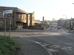
View from the north of the town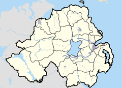

Coalisland shown within Northern IrelandPopulation 4,917 (2001 Census) Irish grid reference H8366 - Belfast 35 miles District Dungannon and South Tyrone County County Tyrone Country Northern Ireland Sovereign state United Kingdom Post town DUNGANNON Postcode district BT71 Dialling code 028 Police Northern Ireland Fire Northern Ireland Ambulance Northern Ireland EU Parliament Northern Ireland UK Parliament Mid Ulster NI Assembly Mid Ulster List of places: UK • Northern Ireland • Tyrone Coalisland is a small town in County Tyrone, Northern Ireland, with a population of 4,917 people (in the 2001 Census). As its name suggests, it was formerly a centre for coal mining.
Contents
History
On 24 August 1968, the Campaign for Social Justice (CSJ), the Northern Ireland Civil Rights Association (NICRA), and other groups, held the first 'civil rights march' in Northern Ireland from Coalisland to Dungannon. The rally was officially banned, but took place and passed off without incident. The publicity surrounding the march encouraged other protesting groups to form branches of the NICRA.[2]
The Troubles
Main article: The Troubles in CoalislandFrom 1969 to 2001, a total of 20 people were shot in or near Coalisland as part of the Troubles. The British Army killed a total of 8 people, 7 of whom were IRA members (see below) and one a Catholic civilian,[3] and the IRA in turn killed 2 British soldiers, 3 RUC policemen, 3 UDR soldiers, 1 ex-UDR soldier, and 2 Catholic civilians, all in separate incidents. The UVF was responsible for the murder of 1 Catholic in the nearby town of Aughnamullan.[4]
Transport
Canal
The town was served by a canal (the Coalisland Canal or Tyrone Navigation), although this is now derelict. A campaign for its restoration is underway. A separate navigation Dukart's Canal ran from the town to nearby coalpits.
Rail
Coalisland railway station was opened on 28 July 1897, closed for passenger traffic on 16 January 1956 and for goods traffic on 5 October 1959, finally closing altogether on 1 April 1965. There is no remains of the railway other than the bridge on the Derry Road and an old goods shed and grown over platforms.[5]
Townlands
Coalisland sprang up in a townland called Brackaville[6] and, over time, the urban area spread into the neighbouring townlands.
These include:[7]
- Annagher/Anagher (likely from Eanach Thoir meaning "eastern marsh")
- Brackaville (likely from Bréachmhaoil meaning "wolf hill")
- Derry (from Doire meaning "oak grove")
- Gortgonis (likely from Gort Gonaidh meaning "field of the firewood" or Gort Gabha an Easa meaning "smith's field near the waterfall")
- Gortnaskea (from Gort na Sceach or Gort na Sgeach meaning "field of the thorns")
- Lisnastrane (likely from Lios an tSruthan meaning "ringfort of the streamlet")
Education
- Gaelscoil Ui Neill
- Primate Dixon Primary School
- St. John's Primary School
- St Joseph's High School
Sport
- Coalisland Na Fianna is the local Gaelic Athletic Association club. Its website is coalisland fianna
2001 Census Information
Coalisland is classified by the NI Statistics and Research Agency (NISRA) as a Small Town (ie with population between 4,500 and 10,000 people). On Census day (29 April 2001) there were 4,917 people living in Coalisland. Of these:
- 29.6% were aged under 16 years and 12.4% were aged 60 and over
- 48.2% of the population were male and 51.8% were female
- 95.8% were from a Catholic background and 3.8% were from a Protestant background
- 4.6% of people aged 16–74 were unemployed.
For more details see: NI Neighbourhood Information Service
People
- 1985 Snooker World Champion Dennis Taylor.
- Light middleweight bronze medalist Tom Corr, in the 1982 World Amateur Boxing Championships.
- Northern Ireland international footballer Sean Webb.
References
- ^ Ulster-Scots guide to Moira Station – Department of the Environment
- ^ "A Chronology of the Conflict - 1968". Conflict Archive on the Internet (CAIN). http://cain.ulst.ac.uk/othelem/chron/ch68.htm. Retrieved 11 July 2009.
- ^ "Relatives for Justice". http://www.relativesforjustice.com/martin-mcshane.htm=.
- ^ "CAIN (Conflict Archive on the Internet) - List of Deaths". http://cain.ulst.ac.uk/sutton/chron/index.html=.
- ^ "Coalisland station". Railscot - Irish Railways. http://www.railscot.co.uk/Ireland/Irish_railways.pdf. Retrieved 2007-09-17.
- ^ Ordnance Survey Ireland: Online map viewer (choose "historic" to see townland boundaries)
- ^ "Northern Ireland Placenames Project". http://www.placenamesni.org/Index.html. Retrieved 2010-05-30.
Categories:

Wikimedia Foundation. 2010.