Tattyreagh St. Patrick's — is a Gaelic Athletic Association club based in the townland of Tattyreagh, about halfway between Omagh and Fintona in County Tyrone, Northern Ireland … Wikipedia
Drumragh Sarsfields GAC — Drumragh Sarsfields Droim Ratha Na Sarseíl Founded: 1972 County: Tyrone … Wikipedia
Owen Roes O' Neills GAC, — Owen Roes O Neills is a Gaelic club found in the village of Glenmornan, Strabane, Co. Tyrone.Situated in the parish of Leckpatrick and traditional wearing the Mayo colours of Green and Red.Typically the rural team participate in the 3rd grade of… … Wikipedia
List of townlands in County Monaghan — This is a link page for townlands in County Monaghan in the Republic of Ireland. In any such case where two or more townlands share the same name, the Civil Parish in which the townland lies is denoted directly afterward in brackets. NOTOC AAcres … Wikipedia
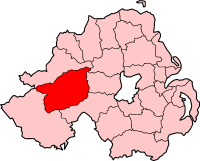
County Tyrone — Tyrone redirects here. For other uses, see Tyrone (disambiguation). County Tyrone Contae Thír Eoghain Coontie Tyrone … Wikipedia
Omagh — This article is about the town of Omagh. For the film of same name, see Omagh (film). Coordinates: 54°35′N 7°17′W / 54.59°N 7.29°W / 54 … Wikipedia
Cookstown — For other towns of this name, see Cookstown (disambiguation). Coordinates: 54°38′49″N 6°44′42″W / 54.647°N 6.745°W / 54.647; 6.7 … Wikipedia
Drum Manor Forest Park — is a forest in Northern Ireland, south of the Sperrin Mountains and west of Lough Neagh. It was bought from a private owner in 1964 and opened to the public in 1970. See: Forests in the United Kingdom External links Homepage at the Forest Service … Wikipedia
Coalisland — Coordinates: 54°32′31″N 6°41′38″W / 54.542°N 6.694°W / 54.542; 6.694 … Wikipedia
Dungannon — For the town in Virginia, see Dungannon, Virginia. For the thoroughbred racehorse, see Dungannon (horse). For the former barony, see Dungannon (barony). Coordinates: 54°30′N 6°46′W / … Wikipedia