- Clogher
-
For other uses, see Clogher (disambiguation).
Coordinates: 54°25′00″N 7°12′00″W / 54.416667°N 7.2°W
Clogher Irish: Clochar 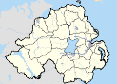
 Clogher
Clogher shown within Northern IrelandPopulation 308 (2001 Census) Irish grid reference H538517 - Belfast 59 miles District Dungannon and South Tyrone County County Tyrone Country Northern Ireland Sovereign state United Kingdom Post town CLOGHER Postcode district BT76 Dialling code 028, +44 28 EU Parliament Northern Ireland UK Parliament Fermanagh and South Tyrone NI Assembly Fermanagh and South Tyrone List of places: UK • Northern Ireland • Tyrone Clogher (from Irish: Clochar)[1] is a village in County Tyrone, Northern Ireland. It lies on the River Blackwater, 18 miles (29 km) south of Omagh. The United Kingdom Census of 2001 recorded a population of 309.
Contents
History
The name Clochar refers to something made of stone; probably on the site of the medieval monastery or a nearby ringfort.[2] Archaeological remains from before the fifth century have been found in the vicinity.[2] Clogher is said to have been the location of a gold pagan idol named Cermand Cestach.[citation needed]
See also: Bishop of ClogherMac Cairthinn of Clogher founded a monastery at the site, which the Synod of Rathbreasail recognised as an episcopal see. The Cathedral Church of Saint Macartan in the village is now one of two cathedrals of the Church of Ireland diocese of Clogher; the other is at Enniskillen. The Roman Catholic Diocese of Clogher has its cathedral in Monaghan.
The "City of Clogher" was a rotten borough in the Parliament of Ireland in the gift of the Protestant bishop. The village also gives its name to the Barony of Clogher, one of the original four baronies of County Tyrone.
Transport
Clogher railway station (on the narrow gauge Clogher Valley Railway) opened on 2 May 1887, but finally closed on 1 January 1942.[3]
Sport
- Clogher Cricket Club plays in the NCU Senior League.
- Clogher Éire Óg is the local Gaelic Athletic Association club.
People
- Some biographers of Jonathan Swift have claimed that Swift married Esther Johnson, known as Stella, in the deanery garden at Clogher in 1716.[4]
- Brigadier Juan Mackenna was born in Clogher in 1771. He was a hero of the Chilean War of Independence and the creator of the Corps of Military Engineers of the Chilean Army.
- The novelist William Carleton was born in the nearby townland of Prillisk in 1794.
- Retailer Timothy Eaton was born in Clogher in 1834.
- Professional soccer player Dermot McCaffrey of Falkirk FC grew up in Clogher and lived his childhood years there.
- Bonanza King James Graham Fair, born in 1831
Education
- Carntall Primary School
- Clogher Regional Primary School
- St. MacCartain's Convent Primary School
See also
- Abbeys and priories in Northern Ireland (County Tyrone)
References
- ^ "Clogher". logainm.ie. http://www.logainm.ie/63266.aspx. Retrieved 7 May 2010.
- ^ a b "16. Stone in Place Names". Ulster Place Names. Ulster Place-Name Society. http://www.ulsterplacenames.org/stone_in_place_names.htm. Retrieved 7 May 2010.
- ^ "Clogher station". Railscot - Irish Railways. http://www.railscot.co.uk/Ireland/Irish_railways.pdf. Retrieved 2007-09-16.
- ^ 1911 Encyclopedia
External links
Categories:- Untranslated Irish place names
- Villages in County Tyrone
Wikimedia Foundation. 2010.