- Moy, County Tyrone
-
Coordinates: 54°26′N 6°41′W / 54.44°N 6.69°W
Moy Irish: an Maigh 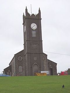
St James Parish Church, Moy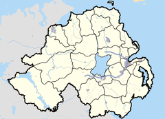

Moy shown within Northern IrelandPopulation 1,218 (2001 Census)[citation needed] Irish grid reference H7962 District Dungannon and South Tyrone County County Tyrone Country Northern Ireland Sovereign state United Kingdom Post town Dungannon Postcode district BT71 Dialling code 028 EU Parliament Northern Ireland UK Parliament Fermanagh and South Tyrone NI Assembly Fermanagh and South Tyrone List of places: UK • Northern Ireland • Tyrone Moy or The Moy (from Irish: an Maigh, meaning "the plain")[1][2] is a village and townland in County Tyrone, Northern Ireland. The 2001 Census recorded a population of 1,218.[citation needed]
It is about 5 miles (8 kilometres) southeast of Dungannon and is beside the smaller village of Charlemont. Charlemont is on the east bank of the River Blackwater and Moy on the west; the two are joined by Charlemont Bridge. The river is also the boundary between County Tyrone and County Armagh.
Contents
History
Moy (mostly known by locals as "The Moy") was laid out in the 1760s for the Volunteer Earl – the patriot and aesthete James Caulfield, 1st Earl of Charlemont (1728-1799) – opposite Charlemont Fort across the Blackwater. The formal rectangular market place, with lawns and horse-chestnut trees, was inspired by the square at Bosco Marengo in Lombardy, admired by the young earl during his grand tour of Europe. The houses lining the village square are mostly mid-18th century, though all four churches (Roman Catholic, Church of Ireland, Presbyterian and Methodist) are later. Moy used to hold a great horse fair, held once a month and lasting a whole week.
The Troubles
Former railway
The Portadown – Dungannon section of the Portadown, Dungannon and Omagh Junction Railway (PD&O) opened in 1858.[3] Its nearest station to Moy was optimistically called Trew and Moy, although it was at Trew Mount over 2 miles (3 kilometres) north of Moy. In 1876 the PD&O became part of the new Great Northern Railway.[4] The Ulster Transport Authority took over the line in 1958[5] and closed it in 1965.[6]
Places of interest
Moy features a cast-iron gate and screen set up in the 19th century to provide the grand entrance to the now-vanished Roxborough Castle. The richly modelled metalwork is thought by some[who?] to have been the work of the company of the celebrated Dublin iron-founder Richard Turner[citation needed], best known for his conservatories in Dublin, Belfast and Kew Gardens.
Moy has a public library. This library, with nine others across Northern Ireland, is under threat of closure by Libraries NI.[citation needed] 138 people came to the information evening in The Ryandale to discuss how the closure of this library would affect Moy.[when?]
Sport
Moy has a long history of horse riding and Gaelic games.
Schools
- Moy Regional Primary School
- St. John's Primary School
2001 Census
Moy is classified as a village by the NI Statistics and Research Agency (NISRA) (ie with population between 1,000 and 2,250 people). On Census day (29 April 2001) there were 1,218 people living in Moy. Of these:
- 26.3% were aged under 16 years and 18.1% were aged 60 and over
- 48.3% of the population were male and 51.7% were female
- 69.1% were from a Catholic background and 28.9% were from a Protestant background
- 4.2% of people aged 16-74 were unemployed.
For more details see: NI Neighbourhood Information Service
References
- ^ Placenames NI
- ^ Placenames Database of Ireland
- ^ Hajducki, S. Maxwell (1974). A Railway Atlas of Ireland. Newton Abbott: David & Charles. map 8. ISBN 0 7153 5167 2.
- ^ Hajducki, op. cit., page xii
- ^ Hajducki, op. cit., page xiii
- ^ Baker, Michael H.C. (1972). Irish Railways since 1916. London: Ian Allan. pp. 155, 209. ISBN 7110 0282 7.
External links
Categories:- Villages in County Tyrone

Wikimedia Foundation. 2010.