- Dromore, County Tyrone
-
Coordinates: 54°30′48″N 7°27′32″W / 54.513309°N 7.458858°W
Dromore Irish: Droim Mór 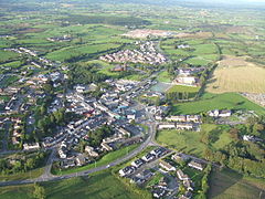
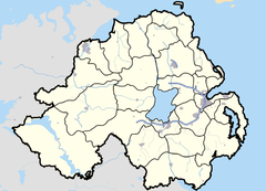

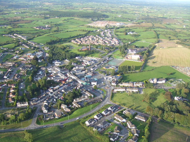
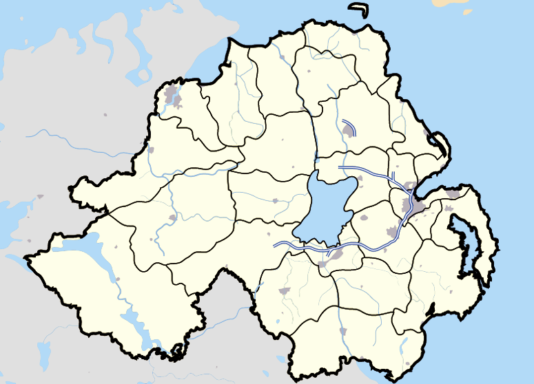
Dromore shown within Northern IrelandPopulation 1,101 (2001 Census) Irish grid reference H349628 - Belfast 76 mi (122 km) District Omagh County County Tyrone Country Northern Ireland Sovereign state United Kingdom Post town OMAGH Postcode district BT78 Dialling code 028, +44 28 EU Parliament Northern Ireland UK Parliament West Tyrone NI Assembly West Tyrone List of places: UK • Northern Ireland • Tyrone Dromore (from Irish: Droim Mór meaning "large ridge") is a village in County Tyrone, Northern Ireland. It is situated nine miles (15 km) south west of Omagh on the A32 road and sixteen miles (26 km) from Enniskillen. The town had a population of 1,101 in the 2001 Census. Agriculture and the building trades are the primary sources of employment in the town. It is situated within the Omagh District Council area.
Contents
History
In 1838 Dromore, in the Parish and Barony of Omagh, was described as a poor town in hilly and bleak country which stretched far around, yet the arable lands were for the most part good. The population of the town was 480 in 1831, and 551 in 1841.
The town was originally built in 1757 when the then Lord of the manor, William Hamilton, of Aughlish House gave a grant of the townland of Mullinacross, now called Dromore, to two families - Stewart and Humphreys. The town at that time consisted of only four houses. The original name of the townland is derived from an ancient stone cross which formerly stood on the top of the hill overlooking the town, and near to where the Cistercian Abbey was located. This abbey which was destroyed by a fire in 1690 is said to have been built on the site of a nunnery founded by Saint Patrick for Saint Cettumbria, the first Irish female who received the veil from his hands. In the village, still to be seen, are the ivy-clad remains of a Protestant church built in 1694.
During the Irish Rebellion of 1798, when Lord Blayney came to Tyrone, as Dromore was principally inhabited by rebels, he set it on fire and burned some of the houses, but owing to the exertions of Captain Charles Muirhead, Lieutenant James Alexander and the Rev. Benjamin Marshall the balance of the town was saved from destruction.
In the area around Dromore are to be found a number of ancient earthen forts. At Dullaghan about four miles to the northwest is a Druid's Altar - a small roofless chamber tomb. A tannery was known to have existed in the village.
In the Dromore Parish at least nine locations of Mass Rocks are known. During the times of the Penal Laws certain "Mass Gardens" were located in the district where the local parishioners met in seclusion to celebrate Mass. It is said that Lord Belmore, who owned considerable property around Dromore, was so impressed with the devotion of the congregation at one of these gatherings, which he came across one day by chance, that he made available a piece of ground for the erection of a church. This is where the Catholic Church of Dromore now stands.
Townlands of Dromore
Early Irish ancestors gave us the vast bulk of the local placenames we use to this day, especially our townland names. The words in Irish for hill (druim, cnoc, cor, iomaire, mullan, tulach) predominate. The name "Dromore" (Droim Mor) itself means "the great ridge". The word "meen" (found in Meenagowan and Meenagar) shows the wet, healthy nature of much of the land. Dromore parish consists of over sixty townlands; roughly elliptical in shape, it is bounded on the north by Drumquin, on the south by Trillick, on the west by Ederney and on the east by Omagh and Fintona.
Nowadays, townland names in particular are under threat owing to a new computerised system of addresses for rural homes, a system suited to areas on the British mainland where townlands do not exist. Roads are now to be given arbitrary names by administrators who do not possess a deep knowledge of the area, attaching arbitrary house numbers to them. For example, the former Corbally Road is to be known as 'St. Dympnas Road', on the specious argument that St. Dympna's Catholic Church is situated near it. This inevitably has met considerable opposition with local residents who value of these ancient names as badges of personal identification, and many will continue to use them to preserve the ancient names for future generations and residents.[1]
Demographics
Dromore is classified as a village by the NI Statistics and Research Agency (NISRA) (ie with population between 1,000 and 2,250 people). On Census day (29 April 2001) there were 1,101 people living in Dromore. Of these:
- 24.8% were aged under 16 years and 17.7% were aged 60 and over
- 50.3% of the population were male and 49.7% were female
- 85.1% were from a Catholic background and 14.1% were from a Protestant background
- 7.6% of people aged 16-74 were unemployed
For more details see: NI Neighbourhood Information Service
Sport
- Dromore St. Dympna's is the local GAA club.
- Tummery Athletic is the local Soccer club.
See also
- Abbeys and priories in Northern Ireland (County Tyrone)
External links
References
- ^ "Dromore Community Website - Townland Names.". Dromore Community Website. Archived from the original on 2008-06-02. http://web.archive.org/web/20080602011101/http://dromore.info/index.php?option=com_content&task=view&id=16&Itemid=2. Retrieved 2008-07-10.
Categories:- Villages in County Tyrone
Wikimedia Foundation. 2010.