- Crumlin, County Antrim
-
Coordinates: 54°37′N 6°14′W / 54.62°N 6.23°W
Crumlin Irish: gCamlin 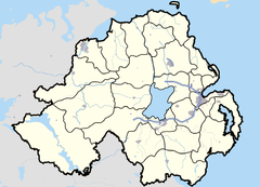

Crumlin shown within Northern IrelandPopulation 4,259 (2001 Census) District Antrim County County Antrim Country Northern Ireland Sovereign state United Kingdom Post town ANTRIM Postcode district BT29 Dialling code 028 EU Parliament Northern Ireland UK Parliament South Antrim NI Assembly South Antrim List of places: UK • Northern Ireland • Antrim Crumlin (from Irish: Cromghlinn, meaning "crooked glen")[1] is a village in County Antrim, Northern Ireland. It is at the head of a wooded glen on the Camlin River, near Lough Neagh, and 20 miles (32 km) west of Belfast city centre. It had a population of over 4,259 people in the 2001 Census. Belfast International Airport lies just north of the village.
A stone clock tower, built in 1897 as a memorial to a member of the Pakenham family who were landlords in the area, stands at the top of the village near the former railway station. The town’s old linen mill was built in 1809.
Contents
Irish language
In recent years, a growing Irish speaking community has evolved in the area and Crumlin now caters for both pre-school and primary school education through the medium of Irish. Naíscoil and Gaelscoil Ghleann Darach now has almost seventy children attending the Irish medium school and almost thirty in the nursery, with 15 members of staff. The Gaelscoil (primary school) is recognised by the Department of Education.
Two voluntary groups, Cumann Gaeilge and Cairde Ghleann Darach encourage and support the school and promotion of the Irish Language. The local societies help organise fund-raisers for the local schools and clubs & organise Irish Language classes, an annual Irish language funday, Céilí, Bi-lingual pub quiz and other events in the area.
The upstairs of the football club was recently converted into a youth club by Crumlin Together, a Community voluntary Management Group, run by their Youth Committee. Ignite is another youth club open on Friday nights in St. Johns Hall.
2001 Census
Crumlin is classified as an intermediate settlement by the NI Statistics and Research Agency (NISRA) (i.e., with population between 2,250 and 4,500 people). On Census day (29 April 2001) there were 4,259 people living in Crumlin. Of these:
- 28.3% were aged under 16 and 11.3% were aged 60 and over
- 49.3% of the population were male and 50.7% were female
- 75.4% were from a Catholic background and 23.3% were from a Protestant background
- 3.4% of people aged 16–74 were unemployed.
For more details see: http://www.ninis.nisra.gov.uk/ NI Neighbourhood Information Service]
Education
- Crumlin Integrated College
- St. Joseph's Primary School
- Crumlin Integrated Primary
- Gaelscoil Ghleann Darach
- Naíscoil Ghleann Darach
Transport
Crumlin railway station opened on 13 November 1871 but is now closed.[2]
In October 2011 it has been rumoured that trains have been pasing past the Crumlin railway station.
References
- ^ Placenames Database of Ireland
- ^ "Crumlin". Railscot - Irish Railways. http://www.railscot.co.uk/Ireland/Irish_railways.pdf. Retrieved 2007-08-27.
External links
Categories:- Villages in County Antrim
Wikimedia Foundation. 2010.