- Jordanstown
Infobox Irish Place
name = Jordanstown
gaeilge = Baile Uí Shiúrtáin
crest
motto =
map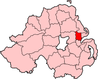
pin coords = left: 160px; top: 71px
north coord = 54.41 | west coord = 5.54
elevation =
province =Ulster
county =County Antrim
NI district =Newtownabbey
UK constituency = East Antrim
EU constituency = Northern Ireland
stdcode = 028, +44 28
posttown =Newtownabbey
postcode = BT37
population = 5,494
census yr = 2001
web =
|Jordanstown is a suburb of Belfast located within the borough of
Newtownabbey ,County Antrim ,Northern Ireland . Jordanstown is situated between the areas ofWhiteabbey , Monkstown andGreenisland . The area boasts a university campus, a bowling club, a few schools and shops. It also has a beach and seafront park area called Loughshore. This park is situated on the shores ofBelfast Lough . It is connected to Hazelbank park by a cycle path that is due to be extended toCarrickfergus . The park has a good play area for children of all ages and a caravan park. The open grass area provides a great space for football, kite flying and hosts the Loughshore Festival and Rock festival. In the summer local bands set up on Wednesday evenings in the car park to provide the community with entertainment.Local Schools & Education
* [http://www.jordanstownschools.co.uk/ Jordanstown Schools] for the Deaf and Blind.
* [http://www.thornfieldhouseschool.co.uk/ Thornfield House School] for those with Specific Speech Impairments.
* Rosstulla Special School
* [http://www.monkstowncommunity.org.uk/ Monkstown Community High School]
* [http://www.belfasthigh.co.uk/ Belfast High School]
* [http://www.ulster.ac.uk/ University of Ulster]History
Jordanstown was a semi-rural district until the 1950s when it expanded rapidly with the construction of new housing. Middle-class families were attracted to the area due to its location adjacent to Belfast Lough and the railway station, which provides access to Belfast city centre.
Transport
*
Jordanstown railway station was opened on1 February 1853 . [cite web | title=Jordanstown station | work=Railscot - Irish Railways | url=http://www.railscot.co.uk/Ireland/Irish_railways.pdf | accessdate=2007-08-28]
* [http://www.translink.co.uk/ Translink Bus & Rail Website]Local Churches
* [http://www.st-patricks-jordanstown.org.uk/ St. Patrick's Church] (Church of Ireland)
Local Councillors and MP's
Jordanstown is covered by the University Constituency.
* [http://www.newtownabbey.gov.uk/councillors/ward.asp?cat=Council&css=normal&ward=1 Jordanstown Councillors]Local MP's for the area include:
* [http://www.niassembly.gov.uk/members/biogs_07/wilson_s.htm Sammy Wilson] (DUP)
* [http://www.niassembly.gov.uk/members/biogs_07/hilditch_d.htm David Hilditch] (DUP)
* [http://www.niassembly.gov.uk/members/biogs_07/ross_a.htm Alastair Ross] (DUP)
* [http://www.niassembly.gov.uk/members/biogs_07/beggs_r.htm Roy Beggs] (UUP)
* [http://www.niassembly.gov.uk/members/biogs_07/robinson_k.htm Ken Robinson] (UUP)
* [http://www.niassembly.gov.uk/members/biogs_07/neeson_s.htm Sean Neeson] (Alliance)2001 Census
Jordanstown is a small settlement within Belfast Metropolitan Urban Area (BMUA). On Census day (29 April 2001) there were 5,494 people living in Jordanstown. Of these:
* 25.9% were under 16 years old and 13.0% were aged 60 and above;
* 49.5% of the population were male and 50.5% were female; and
* 10.4% were from a Catholic Community Background and 83.5% were from the Protestant and Christian Community Backgrounds.More Links
*
List of villages in Northern Ireland
*List of towns in Northern Ireland
*Jordanstown Schools
*University of Ulster References
Wikimedia Foundation. 2010.