Whiteabbey railway station
- Whiteabbey railway station
Infobox NI station
name = Whiteabbey
locale = Whiteabbey
borough = Newtownabbey Borough Council
years = 1848
events = Opened
years1 = 2008
events1 = Refurbished
platforms = 2
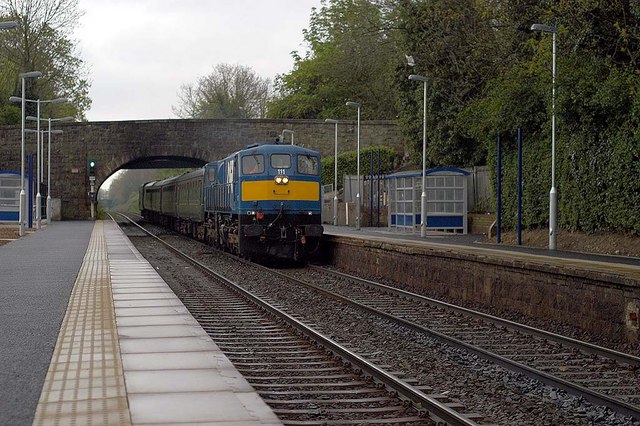
usage0405 = Whiteabbey railway station serves Whiteabbey in Newtownabbey, Northern Ireland. The station opened on 11 April 1848. It is the first station outside Belfast on the Larne Line.
After Whiteabbey, the next station on the line used to be Bleach Green, but this was closed in May 1977.
According to the current timetable, trains on the Londonderry line only stop here once per day, the Belfast service in the morning and the Portrush service in the evening.
###@@@KEYEND@@@###
Wikimedia Foundation.
2010.
Look at other dictionaries:
Mossley West railway station — Mossley West Location Place Newtownabbey Local authority Newtownabbey … Wikipedia
Whiteabbey — Infobox Irish Place name = Whiteabbey gaeilge = An Mhainistir Fhionn crest motto = map pin coords = left: 158px; top: 71px north coord = 54.40 | west coord = 5.54 elevation = province = Ulster county = County Antrim NI district = Newtownabbey UK… … Wikipedia
List of railway stations in Ireland — This article lists railway stations both in the Republic of Ireland and Northern Ireland. In The Republic of Ireland A * Adamstown * Arklow * Ashtown * Athenry * Athlone * Athy * Attymon B *Bagenalstown *Balbriggan *Ballina *Ballinasloe… … Wikipedia
Belfast–Derry railway line — Belfast to Derry line NI Railways Class 3000 at Castlerock. Overview … Wikipedia
Belfast-Larne railway line — The Belfast Larne railway line is a picturesque line for the most part. It runs as double track along the majority of its route up the east Antrim coastline from Belfast to Larne serving commuters and ferry passengers. Recently refurbished… … Wikipedia
Newtownabbey — Coordinates: 54°39′25″N 5°54′25″W / 54.657°N 5.907°W / 54.657; 5.907 … Wikipedia
Northern Counties Committee — The Northern Counties Committee (NCC) was a railway that served the north east of Ireland. It was built to Irish gauge (1,600 mm (5 ft 3 in)) but later acquired a number of 914 mm (3 ft) narrow gauge… … Wikipedia
Derry — For other places with similar names, see Derry (disambiguation) and Londonderry (disambiguation). Coordinates … Wikipedia
County Antrim — Contae Aontroma Coontie Antrìm / Countie Antrim Coat of arms … Wikipedia
Crumlin, County Antrim — Coordinates: 54°37′N 6°14′W / 54.62°N 6.23°W / 54.62; 6.23 … Wikipedia