- Mussenden Temple
-
Coordinates: 55°10′05″N 6°48′22″W / 55.168°N 6.806°W
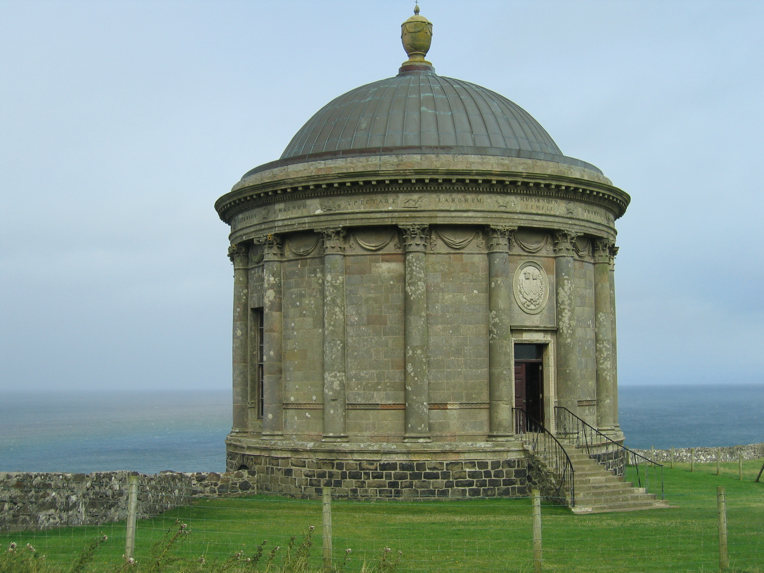
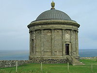 The Mussenden Temple.
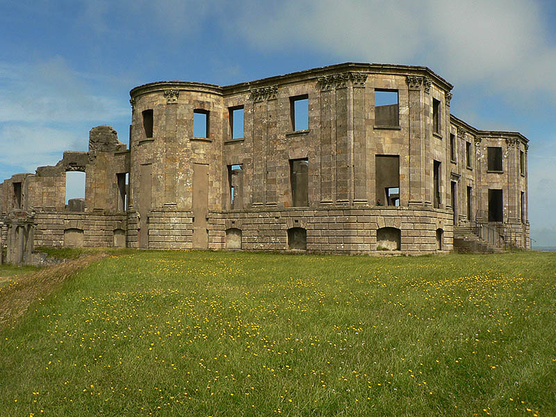
 Downhill House
Mussenden Temple is a small circular building located on cliffs near Castlerock in County Londonderry, high above the Atlantic Ocean on the north-western coast of Northern Ireland.
It was built in 1785 and forms part of the estate of Frederick Augustus Hervey, the 4th Earl of Bristol, Bishop of Derry. Built as a library and modelled on the Temple of Vesta in Italy, it is dedicated to the memory of Hervey's cousin Frideswide Mussenden.
Over the years the erosion of the cliff face at Downhill has brought Mussenden Temple ever closer to the edge, and in 1997 the National Trust carried out cliff stabilisation work to prevent the loss of the building.[1]
The inscription around the building reads, "Tis pleasant, safely to behold from shore/ The rolling ship, and hear the tempest roar." The quotation is from Lucretius.
Now part of the National Trust property of Downhill Estate & Mussenden Temple, the grounds encompassing Mussenden Temple, and its manor house (Downhill Castle) are open to the public all year, from dawn to dusk.[2] The temple itself is open on certain days, and admission is free. The Temple offers views westwards over Downhill Strand towards Magilligan Point and County Donegal and to the east Castlerock beach towards Portstewart, Portrush and Fair Head.
The temple obtained a licence to hold civil wedding ceremonies in 2007.[3]
References
- ^ Examples of recent rockfalls from basalt cliffs in Northern Ireland, Peter Wilson and Alana Cunningham, School of Environmental Sciences, University of Ulster at Coleraine, Irish Geography, Volume 36(2), 2003, 170-177, retrieved 18 September 2009
- ^ Mussenden Temple and Downhill Demesne, National Trust
- ^ Weddings at Mussenden Temple, National Trust
External links
- Downhill Estate & Mussenden Temple at the National Trust
- Virtual Tour of Mussenden Temple Northern Ireland - Virtual Visit Northern Ireland
- Downhill Castle entry from The DiCamillo Companion to British & Irish Country Houses
- BBC NI Schools Landscapes Unlocked: Explore Benone Strand to Downhill - Aerial Views
National museums Northern Ireland Environment Agency Ballycopeland Windmill · Bellaghy Bawn · Carrickfergus Castle · Castle Archdale Country Park · Derry City Walls · Devenish Monastic Site · Dundrum Castle · Dunluce Castle · Greencastle · Grey Abbey · Harry Avery's and Newtownstewart Castle · Hillsborough Courthouse · Inch Abbey · Jordan's Castle · Monuments and Buildings Record · Navan Fort · Nendrum Monastic Site · Tullaghoge · Tully CastleNational Trust Ardress House · The Argory · Carrick-a-Rede Rope Bridge · Castle Coole · Castle Ward · Crom Estate · Crown Liquor Saloon · Derrymore House · Downhill Estate (Mussenden Temple) · Florence Court · Giant's Causeway · Gray's Printing Press · Hezlett House · Mount Stewart · Murlough Nature Reserve · Patterson's Spade Mill · Rowallane Garden · Springhill House · Wellbrook Beetling MillOther museums and galleries Categories:- Buildings and structures in County Londonderry
- National Trust properties in Northern Ireland
- Visitor attractions in County Londonderry
- Grade A listed buildings
Wikimedia Foundation. 2010.