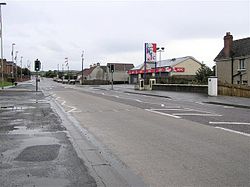
Drumahoe

Drumahoe
View of Drumahoe

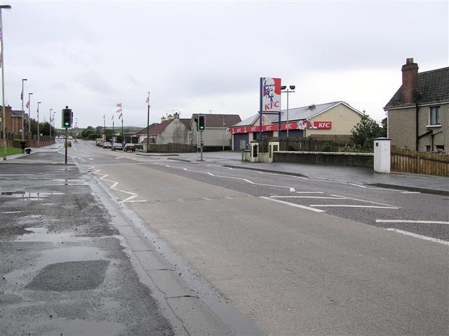
Drumahoe (from Irish: Droim na hUamha meaning "ridge of the cave") is a village and townland in County Londonderry, Northern Ireland. It lies to the east of Derry and was once a village, but has been absorbed by the city. It is home to Institute F.C., an Irish Premier League football club. The busy A6 road from Belfast to Derry passes through the townland.Drumahoe is a protestant area in the waterside of Derry located directly across from Catholic Strathfoyle

Demography

On Census Day 29 April 2001 the resident population of Drumahoe[1] was 1,367.[2] Of these:

  • 26.8% were under 16 years old and 11.2% were aged 60 and above [2]
  • 50.0% of the population were male and 50.0% were female [2]
  • 11.2% were from a Roman Catholic background and 85.7% were from a Protestant background [2]
  • 3.5% of those aged 16–74 were unemployed [2]

See also

References

  1. ^ Note: The population of Altnagelvin SOA 3 directly corresponds with that of Drumahoe
  2. ^ a b c d e "Altnagelvin 3 SOA (ie. Drumahoe) statistics". NINIS. 2007-05-31. http://www.ninis.nisra.gov.uk/mapxtreme/pf_report.asp?sLevel=SOA&sID=95MM01S3&sName=Altnagelvin%203.. Retrieved 2008-02-02. 

Coordinates: 54°58′N 7°16′W / 54.967°N 7.267°W / 54.967; -7.267


Wikimedia Foundation. 2010.

Игры ⚽ Поможем решить контрольную работу

Look at other dictionaries:

  • Derry — For other places with similar names, see Derry (disambiguation) and Londonderry (disambiguation). Coordinates …   Wikipedia

  • Institute FC — Institute Football Club Institute FC Club fondé en 1905 …   Wikipédia en Français

  • Institute Football Club — Infobox club sportif Institute FC Généralités Nom complet …   Wikipédia en Français

  • County Londonderry — For other places with similar names, see Londonderry (disambiguation) and Derry (disambiguation). County Londonderry / County Derry Contae Dhoire Coontie Lunnonderrie …   Wikipedia

  • Limavady — Coordinates: 55°03′11″N 6°56′46″W / 55.053°N 6.946°W / 55.053; 6.946 …   Wikipedia

  • Dungiven — Coordinates: 54°55′41″N 6°55′30″W / 54.928°N 6.925°W / 54.928; 6.925 …   Wikipedia

  • Coleraine — For other uses, see Coleraine (disambiguation). Coordinates: 55°07′59″N 6°39′40″W / 55.133°N 6.661°W / 55.133; 6.661 …   Wikipedia

  • Moneymore — is also the name of a farming district near Milton, New Zealand. Moneymore is also the name of a large housing estate in Drogheda, Ireland. Coordinates: 54°41′31″N 6°40′12″W /  …   Wikipedia

  • Draperstown — Coordinates: 54°47′37″N 6°47′03″W / 54.79361°N 6.78417°W / 54.79361; 6.78417 …   Wikipedia

  • Maghera — For the Romanian village, see Vârfu Câmpului. Coordinates: 54°50′38″N 6°40′23″W / 54.844°N 6.673°W / 54.844; 6.673 …   Wikipedia

Share the article and excerpts

Direct link
Do a right-click on the link above
and select “Copy Link”