- Moneyneany
-
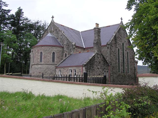
 St Eugene's Roman Catholic church in Moneyneany
Moneyneany or Moneyneena (locally [,mʌni'n'ini], [,mʌni'n'i:nə], and [,mʌni'i:nə], from Irish: Móin na nIonadh, meaning "bog of wonders")[1][2][3] is a small village in County Londonderry, Northern Ireland. In the 2001 Census it had a population of 162.[4] It is in the Magherafelt District Council area.
Locally significant buildings include St Eugene's (Roman Catholic) Church, which is a listed building, and a fort, which is a historic monument partly encroached upon by housing, and an important feature in the landscape. The Altalacky River and the Douglas River are nearby.
Local legends
There was a holy well near the Catholic chapel at Moneyneena that was allegedly defended by a magician named Sir Volvet. The magician was so possessive of the well that he kept an earless dog chained to the well to stop others from benefitting from the water. Through time this well became known as Tobarawathymeel or "The Earless Dog’s Well".
Magical powers were not restricted to Sir Volvet; tradition has it that the townland of Moneyneany derived its name, Móin na n-ionadh ("bog of wonders"), from being a favourite place for the old Irish warriors to learn their exercises and perform great feats of magic.[5]
People
Tony Scullion, Gaelic Football and Hurling player for Ballinascreen and Derry, and receiver of four football GAA All Stars Awards awards, was born in Moneyneena.[6]
References
- ^ Toner, Gregory: Place-Names of Norhtern Ireland, page 29. Queen's University of Belfast, 1996, ISBN 0-85389-613-5
- ^ Placenames NI
- ^ Placenames Database of Ireland
- ^ NI Neighbourhood Information System
- ^ History From Headstones
- ^ All Stars GAA website Retrieved 29 June 2010
Coordinates: 54°49′N 6°50′W / 54.817°N 6.833°W
Categories:- Villages in County Londonderry
- County Londonderry geography stubs

Wikimedia Foundation. 2010.