- Coleraine Borough Council
-
Coordinates: 55°07′55″N 6°40′05″W / 55.132°N 6.668°W
Coleraine Borough
Comhairle Baile Chúil RaithinGeography 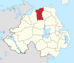
Area
- TotalRanked 13th of 26
486 km²Admin HQ Coleraine ISO 3166-2 GB-CLR ONS code 95C Demographics Population
- Total (2010)
- DensityRanked 15th
56,800
117 / km²Community Catholic: 27.2%
Protestant: 69.4%Politics Control No overall control
DUP: 9
UUP: 5
SDLP: 3
Alliance Party: 2
Sinn Féin: 1
Independents: 2MLAs East Londonderry
DUP: 3
Independent: 1
Sinn Féin: 1
SDLP: 1MPs Gregory Campbell (DUP) Meeting place Website http://www.colerainebc.gov.uk Coleraine Borough Council is a local council mainly in County Londonderry and partly in County Antrim in Northern Ireland. Its headquarters are in the town of Coleraine. Small towns in the area include Garvagh, Portrush, Portstewart and Kilrea. The population of the area is just over 56,000.
The Coleraine Borough Council consists of four electoral areas: Coleraine East, Coleraine Central, The Skerries and Bann. In the last elections in 2005, 22 members were elected from the following political parties: 9 Democratic Unionist Party (DUP), 8 Ulster Unionist Party (UUP), 3 Social Democratic and Labour Party (SDLP), 1 Sinn Féin and 1 Independent. Following the resignation of a DUP councillor, who was jailed for electoral fraud [1] Alliance Party candidate Barney Fitzpatrick was elected to serve on the Council from 14 December 2006. Unionist-controlled Coleraine Borough Council operates a rotation for positions of Mayor and Deputy Mayor between the Ulster Unionist Party(UUP), Democratic Unionist Party (DUP) and the nationalist Social Democratic and Labour Party (SDLP). The next election was due to take place in May 2009, but on April 25, 2008, Shaun Woodward, Secretary of State for Northern Ireland announced that the scheduled 2009 district council elections were to be postponed until the introduction of the eleven new councils in 2011.[1] The proposed reforms were abandoned in 2010, and the next district council elections will take place in 2011[2] The Mayor is currently Councillor William Alexander King of the Ulster Unionist Party (UUP).
The borough council area, together with the neighbouring district of Limavady, forms the East Londonderry constituency for elections to the Westminster Parliament and Northern Ireland Assembly.
Mayor of Coleraine
Source: Freedom of Information request to Coleraine Borough Council
See also
- Local Councils in Northern Ireland
References
Local authorities of Northern Ireland Antrim · Ards · Armagh · Ballymena · Ballymoney · Banbridge · Belfast · Carrickfergus · Castlereagh · Coleraine · Cookstown · Craigavon · Derry · Down · Dungannon and South Tyrone · Fermanagh · Larne · Limavady · Lisburn · Magherafelt · Moyle · Newry and Mourne · Newtownabbey · North Down · Omagh · Strabane
Categories:- Politics of County Londonderry
- Politics of County Antrim
- Coleraine
- Local authorities of Northern Ireland

Wikimedia Foundation. 2010.