- Dover Beaches North, New Jersey
-
"Normandy Beach" redirects here. For the beaches involved in the World War 2 invasion of Normandy, see Normandy Landings.
Dover Beaches North, New Jersey — CDP — Map of Dover Beaches North CDP in Ocean County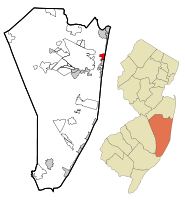
Coordinates: 39°59′29″N 74°3′55″W / 39.99139°N 74.06528°WCoordinates: 39°59′29″N 74°3′55″W / 39.99139°N 74.06528°W Country United States State New Jersey County Ocean Area – Total 1.6 sq mi (4.1 km2) – Land 1.0 sq mi (2.5 km2) – Water 0.6 sq mi (1.6 km2) Elevation 7 ft (2 m) Population (2000) – Total 1,785 – Density 1,821.8/sq mi (703.4/km2) Time zone Eastern (EST) (UTC-5) – Summer (DST) EDT (UTC-4) FIPS code 34-18148[1] GNIS feature ID 1852607[2] Dover Beaches North is a census-designated place and unincorporated area located within Toms River, in Ocean County, New Jersey. As of the United States 2000 Census, the CDP population was 1,785. The CDP includes the communities of half of Normandy Beach, Normandy Shores, Ocean Beaches 1,2 and 3, Chadwick Beach, Chadwick Island, Seacrest Beach, Monterey Beach and Silver Beach. Dover Beaches North is situated on the Barnegat Peninsula, a long, narrow barrier peninsula that separates Barnegat Bay from the Atlantic Ocean.
Toms River Township is split by the United States Census Bureau into three CDPs; Toms River CDP on the mainland comprising over 95% of the Township's population, along with Dover Beaches North and Dover Beaches South.
Contents
Geography
Dover Beaches North is located at 39°59′29″N 74°03′55″W / 39.991367°N 74.065405°W.[3]
According to the United States Census Bureau, the CDP has a total area of 4.1 km2 (1.6 mi2). 2.5 km2 (1.0 mi2) of it is land and 1.6 km2 (0.6 mi2) of it (38.75%) is water.
Demographics
As of the census[1] of 2000, there were 1,785 people, 974 households, and 529 families residing in the CDP. The population density was 703.3/km2 (1,821.8/mi2). There were 40,119 housing units at an average density of 1,622.8/km2 (4,203.9/mi2). The racial makeup of the CDP was 100% White.
There were 974 households out of which 9.5% had children under the age of 18 living with them, 46.7% were married couples living together, 5.5% had a female householder with no husband present, and 45.6% were non-families. 42.2% of all households were made up of individuals and 24.0% had someone living alone who was 65 years of age or older. The average household size was 1.83 and the average family size was 2.44.
In the CDP the population was spread out with 9.0% under the age of 18, 3.6% from 18 to 24, 18.2% from 25 to 44, 30.7% from 45 to 64, and 38.5% who were 65 years of age or older. The median age was 58 years. For every 100 females there were 90.1 males. For every 100 females age 18 and over, there were 91.0 males.
The median income for a household in the CDP was $430,125, and the median income for a family was $580,125. Males had a median income of $570,917 versus $320,083 for females. The per capita income for the CDP was $320,613. About 2.6% of families and 5.4% of the population were below the poverty line, including none of those under age 18 and 4.3% of those age 65 or over.
Summer Living in Silver Beach
Silver Beach, New Jersey is a private beach community that is a part of Toms River Township. This beach community however is only a total of 15 blocks, and does not have their own zip code, nor rarely does it ever appear on any local map.
Silver Beach was established on August 2, 1952. Similar to the other similar shore communities located on the barrier islands, it consists of 3 blocks on a horizontal plane: The Ocean/Beach Side , The Middle, and The Bay Side. The Ocean/Beach side is unique in the aspect that the homes that are the farthest east on the street are actually oceanfront property (with sand as their backyard) and get to enjoy the summer aroma of sand, salt and sun up close and personal.
The Middle properties (which also commonly referred to as “between the highways”) gets its name from simplistic reasons; these houses are in-between the two primary 2 lane highways that are the main source of travel for anyone wishing to go north or south on the Barrier Islands: Routes 35 North and South. And on the western point of the island is the bayside which is unique in its own sense. The front of the house is a street, whereas the back of the house is a man made lagoon filled with water that recalculates in from the Barnegat bay.
Residents are hoping for an outdoor freshwater shower in the next upcoming weeks, thus making their beach visits more pleasurable. Also available to the members of the community is a “Bay Beach” which is located on Rt. 35 South between North Lagoon Road and Silver Beach Road. This small beach which leads into a lagoon consists of a Bathing Area (which Closed until further notice due to sea nettles aka Jellyfish), Bocce Court, Picnic Table, a Playground area, and a Tennis Court.[4]
References
- ^ a b "American FactFinder". United States Census Bureau. http://factfinder.census.gov. Retrieved 2008-01-31.
- ^ "US Board on Geographic Names". United States Geological Survey. 2007-10-25. http://geonames.usgs.gov. Retrieved 2008-01-31.
- ^ "US Gazetteer files: 2010, 2000, and 1990". United States Census Bureau. 2011-02-12. http://www.census.gov/geo/www/gazetteer/gazette.html. Retrieved 2011-04-23.
- ^ Silver Beach Webpage
External links
Municipalities and communities of Ocean County, New Jersey Boroughs 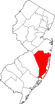
Townships Barnegat | Berkeley | Brick | Eagleswood | Jackson | Lacey | Lakewood | Little Egg Harbor | Long Beach | Manchester | Ocean | Plumsted | Stafford | Toms River
CDPs Barnegat | Beach Haven West | Cassville | Cedar Glen Lakes | Cedar Glen West | Crestwood Village | Dover Beaches North | Dover Beaches South | Forked River | Holiday City-Berkeley | Holiday City South | Holiday Heights | Lakewood | Leisure Knoll | Leisure Village | Leisure Village East | Leisure Village West-Pine Lake Park | Manahawkin | Mystic Island | New Egypt | North Beach Haven | Ocean Acres | Pine Ridge at Crestwood | Silver Ridge | Toms River | Vista Center | Waretown
Communities Bayville | Chadwick Beach Island | Harmony | High Bar Harbor | Jackson Mills | Lanoka Harbor | Loveladies | Parkertown | Silverton | Warren Grove | West Creek | West Tuckerton | Whitesville | Whiting
 State of New Jersey
Topics Regions - Atlantic Coastal Plain
- Central Jersey
- Delaware River Region
- Delaware Valley
- Gateway Region
- Gold Coast
- Highlands
- Jersey Shore
- Meadowlands
- New York metro area
- North Hudson
- North Jersey
- Pascack Valley
- Piedmont
- Pine Barrens
- Raritan Bayshore
- Ridge-and-Valley Appalachians
- Southern Shore Region
- Skylands Region
- South Jersey
- Tri‑State Region
- West Hudson
Counties Major cities Categories:- Toms River, New Jersey
- Census-designated places in New Jersey
- Populated places in Ocean County, New Jersey


Wikimedia Foundation. 2010.